
Posting this in 2019, catching up with whatever information I have. One of our early hikes, checking out trails out of Placitas, on the north end of the Sandia Mountains.
The Hike
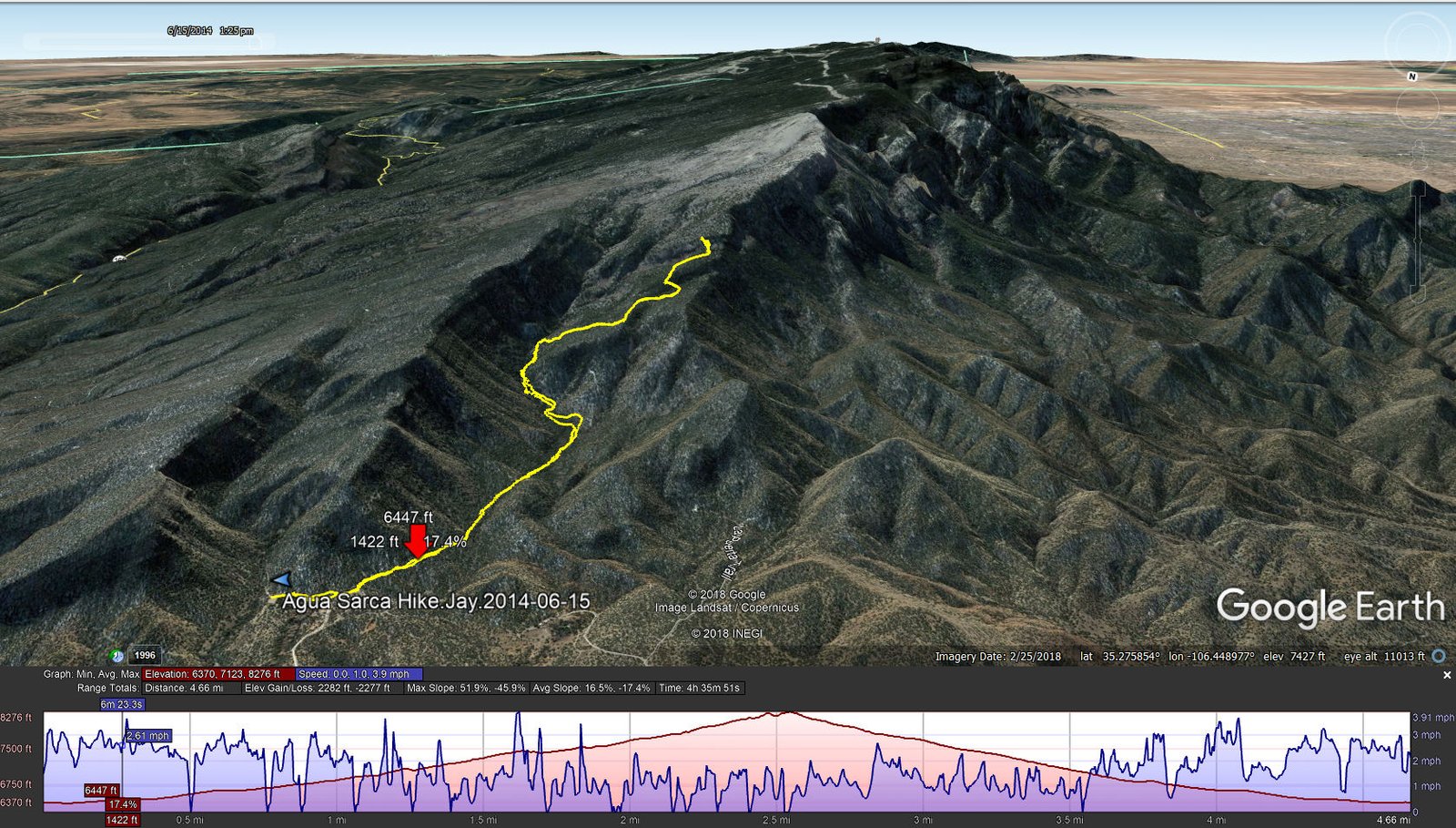
Agua Sarca Hike.Jay.2014-06-15
Statistics
Total Distance: 4.66 miles
Elevation: start 6,387 ft, maximum 8,276 ft, minimum 6,370 ft
Gross gain: 1,906 ft. Aggregate ascending 2,282 ft, descending 2,277 ft
Maximum slope: 52% ascending, 46% descending, 16% average
Duration: 4:37
| GPS Track Files for Download | |
216 Downloads | |
|---|---|
314 Downloads | |
I urge you to explore our hiking tracks with Google Earth. With the virtual 3-dimensional presentation, achieved by panning and tilting the view, you can get a much better idea of the hikes and terrain than you can get from the 2-dimensional screenshot above. For assistance: Using Google Earth Track Files.
References
USDA Forest Service: Agua Sarca Trailhead and Agua Sarca Trail 23
Sandia Hiking Guide: Agua Sarca Trail, North Crest Trail, Del Orno Trail
ASCHG: Del Orno – N Crest – Agua Sarca Loop Hike
AllTrails: Agua Sarca Trail
Backpacker: Albuquerque, NM: Agua Sarca Canyon Loop