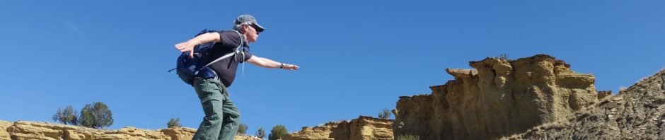
On this hike we explored the south side of Bernalillito Mesa in the Ojito Wilderness, an area that we hadn’t visited before. I’ve labeled this a Wander rather than Hike – there aren’t any defined trails; the topography lends itself to just exploring. Like other parts of Ojito, the views are interesting, the geology varies greatly, and this time of year the early flowers are abloom.
The Hike
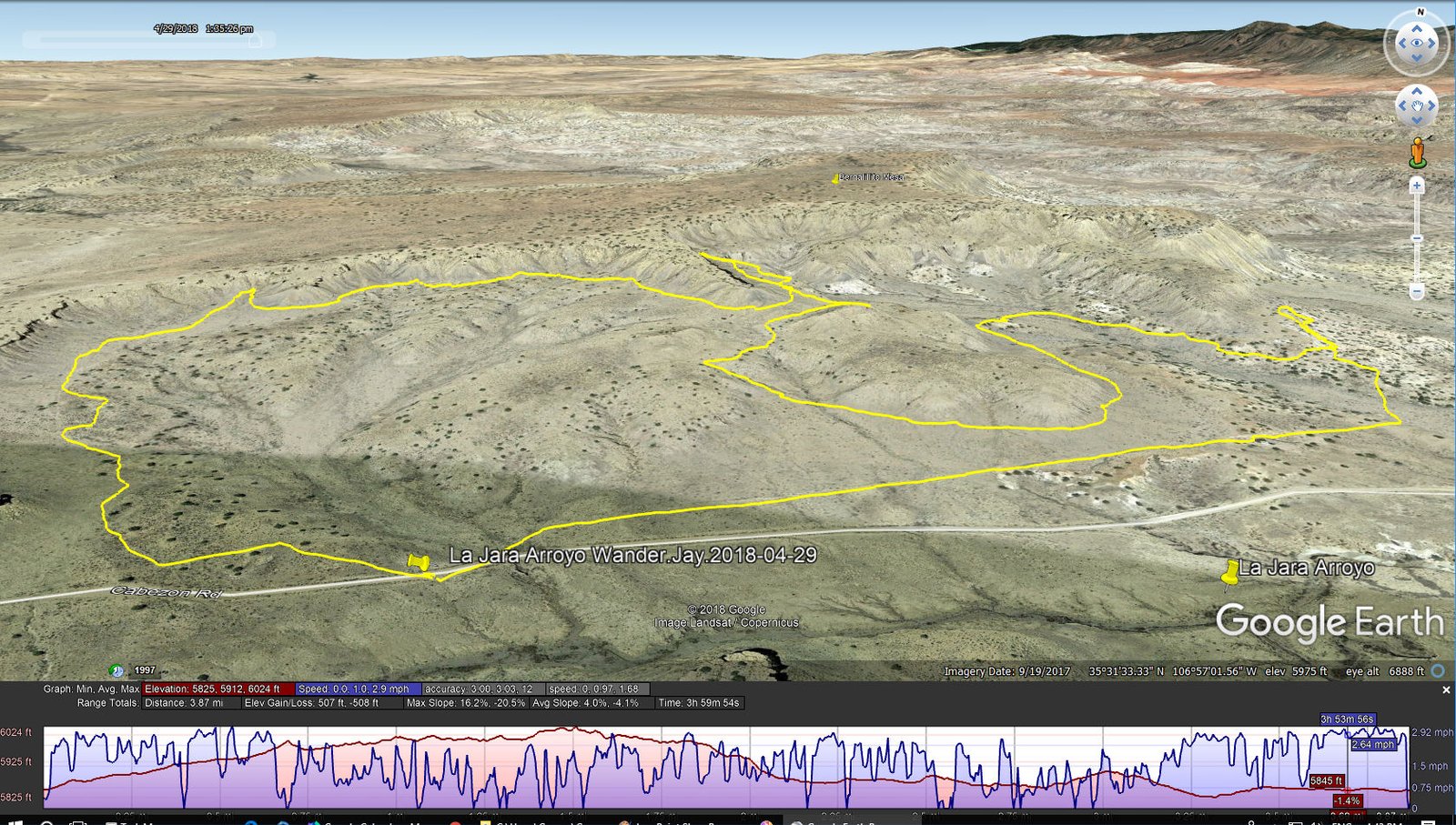
La Jara Arroyo Hike.Jay.2018-04-29
The first 1.25 miles of our wander allowed us to remain close to the bottom of the edge of Bernalillito Mesa. But then we faced a deep washed-out arroyo that we chose not to attempt crossing. So from there we wandered around the bottom of the “sub-mesa”, then back towards the mesa and a bit further for our mid-hike break. Along the way the geology changed continuously (rocks, outcrops, types of material); always great scenery near and far.
Statistics
Total Distance: 3.87 miles
Elevation: start 5,847 ft, maximum 6,024 ft, minimum 5,825 ft
Gross gain: 199 ft. Aggregate ascending 507 ft, descending 508 ft
Maximum slope: 16% ascending, 21% descending, 4% average
Duration: 4:00
| GPS Track Files for Download | |
235 Downloads | |
|---|---|
280 Downloads | |
I urge you to explore our hiking tracks with Google Earth. With the virtual 3-dimensional presentation, achieved by panning and tilting the view, you can get a much better idea of the hikes and terrain than you can get from the 2-dimensional screenshot above. For assistance: Using Google Earth Track Files.
Related Posts (in the vicinity)
References
Hiking in New Mexico: Our hikes in the Ojito WildernessHowdy, George Young
Descriptions, tracks, references, and photos


