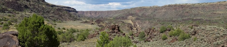
Returning from a 7-day trip across a portion of the Mountain West with my daughter’s family from Virginia, Pat & I spent two nights at an AirBnB in Arroyo Seco, NM. On our way home we stopped at the Wild Rivers Recreation Area to hike the La Vista Verde trail in the Orilla Verde Recreation Area.
The Hike
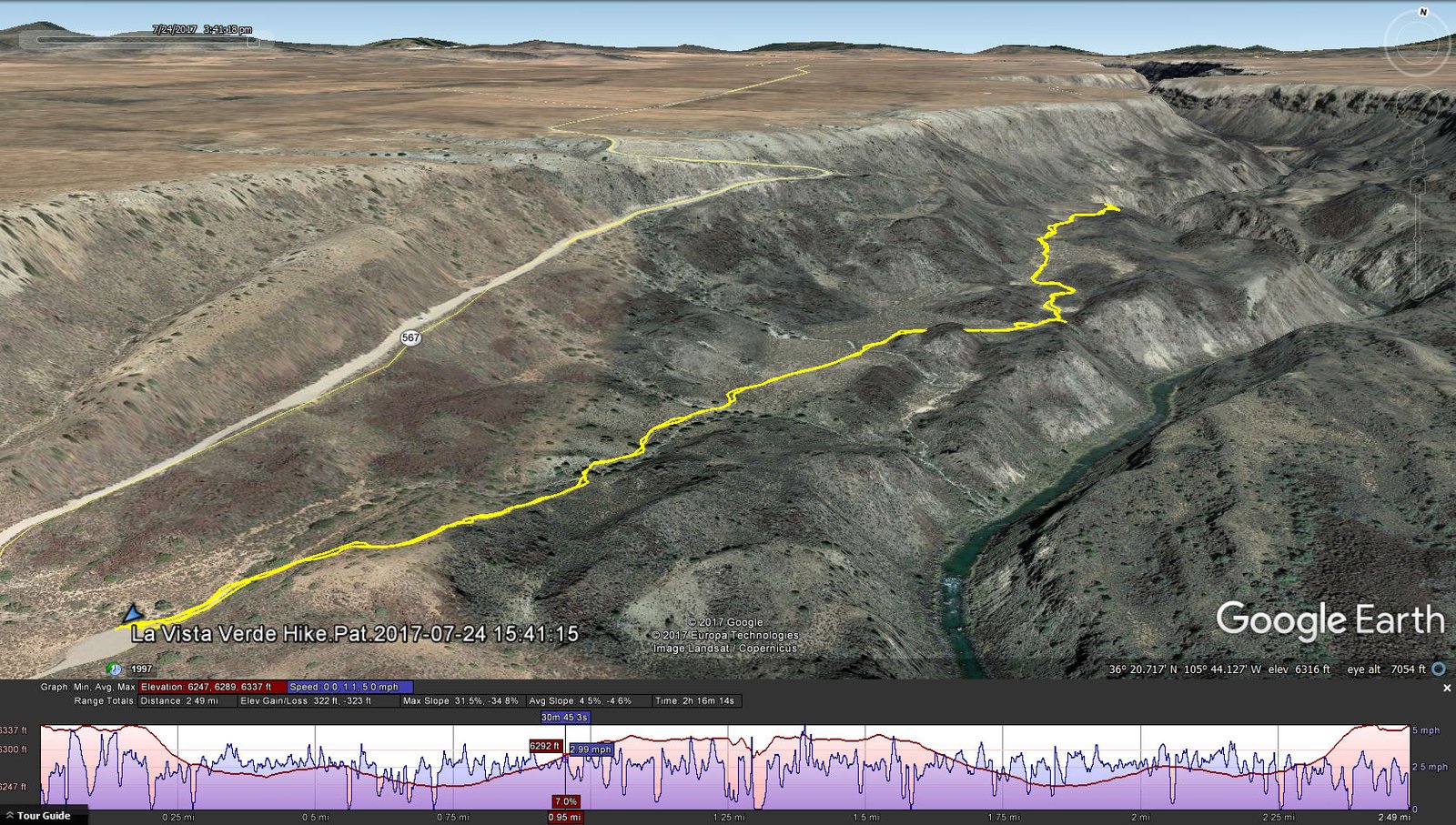
La Vista Verde Hike.Pat.2017-07-24
Tho’ a bit hot on this day, the views up and down the Rio Grande River made this easy hike well worth our visit.
Statistics
Total Distance: 2.49 miles
Elevation: start 6,337 ft, maximum 6,337 ft, minimum 6,247 ft
Gross gain: 90 ft. Aggregate ascending 322 ft, descending 323 ft
Maximum slope: 5% ascending, 5% descending, 5% average
Duration: 2:16
| GPS Track Files for Download | |
175 Downloads | |
|---|---|
349 Downloads | |
208 Downloads | |
158 Downloads | |
I urge you to explore our hiking tracks with Google Earth. With the virtual 3-dimensional presentation, achieved by panning and tilting the view, you can get a much better idea of the hikes and terrain than you can get from the 2-dimensional screenshot above. For assistance: Using Google Earth Track Files.


Looking for some other hiking suggestions near Taos, thanks!
As you see, we haven’t hiked much thereabouts. But we have hiked on some nice trails when camping near Red River, just 30 miles from Taos: Search on Keyword “red river” or use the Maps of Hiking Locations.
Tis nice to receive your comment; I haven’t received many; thanks.
Happy Hiking here in New Mexico.