
One of our early hikes, checking out trails out of Placitas, on the north end of the Sandia Mountains. Published in March 2019.
Statistics
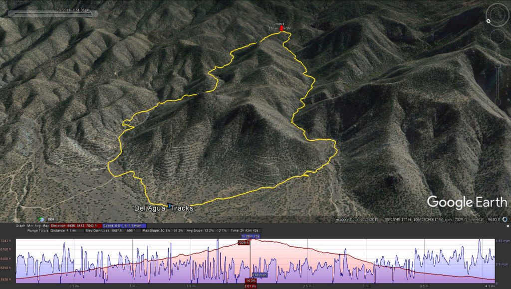
Total Distance: 4.10 miles
Elevation: 5,936 start, 7,043 maximum, 7,043 minimum
Gross gain: 1,107 ft. Aggregate ascending 1,587 ft, descending: 1,598 ft
Maximum slope: 50% ascending, 58% descending, 13% average
Duration: 2:43
| GPS Track Files for Download | |
312 Downloads | |
|---|---|
143 Downloads | |
If you haven’t explored these hiking tracks with Google Earth, I urge you to try it. With the virtual 3-dimensional presentation, achieved by panning and tilting the view, you can get a much better idea of the hikes and terrain than you can get from the screenshot above. For some ideas, check out Using Google Earth Track Files.
Download .kml file for Google Earth here: Del Agua-Piedra Lisa Hike.Jay.2013-03-09
References: Sandia Mountain Hiking Guide: “Del Agua Trail, Piedra Lisa Trail”
ASCHG: “Piedra Lisa North – Del Agua Loop Hike”
ondafringe: “North Piedra Lisa/Del Agua Loop“


It’s good to know someone is using the information I post to plan their own hikes because that is the very reason I started blogging my hikes. So thanks very much for letting me know.
BTW, I have included a link to your hiking info on the main page of my blog.
Safe hiking to you and your wife.
Looks pretty cool… literally! 😉
Thanks for linking to my hiking blog. With your permission, I will include a link to your site on my blog, as well. Just tell me which link you want me to use.
Maybe we’ll run into each other on the trail!
Good evening, George,
Thank you for your comments. Your BLOG has been indispensable as a resource that has given me leads for hiking these past 3 or 4 years, to follow your leads for places, hikes, and for sharing our experiences as you do via your BLOG. I’d be most flattered to have your BLOG recognize our efforts and accomplishments. And it would be an honor to meet you on the trail.
cheers,
george