Tag Archives: Peyton

Kasha-Katuwe Tour – 07/12/2012

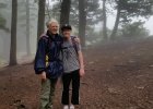
Published in March 2019. One of our early hikes, this during a visit from grandson Peyton.

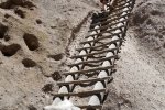
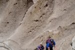
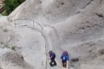
During Peyton’s summer visit in 2012, we visited Kasha-Katuwe Tent Rocks National Monument. This is a favorite place to take visitors to New Mexico. It provides the chance to see ‘hoodoos’, a common geologic formation, but these are somewhat unique in their tent shape. Visiting the Monument affords the chance to walk among a few of the hoodoos, as well as pass through a slot canyon and climb up to the top of the mesa overlooking the formations below.

References

BLM: Kasha-Katuwe Tent Rocks National Monument
New Mexico True: Kasha-Katuwe Tent Rocks National Monument
AllTrails: Tent Rocks Trail
TripAdvisor: Kasha-Katuwe Tent Rocks National Monument
TripSavvy: Tent Rocks national Monument in New Mexico
Hiking Project: Slot Canyon Trail Out and Back

Bandelier, Alcove House Hike – 08/08/2017

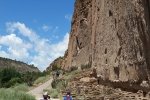
Bandelier National Monument is a great place to introduce visitors to New Mexico to Ancient Pueblo history. 

The Hike

Bandelier, Alcove House Visit.PatPeyton.2017-08-08

Thus, it was time to go there with grandson Peyton. 

Statistics

Total Distance:  2.85 miles
Elevation: start 6,066 ft, maximum 6,400 ft,  minimum 6,066 ft
Gross gain: 336 ft.  Aggregate ascending 944 ft, descending 949 ft
Maximum slope: 72% ascending, 69% descending, 11% average
Duration: 1:57

GPS Track Files for Download
152 Downloads
60 Downloads
I urge you to explore our hiking tracks with Google Earth. With the virtual 3-dimensional presentation, achieved by panning and tilting the view, you can get a much better idea of the hikes and terrain than you can get from the 2-dimensional screenshot above. For assistance: Using Google Earth Track Files.

References

National Park Service: Bandelier National Monument
The American Southwest: Bandelier National Monument
Google: Bandelier National Monument
YouTube Video: Bandelier National Monument (Edward Rozylowicz)
Earth Observatory: Bandelier National Monument

  While Peyton visited, we went to Meow Wolf in Santa Fe.

East Fork Jemez Box Hike – 08/09/2017

Pat and I explored this trail earlier; on this day we returned to it with grandson Peyton.

The Hike

East Fork Jemez Box Hike.PatPeyton.2017-08-09

This is an easy hike, and to exploring the Box was entertaining. And this time we came prepared to wade in the river.

Statistics

Total Distance:  3.36 miles
Elevation: start 8,100 ft, maximum 8,232 ft,  minimum 7,961 ft
Gross gain: 371 ft.  Aggregate ascending 913 ft, descending 913 ft
Maximum slope: 47% ascending, 56% descending, 8% average
Duration: 2:26

GPS Track Files for Download
132 Downloads
127 Downloads
I urge you to explore our hiking tracks with Google Earth. With the virtual 3-dimensional presentation, achieved by panning and tilting the view, you can get a much better idea of the hikes and terrain than you can get from the 2-dimensional screenshot above. For assistance: Using Google Earth Track Files.

References:

SummitPost: East Fork Box
USDA Forest Service: East Fork Trail (FT #137)
ASCHG: East Fork Box Wade Hike

Crest Trail Hike – 8/22/2016

Drove up the Crest Highway to Sandia Crest for a hike with Pat and Peyton.

The Hike

Crest Trail Hike, Pat & Peyton, 8/22/2016
Crest Trail, Pat & Peyton, 8/22/2016

 From Albuquerque, the Crest was shrouded in clouds.  And the clouds were still hanging around when we arrived at the Crest House.  None the less, we had a very nice hike, first north on the Crest Trail for 3/4 of a mile, then south for half a mile.  

Statistics

Total Distance: 2.83 miles
Elevation: 10,389 start, 10,419 maximum, 10,145 minimum
Gross gain: 244.  Aggregate 593 ft ascending, 596 ft descending
Maximum slope: 45% ascending, 46% descending, 7.5% average
Duration: 2:18

GPS Track Files for Download
119 Downloads
174 Downloads
If you haven’t explored these hiking tracks with Google Earth, I urge you to try it. With the virtual 3-dimensional presentation, achieved by panning and tilting the view, you can get a much better idea of the hikes and terrain than you can get from the screenshot above. For some ideas, check out  Using Google Earth Track Files.