Category Archives: Jemez

In the vicinity of the Jemez Mountains, NM.

Rio Cebolla Hike – 06/13/2025

Introduction

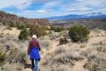
After nearly a year off-trail, this is our first return to hiking – a short one but a step in rehabilitation from back issues that severely limited my mobility. It was a good choice – a seldom used two-track (even surface) and with little elevation gain (‘tho with some ups-and-downs for the walking stride to get re-accustomed to sloped terrain). So I post this “sub-hike” more to document it as to share with others. If it peaked your curiosity, check out the Related Posts below for other forays into Rio Cebolla and references to it on other hikes in the vicinity.

The Drive In

To get to the trailhead drive west on NM 126 up over the high terrain and down to Fenton Lake. At the entrance to the lake turn to the right to remain on NM 126  and continue for about 3 miles. Then turn right on NM 314 towards the Seven Springs Fish Hatchery. Past the fish ponds the road becomes a bit rough, not so rough as previous posts described; medium clearance vehicle is recommended. ‘Tis about 1.5 miles to the Seven Springs Picnic Site (formerly Campground – camping not allowed now).  There is a pit toilet and some picnic tables, plus plenty of parking.

The Hike

Rio Cebolla Canyon Hike Jun 13 2025
FR 314-Cebolla Canyon Hike.Pat.2025-06-13
Notes about the Google Earth screenshot: the graph at the bottom shows elevation of the track (pink area) and speed (the blue line).

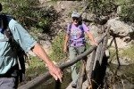
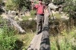
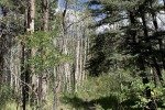
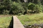
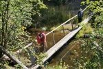
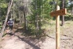
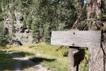
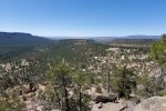
The Rio Cebolla is in a -beautiful canyon-. The trail follows a two-track used regularly by officers tending this “Red Chile Water”, a designation given by the NM Department of Game and Fish for streams receiving special attention. Their goal is the return of native fish, particularly Rio Grand Cutthroat trout, to New Mexico waters.


We hiked in 1.2 miles where the two-track cross to the east side of the Rio Cebolla. For this day, that was as much as I wished to go. During the hike, I recalled some great hikes in Cebolla Canyon and in the canyons that come down from the ridge to the east – Oat, Hay, and Pony.

Statistics

Total Distance:  2.29 miles
Elevation: start 8,073 ft, maximum 8,165 ft,  minimum 8,073 ft
Gross gain: 92 ft.  Aggregate ascending 546 ft, descending 550 ft
Maximum slope: 27% ascending, 34% descending, 6% average
Duration: 1:37

GPS Track Files for Download
13 Downloads
9 Downloads
If you haven’t explored these hiking tracks with Google Earth, I urge you to try it. With the virtual 3-dimensional presentation, achieved by panning and tilting the view, you can get a much better idea of the hikes and terrain than you can get from the screenshot above. For some ideas, check out  Using Google Earth Track Files.

Related Posts

Cebolla Canyon Hike – 10/23/2017
Cebolla Canyon to Oat Canyon to Hay Canyon Hike – 04/23/2017
Cebolla Canyon Hike – 06/29/2014
All posts with reference to Cebolla Canyon (Rio Cebolla)

References and Resources

US Forest Service: AllTrails: Rio Cebolla Trail #68
US EPA: Watershed Program Reduces Sedimenation
New Mexico ENMR: Fenton Lake State Park
Southern New Mexico Explorer: Rio Cebolla-Santa Fe National Forest
Jemez Central – Rio Cebolla
New Mexico Wildlife: Red/Green Chile Waters …

Jemez Pueblo Red Rock Trail Hike – 04/05/2024

With winter’s weather passing, ’tis time for us to get back on the trails. In the past couple of years, we’ve passed the Red Rocks Canyons in Jemez Pueblo. The Pueblo recently opened a trail into one of the canyons visitors; this would be a good start for this year’s hikes.

The Drive In

This may be the easiest trail to access in the Jemez: from Albuquerque west on US 550 to Ysidro. Then north on NM 4, 6.6 miles to the Walatowa Visitor Center. Purchase passes there ($12); the trail is across the highway from the Visitor Center.

The Hike

Jémez Pueblo Red Rock Trail Hike.Pat.2024-04-05
Notes about the Google Earth screenshot: the graph at the bottom shows elevation of the track (pink area) and speed (the blue line).
The trailhead is on the east side of NM 4, through a u-shaped entrance.
The trail is well marked the whole distance, a sandy surface throughout (except in the slot canyon) and little elevation gain. And the view into the canyon is impressive.
Throughout the trail the rock faces and canyon walls present an amazing variety of shapes and patterns.
The canyon wall appears to be impenetrable as we approached the slot canyon.
In the slot canyon (enter at 7/10th mile), the trail is well marked here too (60+ foot canyon walls) but the surface is quite rocky.

At one mile (3/10th into the canyon), we encountered a 10 foot tall rock blocking the way further into the canyon – we chose to stop there.

On the return from the slot canyon the views towards the Visitors Center and the mountains beyond were beautiful.

Highlight

The views up to the entrance the slot canyon are varied: we enjoyed the views back towards the Visitor Center of the mesa and mountains beyond. The varied colors (predominantly red) and patterns on the rock faces are quite interesting. And in the slot canyon we found an amazing variety of rocks – red, black, even a purplish. It would be great to return with a geologist.

Statistics

Total Distance:  1.88 miles
Elevation: start  5,614 ft, maximum  5,862 ft,  minimum  5,614 ft
Gross gain:  248 ft.  Aggregate ascending  625 ft, descending  625 ft
Maximum slope: 64% ascending, 62% descending, 10% average
Duration: 1:38, Average Speed: 1.2 mph

GPS Track Files for Download
43 Downloads
38 Downloads
If you haven’t explored these hiking tracks with Google Earth, I urge you to try it. With the virtual 3-dimensional presentation, achieved by panning and tilting the view, you can get a much better idea of the hikes and terrain than you can get from the screenshot above. For some ideas, check out  Using Google Earth Track Files.

References and Resources

Jemez Pueblo: Red Rock Trails
                           Walatowa Visitor Center
AllTrails: Red Rock Trail with Walatowa Slot Canyon
Atlas Oscura: Walatowa Slot Canyon
Panethos: Rockin’ the red stone trails of New Mexico’s Jemez Pueblo

FR 144-San Antonio Hot Springs Hike – 10/13/2023

‘Tis the time of year when autumn colors fill the bosques (the cottonwood trees) and the mountainsides (aspen). Hoping to catch the time right, we headed for the Jemez Mountains for, a drive on a forest road we haven’t seen in along time, and a hike we haven’t done before.

The Drive In

I will start the description at La Cueva on NM 4 – turn onto NM 126. proceed past the San Antonio Campground, then up-up-up the hill until just past the top, 5.8 miles. Turn right onto FR 144 – it is rough in spots so not suitable for a low-clearance vehicle but high-clearance isn’t required – for 6.4 miles. In a dip in the road, turn right to a parking area maybe 50 yards from FR 144.

The Hike

FR 144-San Antonio Hot Springs Hike 2023-10-13
Notes about the Google Earth screenshot: the graph at the bottom shows elevation of the track (pink area) and speed (the blue line).

This hike began by passing through a pedestrian gate (typical pasture barbed wire gate, it may be closed) and proceeds down a seldom used 2-track. At the bottom of the slope, now in the San Antonio Creek valley (soon to become a cañon), we bore to the right to follow the two-track (this happens to be FR 376).

The trail/2-track proceeds just above the western side of the cañon with nice views across the Creek to the steep slopes of the eastern side of the cañon. And above us the vertical rock outcroppings to prevalent in these Jemez Mountain, formed by the Valles Caldera volcano.


About 2.5 miles into the hike we were abreast of the San Antonio Hot Spring. We crossed the Creek (on a bridge, for our convenience and dry feet) and climbed up a -well used-, steep trail to the Hot Spring, ~200 feet, 2/10th of a mile. There were a handful of people already there enjoying the 3 or 4 pools – the hotest pool at the top, the other pools progressively less hot. We chose the 3rd pool down to soak our feet (we didn’t have appropriate attire to make it a full soak; all the other people were appropriately attired). Then it was a hike back to the truck (including an uphill finish which we normally avoid).

A Note: In talking with a couple of the others who were there, we learned that FR 276 is open and offers a drive in that is closer than our drive/hike; in the past it hasn’t always been open. They also reported that it, like FR 144, is a bit rough.

Highlight

It was great to be back in the Jemez, and ‘tho not yet in full “bloom”, to see the colors of autumn.


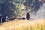
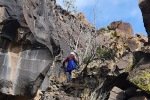
And to top off the highlights of this hike, we were encountered by a pair of (real) cowboys rounding up their cattle before winter sets in. We had exchanged greetings with them as we started the hike at the trailhead, and as they mounted their horses and headed into the cañon. But along the trail towards the Spring they came up behind us, and … asked us to get off the trail – we climbed into a crevice in the cañon wall as they passed us by.
Statistics

Total Distance: 5.32 miles
Elevation: start  8,713 ft, maximum  8,713 ft,  minimum  8,258 ft
Gross gain:  455 ft.  Aggregate ascending  1,353ft, descending  1,352 ft
Maximum slope: 43% ascending, 36% descending, 7.2% average
Duration: 4:19, Average Speed: 1.2 mph

GPS Track Files for Download
45 Downloads
45 Downloads
If you haven’t explored these hiking tracks with Google Earth, I urge you to try it. With the virtual 3-dimensional presentation, achieved by panning and tilting the view, you can get a much better idea of the hikes and terrain than you can get from the screenshot above. For some ideas, check out  Using Google Earth Track Files.

Related Posts

Off of FR 144
Road Canyon Hike – 11/19/2017
San Antonio Canyon North Hike, 11/12/2017
Pony Canyon Hike, 09/04/2017
Pony Canyon Hike, 06/04/2017
  And there are other hikes in cañons off of FR 144
From within Valles Caldera
Valle de San Antonio Hike, 09/22/2020
Valle de San Antonio Hike, 09/11/2019
Hikes in Valles Caldera
Hikes in the Jemez Mountains

References and Resources

USDA Forest Service: San Antonio Hot Springs
All Trails: San Antonio Hot Springs
Trip Advisor: San Antonio Hot Springs
Ultimate Hot Springs Guide: San Antonio Hot Springs
Traxplorio: San Antonio Hot Springs – A Little Slice of Heaven Deep in the Santa Fe National Forest

Photos

White Rock Canyon Rim Trail – 03/10/2023

This was a get-out-of-town day, and our first and probably only visit to see the snow in the Jemez this year, and in particular in Valles Caldera.

The Drive In

We made the full loop around NM 4: Bernalillo, San Ysidro, Jemez Pueblo and a stop at Walatowa (they are set up to serve drinks and soon sandwiches), La Cueva, Valles Caldera, White Rock, Pojoaque (and tacos at El Parasol), then home via Santa Fe. ‘Tis a 200 mile drive, but it was wonderful to return to NM 4 and the Jemez River valley after many months.

NM 4 was clear the whole way. We first encountered snow as we neared La Cueava, nearing 7,500 feet elevation. Both campgrounds (Redondo and Jemez Falls) were closed. The road into the Visitors Center at Valles Caldera was also mostly clear of snow. But the drifts on both sides were 4 feet high (and a fellow we talked reported that was 2 feet less than a week ago). And the Valle itself was white from rim to rim (and with no grass showing, it seems that the elk went to lower elevations).

As for the hike, we stopped at the White Rock Visitors Center to pick up brochures. From there signs directed us to the White Rock Overlook and to the Blue Dot Trailhead.

The Hike

White Rock Canyon Rim Trail.Pat.2023-03-10
Notes about the Google Earth screenshot: the graph at the bottom shows elevation of the track (pink area) and speed (the blue line).

This trail is billed as an easy out-and-back hike, and that it is. At times the trail is but a few steps from the sheer cliff into the Rio Grande canyon, so the views down to the river and up the other side of the canyon are stunning. The trail is well used so it is smooth with a few areas of rocky surface.

Near the end of the designated trail, we decided to turned back. On the way out I had noticed a wide, grassy ledge a few feet below the rim trail. There appeared to be a trail along that ledge – that’s curious I thought. I had also noticed a half mile back a side trail going down off of the rim trail towards the canyon. And one more clue: GAIA GPS (on which I nowadays track our hikes) showed a trail that appeared to exist on that ledge – we decided to take it.

The ledge is 30-60 feet wide, with, yes, a nice well-used trail. It descended gradually as we headed north, and we kept an eye out for a path of some kind back up onto the rim – the cliff to our left was vertical, 20 feet tall when we started, increasing to more that 50 feet. A half mile along, I referred to GAIA and noticed a ‘narrow line’ trail going towards the cliff, and on the ground signs of a trail that corresponded to the map.

Approaching the cliff, we were looking at a cleft filled with tumbled rock. After some hesitation, Pat volunteered to check it out. And up she went. I followed – the climb went smoothly, from one rock to the next, occasionally maintaining balance with hands on nearby rocks. It was surprisingly easy. NOTE: We Would Not Recommend making this loop from the Rim Trail to the ledge in the opposite direction – descending in the rock-strewn crevice would be difficult (for me, dangerous).

Highlight

The views are spectacular: looking down at the Rio Grande nearly 1000 feet below, the sheer walls 1.25 miles across the canyon, and in the distance the Sangre de Cristo mountains and Santa Fe Ski Basin 33 miles to the east.  Oh, and we could see Cañada Ancha, the wash where we did the Diablo Canyon Hike; it beckons us to do that one again. (As you may notice, the photos are a bit washed out – the sky and air were hazy that day. On a day of clear air the views would be more amazing.)

Statistics

Total Distance:   2.88 miles
Elevation: start  6,274 ft, maximum  6,327 ft,  minimum  6,202 ft
Gross gain:  125 ft.  Aggregate ascending  821 ft, descending  820 ft
Maximum slope: 54% ascending, 49% descending, 7.8% average
Duration: 1:50

GPS Track Files for Download
55 Downloads
62 Downloads
If you haven’t explored these hiking tracks with Google Earth, I urge you to try it. With the virtual 3-dimensional presentation, achieved by panning and tilting the view, you can get a much better idea of the hikes and terrain than you can get from the screenshot above. For some ideas, check out  Using Google Earth Track Files.

Related Posts

Diablo Canyon Hike – 12/23/2017

References and Resources

Los Alamos: White Rock Canyon Rim
                     White Rock Canyon Trailheads (pdf)
AllTrails: White Rock Canyon Rim Trail
MTB Project: White Rock Canyon Rim Trail
GAIS GPS: White Rock Canyon Overlook via White Rock Canyon Rim Trail
ondafringe: BlueDot/RedDot Trails~White Rock Canyon

Boletsakwa Ruins Hike – 09/08/2022

This is among our favorite places, although we haven’t returned there since 2018. It is an easy hike and is interesting – a place we consider first when visitors come to town.

The Drive In

From a post for an earlier visit:

“The drive from Bernalillo up US 50 to San Ysidro, then up NM 4 that follows the Jemez River, through Jemez Pueblo (honor the speed limits here) and a visit to the Visitors Center at Jemez Springs. Then we returned south, turned left on NM 290, continued past the name-place Ponderosa and further on the Paliza Campground. At the campground, we turned left onto FR 10, crossed the River and continued up the winding ascent to the top of Ponderosa Mesa. Parking at the top, we walked south, a short 1.2 miles on an easy trail to the Boletsakwa Ruins.”

The Hike

Boletsakwa Ruins Hike.Pat.2022-09-08
Notes about the Google Earth screenshot: the graph at the bottom shows elevation of the track (pink area) and speed (the blue line).

The trail begins on a 2-track at the top of the hill, up FR 10 from the bridge across the creek in Paliza Canyon (one could take a 2-track a short distance before the top of the hill that would shorten the hike a bite). From the top of the hill, the 2-track descends then ends about 3/4 mile on.  From there, ascending a bit, one faces a large rock impediment. One -could- (I suppose) climb over it (it seems some do), but there is a trail that skirts the rock to the right.

The trail crosses a steep slope, ascends, and takes one beyond the rock and onto more flat terrain.


From there the trail is less distinct, but takes one to the Boletsakwa Ruins. This day, thanks to the heavy monsoon season this year, the ruins are thoroughly overgrown and difficult to discern, especially the first and oldest of the two sets or ruins. To get some pictures of the ruins more exposed, review the photos on the hike back in 2016. None-the-less, it is interesting to be in the presence of people from Jemez Pueblo in the 17th century (see Archeology of the Jemez Province).

We continued to the far end of the more recent ruins, wandered about a bit to view the depression that must have been a kiva, then went over the western edge of the mesa to have lunch on our favorite spot – rock benches overlooking San Juan Canyon and San Juan Mesa beyond.

On our return, we followed that alternate 2-track to assess its accessibility – it appears suitable for even  standard-clearance passenger car.


Statistics

Total Distance:   2.53 miles
Elevation: start  7,220 ft, maximum  7,265 ft,  minimum  7,137 ft
Gross gain: 128 ft.  Aggregate ascending  502 ft, descending  502 ft
Maximum slope: 35% ascending, 42% descending, 6.4% average
Duration: 3:17

GPS Track Files for Download
63 Downloads
59 Downloads
If you haven’t explored these hiking tracks with Google Earth, I urge you to try it. With the virtual 3-dimensional presentation, achieved by panning and tilting the view, you can get a much better idea of the hikes and terrain than you can get from the screenshot above. For some ideas, check out  Using Google Earth Track Files.

Related Posts

Other posts for Boletsakwa Ruins

References and Resources

ASCHG: Goblin Rocks And Ponderosa Indian Ruins Hike
ASCHG: Ponderosa Mesa Hike
ASCHG: Ponderosa Mesa from Paliza Group CG Hike
OtherHand: Boletsakwa Ruins
Dog of the Desert: Boletsakwa in the Jemez Mountains 
Museum of New Mexico, Office of Archeological Studies:
       Archeology of the Jemez Province 
“Archeologies of the Pueblo Revolt ..”: Extract from
School for Advanced Research:
     Archaeology of the Jemez Pueblo Revolt, Overnight in Jemez Springs 
San Juan Basin Archaeological Society, Field Trip Report: Jemez Mountains (pdf)
Museum of New Mexico: … Archeology of the Jemez Province … (pdf)
Las Conchas Trail Hike – 08/23/2022

Camped for 3 nights at the Jemez Falls Campground with Jay, Nancy, and Bo. After setting up at the campsite, we took a walkabout down a trail from our campsite towards Jemez Falls. On the 2nd day with Pat and Jay we hiked the Las Conchas Trail in the morning and did another walkabout with Pat, Jay, and Bo in the afternoon.

The Drive In

From Jemez Falls Campground, we drove 4.5 miles east on NM 4. Parking at the traihead was full, so we continued another quarter mile to parking in front of a popular climbing wall (no climbers this day).

The Hike

Las Conchas Trail Hike.PatJay.2022-08-23
Notes about the Google Earth screenshot: the graph at the bottom shows elevation of the track (pink area) and speed (the blue line).

We’ve hiked this trail before, one of our favorites. Notable on this visit to the trail were the wide range of flowers in bloom, courtesy I suppose of the quite wet monsoon season we enjoyed this year. (Nancy didn’t join us, rather staying in camp to look after the new addition to our crew – Bo their Sheltie puppy).

While camping in Jemez Falls Campground, we made a couple of short hikes from our campsite, #28. These were quite pleasant hikes on lightly used trails, going to an overlook above the Jemez River and it’s Falls. One -could- go down into the cañon to the Falls, but we weren’t up to it, for the 1st after arriving after our drive from Albuquerque, and for the 2nd after our hike on the Las Conchas Trail (tracks below are for this 2nd short hike).

Jemez Falls Trail from Site 28.Pat.2022-08-24

Before returning to the Campground, we continued east on NM 4 to take a (longing) look at Valles Caldera. Check out this movie Valles Caldera from NM 4, 08/23/2022, our best shot at sharing with you the vastness and beauty of this special place in New Mexico.

Highlight

With the prodigious monsoon rains this year, New Mexico has turned green (even out in the normally brown/tan grasslands and scars from recent wildfires). And with the green comes an abundance of flowers. I counted more than 30 different blossoms on our hikes – check out the photo gallery below.

Statistics

Los Conchas East Trail
Total Distance: 3.57 miles
Elevation: start  8,400 ft, maximum  8,422 ft,  minimum  8,328 ft
Gross gain: -94 ft.  Aggregate ascending  881 ft, descending  884 ft
Maximum slope: 48% ascending, 40% descending, 6.1% average
Duration: 2:40

Jemez Falls Trail from Site 28
Total Distance: 1.97 miles
Elevation: start  7,965 ft, maximum  8,014 ft,  minimum  7,835 ft
Gross gain: 179 ft.  Aggregate ascending  548 ft, descending  548 ft
Maximum slope: 36% ascending, 43% descending, 9.4% average
Duration: 1:18

GPS Track Files for Download
59 Downloads
77 Downloads
46 Downloads
69 Downloads
If you haven’t explored these hiking tracks with Google Earth, I urge you to try it. With the virtual 3-dimensional presentation, achieved by panning and tilting the view, you can get a much better idea of the hikes and terrain than you can get from the screenshot above. For some ideas, check out  Using Google Earth Track Files.

Related Posts

Hikes on Las Conchas East Trail

References and Resources

The Campground
USDA Forest Service: Jemez Falls Campground (includes line to Recreation.gov)
 CampsitePhotos: Jemez Falls Campground

The Trail
USDA Forest Service: Las Conchas Trailhead
                                        Las Conchas Trail
                                        Jemez Falls Trailhead (from Group Campground to the Falls)
AllTrails: East Fork Trail via Las Conchas Trailhead
                  Jemez Falls Trail (from Group Campground to the Falls)
SummitPost: Las Conchas, Jemez (for the rock climbers)
Santa Fe New Mexican: Day Hike: Lingering along Las Conchas Trail
World of Waterfalls: Jemez Falls

Flowers were very abundant along the Conchas trail and on the hike from the campsite. I counted 30+ different blossoms, many more than we’ve seen before. Here is a sampling of those we saw:

East Fork Jemez River Trail Hike – 09/18/2021

Jay, Nancy, Pat, & me

First day’s hike during a camping trip to Jemez Falls Campground with Pat, Jay, and Nancy. At various times we had done out-and-back hikes from each end of this trail. This day, with two vehicles, we welcomed the opportunity to make it a point-to-point, or through hike.

The Drive In

The trailhead is .9 miles east on NM 4 from the entrance to the Jemez Falls Campground. From here, trailheads of the East Fork Trail go in both directions, to the west passes the Jemez Falls Trailhead (and Campground), terminating at Battleship Rock, And to the east the trail passes above The Box and terminates at the Las Conchas Trailhead. We were taking the latter trail.

The Hike

East Fork Jemez River Trail Hike.PatJayNancy.2021-09-18

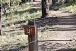
‘Tis a good trail, from beginning to end, smooth surface, little elevation changes, and shaded. The first half mile is on a well used two-track, but then the trail veers off into a pleasant open forest. There are signs along the way for guidance (‘tho the trail is so well used one could hardly get disoriented).

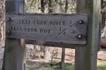
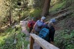
At about 1.1 miles from the trailhead we took a spur trail down into the canyon (250′ descent) to take a look at the East Fork Box. The descent is steep, but in the steepest stairs make it easy. At the bottom a bridge conveniently provides a way to cross and walk a bit upstream to the point where the Box blocks further passage (without wading).

After climbing out of the canyon, we continued on the great trail. It does ascend some 300′ in a gentle slope over 1.5 miles or so, then descends back into the canyon and hooks up with the Las Conchas Trail for the last 1.5 miles. There are river crossings, but in each case a bridge provides for a dry passage. And along the river, the setting is lush with grasses, trees, mosses on the rocks, overall a most pleasant trail.

Highlight

A great day hiking with really great friends.

Statistics

Total Distance:  5.93 miles
Elevation: start  8,113 ft, maximum  8,569 ft,  minimum 7,947 ft
Gross gain: 622 ft.  Aggregate ascending 1,455 ft, descending 1,168 ft
Maximum slope: 27% ascending, 33% descending, 6.7% average
Duration: 4:52

GPS Track Files for Download
160 Downloads
62 Downloads
If you haven’t explored these hiking tracks with Google Earth, I urge you to try it. With the virtual 3-dimensional presentation, achieved by panning and tilting the view, you can get a much better idea of the hikes and terrain than you can get from the screenshot above. For some ideas, check out  Using Google Earth Track Files.

Related Posts

Las Conchas Trail Hike – 08/29/2021
Las Conchas-East Hike – 10/15/2020
Las Conchas Trail Hike – 09/23/2020
East Fork Jemez Box Hike – 08/09/2017
East Fork Jemez Box Hike – 08/02/2017

References and Resources

USDA Forest Service: East Fork Trail (FT #137)
                                        East Fork Trailhead #137
AllTrails: East Fork Trail via Las Conchas Trailhead
                  East Fork Trailhead from Las Conchas Trailhead …
Hiking Project: East Fork Trail #137
SummitPost: East Fork Box
Trip Advisor: Las Conchas Trailhead … (great reviews)

East Fork Jemez River Hike – 09/17/2021

First day on a camping/hiking trip to Jemez Falls Campground. After getting the R-Pod set up, we had time to make a short exploratory hike into the East Fork Jemez River Slot Canyon.

The Drive In

The East Fork Jemez River crosses NM 4 just .4 miles east of the entrance to the Jemez Falls Campground. Parking is along side the road; it seems no one observes the No Parking signs, but beware of cars rounding the curve in the road at the bottom of a hill in each direction.

The Hike

Las Conchas West Hike.Pat.2021-09-17

This hike is just an exploratory hike to determine how far we could go before finding it necessary to “take to the river”.

‘Tis a steep descent from NM 4 into the canyon, but only 10 or 20 yards into a small parking area with picnic facilities. From there it is a pleasant trail along the River for about .45 miles when the Canyon narrows; continuing further would require wading in the River. We were not so prepared, so we turned back, satisfied with our reconnoitering.

Just a note: This point is also the starting point for the El Cajete Canyon Trail Hike – 08/30/2021.

Statistics

Total Distance:  0.89 miles
Elevation: start  7,944 ft, maximum  7,957 ft,  minimum 7,927 ft
Gross gain: 60 ft.  Aggregate ascending 292 ft, descending 292 ft
Maximum slope: 44% ascending, 36% descending, 9.2% average
Duration: 0:38

GPS Track Files for Download
108 Downloads
112 Downloads
If you haven’t explored these hiking tracks with Google Earth, I urge you to try it. With the virtual 3-dimensional presentation, achieved by panning and tilting the view, you can get a much better idea of the hikes and terrain than you can get from the screenshot above. For some ideas, check out  Using Google Earth Track Files.

Related Posts

Las Conchas Trail Hike – 08/29/2021
Las Conchas-East Hike – 10/15/2020
Las Conchas Trail Hike – 09/23/2020
Las Conchas Trail Hike – 07/26/2019

References and Resources

Only in Your State: This Easy 2.2-Mile Hike …
AllTrails: Jemez East River Slot Canyon

Las Conchas Trail Hike – 08/29/2021

The start of a 3-night camping trip in the Jemez Mountains with friends Jay & Nancy. Pat & I arrived early, leaving time for a short hike along the East Fork Jemez River.

The Drive In

We reserved a campsite at the Jemez Falls Campground – US 550 west from Albuquerque to San Ysidro, then north on NM 4 through the Jemez Pueblo, the village of Jemez Springs and on through La Cueva. Then another 5.5 miles to the entrance road to the Campground. We had reserved site 28 in Loop 2, a double site and very comfortable.

The Hike

Las Conchas Trail Hike.Pat.2021-08-29

We’ve hiked here before – ’tis a lovely canyon along the East Fork Jemez River, a well used trail. Vertical walls rise above the canyon floor on both sides of the River, in some places used extensively for rock climbers (there were a half dozen climbing this day). As always (except in winter), there were flowers all along the trail making it a most pleasant, short hike.


Statistics

Total Distance:  0.86 miles
Elevation: start  8,359 ft, maximum  8,418 ft,  minimum 8,355 ft
Gross gain: 63 ft.  Aggregate ascending 249 ft, descending 190 ft
Maximum slope: 59% ascending, 34% descending, 6.8% average
Duration: 0:33

GPS Track Files for Download
231 Downloads
144 Downloads
If you haven’t explored these hiking tracks with Google Earth, I urge you to try it. With the virtual 3-dimensional presentation, achieved by panning and tilting the view, you can get a much better idea of the hikes and terrain than you can get from the screenshot above. For some ideas, check out  Using Google Earth Track Files.

Related Posts

Las Conchas-East Hike – 10/15/2020
Las Conchas Trail Hike – 09/23/2020
Las Conchas Trail Hike – 07/26/2019

References and Resources

See the Related Posts above


‘Goblin Mesa’ & Goblin Colony – 04/07/2021

We had no advance plan, but we needed to get out into nature this week. Weather was a bit iffy, forecast to be chilly and windy. We decided to visit an old friend, Goblin Colony, up Paliza Canyon in the Jemez Mountains.

The Drive In

Driving towards the Jemez Mountains is always pleasant. The scenery heading west on US 550 gets better as White Mesa comes into view on the left, and the red cliffs of Mesa Cuchilla west of San Ysidro and the Jemez River come into view. Then the drive north on NM 4 adds more scenery as one passes through the Jemez Pueblo (Obey the Speed Limits – the Pueblo police “give no quarter”.)

No more than half a mile from leaving the Pueblo, turn right onto NM 290, continue pasts the Ponderosa Valley Vineyards and Winery, through the sparse village of Ponderosa, past the lake providing irrigation water to the Pueblo, and onto FR 10 (where the road changes to gravel). In another 2.5 miles or so is the Paliza Camptround (not open yet, but a really nice campground). Turn left across the bridge over Paliza Creek and park at the junction of FR 10, FR 266, and FR 271.

The Hike

‘Goblin Mesa’ & Goblin Colony Hike.Pat.2021-04-07

Goblin Colony is a great, short hike to some fascinating rock formations. The hike to goes up FR 271 (a two-track), then bears to the left. ‘Tis about 1.7 miles from parking with only a couple hundred feet elevation gain. For part of the way on the two-track, water was running in Paliza Creek and was filled with watercress. About .8 miles on, bear to the left and continue up a wash (bearing to the right, through a gate across the two-track, and up Paliza Creek makes for a great alternative, or an extension for some more hiking distance).

Normally, we’ve taken the wash to the Colony. But today – we diverted to explore potential camping sites, looking for level ground on the hillside above the wash. So we climbed 50′ to to the first area, then 150′ to another; and then without a real plan we continued climbing up the side of this small mesa (I can’t find a name for it, so I’m dubbing it “Goblin Mesa”, in honor of the Colony). And we continued climbing.

As we neared the top, of course it became more and more steep, until the last 100′ we were scrambling up a rock and gravel slope, about 45°. But we gained the top of Goblin Mesa. We found ourselves on flat & level rock surface that forms the end of the mesa, with an edge that was -vertical-, dropping precipitously a few 10s of feet. From this vantage point, where we paused for a snack, we took in the marvelous views of the canyons and mesas of this part of the Jemez Mountains. 

We gave only momentary thought to descending the way we came up. After checking the topo map (on USTopo, the GPS app on my phone), we decided to take our chances that there would be a easier descent (& safer!) at the other end of the mesa. The hiking along the mesa was easy with some rocky areas and a fair amount of deadfall in some areas (it appeared to be wind-blown where the mesa narrowed, exposing the trees to the strongest winds).

From visits to various sites of Pueblo ruins, I suspected there might be a Pueblo ruin of some sort on this mesa; I was on the lookout for any sign of a ruin. And I did spot a mound with lots of rocks strewn across it, which did not look like something Mother Nature would have formed. I’m convinced it is a small (15’x15′) ruin site. Hiking north for about half a mile, we found ourselves looking down upon Goblin Colony. And as hoped, we enjoyed a reasonable descent from the mesa top into the Colony.

Entering from this direction introduced us to somewhat different formations – quite interesting. We descended to the lower portion of the Colony, stopped in a nook out of the wind for our usual lunch (Trader Joe’s Ramen, PB&J sandwich, apple slices, and carrot sticks) and admired the Goblins around us. Then we hiked down the wash and Paliza Creek, back to the Tacoma.

Statistics

Total Distance:  4.07 miles
Elevation: start  6,854 ft, maximum  7,519 ft,  minimum 6,847 ft
Gross gain: 671 ft.  Aggregate ascending 1,019 ft, descending 1,027 ft
Maximum slope: 48% ascending, 44% descending, 7.8% average
Duration: 5:30

GPS Track Files for Download
328 Downloads
93 Downloads
If you haven’t explored these hiking tracks with Google Earth, I urge you to try it. With the virtual 3-dimensional presentation, achieved by panning and tilting the view, you can get a much better idea of the hikes and terrain than you can get from the screenshot above. For some ideas, check out  Using Google Earth Track Files.

Previous Posts in the area

Paliza Canyon Hike – 8/24/2014
Paliza Canyon & Goblin Colony Hike – 7/19/2015
Paliza Canyon & Goblin Colony Hike – 09/09/2015
Paliza Canyon, Ruins, Goblin Colony Hike – 9/11/2016
Paliza Canyon Hike – 11/09/2017
Ponderosa Mesa Hike – 02/18/2018

References and Resources

***Geology of the Jemez Area, Chapter 13: The Holocene
Prime Passages: Goblin Colony Hike
Lauren Danner: Chasing goblins in the Jemez Mountains
Atlas Obscura: The Goblin Colony
The Shallow Sky: Paliza Goblin Colony (includes Kiatsukwa Ruins)
Only In Your State:
      The Unforgettable New Mexico Hike That Leads To A Goblin Colony
AllTrails: Paliza Goblin Colony
The Gentle Art of Wandering: The Goblin Colony
Judith Bauman: Paliza Canyon Goblin Colony
The Kruse Chronicles: Paliza Canyon Goblin Colony