Category Archives: Camping

Activity: trips with camping.

Cumbres Pass CDT Trail South Hike – 07/12/2023

This post is for a 2nd hike that we made with Jay, Nancy, and Bo during a camping trip to Cumbres Pass and the Trujillo Meadows campground (10,000 feet elevation and above). Check out the 1st hike, Red Lake Trail Hike – 07/11/2023.

The Drive In

Repeating here The Drive In from the post for the 1st hike:

We chose to avoid I-25 and US 84, both busy roadways, and instead chose a route through Cuba (I-25 to Bernalillo, then US 550). Four miles beyond Cuba we turned right on NM 96. Upon reaching the sharp right turn of NM 96, we turned left to continue north on NM 112. The first 27 miles is paved; from there to El Vado dam (19 miles) the road is well maintained gravel; we kicked up quite a plume of dust behind us at 35-45 MPH. Tho’ a  sign warned us of the possibility of a delay of up to 2 hours, we took our chances – and won – no delay at the El Vado dam.

The road to cross El Vado dam is interesting. It is one lane down a very steep incline, then very narrow lane across the dam itself. We were OK with the R-Pod but would not attempt to cross here with anything larger. From there, NM 96 is paved to the intersection with US-84; then it was on to Chama. Borrowing the remainder of The Drive In from the post for last year’s trip:

“We drove from Albuquerque to Chama and continued on NM 17 up to the crest of Cumbres Pass (the highway becomes CO 17 as it passes into Colorado). For a good part of the way, Hwy 17 follows the tracks of the Denver and Rio Grande Railroad, aka Cumbres and Toltec Railroad to the crest where there is a small railyard.

Our campsite in Trujillo Meadows Campground. Atop a hill in the middle of the campground, we had great views in all directions.


Continuing past the crest for 1/4 mile, we turned left onto FR 118 (a good Class 3 road, tho’ there are some sections of serious washboard); in 2.5 miles turn right at the entrance to the campground. (Adjacent to the campground is Trujillo Meadows Reservoir. There are some sites that look down upon the reservoir and there is a road from the campground entrance to a boating ramp; we did not investigate either.) (We met Jay and Nancy in the same campsite that we used last year.)

The Red Lake trail is a bit further north on CO 17 — 6.4 miles from the turnoff to the Trujillo Meadows Campground. Turn left onto FR 113, a Class 3 road towards Red Lake — 3.5 miles. The road makes a sharp 180° turn to the left — parking is on the right up a short rise.”

The Hike

Cumbres Pass CDT Trail South Hike.PatJayNancyBo.2023-07-12
Notes about the Google Earth screenshot: the graph at the bottom shows elevation of the track (pink area) and speed (the blue line).

All of us agreed – this was among the most spectacular hikes that we’ve taken. I had hiked this trail in 2021 while Pat was attending a workshop in Chama. But I didn’t remember just how spectacular it is; Pat, Jay, and Nancy to brought it into focus for me.

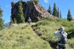
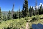
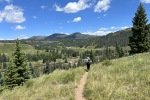
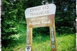
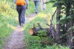
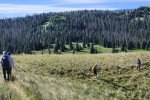
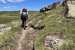
The trail begins from the parking area on the right side of CO 17 at the top of Cumbres Pass, just below (west of) the Cumbres and Toltec train station. The trailhead is well marked and well used – smooth ground through pine and fir forest bordered by grass and many varieties of flowers. It presents easy ascent for about 200 feet of elevation gain (with switchbacks) to get atop a long ridge (about half a mile).

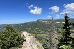
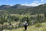
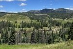
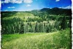
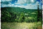
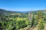
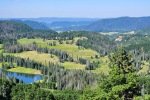
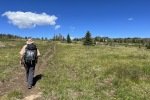
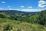
Along the ridge the views are amazing: to the west down the valley with the C&T tracks twisting their way to the top of Cumbres Pass, mountains in the distance to the north, and down the valley of Rio de los Piños and the railroad tracks.

The trail continues on the ridge for 8/10ths of a mile, descending 100 feet or so. It then enters a somewhat dense forest and begins to climb again, an easy ascent in and out of forest with a great overlook 2.2 miles into the hike. This was our plan for the day, 4+ miles – we turned back.

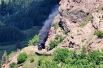
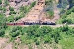
As we hiked along the ridge we kept our eyes on the railroad tracks. Our timing was good – the 10 o’clock train was on its way from Chama. We watched it stop at a water tank, then continue up to the station at Cumbres Pass. What a sight, especially as it rounded the steep end of a ridge on an embankment that must have been a marvel of engineering a 100+ years ago.

width=

Highlight

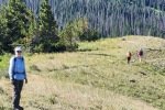
It was unanimous – this is among the best trails we’ve hiked – easy with marvelous, spectacular views. And Bo is getting his trail legs.

Jay here: Yep, they don’t say Bo is a Westie for nothing. Terriers are diggers but so far, Bo just digs coming along on the trail. Views from this hike were much better than average for sure, and the train going up the valley was a bonus.


Statistics

Total Distance:   4.54
Elevation: start  9,964 ft, maximum  10,342 ft,  minimum  9,964 ft
Gross gain:  378 ft.  Aggregate ascending  997 ft, descending  995 ft
Maximum slope: 26% ascending, 27% descending, 7.0% average
Duration: 3:27, Average Speed: 1.3 mph

GPS Track Files for Download
59 Downloads
204 Downloads
If you haven’t explored these hiking tracks with Google Earth, I urge you to try it. With the virtual 3-dimensional presentation, achieved by panning and tilting the view, you can get a much better idea of the hikes and terrain than you can get from the screenshot above. For some ideas, check out  Using Google Earth Track Files.

Related Posts

Hikes around Cumbres Pass

References and Resources

TrailForks: Continental Divide Trail (CDT) Complete
GAIA GPS:  Continental Divide Trail
MTB Project: CDT: Cumbres Pass to lagunitas (NM Section 31)
Mountain Photography: Continental Divide Trail through the South San Juans
Wikipedia: Cumbres Pass
Cumbres & Toltec Railroad: The Ride of a Lifetime

Red Lake Trail Hike – 07/11/2023

It has been -hot- in Albuquerque (and in Santa Fe). Even hotter than we anticipated when a few months ago we planned this camping and hiking trip to Cumbres Pass and the Trujillo Meadows campground (10,000 feet elevation and above). This post is for our first hike during this trip: the Red Lake Trail which Pat & I hiked a year ago.

The Drive In

We chose to avoid I-25 and US 84, both busy roadways, and instead chose a route through Cuba (I-25 to Bernalillo, then US 550). Four miles beyond Cuba we turned right on NM 96. Upon reaching the sharp right turn of NM 96, we turned left to continue north on NM 112. The first 27 miles is paved; from there to El Vado dam (19 miles) the road is well maintained gravel; we kicked up quite a plume of dust behind us at 35-45 MPH. Tho’ a  sign warned us of the possibility of a delay of up to 2 hours, we took our chances – and won – no delay at the El Vado dam.

The road to cross El Vado dam is interesting. It is one lane down a very steep incline, then very narrow lane across the dam itself. We were OK with the R-Pod but would not attempt to cross here with anything larger. From there, NM 96 is paved to the intersection with US-84; then it was on to Chama. Borrowing the remainder of The Drive In from the post for last year’s trip:

“We drove from Albuquerque to Chama and continued on NM 17 up to the crest of Cumbres Pass (the highway becomes CO 17 as it passes into Colorado). For a good part of the way, Hwy 17 follows the tracks of the Denver and Rio Grande Railroad, aka Cumbres and Toltec Railroad to the crest where there is a small railyard.

Our campsite in Trujillo Meadows Campground. Atop a hill in the middle of the campground, we had great views in all directions.

Continuing past the crest for 1/4 mile, we turned left onto FR 118 (a good Class 3 road, tho’ there are some sections of serious washboard); in 2.5 miles turn right at the entrance to the campground. (Adjacent to the campground is Trujillo Meadows Reservoir. There are some sites that look down upon the reservoir and there is a road from the campground entrance to a boating ramp; we did not investigate either.) (We met Jay and Nancy in the same campsite that we used last year.)

The Red Lake trail is a bit further north on CO 17 — 6.4 miles from the turnoff to the Trujillo Meadows Campground. Turn left onto FR 113, a Class 3 road towards Red Lake — 3.5 miles. The road makes a sharp 180° turn to the left — parking is on the right up a short rise.”

The Hike

Red Lake Trail Hike.PatJayNancyBo.2023-07-11
Notes about the Google Earth screenshot: the graph at the bottom shows elevation of the track (pink area) and speed (the blue line).

There is little that I can add to the description from last year’s Post. There was however more snow this year as in a large depression we passed and against embankments where it must have been deep. We also had more stream crossings (some small, some large). And there were more wildflowers in bloom this year courtesy the late arrival of spring.


Highlight

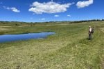
This is a beautiful trail with amazing vistas across a verdant meadow to the mountains all a around. It is an easy trail with a few challenges crossing runoff and streams. Although we cut short the hike again this year and didn’t go as far as Red Lake itself, it remains on our list of hikes to complete in the future.

Jay here: Snow! Snow? It seemed like such a warm day, you had to ask yourself why there was still snow on the ground. But then you remember you’re at 11,000 + feet. It was a great hike that somehow brought us just a little closer to some magnificent clouds.

Statistics

Total Distance:   4.2 miles
Elevation: start  11,004 ft, maximum  11,656 ft,  minimum  10,981 ft
Gross gain:  675 ft,  Aggregate ascending  831 ft, descending  831 ft
Maximum slope: 24% ascending, 22% descending, 6.9% average
Duration: 3:47, Average Speed: 1.1 mph

GPS Track Files for Download
43 Downloads
37 Downloads
If you haven’t explored these hiking tracks with Google Earth, I urge you to try it. With the virtual 3-dimensional presentation, achieved by panning and tilting the view, you can get a much better idea of the hikes and terrain than you can get from the screenshot above. For some ideas, check out  Using Google Earth Track Files.

Related Posts

Hikes around Cumbres Pass

References and Resources

USDA Forest Service: Red Lake Trailhead, Trail 733
AllTrails: Red Lake Trail
GAIA GPS: Red Lake
Alamosa.org: 5 Trails You Need To Be On
Oh Ranger.com: Rio Grande National Forest, Red Lake Trail

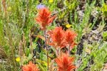
If you have viewed many of my other posts, you no doubt have noticed that I’ve included many photos and galleries of flowers. And you’ve seen repetition – the same flowers show up on posts for many hikes. That observation having occurred to me, I questioned why I would include flowers .. again. Well .. because they always attract my attention – there are so many colors, shapes, and settings. They exist often in environments that would be drab without them, sometimes in locations that appear to be quite inhospitable. So, again, I include in this post a “bouquet” of flowers:

VC02-VC0201 Trails Hike – 05/24/2023

During a two-night camping trip in Jemez Falls Campground, Jay and I headed into Valles Caldera for a mid-distance hike. Pat and Nancy (with Bo) remained at the campground, “chilling out”.

The Drive In

From the Campground, head east on NM 4 to the entrance to Valles Caldera National Preserve, then down into Valle Grande to the  Entrance Station (the Visitor Center has been moved to the Cabin District). We had read that a daily limit of the number of visitors allowed into the Back Country was being implemented. Visitors are premitted to continue beyond the Entrance Station to visit the Cabin District, but cannot go further into the Caldera.

On our visit, we learned that … reservations are now required to obtain one of the limited number of daily passes. Reservations are made via Recreation.gov, just has has been the case for campgrounds in recent. Fortunately, Internet service is good in the Caldera; for those who don’t have a “device”, a computer is available in the Visitor Center. It appears Backcouintry Vehicle Passes can be reserved for the day of visit or dates into the future. There is presently no charge for private vehicles, although there is a $2.00 “Reservation Fee” for each pass.

The Hike
We’ve hiked this route before – check out the links in Related Posts below.

Valles Caldera-VC02-VC0201 Trail Hike.Jay.2023-05-24
Notes about the Google Earth screenshot: the graph at the bottom shows elevation of the track (pink area) and speed (the blue line).

We chose to limit our drive into the Caldera by hiking in the “front country” (it is a long drive into the “back country”). We started out thinking we would hike from the Cabin District to El Cajete, a “recent” crater that created a most pleasant open meadow. Parking on the south end of the Cabin District, we headed off down, VC-01 – a two-track – easy walking, lush grasses, and a great view across the Valle. Along the way we crossed 3 or 4 streams coming down from the mountainside to the west – a real treat here in New Mexico.

About 1.25 miles on, we began a climb, passing the cutoff for the trail to the top of South Mountain, continuing on the two-track. We continued up the two-track, climbing to the top of the ridge where we could see ahead/down hill towards El Cajete. We decided we weren’t up for that long a hike (for me particularly since Pat & I planned two days later to drive to Grants and hike to the top of Mount Taylor: 2,000 feet elevation gain, to the top at 11,003). So Jay and I continued on an old two-track to the left, to a bit higher elevation and saddle from which we enjoyed more of a view to the south and east.

Heading downhill, we decided to hang a left and return via VC0201, a two-track that paralleled VC02 at higher up on the mountainside. Misreading the topo lines for VC0201 running parallel, we found the trail ascended more than anticipated. But we avoided some of the rocky trail of VC-02. We also anticipated that we would need to bushwhack downhill to VC-02 at some point to return to parking. We entered into an old burn area with many fallen trunks, but saw a path with fewer trunks to climb over. So we headed downhill, entered again into an area of open forest, and VC-02. >>>> A good hike.

Statistics

Total Distance:   4.84 miles
Elevation: start  8,748 ft, maximum  9,242 ft,  minimum  8,725 ft
Gross gain:  517 ft.  Aggregate ascending  1,043 ft, descending  1,043 ft
Maximum slope: 23% ascending, 22% descending, 7.2% average
Duration: 3:11

GPS Track Files for Download
85 Downloads
141 Downloads
If you haven’t explored these hiking tracks with Google Earth, I urge you to try it. With the virtual 3-dimensional presentation, achieved by panning and tilting the view, you can get a much better idea of the hikes and terrain than you can get from the screenshot above. For some ideas, check out  Using Google Earth Track Files.

Related Posts

El Cajete Through Hike – 10/21/2021
VCc02-VC0201 Trail Hike – 08/31/2021
VC02 South Mountain Hike – 05/27/2019

References and Resources (** – recommended)

National Park Service:
     Valles Caldera National Preserve
     Valles Caldera – Learn About the Park
     NPS Geodiversity Atlas-Valles Caldera National Preserve, New Mexico
** USGS: New Mexico’s answer to Yellowstone: The geological story of Valles Caldera
**NM Museum of Natural History & Science: Valles Caldera, Jemez Volcanic Field
FaceBook: Valles Caldera National Preserve
Santa Fe New Mexican: Valles Caldera reservation system sparks debate
Visit Los Alamos: Valles Caldera National Preserve
Wikipedia: Valles Caldera
Prime Passages: El Cajete Three Ways

Gooseberry Springs Trail #77 – 05/26/2023

We returned to Mount Taylor again this year. This Gooseberry Springs Trail presents a challenging hike with great views going up, coming down, and from the peak – together they make it one of our favorite hikes. We plan to hike it each year in to the ?? future.

The Drive In

Borrowing from our visit back in 2020:

“We had an easy drive to Grants, then through Lobo Canyon on NM 547 to FR 193 and on to our target campsite. The road has fresh, deep gravel (a Class 3 road) but the Tacoma/R-Pod handled it easily. We chose the campsite closer to the trailhead; an added benefit – it is located on the edge of Lobo Canyon and thus affords better views than the other campsites. This, our first setup outside of an established campground challenged us in maneuvering It was still a challenge to maneuver  the R-Pod among trees and rocks to an area relatively level – great experience for future forays.”
This is our new 2023 R-Pod – RP-171. We enjoyed 12 years of great camping and traveling with our 2011 RP-177, but time came for it to be retired. We miss the space of the slideout in the -177, but we are adjusting to this more compact camper – and we like very much the “picture window” in the front which “opens up” the space inside. And a new, larger 100 watt, solar panel.

The Hike

Gooseberry Springs Trail Hike.Pat.2023-05-26
Notes about the Google Earth screenshot: the graph at the bottom shows elevation of the track (pink area) and speed (the blue line).

We “trained” for this hike, walking daily in the Bosque during the winter and hiking up Three Gun Springs during the preceding weeks. This preparation no doubt served us well, but 2,000 feet elevation gain is nonetheless a challenge. The trail is well used, and descriptions of our previous hikes are still accurate.

Weather was perfect for this day’s hike, sunny and cool with some breezy and chilly conditions at the higher elevations. We stopped regularly for brief rests, especially on the steeper sections. We encountered only a couple of other hikers, ‘tho about half way up the open zig-zags approaching the peak, we noted a hiker with a dog following us; she passed us before we reached the peak. It was apparent from her pace and her pack that she was a through-hiker – she confirmed it during our brief conversation.

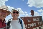
Approaching the peak we passed a couple of snow banks left over from this year’s heavy snow season. Reaching the peak, we took the obligatory selfie to document our arrival, then joined Brittany (trail name Dits) and Mono for lunch and pleasant conversation. As we headed back down the mountain, we wished her well on her journey as a NoBo (NOrth BOund) on the CDT.

This year we chose to return on the trail rather than the alternate routes that we chose on previous hikes. Returning to the R-Pod, we opened a beer and relaxed in the wonderful blue skies and clear air of New Mexico.

Highlight

As a bonus, during this last half of May we can anticipate meeting northbound through-hikers on the Continental Divide Trail. On the our hike in 2021 with Jay and Nancy, we met a couple of through-hikers and a Trail Angel, Cheshire Cat, and enjoyed the company of a through-hiker, trail name NoNo. And again this year, it was great to meet another CDT through-hiker, Dits and her dog Mono, and to share a mid-day meal with them atop Mount Taylor.

In 2021, No-No, gave us the link to her VLOG on YouTube, Jennifer Journeys. We continued to follow her progress up the CDT to Canada – she produced some truly great videos through which she shared her experience.  She has published two other series of her adventures on YouTube: Peru 2022 and Mountains to Sea Trail. We hope that she is continuing with the life that she loves, and perhaps publishes VLOGs of more of her adventures. Thank you, Jennifer!

Statistics

Total Distance:   6.46 miles
Elevation: start  9,325 ft, maximum  11,305 ft,  minimum  9,274 ft
Gross gain:  2,031 ft.  Aggregate ascending  2,221 ft, descending  2,221 ft
Maximum slope: 26%% ascending, 34% descending, 12.4% average
Duration: 8:04

GPS Track Files for Download
272 Downloads
80 Downloads
If you haven’t explored these hiking tracks with Google Earth, I urge you to try it. With the virtual 3-dimensional presentation, achieved by panning and tilting the view, you can get a much better idea of the hikes and terrain than you can get from the screenshot above. For some ideas, check out  Using Google Earth Track Files.

Related Posts

Gooseberry Springs Trail Hike – 05/10/2021
Gooseberry Springs Trail Hike – 06/10/2020
Gooseberry Springs Trail Hike #2- 06/13/2018
Gooseberry Springs Trail Hike – 06/01/2018

References and Resources

A Note: I realize this is a long list of References and Resources, but I found many of them to be interesting, some going beyond just a hike up Mt. Taylor on the Gooseberry Springs Trail. I’ve marked with ** some that I found intriguing.

New References:
** PeakVisor: Cibola National Forest – Mt. Taylor Ranger District (East)
      A comprehensive description of Mt Taylor and the region
Continental Divide National Scenic Trail Coalition:
    ** Day & Overnight Hikes – New Mexico (PDF)
         A compendium of descriptions of segments of the CDT in New Mexico
    Tsoodzil (Mt. Taylor), Cibola National Forest
** Hike with Gravity: CDT 2021: Day 27, Gooseberry Springs Trail …
      This is a post in his BLOG of hiking the CDT – interesting reading.
SummitPost: Gooseberry Springs Trail
** Quincy Koetz: Mt Taylor, New Mexico Winter Hike
Hiking Tom: Mount Taylor – Gooseberry Springs Trail (YouTube, late winter)
Sharing my Suitcase: Mt. Taylor- The Gooseberry Springs Trail
** Overland Mama: Weekend Camping: Cabezon Peak to Mt. Taylor etc
Trip Advisor: Mount Taylor

From Previous Posts: 
US Forest Service: Gooseberry Springs Trail
                                  Gooseberry Springs Trailhead
SummitPost: Mount Taylor
AllTrails: Gooseberry Springs and Mount Taylor Loop
                  Mount Taylor via Gooseberry Trail
ondafring: Day Hike: Mount Taylor
ASCHG: Mount Taylor From Gooseberry Spring Hike
Stav is Lost: Hike Mt. Taylor via Gooseberry Springs Trail (great photos)
Four Corners GeoTourism: Gooseberry Springs Trail – Mt. Taylor
Outdoor Project: Gooseberry Springs Trail to Mount Taylor
Hiking Project: Gooseberry Trail


Rio de las Vacas Walkabout – 07/31/2022

 A short walk out of Rio de las Vacas campground, in the afternoon after setting up camp with Jay and Nancy. This was a warmup for hiking the following 2 days in the San Pedro Parks Wilderness. San Pedro Parks is at nearly 10,000 feet elevation – and cooler, a getaway from Albuquerque’s hot summer weather.

The Drive In

The drive to San Pedro Parks: from Bernalillo: US 550 to Cuba; in the middle of town turn right onto NM 126, continue for 10 miles. Continue past the turnoff to San Gregorio Lake (FR70) for 2 miles to the entrance to the Rio de las Vacas Campground. We chose Sites 11, a double site to accommodate our R-Pod camper and Jay and Nancy’s Vanaa.

The Hikes

Rio de las Vacas Walkabout.PatJayNancyBo.2022-07-31
Notes about the Google Earth screenshot: the graph at the bottom shows elevation of the track (pink area) and speed (the blue line).

Suggested by Ben, the camp host, we crossed NM 126 directly below our campsite (#11), passed through the fence at a gate, and continued downhill towards a pleasant open meadow and the Rio de las Vacas. Reaching the creek, we angled of to the left and followed it downstream, soon crossing to the southside. We continued until the streambanks narrowed blocking our route with dry feet. We crossed back over to the north side (using rocks and a log) and decided to head back to the campground through the woods.  Although there was no trail, the ponderosa and fir forest was quite on open and easy to pass through.

Along the stream, it was grassland – easy walking. Through the forest, the floor was gravel and dirt – more easy walking with hardly any deadfall.

Statistics

Total Distance:   1.18 miles
Elevation: start  8,302 ft, maximum  8,304 ft,  minimum  8,160 ft
Gross gain:  144 ft.  Aggregate ascending 207 ft, descending 165 ft
Maximum slope: 34% ascending, 31% descending, 5.6% average
Duration: 0:52

GPS Track Files for Download
59 Downloads
54 Downloads
If you haven’t explored these hiking tracks with Google Earth, I urge you to try it. With the virtual 3-dimensional presentation, achieved by panning and tilting the view, you can get a much better idea of the hikes and terrain than you can get from the screenshot above. For some ideas, check out  Using Google Earth Track Files.

Related Posts

Peñas Negras Trail Hike. 08/01/2022
Hikes in San Pedro Parks

References and Resources

USDA Forest Service: Rio de las Vacas Campground

Red Lake Trail Hike – 07/08/2022

Our 2nd hike on a 3-night camping trip into northern New Mexico (actually just across the state line into Colorado). We set up the R-Pod in the USFS Trujillo Meadows campground. Reservations are not offered, but there are 41 campsites so we anticipated that we would get one. And we did – there were only a few (<10) campers in the campground on our arrival and the host told us that the campground is not heavily used. After touring the maze of roads looking for the best site, we chose one near the entrance and on the highest point in the campground. The view from there was the best.

The Drive In

We drove from Albuquerque to Chama and continued on NM 17 up to the crest of Cumbres Pass (the highway becomes CO 17 as it passes into Colorado). For a good part of the way, Hwy 17 follows the tracks of the Denver and Rio Grande Railroad, aka Cumbres and Toltec Railroad to the crest where there is a small railyard.

Our campsite in Trujillo Meadows Campground. Atop a hill in the middle of the campground, we had great views in all directions.

Continuing past the crest for 1/4 mile, we turned left onto FR 118 (a good Class 3 road, tho’ there are some sections of serious washboard); in 2.5 miles turn right at the entrance to the campground. (Adjacent to the campground is Trujillo Meadows Reservoir. There are some sites that look down upon the reservoir and there is a road from the campground entrance to a boating ramp; we did not investigate either.)

The Red Lake trail is a bit further north on CO 17 — 6.4 miles from the turnoff to the Trujillo Meadows Campground. Turn left onto FR 113, a Class 3 road towards Red Lake — 3.5 miles. The road makes a sharp 180° turn to the left — parking is on the right up a short rise.

The Hike

Red Lake Trail Hike.Pat.2022-07-08
Notes about the Google Earth screenshot: the graph at the bottom shows elevation of the track (pink area) and speed (the blue line).

The trail starts at an elevation of 11,000 feet – yes, the temperature was comfortably cool. It proceeds for 1/4 mile with not much elevation gain, through nice forest. About a half mile on we encountered our first stream crossing, easy with rocks for stepping stones. Here the trail takes on a bit more elevation gain, and we encountered more flowing water, even down the trail itself.

A bit further on (3/4 mile point) the trail begins to leave the forest behind, and at about the 1 mile point, the trail enters a wide open lush meadow with another small stream crossing. The trail continues it’s gentle climb and the meadow continues to open up ahead and around us with a few ponds off to the west.

We continue up to the top of the rise and decide we’ve come far enough so we find some rocks to use for dining. On our return trip, we heard running water. Taking a short detour from the trail we found a rocky slop with a series of small waterfalls, a nice scene to take with us as we return to the trailhead.

Highlight

The amount of water flowing across the meadow and down the streams was striking. It was such a contrast to what we encounter on trails in New Mexico. And the vista view across the meadows, with the lakes and smattering of forest made for -great- scenery. We’ll add this trail to our list for future hikes, with the goal of continuing on to Red Lake itself.

Statistics

Total Distance:  3.99 miles
Elevation: start  11,003 ft, maximum  11,643 ft,  minimum 10,974 ft
Gross gain: 669 ft.  Aggregate ascending 819 ft, descending 818 ft
Maximum slope: 23% ascending, 23% descending, 7.3% average
Duration: 3:42

GPS Track Files for Download
56 Downloads
106 Downloads
148 Downloads
68 Downloads
If you haven’t explored these hiking tracks with Google Earth, I urge you to try it. With the virtual 3-dimensional presentation, achieved by panning and tilting the view, you can get a much better idea of the hikes and terrain than you can get from the screenshot above. For some ideas, check out  Using Google Earth Track Files.

Related Posts

Hikes around Cumbres Pass

References and Resources

USDA Forest Service: Red Lake Trailhead, Trail 733
AllTrails: Red Lake Trail
Alamosa.org: 5 Trails You Need To Be On
Oh Ranger.com: Rio Grande National Forest, Red Lake Trail

Cumbres Pass-CDT North Trail Hike – 07/07/2022

Our first hike on a 3-night camping trip into northern New Mexico (actually just across the state line into Colorado). We set up the R-Pod in the USFS Trujillo Meadows campground. Reservations are not offered, but there are 41 campsites so we anticipated that we would get one. And we did – there were only a few (<10) campers in the campground on our arrival and the host told us that the campground is not heavily used. After touring the maze of roads looking for the best site, we chose one near the entrance and on the highest point in the campground. The view from there was the best.

The Drive In

Late afternoon view from the door of our RPod camper.

We drove from Albuquerque to Chama and continued on NM 17 up to the crest of Cumbres Pass (the highway becomes CO 17 as it passes into Colorado). For a good part of the way, Hwy 17 follows the tracks of the Denver and Rio Grande Railroad, aka Cumbres and Toltec Railroad to the crest where there is a small railyard. Continuing past the crest for 1/4 mile, we turned left onto FR 118 (a good Class 3 road, tho’ there are some sections of serious washboard); in 2.5 miles turn right at the entrance to the campground. (Adjacent to the campground is Trujillo Meadows Reservoir. There are some sites that look down upon the reservoir and there is a road from the campground entrance to a boating ramp; we did not investigate either.)

The CDT crosses CO 17 just below the crest of Cumbres pass, to the west; from the campground we returned to CO 17, turned right, back over the crest. Less than 14 mile below the crest there is parking on the south side of CO 17. The trailhead for the CDT going south is located there. For the trailhead northbound, cross the road and continue up and under the railroad trestle.

The Hike

Cumbres-Pass-CDT-North.Pat_.2022-07-07
Notes about the Google Earth screenshot: the graph at the bottom shows elevation of the track (pink area) and speed (the blue line).

I hiked this bit of the CDT last year while Pat attended a workshop in Chama, and for some time I’ve looked forward to revisiting it with Pat. Donning our packs and crossing the road, we walked beneath the RR trestle to the trailhead, where Pat signed us in. We then headed past the trailhead sign and into the woods; we were quickly above 10,000 feet elevation.


About 1/3 mile on, we left the woods behind, entering a meadow for a few hundred yards. Then it was onto hillside slopes for most of the remainder of the hike. Here we enjoyed a great vantage point to watch the Cumbres & Toltec steam locomotive and excursion cars climb the last few hundred feet elevation to Cumbres Pass.

The trail is well used, a smooth trail surface, little worn into the ground. We passed through open forest, occasionally with fallen trees. About 1.3 miles on we came to the first of two water crossings, nice flow of water but rocks ready for us to cross on. We continued on for 2.3 miles, enjoying fabulous views of the valley and mountains to the west of the trail.

Highlight

We have puzzled over how to convey to readers of this BLOG the beauty of scenery all around us on these hikes. I think Pat has found the answer in this video.

Statistics

Total Distance:  4.79 miles
Elevation: start  9,965 ft, maximum  10,299 ft,  minimum 9,965 ft
Gross gain: 334 ft.  Aggregate ascending 1,052 ft, descending 1,053 ft
Maximum slope: 29% ascending, 25% descending, 6.4% average
Duration: 3:37

GPS Track Files for Download
61 Downloads
46 Downloads
If you haven’t explored these hiking tracks with Google Earth, I urge you to try it. With the virtual 3-dimensional presentation, achieved by panning and tilting the view, you can get a much better idea of the hikes and terrain than you can get from the screenshot above. For some ideas, check out  Using Google Earth Track Files.

Related Posts

Red Lake Trail Hike – 07/08/2022
Cumbres Pass/CDT North Hike – 08/12/2021
Cumbres Pass/CDT South Hike – 08/13/2021

References and Resources

USDA Forest Service: CDNST – Cumbres Pass North Trailhead # 813
AllTrails: Cumbres Pass CDT North

Deer Trap Mesa Trail Hike – 04/26/2022

A hike on the Deer Trap Mesa Trail, one of the many trails in and around Los Alamos, with Jay and Nancy on the third day of a camping trip to Bandelier.

The Drive In

The trailhead is on the perimeter of Los Alamos, on one of the narrow mesas/ridges between the many canyons across which the city is spread. Here are directions from Trail Network Map – Los Alamos County (pdf):

From NM 501/East Jemez Road, turn right onto Diamond Drive.  Go north then east on Diamond for 2.6 miles to the roundabout at San Ildefonso. Turn left and in 0.3 mile continue straight onto Barranca Road. Follow this road 1.3 miles to its end just past the intersection with Navajo. Parking along the road, with signs for the Trail.

The Hike

Deer Trap Mesa Trail Hike.PatJayNancy.2022-04-26
Notes about the Google Earth screenshot: the graph at the bottom shows elevation of the track (pink area) and speed (the blue line).

The trail, as we took it, begins on the somewhat narrow spine of Deer Trap Mesa. A couple of hundred yards on, it leaves the spine and traverses the slope near the top of the mesa. It is a well used trail – generally sandy surface but with rock small and large outcroppings to work around. And to the left – a steep slope to the bottom of Rendija Canyon. We continued along this edge of the mesa for about a mile into the hike, where we again climbed atop it. From there, another half mile to a point that required some rock climbing to continue further. We turned back, finding a place for lunch on top, then retraced our steps.

That was -our- hike. Upon returning home and looking again at the published maps of the Deer Trap Mesa Trail, I realized that we missed a turn that would have taken us on top of the mesa. From there, relatively level ground and a loop around the mesa top – that will make a great plan for a return trip.

Statistics

Total Distance:  2.8 miles
Elevation: start  7,235 ft, maximum  7,236 ft,  minimum 6,973 ft
Gross gain: 263 ft.  Aggregate ascending 919 ft, descending 923 ft
Maximum slope: 37% ascending, 40% descending, 8.5% average
Duration: 2:55

GPS Track Files for Download
56 Downloads
58 Downloads
If you haven’t explored these hiking tracks with Google Earth, I urge you to try it. With the virtual 3-dimensional presentation, achieved by panning and tilting the view, you can get a much better idea of the hikes and terrain than you can get from the screenshot above. For some ideas, check out  Using Google Earth Track Files.

References and Resources

Los Alamos:
              Deer Trap Mesa Trails
              Trail Network Map – Los Alamos County (pdf)
AllTrails: Deer Trap Mesa Trail
Pajarito Environmental Education Center (PEEC): Deer Trap Mesa Trail

Bandelier-Falls Trail Hike – 04/25/2022

Our 2nd hike this day, on a 2-day camping trip to Bandelier National Monument.

The Drive In

The trailhead is down in Frijoles Canyon, so the drive in is to go to the Bandelier Visitor Center.

The Hike

Bandelier-Falls Trail Hike.Pat.2022-04-25
Notes about the Google Earth screenshot: the graph at the bottom shows elevation of the track (pink area) and speed (the blue line).

After having hiked the Frey Trail, with time (and energy) remaining, we headed down-river towards the Rio Grande on the Falls Trail. The trailhead is southwest of the Visitors Center, across the Rio de los Frijoles. It then proceeds down the western side of Frijoles Canyon, on a well used trail of gravel.

The trail ends at an overlook with a view upstream to the Upper Frijoles Falls. From here one can also see downstream, through the narrowing of the canyon where the Rio de los Frijoles flows into the Rio Grande.


The view near the start of the trail, looking downstream into the canyon.
From the overlook at trail’s end, looking upstream at Upper Frijoles Falls


Highlight

This is a very nice, easy hike that would be great for visitors unaccustomed to hiking longer trails, with the Falls being a feature of interest.

Statistics

Total Distance:  2.66 miles
Elevation: start  6,061 ft, maximum  6,080 ft,  5,830 minimum ft
Gross gain: 250 ft.  Aggregate ascending 800 ft, descending 801 ft
Maximum slope: 47% ascending, 46% descending, 8.7% average
Duration: 1:58

GPS Track Files for Download
0 Downloads
67 Downloads
If you haven’t explored these hiking tracks with Google Earth, I urge you to try it. With the virtual 3-dimensional presentation, achieved by panning and tilting the view, you can get a much better idea of the hikes and terrain than you can get from the screenshot above. For some ideas, check out  Using Google Earth Track Files.

Related Posts

Hikes in Bandelier National Monument

References and Resources

NPS Bandelier National Monument: Falls Trail
AllTrails: Upper Falls Trail
American Southwest: Falls Trail, Bandelier National Monument
Red Around the World: Hike The Falls Trail In Bandelier National Monument, New Mexico
Discover All Corners: Falls Trail, Bandelier National Monument (to the Upper Frijoles Falls)

Bandelier-Frey Trail Hike – 04/25/2022

Our first full day on a camping trip to Bandelier National Monument. Wanting a trail with some elevation gain, we chose the Frey Trail for a few hundred feet up and back down again.

The Drive In

The trailhead is down in Frijoles Canyon, so the drive in is to go to the Bandelier Visitor Center.

The Hike

Bandelier-Frey Trail Hike.Pat.2022-04-25
Notes about the Google Earth screenshot: the graph at the bottom shows elevation of the track (pink area) and speed (the blue line).

We sought a hike with some elevation gain – Frey Trail offered some – 541 ft up from Frijoles Canyon. The trailhead is 400 yards from the Bandelier Visitors Center, on the right bit past the Tyuonyi Ruins. It is a well used trail up the canyon wall topping  out on the mesa top. We continued another quarter mile continuing on the Frey Trail, then turned back and down into Frijoles Canyon.

Back on the canyon floor, we turned right onto the Alcove House Trail for 1/3rd of a mile, then crossed over Rio de los Frijoles to the Long Trail. From there we returned to the visitors center, having gotten -some- elevation gain.

Statistics

Total Distance:  3.05 miles
Elevation: start  6,089 ft, maximum  6,619 ft,  minimum 6,078 ft
Gross gain: 541 ft.  Aggregate ascending 852 ft, descending 853 ft
Maximum slope: 53% ascending, 53% descending, 8.6% average
Duration: 3:16

GPS Track Files for Download
63 Downloads
80 Downloads
If you haven’t explored these hiking tracks with Google Earth, I urge you to try it. With the virtual 3-dimensional presentation, achieved by panning and tilting the view, you can get a much better idea of the hikes and terrain than you can get from the screenshot above. For some ideas, check out  Using Google Earth Track Files.

Related Posts

Hikes in Bandelier National Monument

References and Resources

NPS Bandelier National Monument:
    Frey Trail
    Virtual Hike on the Frey Trail                
AllTrails: Frey Trail
The Great Outdoors: Hike the Frey Trail
ProTrails: Frey Trail – 3.4 miles
gHikes: Frey Trail