Category Archives: San Pedro Parks

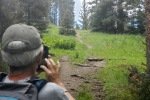
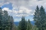
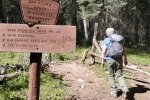
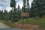
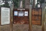
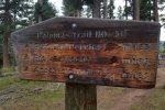
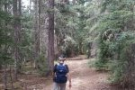
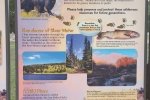
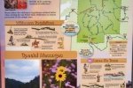
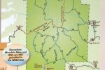
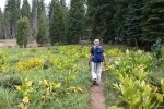
In the vicinity of the San Pedro Parks Wilderness, NM.

Las Vacas Trail Hike – 08/03/2022

Our 2nd hike during a 3-day camping trip to San Pedro Parks, with Jay and Nancy and their new dog, Bo. ‘Tis a trail that we’ve hiked before, a very pleasant hike through open forest, past San Gregorio Reservoir and to the edge of Vallecito Damian. (Past posts for this trail were titled “San Gregorio Lake Hikes”. The trail is also considered part of the Clear Creek Trail.)

The Drive In

From the Rio de las Vacas Campground, drive west on NM  126 for about 2 miles, turn right onto FR 70, a good Forest Road (Class3). In about 6 miles, the trailhead will be on the left. The parking will be an area on the right.

The Hike

Vacas Trail Hike.PatJayNancyBo.2022-08-02 (KML)
Notes about the Google Earth screenshot: the graph at the bottom shows elevation of the track (pink area) and speed (the blue line).

This is a very easy trail, as are many on San Pedro Parks – wide, smooth path, open forest, little elevation change. From parking, San Gregorio Reservoir is a mile in. Bo, still a puppy, was tiring from the hiking the past two days, so Jay and Nancy “lounged” around the lake while Pat & I continued on up the trail.

On arriving at Clear Creek, near where it enters into the Reservoir, we came upon a group of youngsters playing in the water. (Tents and adults were nearby, suggesting that they were camping in this beautiful place.) With the boisterous Monsoon Season this year, Clear Creek was running well, but not so high that we weren’t able to cross on a pair of logs, as the youngsters watched (or continued their play). 

We continued on the trail, encountering a few deadfall trees across the trail, easily overcome (over or around). Going out far enough to get in a 4 mile hike, we turned back at the edge of Vallecito Damian and met Jay, Nancy, and Bo for lunch. Then made the easy walk back to parking.

Statistics

Total Distance:   3.94 miles
Elevation: start 9,223  ft, maximum 9,419 ft,  minimum 9,223 ft
Gross gain:  196 ft.  Aggregate ascending 654 ft, descending 663 ft
Maximum slope: 24% ascending, 18% descending, 5.2% average
Duration: 2:37

GPS Track Files for Download
152 Downloads
68 Downloads
If you haven’t explored these hiking tracks with Google Earth, I urge you to try it. With the virtual 3-dimensional presentation, achieved by panning and tilting the view, you can get a much better idea of the hikes and terrain than you can get from the screenshot above. For some ideas, check out  Using Google Earth Track Files.

Related Posts

Rio de las Vacas Walkabout – 07/31/2022
Peñas Negras Trail Hike – 08/01/2022
Hikes in San Pedro Parks

References and Resources

USDA Forest Service: Vacas Trail/San Gregorio Lake Trailhead #51
AllTrails:
      San Gregorio Reservoir
      Clear Creek Trail
Dog of the Desert: Clear Creek in the San Pedro Parks Wilderness
Only in Your State: San Gregorio Reservoir …
The Outbound: Backpack the Vacas Trail Loop
Astec NM: San Pedro Parks Wilderness Trails (pdf)

Peñas Negras Trail Hike – 08/01/2022

Our first hike in the San Pedro Parks Wilderness Area during a 3-night camping trip. Upon arrival, we set up camp in the Rio de las Vacas campground then did the Rio de las Vacas Walkabout along the Rio near the campground.

The Drive In

The drive in to this trail: from the Rio de las Vacas Campground drive west on NM  126 for about 2 miles, turn right onto FR 70, a good Forest Road (Class3). In about 6 miles, the trailhead will be on the left, just the intersection of FR 70 and a two-track.

The Hike

Peñas Negras Trail Hike.Jay.2022-08-01
Notes about the Google Earth screenshot: the graph at the bottom shows elevation of the track (pink area) and speed (the blue line).

Leaving Pat, Nancy, and Bo for a day of relaxing at the campsite, Jay and I headed off for territory unknown (except for cues from GAIA and USTopo topographical maps). As we approached the area expecting to find a trailhead, a sign announced the Peñsa Negras trail leading to the Vacas Trail (3 miles as I recall). The sign was at the foot of a steep slope up onto the mesa, not an appealing beginning. We drove a quarter mile further and noticed an old two-track heading up the Rito Cafe valley. We parked and proceeded to check it out.

The going was easy – gentle slope on this old two-track. With the goal of getting up on the mesa and finding the trail depicted on the maps, we selected a place where the slope up and the elevation gain were the least. This -did- make for an easy ascent onto the nearly level mesa top, on the east edge of the mesa.

The trail was depicted to be on the west side, so we headed across. Not really bushwhacking, but there was no trail to follow; we walked through open forest and lots of green grass and flowers, among tall ponderosa trees. Approaching the west edge of the mesa, we hoped to find the trail depicted on the topo maps – it was not apparent. We wandered a bit further up the mesa along an opening in the forest (appeared to be an old two-track). This took us away from the western edge, until encountering a fence. We followed the fence back towards that edge, into a large opening in the forest.

Figuring the trail was just not evident, and before heading back to the trailhead, we paused for our mid-hike break, on a log nicely in place for lunchtime seating.

As we packed up, Jay noticed this nice pile of rocks – a cairn for the trail? Looking further along we saw another, then another – ah ha, the Trail? Crossing the meadow guided by the cairns we soon found the semblance of a path; the location matched reasonably closely the map’s trail. Soon we were back in the clearing we had been on earlier. (Click on a photo for an enlarged view, then <back> on your browser to return to this page.)

First sighting of a cairn.
Another cairn, leading us across the meadow.
On the trail, the old two-track.

We continued towards the end of the mesa; the two-track dwindled until we were on a faint path that followed the map’s trail. Using the topo lines as a guide, we continued to the pointy end of the mesa where we found ourselves again on a faint path down a moderate slope to the base of the mesa .. and the trailhead. Perhaps a mile from the trailhead, Mother Nature visited us with some light rain, enough to get out our raincoats and to make mud around the truck when we got there.

Highlight

I enjoyed once again exploring a trail with Jay, with little information at hand, and being satisfied in the end that we met our objectives – to have a great hike in a beautiful place

Statistics

Total Distance:   4.51 miles
Elevation: start 9,334 ft, maximum 9,842 ft,  minimum 9,334 ft
Gross gain:  508 ft.  Aggregate ascending  852 ft, descending  854 ft
Maximum slope: 31% ascending, 26% descending, 5.0% average
Duration: 3:36

GPS Track Files for Download
74 Downloads
59 Downloads
45 Downloads
48 Downloads
If you haven’t explored these hiking tracks with Google Earth, I urge you to try it. With the virtual 3-dimensional presentation, achieved by panning and tilting the view, you can get a much better idea of the hikes and terrain than you can get from the screenshot above. For some ideas, check out  Using Google Earth Track Files.

Related Posts

Rio de las Vacas Walkabout
Hikes in San Pedro Parks

References and Resources

USDA Forest Service:
      Penas Negras #32
      Rio de las Vacas Campground
New Mexico Trails: Penas Negras Trail – Trail #32
ondafringe: Day HIke: Penas Negras/Perchas/Palomas Trails Loop

Rio de las Vacas Walkabout – 07/31/2022

 A short walk out of Rio de las Vacas campground, in the afternoon after setting up camp with Jay and Nancy. This was a warmup for hiking the following 2 days in the San Pedro Parks Wilderness. San Pedro Parks is at nearly 10,000 feet elevation – and cooler, a getaway from Albuquerque’s hot summer weather.

The Drive In

The drive to San Pedro Parks: from Bernalillo: US 550 to Cuba; in the middle of town turn right onto NM 126, continue for 10 miles. Continue past the turnoff to San Gregorio Lake (FR70) for 2 miles to the entrance to the Rio de las Vacas Campground. We chose Sites 11, a double site to accommodate our R-Pod camper and Jay and Nancy’s Vanaa.

The Hikes

Rio de las Vacas Walkabout.PatJayNancyBo.2022-07-31
Notes about the Google Earth screenshot: the graph at the bottom shows elevation of the track (pink area) and speed (the blue line).

Suggested by Ben, the camp host, we crossed NM 126 directly below our campsite (#11), passed through the fence at a gate, and continued downhill towards a pleasant open meadow and the Rio de las Vacas. Reaching the creek, we angled of to the left and followed it downstream, soon crossing to the southside. We continued until the streambanks narrowed blocking our route with dry feet. We crossed back over to the north side (using rocks and a log) and decided to head back to the campground through the woods.  Although there was no trail, the ponderosa and fir forest was quite on open and easy to pass through.

Along the stream, it was grassland – easy walking. Through the forest, the floor was gravel and dirt – more easy walking with hardly any deadfall.

Statistics

Total Distance:   1.18 miles
Elevation: start  8,302 ft, maximum  8,304 ft,  minimum  8,160 ft
Gross gain:  144 ft.  Aggregate ascending 207 ft, descending 165 ft
Maximum slope: 34% ascending, 31% descending, 5.6% average
Duration: 0:52

GPS Track Files for Download
58 Downloads
53 Downloads
If you haven’t explored these hiking tracks with Google Earth, I urge you to try it. With the virtual 3-dimensional presentation, achieved by panning and tilting the view, you can get a much better idea of the hikes and terrain than you can get from the screenshot above. For some ideas, check out  Using Google Earth Track Files.

Related Posts

Peñas Negras Trail Hike. 08/01/2022
Hikes in San Pedro Parks

References and Resources

USDA Forest Service: Rio de las Vacas Campground

Palomas Trail Hike – 07/21/2022

This was foremost a reconnoitering trip to San Pedro Parks to check out the two campgrounds for an upcoming 3-day trip. And while there, we took advantage of the cooler temperatures to do a bit of hiking — temperatures at 9,200+ feet that are cooler than in Albuquerque.

The Drive In

The drive to San Pedro Parks: from Bernalillo: US 550 to Cuba; in the middle of town turn right onto NM 126, continue for 10 miles; turn left onto FR 70, continue for 9.9 miles; trailhead parking will be on your left. NM 126 is paved the whole distance; FR 70 is a Class 3 road with some hillside sections; a couple of slick sections on our way back to NM 126 after the showers that occurred during our hike.

Note: We checked out both of the Forest Service campgrounds: Clear Creek and Rio de las Vacas. They are just off of NM 126 beyond the turnoff for FR 70, .8 miles and 2 miles respectively. Each are very clean with paved roads within the campgrounds and paved parking on all the sites. And each has a stream running along a border (namesakes of the campgrounds).

The Hike

Palomas Trail Hike.Pat.2022-07-21
Notes about the Google Earth screenshot: the graph at the bottom shows elevation of the track (pink area) and speed (the blue line).

The trail gets moderate use so it is easy to follow. The surface is dirt with only a few sections with rocks or tree roots; mimimal downfall. For our hike it made a steady climb from 9,258 ft to 9,839 feet; a few hundred yards into the hike we got a glimpse of a handful of elk passing across the trail ahead of us.

Reaching the top of the ridge, we chose to find a spot for lunch with a good view and seating accommodations (rocks on a slope). We did enjoy the view of the open forest around us and views to the east through breaks in the trees of the mountains around Valles Caldera including Redondo. Had we continued on the trail descended 200 feet into the valley for the Rito de las Perchas. However, we decided to return to the traihead for the 2 1/2 hour drive home. There were rain showers in the area during our hike (tho’ we did not get wet); on the way back to NM 126, the well-gravelled road was in ok condition except one section of say 100 yards that was a bit slick.

Note: Trails criss-cross San Pedro Parks. The Palomas Trail is one of two entrance trails off of NM 126 that go  into the interior. Check GAIA or other resources for maps of these trails. With the network of trails, the Park is an ideal locale for short backpacking trips or longer day trips.

Statistics

Total Distance:   2.49 miles
Elevation: start  9,264 ft, maximum  9,839 ft,  minimum  9,258 ft
Gross gain:  580 ft.  Aggregate ascending  683 ft, descending  685 ft
Maximum slope: 32% ascending, 37% descending, 10.0% average
Duration: 2:28

GPS Track Files for Download
64 Downloads
98 Downloads
56 Downloads
46 Downloads
If you haven’t explored these hiking tracks with Google Earth, I urge you to try it. With the virtual 3-dimensional presentation, achieved by panning and tilting the view, you can get a much better idea of the hikes and terrain than you can get from the screenshot above. For some ideas, check out  Using Google Earth Track Files.

Related Posts

Hikes in San Pedro Parks

References and Resources

USDA Forest Service: Palomas Trail #50
AllTrails: Palomas Trail
Hiking Trails of the Oachitas & Ozarks: San Pedro Parks Wilderness

Vega Redonda Trail Hike – 08/20/2021

We’ve been quite curious about the territory north of San Pedro Parks and Valles Caldera. This trip was to explore the area north of the Parks, with an eye on campsites and hiking trails, and on the condition of the roads.

The Drive In

We drove from Bernalillo on US 550 to just beyond Cuba, then turned north on NM 96 towards Regina. A few miles beyond Regina, NM 56 turns east toward Gallina and ultimately Abiqui Dam. About 4 miles beyond Gallina, we turned right onto FR 103 and followed it for 10.4 miles to check out the Rio Puerco Campground. This is a very small campground, a few sites for tents, no sites really set up for a camper of any kind. It is situated nicely along Rio Puerco with water running in the creek the day we were there.

Note: On the way from NM 93, we made a point of identifying where the Continental Divide Trail (CDT) crosses FR 103. Mayhap, this will be a trailhead for a future hike, or even a backpacking trip.

We backtracked on FR 103 1.5 miles and turned left on FR 93 towards the Resumidero Campground, 2 miles on. This is a ‘primitive’ campground with facilities limited to one pit toilet. It is identified on the Forest Service web site as a “Camping Area”, an area with trees on the periphery and where one can set up any kind of campsite. (As you can see by the dearth of References below, there isn’t much being reported about this camping area.)

The Hike

Redonda Trail Hike.Pat.2021-08-20

After driving through the Camping Area, we returned to FR 93 and parked along the road at the eastern edge of the Area. From there walking a bit further along the road, we turned right onto a rough two track where a sign pointed towards the San Pedro Parks Wilderness Boundary and … the Vega Redonda Trailhead. (The tw0-track is identified on the USGS Topo map as FR 53G.) We followed this two-track for .85 miles where it ended and we entered into the Wilderness. Not far to the right was the Rito Resimudero, with a pleasant flow of water (the same Rito the we saw at the Rio Puerco Campground). At the boundary, another sign pointed us onward on the “Vega Redonda Trail No. 43”.

Within the Wilderness the trail was clean and easy to follow. We continued for .9 miles, encountering some elevation gain in the last half mile. Looking at the topo map, the tril continues to climb up to 10,000 feet, the elevation of much of San Pedro Parks. Since this trip was intended as a reconnoitering visit to the area, and it is quite a long drive from home, we paused here for lunch, then repaired back to the truck.

The area is quite appealing, remote with good hiking opportunities nearby. From this and other visits that we’ve made to San Pedro Parks, it receives ample rain (and/or winter snow?) so the forest is green and healthy. And I’m given to understand that there is a lot of backpacking in the Parks, so the trails are in great condition (which certainly applies to this trail).

Statistics

Total Distance:  3.56 miles
Elevation: start  8,940 ft, maximum  9,481 ft,  minimum 8,928 ft
Gross gain: 553 ft.  Aggregate ascending 784 ft, descending 787 ft
Maximum slope: 23% ascending, 22% descending, 7.6% average
Duration: 3:19

GPS Track Files for Download
63 Downloads
56 Downloads
54 Downloads
123 Downloads
If you haven’t explored these hiking tracks with Google Earth, I urge you to try it. With the virtual 3-dimensional presentation, achieved by panning and tilting the view, you can get a much better idea of the hikes and terrain than you can get from the screenshot above. For some ideas, check out  Using Google Earth Track Files.

References and Resources
The trailheads below are within the boundary of San Pedro Parks, not far from the Resumidero Camping Area.

USDA Forest Service: Resumidero Camping Area
                                         Rio Puerco Campground
                                         Vega Redonda Trail
                                         Corralitos Trail #452
GAIA GPS: Best Hiking Trails near Resumidero Camping Area
                     Vega Redonda Loop
                      Vega Redonda Loop via Corralitos 452
AllTrails: San Pedro Peaks
                  Redonda Trail
PeakBagger.com: Ascent of San Pedro Peaks on 2020-07-11


San Gregorio Lake Hike – 08/01/2018

‘Tis summer, hot in the “low lands”.  San Pedro Parks beckons us, to it’s higher elevation and forested landscape.  Having hiked here with Jay two years ago, I’ve looked forward to returning with Pat. 

The Hike

San Gregorio Lake Hike.Pat.2018-08-01

‘Tis much as I described in that earlier BLOG post – an easy trail, wide without much elevation change.  I didn’t recall that there is so much downfall – downed trees all along the trail in this part of the Parks.  We did look about for camping sites for possible future (short) backpacking; one of the first sites we came upon is, unfortunately, within the No Camping boundary around the lake.  There is an open meadow where we turned around that looked appealing.  And I’ve read that San Pedro Parks is great for camping.  This was a most pleasant hike, so pleased to come here with Pat. 

Statistics

Total Distance:  4.8 miles
Elevation: start  9,223 ft, maximum  9,620 ft,  minimum  9,223 ft
Gross gain:  397 ft.  Aggregate ascending  778 ft, descending  784 ft
Maximum slope: 25% ascending, 23% descending, 5% average
Duration: 4:26

GPS Track Files for Download
142 Downloads
222 Downloads
I urge you to explore our hiking tracks with Google Earth. With the virtual 3-dimensional presentation, achieved by panning and tilting the view, you can get a much better idea of the hikes and terrain than you can get from the 2-dimensional screenshot above. For assistance: Using Google Earth Track Files.
 

Related Posts

Hikes in San Pedro Parks

References

USDA Forest Service: Vacas Trail/San Gregorio Lake Trailhead #51
ASCHG: San Gregorio Reservoir Long Hike
Hiking in New Mexico: San Gregorio Hike – 08/20/2017
ondafringe: Backpacking: San Pedro Parks Wilderness
Wilderness Connect: San Pedro Parks Wilderness
AllTrails: San Pedro Parks Trail
Summit Post: San Pedro Parks Wilderness

Rio de las Vacas Hike – 07/24/2018

Another day seeking cooler temperatures, so we headed to San Pedro Parks Wilderness with elevations above 8,000 feet.  However, with recent rains particularly in these mountains, we also chose to remain on paved roads (NM 126 is paved from Cuba to Telephone Canyon; Jay & I have hiked in Telephone but came in on NM 126 from the other direction; that portion -is not paved- from the Fish Hatchery to Telephone). 

Not finding any published trails in our research, using GoogleEarth (GE) I sketched a couple of hikes beginning in the Rio de las Vacas campground.  One track proceeded up the Rio de las Vacas canyon – on GE it appeared to be a narrow canyon with steep sides, sometimes cliffs (GoogleEarth file: Rio Vacas CampgroundCanyon Loop Sketch).  In case the Rio canyon involved too much bushwhacking, as a backup I also sketched a loop heading first to the top of the mesa east of the Rio, then back down to NM 126 (GoogleEarth file: Rio Vacas Campground Canyon Loop Sketch 2).

The Drive In

The drive from Bernalillo is always enjoyable with beautiful New Mexico scenery – varying topography and geology all the way.  In the middle of Cuba one turns right onto NM 126.  The scenery changes because one now is driving through Señorito Canyon, climbing from Cuba’s 7,000 ft elevation to nearly 9,000 feet with ponderosa pine, some aspen, and at higher elevation spruce and fir forest.  The Rio de las Vacas campground lies along it’s namesake river, with tall trees and 15 wide backin camp sites; we will return (‘tho before Sep 11 when the campground is closed for the winter).

The Hike

Rio de las Vacas Hike.Pat.2018-07-24

Donning our packs we started up the Rio canyon, intending to follow the first sketch.  ‘Tho initially there appeared to be a trail, we soon found ourselves engaged in some serious bushwhacking; the canyon is very narrow, rocks, trees, and bushes completely blocking our progress.  We soon “headed for higher ground”, climbing up the steep side of the canyon into more open spaces.  At this point we changed our plan to lean towards the 2nd sketch.

The climb out of the canyon was quite steep, at times requiring a 4-point stance for balance.  We climbed 400 ft in .4 miles to reach near the top of the mesa; slope at times greater than 45 degrees.  At times we were able to follow game trails that made things easier, but those trails didn’t always go where we wanted to go.

Once on top, close to 9,000 feet, we enjoyed a nice open forest with occasional views across canyons to other canyons and mesas.  We checked our track against the 2nd sketch, and based on our experience and lessons learned (below), we plotted our return track to follow a ridge rather than a canyon back to NM 126 and the campground.  The proved to be a good choice – the descent was steady but not steep, and we were able to follow game trails all the way down (those deer and elk have it figured out).  Nearing the road we found open spaces that should be ideal for campsites with short backpacking from the road.

This wasn’t a long hike, but challenging and at the same time quite relaxing. There are published trails a bit north of this hike, around San Gregorio Lake and including part of the Continental Divide Trail; we’ll be heading back to San Pedro Parks when muddy roads aren’t a concern. This is a beautiful area.

Highlight

  • Some lessons learned:
    • When a canyon appears on GoogleEarth to be narrow with steep sides, plan on serious bushwhacking
    • When the 20 foot lines on a topo map run together, expect nearly sheer cliffs
    • When the 20 foot lines on a topo map have space between them only as wide as the line, it will be a –steep– climb
    • Be wary of a narrow canyon with a stream running, like the Rio de las Vacas; it is likely to be “bush-heavy” with rocks, trees, fallen trees, and thick bush growth

Statistics

Total Distance:  2.61 miles
Elevation: start  8,320 ft, maximum  8,935 ft,  minimum  8,259 ft
Gross gain:  676 ft.  Aggregate ascending  908 ft, descending  929 ft
Maximum slope: 50% ascending, 35% descending, 12% average
Duration: 4:42

GPS Track Files for Download
70 Downloads
69 Downloads
336 Downloads
80 Downloads
74 Downloads
394 Downloads
109 Downloads
54 Downloads
I urge you to explore our hiking tracks with Google Earth. With the virtual 3-dimensional presentation, achieved by panning and tilting the view, you can get a much better idea of the hikes and terrain than you can get from the 2-dimensional screenshot above. For assistance: Using Google Earth Track Files.

References

Recreation.gov: Rio de las Vacas Campground

Palomas Trail Hike – 09/10/2017

This is our second foray into the San Pedro Parks Wilderness.

The Drive In

‘Tis quite a drive, to Cuba, then east on NM 126 (10 mi, paved), then left onto FR 70, same as going to San Gregorio Lake.  Continue past the Vacas/San Gregorio trailhead (2.6 mi from NM 126) for another 7.23 mi to the Palomas trailhead. The road is a well maintained forest road, good gravel, probably OK with less than 4WD.

The Hike

Palomas Trail Hike.Jay.2017-09-10

The trail, like Vaca, is well used – open forest, wide, generally level with gradual slopes throughout, clear of rocks and debris.  After topping the ridge between the Rito de las Palomas into the Rio de las Vacas, we found ourselves in a large, open meadow.  It was then descending into the las Vacas, more open space, and a bit of water flowing.  ‘Tis here we found the junction with the Damian trail that would take us back to the turn-around point on our San Gregorio Hike. From here it was a steady climb in a mostly open shallow valley.  There is much more hiking in the San Pedro Parks, including what appears to be great backpacking.

Jay here: This hike starts off with continuous ascent that has the breathing coming hard and fast before it levels off and meanders through pleasant meadows. Towards the end of the hike we passed two bow hunters that were using their horses to pack in feed and supplies. Looked like they were going to be up there for a while.

Statistics

Total Distance:  6.62 miles
Elevation: start 9,268 ft, maximum 10,185 ft,  minimum 9,268 ft
Gross gain: 917 ft.  Aggregate ascending 1,347 ft, descending 1,348 ft
Maximum slope: 32% ascending, 30% descending, 7% average
Duration: 4:04

GPS Track Files for Download
139 Downloads
61 Downloads
I urge you to explore our hiking tracks with Google Earth. With the virtual 3-dimensional presentation, achieved by panning and tilting the view, you can get a much better idea of the hikes and terrain than you can get from the 2-dimensional screenshot above. For assistance: Using Google Earth Track Files.

References

USDA/Forest Service: Palomas Trailhead
ondafringe.com:
     Backpacking: San Pedro Parks Wilderness …
     Backpacking: San Pedro Parks Wilderness …
SummitPost.org: San Pedro Parks Wilderness
Wilderness Connect: San Pedro Parks Wilderness
Continental Divide Trail Coalition: San Pedro Parks Wilderness …
The Outbound Collective: Backpack the Vacas Trail Loop
Meetup: San Pedro Parks – via the Palomas Trail
OuachitgaMaps,com: San Pedro Parks Wilderness, New Mexico
OhRanger.com: Trail 50 Palomas Trail

San Gregorio Lake Hike – 08/20/2017

Before the weather turns colder, and snow comes to the Jemez, and having hiked in all of the canyons off of the Rio Cebolla, we headed to the San Pedro Parks Wilderness. This is a most beautiful area, with higher elevations than other parts of the Jemez, and tho’ further in miles than the Rio Cebolla the drive is on highway/paved roads. Thus the time to get there from Bernalillo is about the same.

The Hike

San Gregorio.Jay.2017-08-20

We opted for the Vacas Trail (#51), starting at the San Gregorio Lake trailhead as our first outing in the San Pedro Parks. This looked like an easy trail and closest driving distance from Bernalillo.  It appears to be quite heavily used, relatively level on easy walking surface.  Its pretty much a steady climb through open woods, past the San Gregorio Reservoir. We turned left some distance above the reservoir, at the junction with the Damian Trail to remain on the Vacas Trail, continuing up Clear Creek (which had a trickle of water running).  We stopped for our mid-hike break, at 3.44 miles, at the junction with other trails in the Wilderness.

There is much more to explore in the San Pedro Parks – we will return.

Statistics

Total Distance:  6.73 miles
Elevation: start 9,218 ft, maximum 9,972 ft,  minimum 9,218 ft
Gross gain: 754 ft.  Aggregate ascending 1,257 ft, descending 1,258 ft
Maximum slope: 43% ascending, 32% descending, 6% average
Duration: 3:31

GPS Track Files for Download
242 Downloads
57 Downloads
I urge you to explore our hiking tracks with Google Earth. With the virtual 3-dimensional presentation, achieved by panning and tilting the view, you can get a much better idea of the hikes and terrain than you can get from the 2-dimensional screenshot above. For assistance: Using Google Earth Track Files.

Related Posts

Hikes in San Pedro Parks

References

USDA/Forest Service: Vacas Trail/San Gregorio Lake Trailhead #51
ondafringe.com:
     Backpacking: San Pedro Parks Wilderness …2013
     Backpacking: San Pedro Parks Wilderness …2016
SummitPost.org: San Pedro Parks Wilderness
Wilderness Connect: San Pedro Parks Wilderness
Continental Divide Trail Coalition: San Pedro Parks Wilderness …
The Outbound Collective: Backpack the Vacas Trail Loop