Another day seeking cooler temperatures, so we headed to San Pedro Parks Wilderness with elevations above 8,000 feet. However, with recent rains particularly in these mountains, we also chose to remain on paved roads (NM 126 is paved from Cuba to Telephone Canyon; Jay & I have hiked in Telephone but came in on NM 126 from the other direction; that portion -is not paved- from the Fish Hatchery to Telephone).
Not finding any published trails in our research, using GoogleEarth (GE) I sketched a couple of hikes beginning in the Rio de las Vacas campground. One track proceeded up the Rio de las Vacas canyon – on GE it appeared to be a narrow canyon with steep sides, sometimes cliffs (GoogleEarth file: Rio Vacas CampgroundCanyon Loop Sketch). In case the Rio canyon involved too much bushwhacking, as a backup I also sketched a loop heading first to the top of the mesa east of the Rio, then back down to NM 126 (GoogleEarth file: Rio Vacas Campground Canyon Loop Sketch 2).
The Drive In
The drive from Bernalillo is always enjoyable with beautiful New Mexico scenery – varying topography and geology all the way. In the middle of Cuba one turns right onto NM 126. The scenery changes because one now is driving through Señorito Canyon, climbing from Cuba’s 7,000 ft elevation to nearly 9,000 feet with ponderosa pine, some aspen, and at higher elevation spruce and fir forest. The Rio de las Vacas campground lies along it’s namesake river, with tall trees and 15 wide backin camp sites; we will return (‘tho before Sep 11 when the campground is closed for the winter).
The Hike

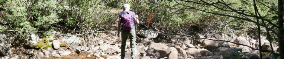
Rio de las Vacas Hike.Pat.2018-07-24
Donning our packs we started up the Rio canyon, intending to follow the first sketch. ‘Tho initially there appeared to be a trail, we soon found ourselves engaged in some serious bushwhacking; the canyon is very narrow, rocks, trees, and bushes completely blocking our progress. We soon “headed for higher ground”, climbing up the steep side of the canyon into more open spaces. At this point we changed our plan to lean towards the 2nd sketch.
The climb out of the canyon was quite steep, at times requiring a 4-point stance for balance. We climbed 400 ft in .4 miles to reach near the top of the mesa; slope at times greater than 45 degrees. At times we were able to follow game trails that made things easier, but those trails didn’t always go where we wanted to go.
Once on top, close to 9,000 feet, we enjoyed a nice open forest with occasional views across canyons to other canyons and mesas. We checked our track against the 2nd sketch, and based on our experience and lessons learned (below), we plotted our return track to follow a ridge rather than a canyon back to NM 126 and the campground. The proved to be a good choice – the descent was steady but not steep, and we were able to follow game trails all the way down (those deer and elk have it figured out). Nearing the road we found open spaces that should be ideal for campsites with short backpacking from the road.
This wasn’t a long hike, but challenging and at the same time quite relaxing. There are published trails a bit north of this hike, around San Gregorio Lake and including part of the Continental Divide Trail; we’ll be heading back to San Pedro Parks when muddy roads aren’t a concern. This is a beautiful area.
Highlight
- Some lessons learned:
- When a canyon appears on GoogleEarth to be narrow with steep sides, plan on serious bushwhacking
- When the 20 foot lines on a topo map run together, expect nearly sheer cliffs
- When the 20 foot lines on a topo map have space between them only as wide as the line, it will be a –steep– climb
- Be wary of a narrow canyon with a stream running, like the Rio de las Vacas; it is likely to be “bush-heavy” with rocks, trees, fallen trees, and thick bush growth
Statistics
Total Distance: 2.61 miles
Elevation: start 8,320 ft, maximum 8,935 ft, minimum 8,259 ft
Gross gain: 676 ft. Aggregate ascending 908 ft, descending 929 ft
Maximum slope: 50% ascending, 35% descending, 12% average
Duration: 4:42
| GPS Track Files for Download | |
180 Downloads | |
|---|---|
185 Downloads | |
618 Downloads | |
194 Downloads | |
192 Downloads | |
656 Downloads | |
216 Downloads | |
169 Downloads | |
I urge you to explore our hiking tracks with Google Earth. With the virtual 3-dimensional presentation, achieved by panning and tilting the view, you can get a much better idea of the hikes and terrain than you can get from the 2-dimensional screenshot above. For assistance: Using Google Earth Track Files.
References
Recreation.gov: Rio de las Vacas Campground


