Tag Archives: Nancy

Cumbres Pass CDT North Hike – 06/18/2024

Cumbres Pass and the Continental Divide Trail (CDT) are a favorite destination and hike. You will find other posts of our visits there, one solo, another with Pat, and still another with Jay and Nancy. For this trip, we reserved Campsite 13 at the Heron Lake “Willow Creek” campground. Many of the sites in this campground are quite nice; Site 13 offered a through-drive with room for 2 vehicles, and 2 or 3 spots suitable for tent camping (since Pat didn’t make this trip, I brought a tent to sleep in).

The Drive In

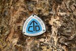
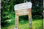
I will leave it to you to find your way to the Heron Lake campgrounds, and from Heron (if you camp there) to Chama. From Chama, continue north on NM 17 for 12 miles (..uphill.. from 7,900 feet to 10,000 feet at the pass) following the tracks of the Cumbres & Toltec Railroad (a National Historic Landmark). You will leave New Mexico for Colorado about 5 miles below the pass, continue on CO 17. Maybe 200 yards before reaching the summit, use the parking area on your right; there is a sign above the parking lot for CDT Trailhead #813. (The CDT goes both north and south from here – we hiked to the north, across the highway from the sign.)

The Hike

https://nmhiking.com/wp-content/uploads/2024/06/Cumbres-Pass-CDT-North-Hike.JayNancyBo.2024-06-18
Notes about the Google Earth screenshot: the graph at the bottom shows elevation of the track (pink area) and speed (the blue line).


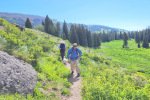
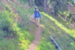
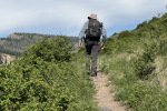
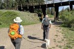
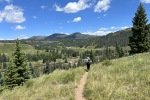
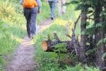
From parking, we crossed the highway and under the C&TRR trestle; the trailhead is just beyond. The first quarter mile is uphill, through an area of open forest. Then across an flat open area before taking on the climb. For the next 1.4 mile or so the trail climbs, traversing a steep slope (as Jay says, FARD – Fall and Roll Downhill).

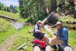
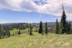
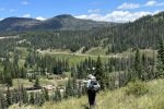
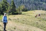
From there the trail continues on a not-so-steep slope across an open hillside. Twice the trail crosses a tiny “valley”, the 2nd at 2.2 miles which had a bit of water draining from above. We continued until encountering a flowing stream which would require wading to cross; we decided to pause here for lunch, then return to the trailhead. (As I had done on my solo hike, added our names to the logbook.

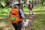
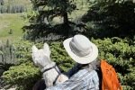
Jay here: Like finding a missing cufflink, we now have the matching set of CDT hikes: North and South. Very different in character. CDTS was mostly open along the ridge tops and with wide views of the valley below. CDTN was more confined in some ways but still had extended views to the ridges we hiked on CDTS the prior year. The steep portions were not FOAD (Fall Off And Die) but you could roll a long way down before arresting your descent. Bo did a great job for a little Westie, even jumping over logs a few times.

Highlight

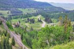
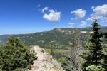
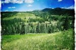
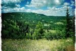
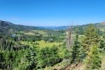
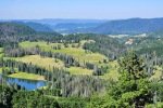
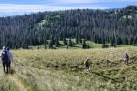
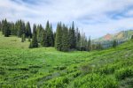
The views from the beginning of this section are magnificent. Here’s an excerpt from a hike with Pat back in 2022 that will give you an idea:

Statistics

Total Distance:  5.77 miles
Elevation: start 9,976 ft, maximum 10,303 ft,  minimum 9,961 ft
Gross gain: 342 ft.  Aggregate ascending 1,225  ft, descending 1,239 ft
Maximum slope: 23% ascending, 23% descending, 6.1% average
Duration: 4:26, Average Speed: 1.3 mph

GPS Track Files for Download
42 Downloads
32 Downloads
If you haven’t explored these hiking tracks with Google Earth, I urge you to try it. With the virtual 3-dimensional presentation, achieved by panning and tilting the view, you can get a much better idea of the hikes and terrain than you can get from the screenshot above. For some ideas, check out  Using Google Earth Track Files.

Related Posts

Cumbres Pass Hikes

References and Resources

USDA Forest Service: CDNST – Cumbres Pass North Trailhead # 813
AllTrails: Cumbres Pass CDT North
Continental Divide Trail Coalition: Cumbres Pass on the CDT, …
Taos News: Hiking in Southren Colorado: Cumbres Pass North to Wolf Creek Falls
Photos

Cumbres Pass CDT Trail South Hike – 07/12/2023

This post is for a 2nd hike that we made with Jay, Nancy, and Bo during a camping trip to Cumbres Pass and the Trujillo Meadows campground (10,000 feet elevation and above). Check out the 1st hike, Red Lake Trail Hike – 07/11/2023.

The Drive In

Repeating here The Drive In from the post for the 1st hike:

We chose to avoid I-25 and US 84, both busy roadways, and instead chose a route through Cuba (I-25 to Bernalillo, then US 550). Four miles beyond Cuba we turned right on NM 96. Upon reaching the sharp right turn of NM 96, we turned left to continue north on NM 112. The first 27 miles is paved; from there to El Vado dam (19 miles) the road is well maintained gravel; we kicked up quite a plume of dust behind us at 35-45 MPH. Tho’ a  sign warned us of the possibility of a delay of up to 2 hours, we took our chances – and won – no delay at the El Vado dam.

The road to cross El Vado dam is interesting. It is one lane down a very steep incline, then very narrow lane across the dam itself. We were OK with the R-Pod but would not attempt to cross here with anything larger. From there, NM 96 is paved to the intersection with US-84; then it was on to Chama. Borrowing the remainder of The Drive In from the post for last year’s trip:

“We drove from Albuquerque to Chama and continued on NM 17 up to the crest of Cumbres Pass (the highway becomes CO 17 as it passes into Colorado). For a good part of the way, Hwy 17 follows the tracks of the Denver and Rio Grande Railroad, aka Cumbres and Toltec Railroad to the crest where there is a small railyard.

Our campsite in Trujillo Meadows Campground. Atop a hill in the middle of the campground, we had great views in all directions.


Continuing past the crest for 1/4 mile, we turned left onto FR 118 (a good Class 3 road, tho’ there are some sections of serious washboard); in 2.5 miles turn right at the entrance to the campground. (Adjacent to the campground is Trujillo Meadows Reservoir. There are some sites that look down upon the reservoir and there is a road from the campground entrance to a boating ramp; we did not investigate either.) (We met Jay and Nancy in the same campsite that we used last year.)

The Red Lake trail is a bit further north on CO 17 — 6.4 miles from the turnoff to the Trujillo Meadows Campground. Turn left onto FR 113, a Class 3 road towards Red Lake — 3.5 miles. The road makes a sharp 180° turn to the left — parking is on the right up a short rise.”

The Hike

Cumbres Pass CDT Trail South Hike.PatJayNancyBo.2023-07-12
Notes about the Google Earth screenshot: the graph at the bottom shows elevation of the track (pink area) and speed (the blue line).

All of us agreed – this was among the most spectacular hikes that we’ve taken. I had hiked this trail in 2021 while Pat was attending a workshop in Chama. But I didn’t remember just how spectacular it is; Pat, Jay, and Nancy to brought it into focus for me.

The trail begins from the parking area on the right side of CO 17 at the top of Cumbres Pass, just below (west of) the Cumbres and Toltec train station. The trailhead is well marked and well used – smooth ground through pine and fir forest bordered by grass and many varieties of flowers. It presents easy ascent for about 200 feet of elevation gain (with switchbacks) to get atop a long ridge (about half a mile).

Along the ridge the views are amazing: to the west down the valley with the C&T tracks twisting their way to the top of Cumbres Pass, mountains in the distance to the north, and down the valley of Rio de los Piños and the railroad tracks.

The trail continues on the ridge for 8/10ths of a mile, descending 100 feet or so. It then enters a somewhat dense forest and begins to climb again, an easy ascent in and out of forest with a great overlook 2.2 miles into the hike. This was our plan for the day, 4+ miles – we turned back.

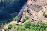
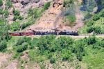
As we hiked along the ridge we kept our eyes on the railroad tracks. Our timing was good – the 10 o’clock train was on its way from Chama. We watched it stop at a water tank, then continue up to the station at Cumbres Pass. What a sight, especially as it rounded the steep end of a ridge on an embankment that must have been a marvel of engineering a 100+ years ago.

width=

Highlight

It was unanimous – this is among the best trails we’ve hiked – easy with marvelous, spectacular views. And Bo is getting his trail legs.
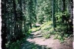
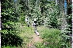
Jay here: Yep, they don’t say Bo is a Westie for nothing. Terriers are diggers but so far, Bo just digs coming along on the trail. Views from this hike were much better than average for sure, and the train going up the valley was a bonus.


Statistics

Total Distance:   4.54
Elevation: start  9,964 ft, maximum  10,342 ft,  minimum  9,964 ft
Gross gain:  378 ft.  Aggregate ascending  997 ft, descending  995 ft
Maximum slope: 26% ascending, 27% descending, 7.0% average
Duration: 3:27, Average Speed: 1.3 mph

GPS Track Files for Download
58 Downloads
203 Downloads
If you haven’t explored these hiking tracks with Google Earth, I urge you to try it. With the virtual 3-dimensional presentation, achieved by panning and tilting the view, you can get a much better idea of the hikes and terrain than you can get from the screenshot above. For some ideas, check out  Using Google Earth Track Files.

Related Posts

Hikes around Cumbres Pass

References and Resources

TrailForks: Continental Divide Trail (CDT) Complete
GAIA GPS:  Continental Divide Trail
MTB Project: CDT: Cumbres Pass to lagunitas (NM Section 31)
Mountain Photography: Continental Divide Trail through the South San Juans
Wikipedia: Cumbres Pass
Cumbres & Toltec Railroad: The Ride of a Lifetime

Red Lake Trail Hike – 07/11/2023

It has been -hot- in Albuquerque (and in Santa Fe). Even hotter than we anticipated when a few months ago we planned this camping and hiking trip to Cumbres Pass and the Trujillo Meadows campground (10,000 feet elevation and above). This post is for our first hike during this trip: the Red Lake Trail which Pat & I hiked a year ago.

The Drive In

We chose to avoid I-25 and US 84, both busy roadways, and instead chose a route through Cuba (I-25 to Bernalillo, then US 550). Four miles beyond Cuba we turned right on NM 96. Upon reaching the sharp right turn of NM 96, we turned left to continue north on NM 112. The first 27 miles is paved; from there to El Vado dam (19 miles) the road is well maintained gravel; we kicked up quite a plume of dust behind us at 35-45 MPH. Tho’ a  sign warned us of the possibility of a delay of up to 2 hours, we took our chances – and won – no delay at the El Vado dam.

The road to cross El Vado dam is interesting. It is one lane down a very steep incline, then very narrow lane across the dam itself. We were OK with the R-Pod but would not attempt to cross here with anything larger. From there, NM 96 is paved to the intersection with US-84; then it was on to Chama. Borrowing the remainder of The Drive In from the post for last year’s trip:

“We drove from Albuquerque to Chama and continued on NM 17 up to the crest of Cumbres Pass (the highway becomes CO 17 as it passes into Colorado). For a good part of the way, Hwy 17 follows the tracks of the Denver and Rio Grande Railroad, aka Cumbres and Toltec Railroad to the crest where there is a small railyard.

Our campsite in Trujillo Meadows Campground. Atop a hill in the middle of the campground, we had great views in all directions.

Continuing past the crest for 1/4 mile, we turned left onto FR 118 (a good Class 3 road, tho’ there are some sections of serious washboard); in 2.5 miles turn right at the entrance to the campground. (Adjacent to the campground is Trujillo Meadows Reservoir. There are some sites that look down upon the reservoir and there is a road from the campground entrance to a boating ramp; we did not investigate either.) (We met Jay and Nancy in the same campsite that we used last year.)

The Red Lake trail is a bit further north on CO 17 — 6.4 miles from the turnoff to the Trujillo Meadows Campground. Turn left onto FR 113, a Class 3 road towards Red Lake — 3.5 miles. The road makes a sharp 180° turn to the left — parking is on the right up a short rise.”

The Hike

Red Lake Trail Hike.PatJayNancyBo.2023-07-11
Notes about the Google Earth screenshot: the graph at the bottom shows elevation of the track (pink area) and speed (the blue line).

There is little that I can add to the description from last year’s Post. There was however more snow this year as in a large depression we passed and against embankments where it must have been deep. We also had more stream crossings (some small, some large). And there were more wildflowers in bloom this year courtesy the late arrival of spring.


Highlight

This is a beautiful trail with amazing vistas across a verdant meadow to the mountains all a around. It is an easy trail with a few challenges crossing runoff and streams. Although we cut short the hike again this year and didn’t go as far as Red Lake itself, it remains on our list of hikes to complete in the future.

Jay here: Snow! Snow? It seemed like such a warm day, you had to ask yourself why there was still snow on the ground. But then you remember you’re at 11,000 + feet. It was a great hike that somehow brought us just a little closer to some magnificent clouds.

Statistics

Total Distance:   4.2 miles
Elevation: start  11,004 ft, maximum  11,656 ft,  minimum  10,981 ft
Gross gain:  675 ft,  Aggregate ascending  831 ft, descending  831 ft
Maximum slope: 24% ascending, 22% descending, 6.9% average
Duration: 3:47, Average Speed: 1.1 mph

GPS Track Files for Download
42 Downloads
36 Downloads
If you haven’t explored these hiking tracks with Google Earth, I urge you to try it. With the virtual 3-dimensional presentation, achieved by panning and tilting the view, you can get a much better idea of the hikes and terrain than you can get from the screenshot above. For some ideas, check out  Using Google Earth Track Files.

Related Posts

Hikes around Cumbres Pass

References and Resources

USDA Forest Service: Red Lake Trailhead, Trail 733
AllTrails: Red Lake Trail
GAIA GPS: Red Lake
Alamosa.org: 5 Trails You Need To Be On
Oh Ranger.com: Rio Grande National Forest, Red Lake Trail

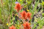
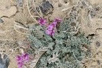
If you have viewed many of my other posts, you no doubt have noticed that I’ve included many photos and galleries of flowers. And you’ve seen repetition – the same flowers show up on posts for many hikes. That observation having occurred to me, I questioned why I would include flowers .. again. Well .. because they always attract my attention – there are so many colors, shapes, and settings. They exist often in environments that would be drab without them, sometimes in locations that appear to be quite inhospitable. So, again, I include in this post a “bouquet” of flowers:

Las Vacas Trail Hike – 08/03/2022

Our 2nd hike during a 3-day camping trip to San Pedro Parks, with Jay and Nancy and their new dog, Bo. ‘Tis a trail that we’ve hiked before, a very pleasant hike through open forest, past San Gregorio Reservoir and to the edge of Vallecito Damian. (Past posts for this trail were titled “San Gregorio Lake Hikes”. The trail is also considered part of the Clear Creek Trail.)

The Drive In

From the Rio de las Vacas Campground, drive west on NM  126 for about 2 miles, turn right onto FR 70, a good Forest Road (Class3). In about 6 miles, the trailhead will be on the left. The parking will be an area on the right.

The Hike

Vacas Trail Hike.PatJayNancyBo.2022-08-02 (KML)
Notes about the Google Earth screenshot: the graph at the bottom shows elevation of the track (pink area) and speed (the blue line).

This is a very easy trail, as are many on San Pedro Parks – wide, smooth path, open forest, little elevation change. From parking, San Gregorio Reservoir is a mile in. Bo, still a puppy, was tiring from the hiking the past two days, so Jay and Nancy “lounged” around the lake while Pat & I continued on up the trail.

On arriving at Clear Creek, near where it enters into the Reservoir, we came upon a group of youngsters playing in the water. (Tents and adults were nearby, suggesting that they were camping in this beautiful place.) With the boisterous Monsoon Season this year, Clear Creek was running well, but not so high that we weren’t able to cross on a pair of logs, as the youngsters watched (or continued their play). 

We continued on the trail, encountering a few deadfall trees across the trail, easily overcome (over or around). Going out far enough to get in a 4 mile hike, we turned back at the edge of Vallecito Damian and met Jay, Nancy, and Bo for lunch. Then made the easy walk back to parking.

Statistics

Total Distance:   3.94 miles
Elevation: start 9,223  ft, maximum 9,419 ft,  minimum 9,223 ft
Gross gain:  196 ft.  Aggregate ascending 654 ft, descending 663 ft
Maximum slope: 24% ascending, 18% descending, 5.2% average
Duration: 2:37

GPS Track Files for Download
152 Downloads
68 Downloads
If you haven’t explored these hiking tracks with Google Earth, I urge you to try it. With the virtual 3-dimensional presentation, achieved by panning and tilting the view, you can get a much better idea of the hikes and terrain than you can get from the screenshot above. For some ideas, check out  Using Google Earth Track Files.

Related Posts

Rio de las Vacas Walkabout – 07/31/2022
Peñas Negras Trail Hike – 08/01/2022
Hikes in San Pedro Parks

References and Resources

USDA Forest Service: Vacas Trail/San Gregorio Lake Trailhead #51
AllTrails:
      San Gregorio Reservoir
      Clear Creek Trail
Dog of the Desert: Clear Creek in the San Pedro Parks Wilderness
Only in Your State: San Gregorio Reservoir …
The Outbound: Backpack the Vacas Trail Loop
Astec NM: San Pedro Parks Wilderness Trails (pdf)

Rio de las Vacas Walkabout – 07/31/2022

 A short walk out of Rio de las Vacas campground, in the afternoon after setting up camp with Jay and Nancy. This was a warmup for hiking the following 2 days in the San Pedro Parks Wilderness. San Pedro Parks is at nearly 10,000 feet elevation – and cooler, a getaway from Albuquerque’s hot summer weather.

The Drive In

The drive to San Pedro Parks: from Bernalillo: US 550 to Cuba; in the middle of town turn right onto NM 126, continue for 10 miles. Continue past the turnoff to San Gregorio Lake (FR70) for 2 miles to the entrance to the Rio de las Vacas Campground. We chose Sites 11, a double site to accommodate our R-Pod camper and Jay and Nancy’s Vanaa.

The Hikes

Rio de las Vacas Walkabout.PatJayNancyBo.2022-07-31
Notes about the Google Earth screenshot: the graph at the bottom shows elevation of the track (pink area) and speed (the blue line).

Suggested by Ben, the camp host, we crossed NM 126 directly below our campsite (#11), passed through the fence at a gate, and continued downhill towards a pleasant open meadow and the Rio de las Vacas. Reaching the creek, we angled of to the left and followed it downstream, soon crossing to the southside. We continued until the streambanks narrowed blocking our route with dry feet. We crossed back over to the north side (using rocks and a log) and decided to head back to the campground through the woods.  Although there was no trail, the ponderosa and fir forest was quite on open and easy to pass through.

Along the stream, it was grassland – easy walking. Through the forest, the floor was gravel and dirt – more easy walking with hardly any deadfall.

Statistics

Total Distance:   1.18 miles
Elevation: start  8,302 ft, maximum  8,304 ft,  minimum  8,160 ft
Gross gain:  144 ft.  Aggregate ascending 207 ft, descending 165 ft
Maximum slope: 34% ascending, 31% descending, 5.6% average
Duration: 0:52

GPS Track Files for Download
58 Downloads
53 Downloads
If you haven’t explored these hiking tracks with Google Earth, I urge you to try it. With the virtual 3-dimensional presentation, achieved by panning and tilting the view, you can get a much better idea of the hikes and terrain than you can get from the screenshot above. For some ideas, check out  Using Google Earth Track Files.

Related Posts

Peñas Negras Trail Hike. 08/01/2022
Hikes in San Pedro Parks

References and Resources

USDA Forest Service: Rio de las Vacas Campground

Deer Trap Mesa Trail Hike – 04/26/2022

A hike on the Deer Trap Mesa Trail, one of the many trails in and around Los Alamos, with Jay and Nancy on the third day of a camping trip to Bandelier.

The Drive In

The trailhead is on the perimeter of Los Alamos, on one of the narrow mesas/ridges between the many canyons across which the city is spread. Here are directions from Trail Network Map – Los Alamos County (pdf):

From NM 501/East Jemez Road, turn right onto Diamond Drive.  Go north then east on Diamond for 2.6 miles to the roundabout at San Ildefonso. Turn left and in 0.3 mile continue straight onto Barranca Road. Follow this road 1.3 miles to its end just past the intersection with Navajo. Parking along the road, with signs for the Trail.

The Hike

Deer Trap Mesa Trail Hike.PatJayNancy.2022-04-26
Notes about the Google Earth screenshot: the graph at the bottom shows elevation of the track (pink area) and speed (the blue line).

The trail, as we took it, begins on the somewhat narrow spine of Deer Trap Mesa. A couple of hundred yards on, it leaves the spine and traverses the slope near the top of the mesa. It is a well used trail – generally sandy surface but with rock small and large outcroppings to work around. And to the left – a steep slope to the bottom of Rendija Canyon. We continued along this edge of the mesa for about a mile into the hike, where we again climbed atop it. From there, another half mile to a point that required some rock climbing to continue further. We turned back, finding a place for lunch on top, then retraced our steps.

That was -our- hike. Upon returning home and looking again at the published maps of the Deer Trap Mesa Trail, I realized that we missed a turn that would have taken us on top of the mesa. From there, relatively level ground and a loop around the mesa top – that will make a great plan for a return trip.

Statistics

Total Distance:  2.8 miles
Elevation: start  7,235 ft, maximum  7,236 ft,  minimum 6,973 ft
Gross gain: 263 ft.  Aggregate ascending 919 ft, descending 923 ft
Maximum slope: 37% ascending, 40% descending, 8.5% average
Duration: 2:55

GPS Track Files for Download
55 Downloads
57 Downloads
If you haven’t explored these hiking tracks with Google Earth, I urge you to try it. With the virtual 3-dimensional presentation, achieved by panning and tilting the view, you can get a much better idea of the hikes and terrain than you can get from the screenshot above. For some ideas, check out  Using Google Earth Track Files.

References and Resources

Los Alamos:
              Deer Trap Mesa Trails
              Trail Network Map – Los Alamos County (pdf)
AllTrails: Deer Trap Mesa Trail
Pajarito Environmental Education Center (PEEC): Deer Trap Mesa Trail

Tapia Canyon & Tower Ceremonial Site Hike – 03/28/2022

Went to the Rio Puerco to hike with Jay and Nancy, her first visit to Tapia Canyon. From the large number of visits t0 my previous posts for Tapia Canyon, this is a popular destination.

The Drive In

Not much to add this trip to the description on my most recent visit to Tapia Canyon, Tapia Canyon Hike – 04/06/2020. See the Photo Galleries below for photos and comments on our drive in this trip.

The Hike

Tapia Canyon & Tower Ruins Hike.JayNancy.2022-03-28
Notes about the Google Earth screenshot: the graph at the bottom shows elevation of the track (pink area) and speed (the blue line).

Descriptions from our previous hikes tell much the same story as for this hike. Tapia Canyon Hike – 04/06/2020 provides a good description overall, including the .gps track. And an earlier hike with Jay,  Tapia Canyon & Tower Ruins Hike – 11/19/2016 (with .gpss track) describes the climb out of the canyon to see the Tower Ruins. (Note: Now I prefer to refer to “Ruins” as the “Tower Ceremonial Site”. The area is closed to the public for 2 weeks 4 times per year for “.. sacred native American traditional activities”. And there is little evidence typical of ruins at other sites that I’ve visited.)

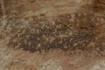
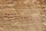
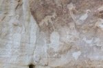
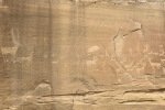
An update, tho’, about the climb out: during this hike I had forgotten about the steps Jay and I found back in 2016. Jay had a clear memory of them, but not where they were located. As we hiked down-canyon we scrutinized the right-hand wall looking for something we recognized. Almost to the point of giving up, we checked one more suspicious break in the wall, and behind a couple of juniper trees were those footsteps (or footholds). Adding to our previous visit: this time we noticed some amazing petroglyphs on the wall at the bottom of the steps and more at the top. 

So up onto the mesa we went, looked at the block building and kiva circles of rocks, then continued on to an easy descent back into the canyon.

Jay here: Funny (or not) how the memory is either crystal clear or hazy. In the case of the foothold path up to the mesa and the Tower, I remembered very specific details about the route but not how far back up the canyon it was from the arch. Only that it was on the right side of the canyon and that it was obscured somewhat by vegetation. Once you got close to the canyon wall, the route was obvious. Perseverance paid off and the path looked exactly as I remembered.

Statistics

Total Distance:  5.65 miles
Elevation: start  5,959 ft, maximum  6,168 ft,  minimum 5,929 ft
Gross gain: 239 ft.  Aggregate ascending 753 ft, descending 753 ft
Maximum slope: 29% ascending, 25% descending, 3.6% average
Duration: 4:10

GPS Track Files for Download
55 Downloads
64 Downloads
If you haven’t explored these hiking tracks with Google Earth, I urge you to try it. With the virtual 3-dimensional presentation, achieved by panning and tilting the view, you can get a much better idea of the hikes and terrain than you can get from the screenshot above. For some ideas, check out  Using Google Earth Track Files.

Related Posts

Tapia Canyon Hike – 04/06/2020
Tapia Canyon & Tower Ruins Hike – 11/19/2016

References and Resources

See the other Related Posts.

The next gallery are a few of the photos of petroglyph panels that I took during this visit. Check to other posts for other photos of these and other panels.

White Mesa Bike Trails East – 02/21/2022

With this hike we explore more of the White Mesa Bike Trails, also known as the Dragon’s Back area.

The Drive In

This trailhead is at the parking lot as one enters BLM’s Ojito Wilderness. From the Bernalillo exit off of I-25, proceed west on US 550 for 32 miles. Turn left on Cabezon Road (bear left a short distance off of US 550) and continue for 4 miles. Park on the left just beyond gate/cattle guard.

The Hike

White Mesa Bike Trails East.PatJayNancy.2022-02-21
Notes about the Google Earth screenshot: the graph at the bottom shows elevation of the track (pink area) and speed (the blue line).

Our guide for this hike was GAIA’s map of the area, showing with dotted lines what we took to be trails. We planned to make a clockwise loop, first down the steepest slope into the canyon, then return to the trailhead along the east side of the loop. So we began by heading north from the trailhead parking lot, on a 2-track that followed a fence that defines the boundary between BLM land and Zia Pueblo land.

Less than 1/4 mile on, the 2-track angled off the the northwest then petered out at the bottom of a small ravine (or canyon?). It seemed logical to head up this ravine – ‘tho it was narrow the going was mostly easy (a few small rock climbs) as it wound its way toward the top of the ridge. Along the way we passed through some of the many colors that are characteristic of this area of the Ojito Wilderness. [At some point, we noticed that GAIA’s dotted line was to our right. But we were going in the right direction – up and northerly. Later we learned more about GAIA’s ‘trail’ – see below.]


Once atop the ridge, we had marvelous views, east to the Sandia Mountains and west across Dragon’s Back itself to Cabezon beyond. From reconnoitering on GoogleEarth, we planned to take the loop clockwise so as to -descend- on the steepest section of the trail.

Thus we turned left (west) atop this mesa, then to descend on what a sign identified as the “Spine”. We shortly encountered a steep descent through a cleft in rocks. Then we continued on to the spine. And a spine it was, a narrow ridge (<20′ wide), descending gradually at first.

The last few yards to the canyon floor were -very steep-, made treacherous by sections of mud left over from melting snow. The soil is such that when wet, it becomes very slippery. To  make the descent safe, we squatted, braced ourselves on the edges of the “trail”, and duck-walked down. With the weight of my pack, I was comfortable only by sitting down and working my way down a foot or two at a time.


Once we were down into the canyon, the trail was smooth and level – for 300 yards or so. We then began a climb up on the ridge that splits the middle of the canyon. Up on the ridge we had a great view of the length of Dragon’s Back, with Cabezon on the horizon beyond. Along the way we came upon one of the many springs that dot this area, surrounded by a mound of gypsum that continued downhill, from years (decades?) of evaporation of the spring water. I was curious, thinking maybe the water was warm – nope, it was cool.


We continued north on this ridge until our planned turn-around point. Before heading back towards the trailhead, we went a bit further to show Nancy & Jay the big hole Pat & I had discovered on our earlier hike (Dragon’s Back Canyon Hike – 1/21/2022). We also took a break for lunch here.

The route back started on a two-track which we followed for about 3/4 mile, at which point we took the bike trail to the right. That went well, easy to follow and an easy surface. The views to the west across the canyon were studding, with many variations of red, white, yellow, even some bluish tints in the canyon walls, punctuated by snow in shaded areas. Continuing to follow the GAIA track of the bike trail, once atop the ridge we came to a Y junction; we chose the one to the left that followed the GAIA track. 


Some 300 yards on we encountered a -very narrow- section with a steep slope  falling off to the right, and a sign that warned that it was a dangerous route – it was too risky for us. And it is hard for us to imagine that people would take that narrow trail on mountain bikes. So we retraced our steps to the Y junction and took the other leg that took us back to the top of the narrow ravine that we climbed through on our way from the trailhead.


We considered descending that ravine, but chose instead to continue west on the bike trail, then pick up the 2-track that would take us to Cabezon Road, then a third of a mile to the trailhead. ‘Twas a good choice to finish what had been a challenging adventure, an easy downhill trek, then head to Bernalillo and a beer at Bosque Brewing.

Jay here: Steep drop-offs my ass! What he means is that on that one descent from the spine into the canyon, some of us spent quite a bit of time on our asses. Amazing variety to this hike. Starts with walking through a confined ravine, then tops out on to a spine, across a canyon, and then back on to limestone spines most of the way back. When you think about people tackling this on mountain bikes, you have to give them a badge for bravery.

Highlight

Statistics

Total Distance:  5.8 miles
Elevation: start  5,749 ft, maximum  6,028 ft,  minimum 5,681 ft
Gross gain: 347 ft.  Aggregate ascending 1,130 ft, descending 1,130 ft
Maximum slope: 26% ascending, 36% descending, 6.7% average
Duration: 4:28

GPS Track Files for Download
114 Downloads
83 Downloads
If you haven’t explored these hiking tracks with Google Earth, I urge you to try it. With the virtual 3-dimensional presentation, achieved by panning and tilting the view, you can get a much better idea of the hikes and terrain than you can get from the screenshot above. For some ideas, check out  Using Google Earth Track Files.

Related Posts

Dragon’s Back Canyon Hike – 1/21/2022
White Mesa Bike Trails Hike – 03/09/2017
Dragon Back, White Mesa Bike Trail – 02/16/2016
All Ojito Hikes

References and Resources

BLM: White Ridge Bike Trails
           White Ridge Bike Trails (pdf)
ASCHG: White Mesa – East Loop Hike
                White Meas – East Ridge Hike
                White Mesa – West Loop Hike
AllTrails: White Mesa and Dragon’s Back Trail Loop
MTB Project: White Ridge Trail System – Main Loop
Trailforks: White Ridge Trail System


San Ysidro Trials Loop Hike – 02/09/2022

For years we’ve driven by the San Ysidro Bike Trials Area on our way to places further west. Jay recently came upon reports in AllTrails that brought our attention to this southern end of the Sierra Nacimiento.We  hiked Red Mesa a few years back; today we tackled the Bike Trials.

The Drive In

This one is easy – US 550 west from Bernalillo, through San Ysidro, then 1.6 miles on look for the parking area for San Ysidro Bike Trials Area. The trailhead is on the west side of the parking lot.

The Hike

San Ysidro Trials Loop Hike.PatJayNancy.2022-02-09
Notes about the Google Earth screenshot: the graph at the bottom shows elevation of the track (pink area) and speed (the blue line).

The parking lot for the Bike Trials is quite large, just off of US 550; pass through a V-shaped gate to begin the hike. We could take a 2-track into the Area; we chose a hiking trail that took us away from US 550. The trail was easy – sand and dirt and a few rocky areas – climbing 200 feet in 1.1 miles. At 1.2 miles we entered the ‘central junction’, a large area cleared of vegetation and rocks and appears to be a marshaling point for off-road bikes. (We found bike tracks on trails for much of our hike.)

We had chosen to make a loop from here, heading southeast down a somewhat wide canyon. Like the trail from the parking area, it was easy going until .. some 300 yards on the trail  traversed an area of solid rock surface. Beyond this area we found the trail to again be easy to follow. We continued generally east, curving around the south end of one ridge through open area, then a short climb over a narrow ridge, and continuing around another couple of ridges to set a northerly course.

Tracking north, we again found ourselves on solid rock, generally flat but with many benches and other disjunctures and scattered rocks that demanded our attention. Not far up this northbound leg we could look down into a sometimes deep (20′) narrow (15′-20′) “rock arroyo”. ‘Tis amazing what Mother Nature has wrought; here erosion has carved out what could be called a crevasse which we followed for about half a mile. To add to the interest, the surface of this flat rock came with many colors and patterns.

Three miles into the hike we came to a junction of trails; our plan was to track southwest on what proved to be a well used trail back to the ‘central junction’ – easy going. After a break for lunch, we headed back to the parking area, this leg using the 2-track that provided an easy, steady downhill route back to the trailhead.

Jay here: Pleasant surprise. Been passing this way for years and never knew about this great trail. Rock formations come out of nowhere and are amazing looking. Not so much fun in the summer or on a day when the dirt bikes might be out, but it’s perfect for sunny winter Monday.

Statistics

Total Distance:  5.16 miles
Elevation: start  5,495 ft, maximum  5,737 ft,  minimum 5,491 ft
Gross gain: 245 ft.  Aggregate ascending 607 ft, descending 607 ft
Maximum slope: 16% ascending, 19% descending, 4.6% average
Duration: 3:22

GPS Track Files for Download
62 Downloads
173 Downloads
If you haven’t explored these hiking tracks with Google Earth, I urge you to try it. With the virtual 3-dimensional presentation, achieved by panning and tilting the view, you can get a much better idea of the hikes and terrain than you can get from the screenshot above. For some ideas, check out  Using Google Earth Track Files.

Related Posts (in the vicinity)

Red Mesa Hike – 11/13/2016
All Ojito Hikes

References and Resources

BLM: San Ysidro Trials Area
AllTrails:
      San Ysidro Trail Loop
      Red Mesa Loop San Ysidro
SummitPost:
      San Ysidro Trials Area Canyon (East)
      San Ysidro Trials Area Canyon (West)
SingleTracks: San Ysidro Mountain Bike Trails
ASCHG:
      San Ysidro Trials East Hike
      San Ysidro Trials Long Loop Hike
      Red Mesa East Loop Hike


Dripping Springs Trail Hike – 11/29/2021

Our 2nd hike on a 3-night camping trip to southern New Mexico (where it would be warmer than our usual camping in northern New Mexico). We set up camp in the Leasburg State Park, having made reservations for a larger dry campsite with sufficient room for our Tacoma & R-Pod and Jay and Nancy’s Subaru. The site was quite clean and comfortable with a large table under a shelter and a firepit. And not far from roads to prospective hiking trails.

The Drive In

From Leasburg State Park, we returned to I-25, then 17 miles into Las Cruces where we took the exit to get onto East University Avenue eastbound. About 1.5 miles on, the name changes to Dripping Springs Road; continued for 9 miles to the parking lot for the Dripping Springs Natural Area.

The Hike

Dripping Springs Trail Hike.PatJayNancy.2021-11-29
Notes about the Google Earth screenshot: the graph at the bottom shows elevation of the track (pink area) and speed (the blue line).

The route from parking to the trailhead is well marked; at the entrance there is a registration stand where one can pay the access fee. (We chose not to pay here, but did pay on our departure after getting a reminder note on our windshield.) The trail was wide with fresh gravel making the hiking easy.

The grasses in the valley are quite healthy, presenting a bright yellow landscape all along. A quarter mile into the hike, we spied deer – 2 does and 2 bucks. The latter stayed around long enough for a portrait.

The trail rounds the edge of an extension of the Organ Mountains and enters Ice Canyon, which became narrower as we approached Dripping Springs. The first “improvement” we encountered were buildings that were stage coach stops for people coming from Las Cruces to the Sanatorium (or later, the Mountain Camp). Then we came upon a buttress that forms a dam below a waterfall; there was only a trickle of water this time of year. A bit further on we came upon the buildings that constituted the Boyd Sanatorium and the Van Patten Mountain Camp (great histories by New Mexico Nomad and Hidden New Mexico).

Heading back towards the truck, we decided to make the hike longer by turning right at a trail intersection and take the loop around a large outcropping. The trail continued easy to walk on, descending gently. Rounding the west end of the outcropping, we chose to continue east along the south side; continuing west would have taken us to the La Cueva Picnic Area and a parking lot (not where our truck was parked).

Proceeding east on the trail, we came across what I now know is La Cueva, a cave where the El Hermitaño spent the last days of his life. There are many recounts of his story – see the References below. From there it was an easy hike back to the truck. (And then into Las Cruces for beer at the Little Toad Creek Brewery.)

Jay here: A return trip for Nancy and myself but we got to see more of the ruins when we stopped for snacks at Boyd’s Mountain Camp. Still hard to believe that people came up the mountain via horse drawn wagons.

Statistics

Total Distance:  5.14 miles
Elevation: start  5,661 ft, maximum  6,210 ft,  minimum 5,431 ft
Gross gain:  779 ft. Aggregate ascending 1,085 ft, descending 1,088 ft
Maximum slope: 32% ascending, 31% descending, 7.6% average
Duration: 3:56

GPS Track Files for Download
73 Downloads
80 Downloads
If you haven’t explored these hiking tracks with Google Earth, I urge you to try it. With the virtual 3-dimensional presentation, achieved by panning and tilting the view, you can get a much better idea of the hikes and terrain than you can get from the screenshot above. For some ideas, check out  Using Google Earth Track Files.

Related Posts

References and Resources

BLM: Dripping Springs Natural Area
            Glimpse to the Dripping Springs History
           La Cueva Rock Shelter
AllTrails: Dripping Springs Trail
Visit Las Cruces: Hiking in Las Cruces – Dripping Springs Trail
New Mexico Nomad: Dripping Springs Trail (a superb description)
DesertUSA: The Lure of Dripping Springs (providing a great history)
Tripadvisor: Dripping Springs Natural Area
American Trails: Dripping Spring Trail System, New Mexico
New Mexico Nomad:
      Tripping Springs Trail (great history)
      The Hermit
Hidden New Mexico: Touching the Past at Dripping Springs (more history)
New Mexico Nomad: Organ Mountains-Desert Peaks National Monument
KFOX14: The haunting past of Dripping Springs (w/ Video)
HistoryNet: Hermit of the Organ Mountains