With this hike we explore more of the White Mesa Bike Trails, also known as the Dragon’s Back area.
The Drive In
This trailhead is at the parking lot as one enters BLM’s Ojito Wilderness. From the Bernalillo exit off of I-25, proceed west on US 550 for 32 miles. Turn left on Cabezon Road (bear left a short distance off of US 550) and continue for 4 miles. Park on the left just beyond gate/cattle guard.
The Hike
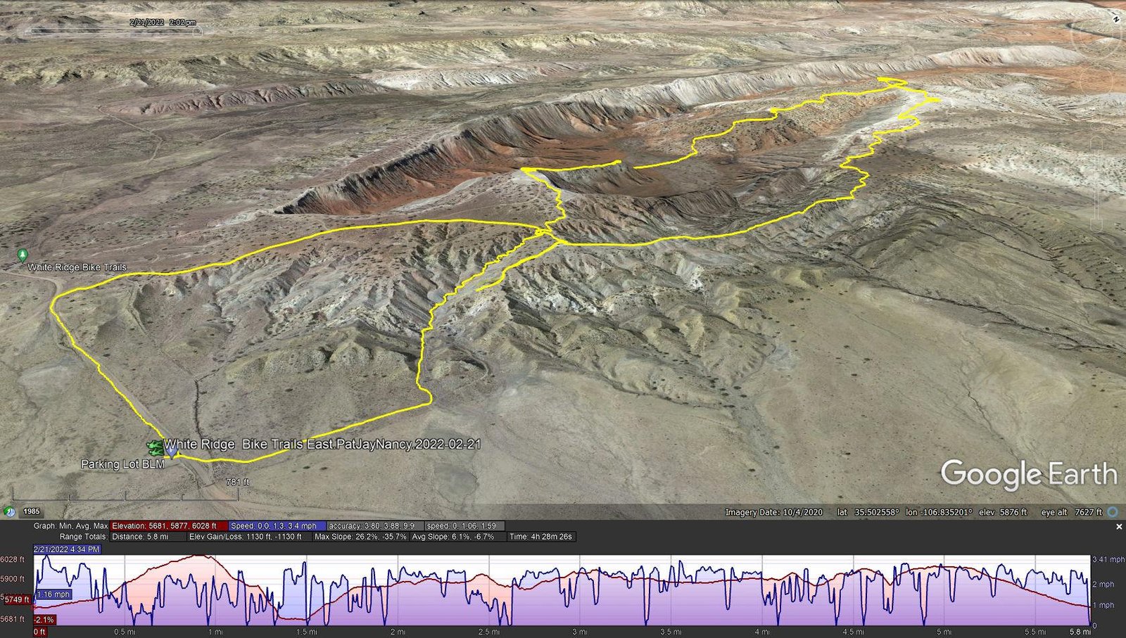
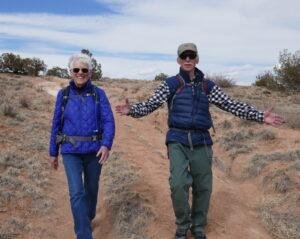
White Mesa Bike Trails East.PatJayNancy.2022-02-21
Notes about the Google Earth screenshot: the graph at the bottom shows elevation of the track (pink area) and speed (the blue line).
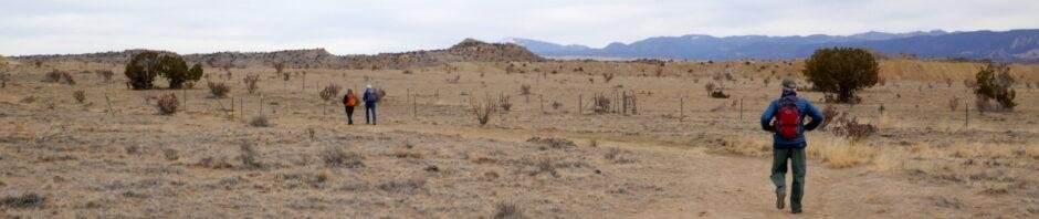
Our guide for this hike was GAIA’s map of the area, showing with dotted lines what we took to be trails. We planned to make a clockwise loop, first down the steepest slope into the canyon, then return to the trailhead along the east side of the loop. So we began by heading north from the trailhead parking lot, on a 2-track that followed a fence that defines the boundary between BLM land and Zia Pueblo land.


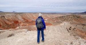 Once atop the ridge, we had marvelous views, east to the Sandia Mountains and west across Dragon’s Back itself to Cabezon beyond. From reconnoitering on GoogleEarth, we planned to take the loop clockwise so as to -descend- on the steepest section of the trail.
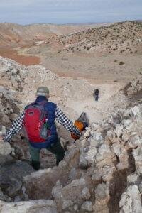 Thus we turned left (west) atop this mesa, then to descend on what a sign identified as the “Spine”. We shortly encountered a steep descent through a cleft in rocks. Then we continued on to the spine. And a spine it was, a narrow ridge (<20′ wide), descending gradually at first.
The last few yards to the canyon floor were -very steep-, made treacherous by sections of mud left over from melting snow.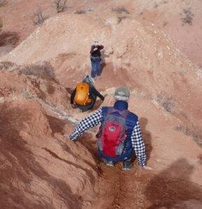 The soil is such that when wet, it becomes very slippery. To make the descent safe, we squatted, braced ourselves on the edges of the “trail”, and duck-walked down. With the weight of my pack, I was comfortable only by sitting down and working my way down a foot or two at a time.
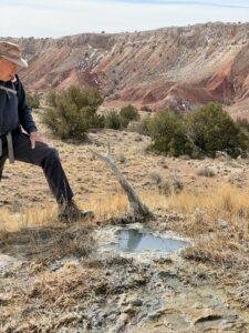 Once we were down into the canyon, the trail was smooth and level – for 300 yards or so. We then began a climb up on the ridge that splits the middle of the canyon. Up on the ridge we had a great view of the length of Dragon’s Back, with Cabezon on the horizon beyond. Along the way we came upon one of the many springs that dot this area, surrounded by a mound of gypsum that continued downhill, from years (decades?) of evaporation of the spring water. I was curious, thinking maybe the water was warm – nope, it was cool.
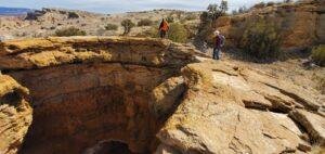 We continued north on this ridge until our planned turn-around point. Before heading back towards the trailhead, we went a bit further to show Nancy & Jay the big hole Pat & I had discovered on our earlier hike (Dragon’s Back Canyon Hike – 1/21/2022). We also took a break for lunch here.
 The route back started on a two-track which we followed for about 3/4 mile, at which point we took the bike trail to the right. That went well, easy to follow and an easy surface. The views to the west across the canyon were studding, with many variations of red, white, yellow, even some bluish tints in the canyon walls, punctuated by snow in shaded areas. Continuing to follow the GAIA track of the bike trail, once atop the ridge we came to a Y junction; we chose the one to the left that followed the GAIA track.
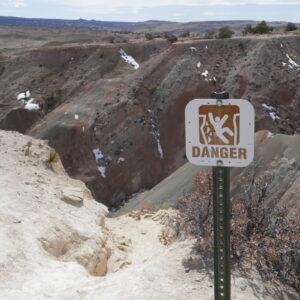 Some 300 yards on we encountered a -very narrow- section with a steep slope falling off to the right, and a sign that warned that it was a dangerous route – it was too risky for us. And it is hard for us to imagine that people would take that narrow trail on mountain bikes. So we retraced our steps to the Y junction and took the other leg that took us back to the top of the narrow ravine that we climbed through on our way from the trailhead.
 We considered descending that ravine, but chose instead to continue west on the bike trail, then pick up the 2-track that would take us to Cabezon Road, then a third of a mile to the trailhead. ‘Twas a good choice to finish what had been a challenging adventure, an easy downhill trek, then head to Bernalillo and a beer at Bosque Brewing.
Jay here: Steep drop-offs my ass! What he means is that on that one descent from the spine into the canyon, some of us spent quite a bit of time on our asses. Amazing variety to this hike. Starts with walking through a confined ravine, then tops out on to a spine, across a canyon, and then back on to limestone spines most of the way back. When you think about people tackling this on mountain bikes, you have to give them a badge for bravery.
Highlight
Statistics
Total Distance: 5.8 miles
Elevation: start 5,749 ft, maximum 6,028 ft, minimum 5,681 ft
Gross gain: 347 ft. Aggregate ascending 1,130 ft, descending 1,130 ft
Maximum slope: 26% ascending, 36% descending, 6.7% average
Duration: 4:28
| GPS Track Files for Download | |
230 Downloads | |
|---|---|
195 Downloads | |
If you haven’t explored these hiking tracks with Google Earth, I urge you to try it. With the virtual 3-dimensional presentation, achieved by panning and tilting the view, you can get a much better idea of the hikes and terrain than you can get from the screenshot above. For some ideas, check out Using Google Earth Track Files.
Related Posts
Dragon’s Back Canyon Hike – 1/21/2022
White Mesa Bike Trails Hike – 03/09/2017
Dragon Back, White Mesa Bike Trail – 02/16/2016
All Ojito Hikes
References and Resources
BLM: White Ridge Bike Trails
White Ridge Bike Trails (pdf)
ASCHG: White Mesa – East Loop Hike
White Meas – East Ridge Hike
White Mesa – West Loop Hike
AllTrails: White Mesa and Dragon’s Back Trail Loop
MTB Project: White Ridge Trail System – Main Loop
Trailforks: White Ridge Trail System


