For years we’ve driven by the San Ysidro Bike Trials Area on our way to places further west. Jay recently came upon reports in AllTrails that brought our attention to this southern end of the Sierra Nacimiento.We hiked Red Mesa a few years back; today we tackled the Bike Trials.
The Drive In
This one is easy – US 550 west from Bernalillo, through San Ysidro, then 1.6 miles on look for the parking area for San Ysidro Bike Trials Area. The trailhead is on the west side of the parking lot.
The Hike
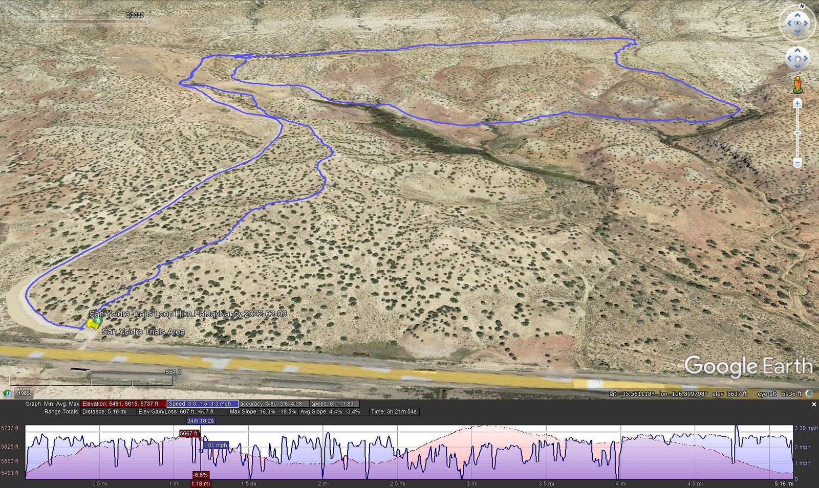
San Ysidro Trials Loop Hike.PatJayNancy.2022-02-09
Notes about the Google Earth screenshot: the graph at the bottom shows elevation of the track (pink area) and speed (the blue line).
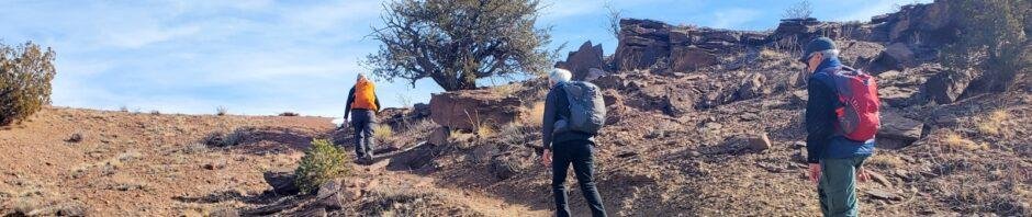
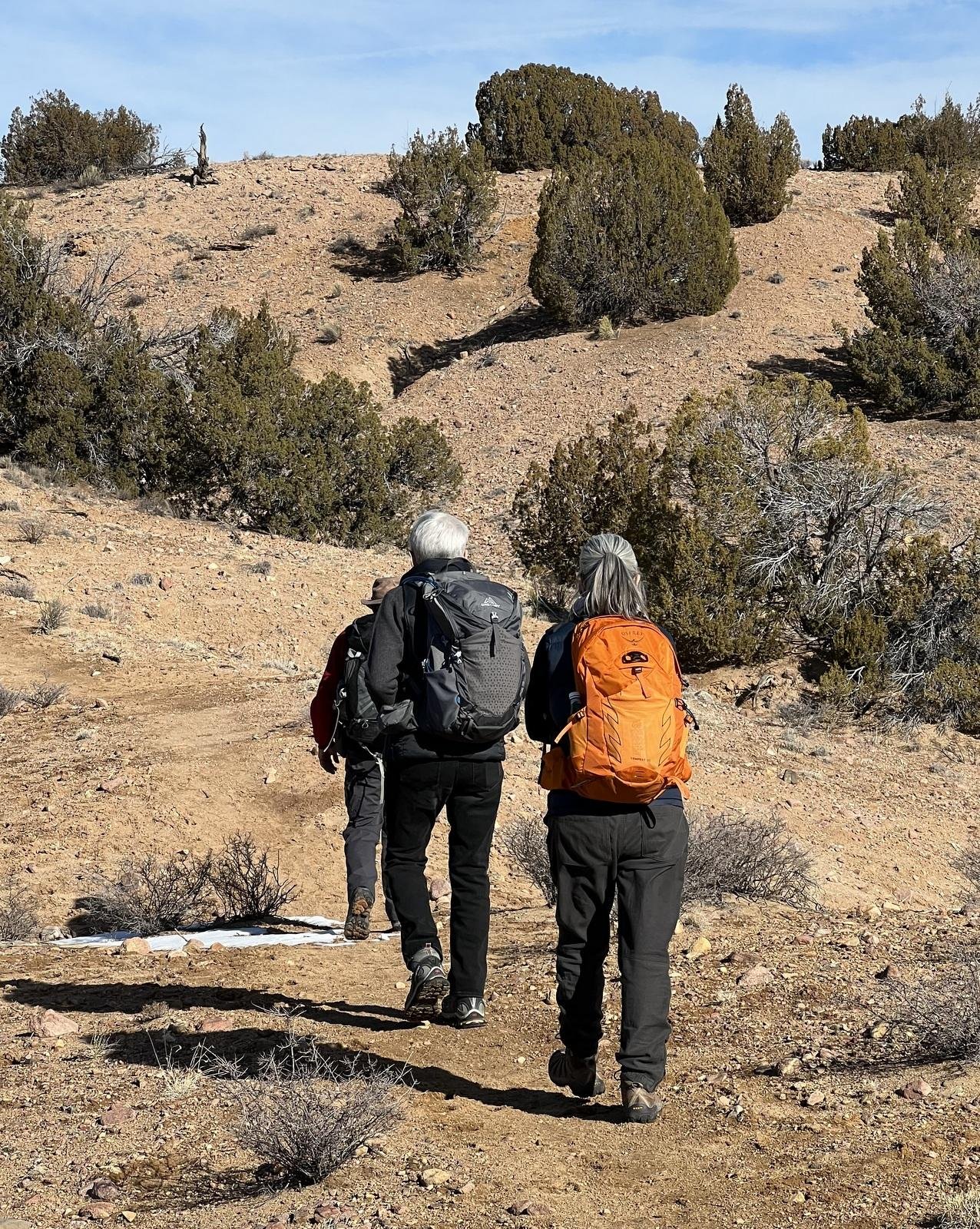 The parking lot for the Bike Trials is quite large, just off of US 550; pass through a V-shaped gate to begin the hike. We could take a 2-track into the Area; we chose a hiking trail that took us away from US 550. The trail was easy – sand and dirt and a few rocky areas – climbing 200 feet in 1.1 miles. At 1.2 miles we entered the ‘central junction’, a large area cleared of vegetation and rocks and appears to be a marshaling point for off-road bikes. (We found bike tracks on trails for much of our hike.)
 We had chosen to make a loop from here, heading southeast down a somewhat wide canyon. Like the trail from the parking area, it was easy going until .. some 300 yards on the trail traversed an area of solid rock surface. Beyond this area we found the trail to again be easy to follow. We continued generally east, curving around the south end of one ridge through open area, then a short climb over a narrow ridge, and continuing around another couple of ridges to set a northerly course.
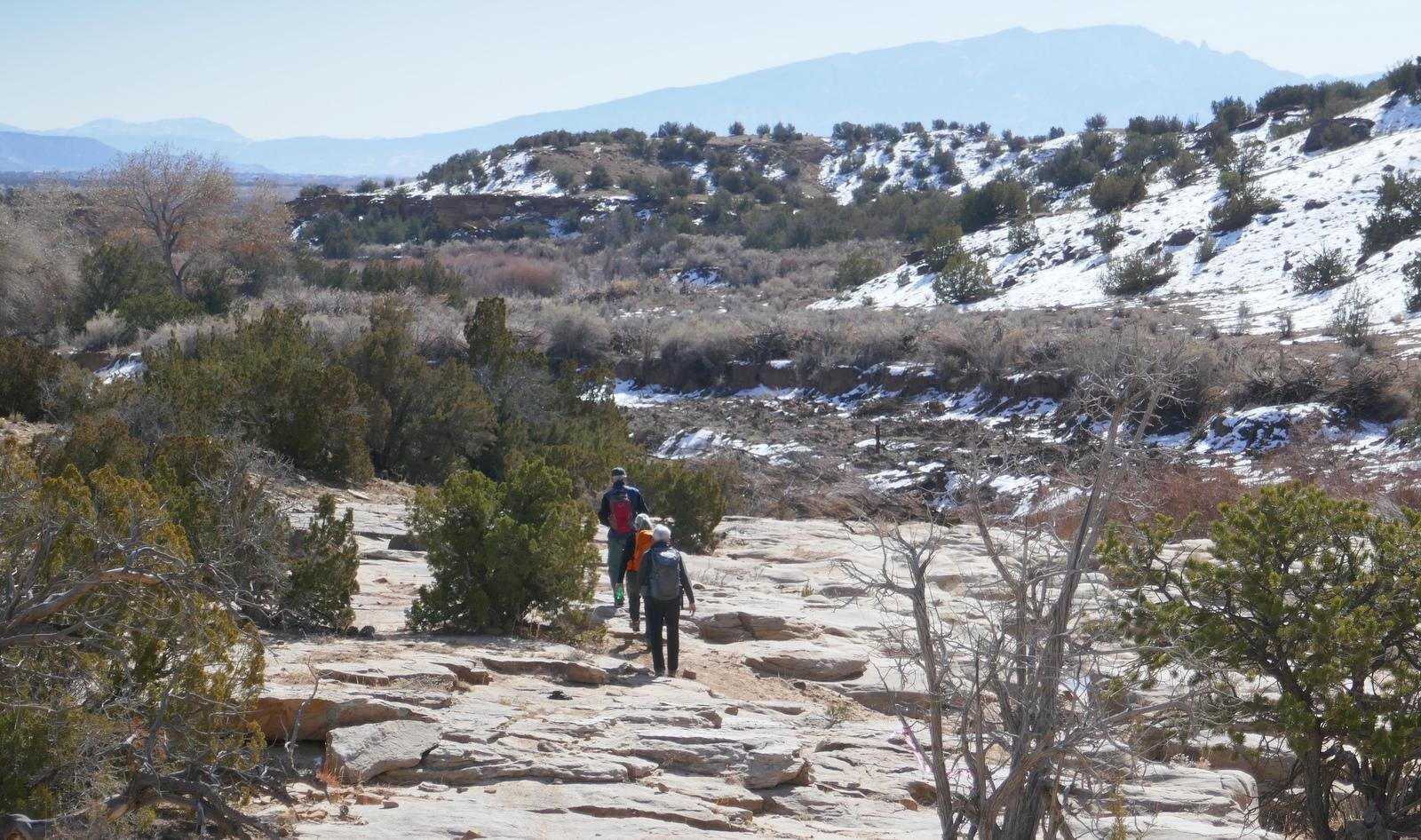
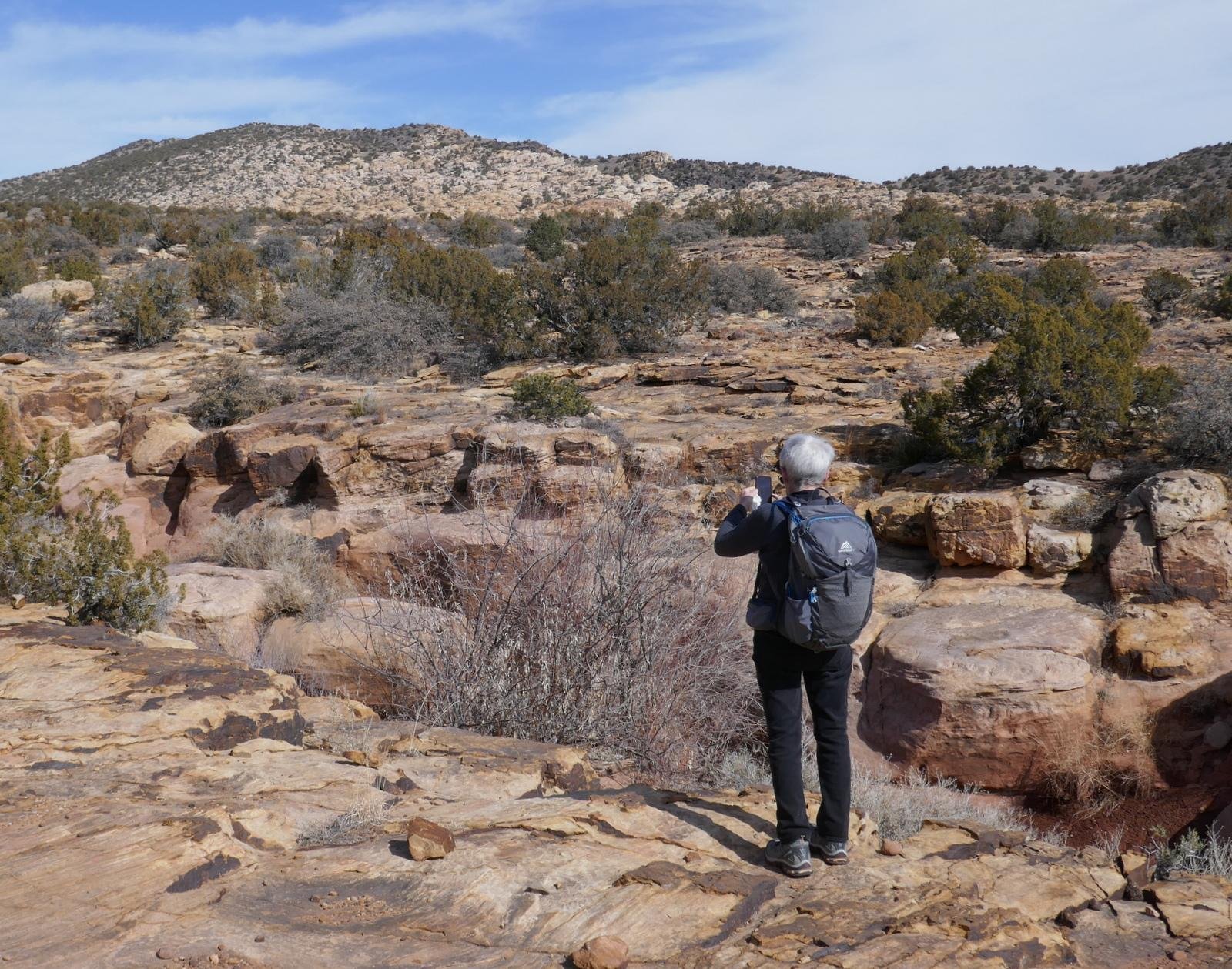 Tracking north, we again found ourselves on solid rock, generally flat but with many benches and other disjunctures and scattered rocks that demanded our attention. Not far up this northbound leg we could look down into a sometimes deep (20′) narrow (15′-20′) “rock arroyo”. ‘Tis amazing what Mother Nature has wrought; here erosion has carved out what could be called a crevasse which we followed for about half a mile. To add to the interest, the surface of this flat rock came with many colors and patterns.
Three miles into the hike we came to a junction of trails; our plan was to track southwest on what proved to be a well used trail back to the ‘central junction’ – easy going. After a break for lunch, we headed back to the parking area, this leg using the 2-track that provided an easy, steady downhill route back to the trailhead.
Jay here: Pleasant surprise. Been passing this way for years and never knew about this great trail. Rock formations come out of nowhere and are amazing looking. Not so much fun in the summer or on a day when the dirt bikes might be out, but it’s perfect for sunny winter Monday.
Statistics
Total Distance: 5.16 miles
Elevation: start 5,495 ft, maximum 5,737 ft, minimum 5,491 ft
Gross gain: 245 ft. Aggregate ascending 607 ft, descending 607 ft
Maximum slope: 16% ascending, 19% descending, 4.6% average
Duration: 3:22
| GPS Track Files for Download | |
188 Downloads | |
|---|---|
295 Downloads | |
If you haven’t explored these hiking tracks with Google Earth, I urge you to try it. With the virtual 3-dimensional presentation, achieved by panning and tilting the view, you can get a much better idea of the hikes and terrain than you can get from the screenshot above. For some ideas, check out Using Google Earth Track Files.
Related Posts (in the vicinity)
Red Mesa Hike – 11/13/2016
All Ojito Hikes
References and Resources
BLM: San Ysidro Trials Area
AllTrails:
San Ysidro Trail Loop
Red Mesa Loop San Ysidro
SummitPost:
San Ysidro Trials Area Canyon (East)
San Ysidro Trials Area Canyon (West)
SingleTracks: San Ysidro Mountain Bike Trails
ASCHG:
San Ysidro Trials East Hike
San Ysidro Trials Long Loop Hike
Red Mesa East Loop Hike


