 This was our first camping trip of the year, returning to the Cave Creek Canyon in the Chiracahua Mountains. ‘Tis a long drive so we left Albuquerque on the 9th, so we spent a night Deming which left us with a short trip to Cave Creek Canyon. On the 10th we left reasonably early so we could arrive at the first-come-first-serve campgrounds by midday which would give us a better chance to get a campsite.
The Drive In
From Albuquerque, we drove south on I-25 to Caballo, then west on NM 152 to Hillsboro, south in NM 27 to Nutt, continuing southwest on NM 26 to Demming – 233 miles. After a good nights rest at the Wagon Wheel RV Park, we continued west on I-10 to the turnoff on NM 146 south to Hachita, then west on NM 9 to NM 80, south to Rodeo and west into Cave Creek Canyon (this route was much more scenic than continuing west on I-10 to NM 80/Road Fork, and with the R-Pod we can’t make interstate speeds anyhow).
Across from the Chiracahua Desert Museum, we turned right on NM 533, soon we crossed State Line Road and into Arizona, and in 7 miles through the village of Portal, AZ. Continuing on we entered Coronado National Forest, passed the Idlewilde CG (closed), the Stewart CG, and on to the Sunny Flat CG where we hoped to find a campsite – all were full. We returned to Stewart and quickly occupied the one campsite available, #6, the last one around the loop, next to Cave Creek (which had some water running in it). It was a tight fit for our R-Pod, but served us well.
Prologue

Cave Creek Overlook Trail Walkabout.Pat.2022-03-10
The trail to Cave Creek Overlook as it leaves from near the entrance to Stewart Campground.
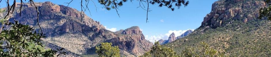
Having arrived around noon on the 10th, and not requiring much time to get the R-Pod set up, we had ample time to stretch our legs after a day and a half of driving. We had noticed a sign pointing to a Cave Creek Overlook up the road a half mile from Stewart. Not knowing otherwise, we walked up the road to the “trailhead” and up to the Overlook. It affords a great view ‘upstream’ on Cave Creek and its South Fork. (The GoogleEarth screen shot above gives one an idea of what Cave Creek Canyon is like, looking from above the entrance to the Canyon. ‘Tis a beautiful, amazing place.)
The climb up from the road is only about 200 feet and a couple of hundred yards. On the Overlook, we noticed what appeared to be a trail heading through the woods back towards the campground – we took it. It proved to be a much more pleasant walk than the road, an easy trail – to follow and to walk on. And we ended up at a trailhead at the entrance end of the Stewart Campground.
The Hike
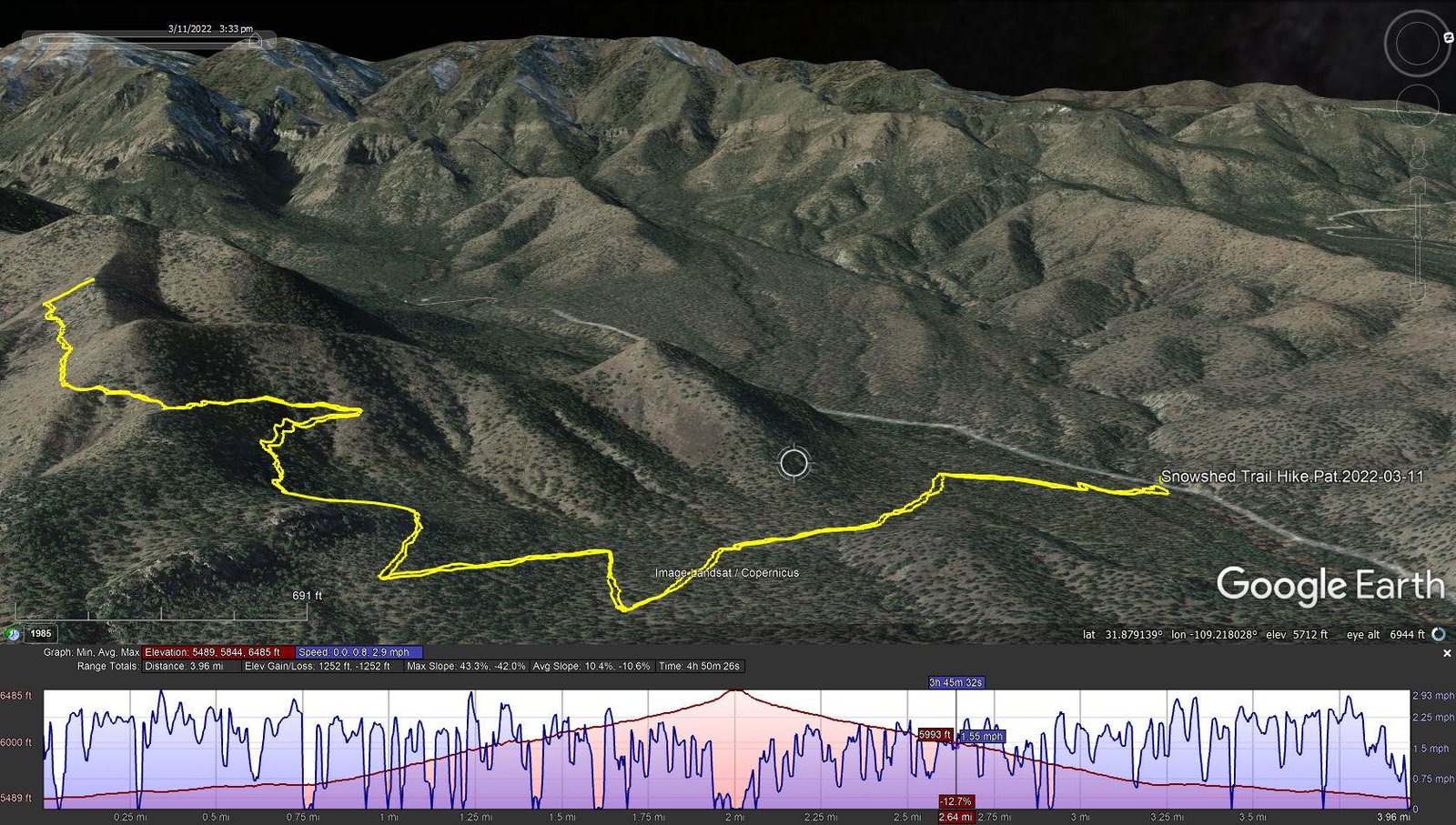
Snowshed Trail Hike.Pat.2022-03-11
Notes about the Google Earth screenshot: the graph at the bottom shows elevation of the track (pink area) and speed (the blue line).
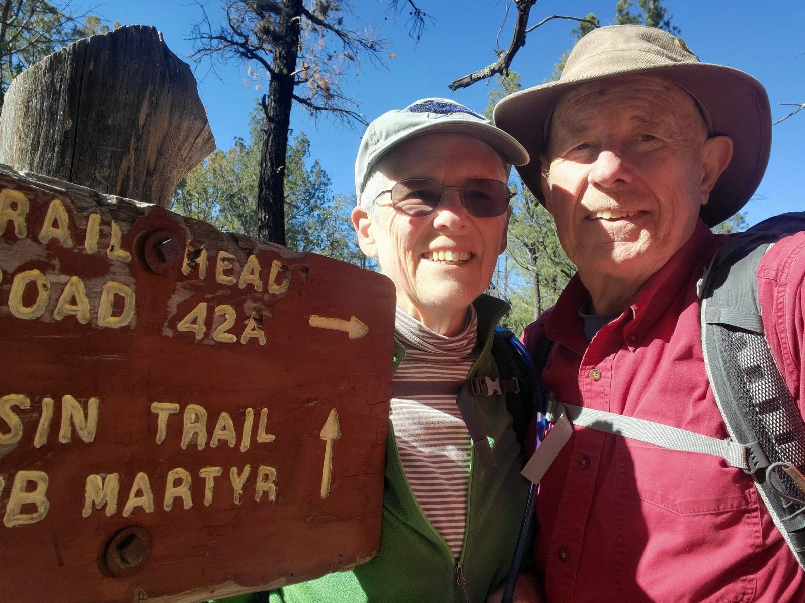
After another good night’s rest in the R-Pod and a nice breakfast, we set off for our first hike of this trip, to the Snowshed Trail. There are many choices in this vicinity, including a loop around to Herb Martyr Campground, or continuing up to Snowshed Peak (8+ miles), with other trails branching off from there (for the backpackers); check it out on GAIA. We chose to go up Snowshed a distance that was comfortable for us.
To get to the trailhead, drive further into Cave Creek Canyon on South Fork Road, turning right at Sunny Flat Campground (don’t continue straight ahead onto South Fork Road). Almost 2 miles up Cave Creek Road you will come to the Southwestern Research Station; turn left, proceed for half a mile and park on the left for the Trailhead.
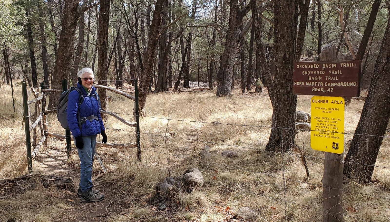
Trailhead to Snowshed Trail #246, just off of Cave Creek Road.
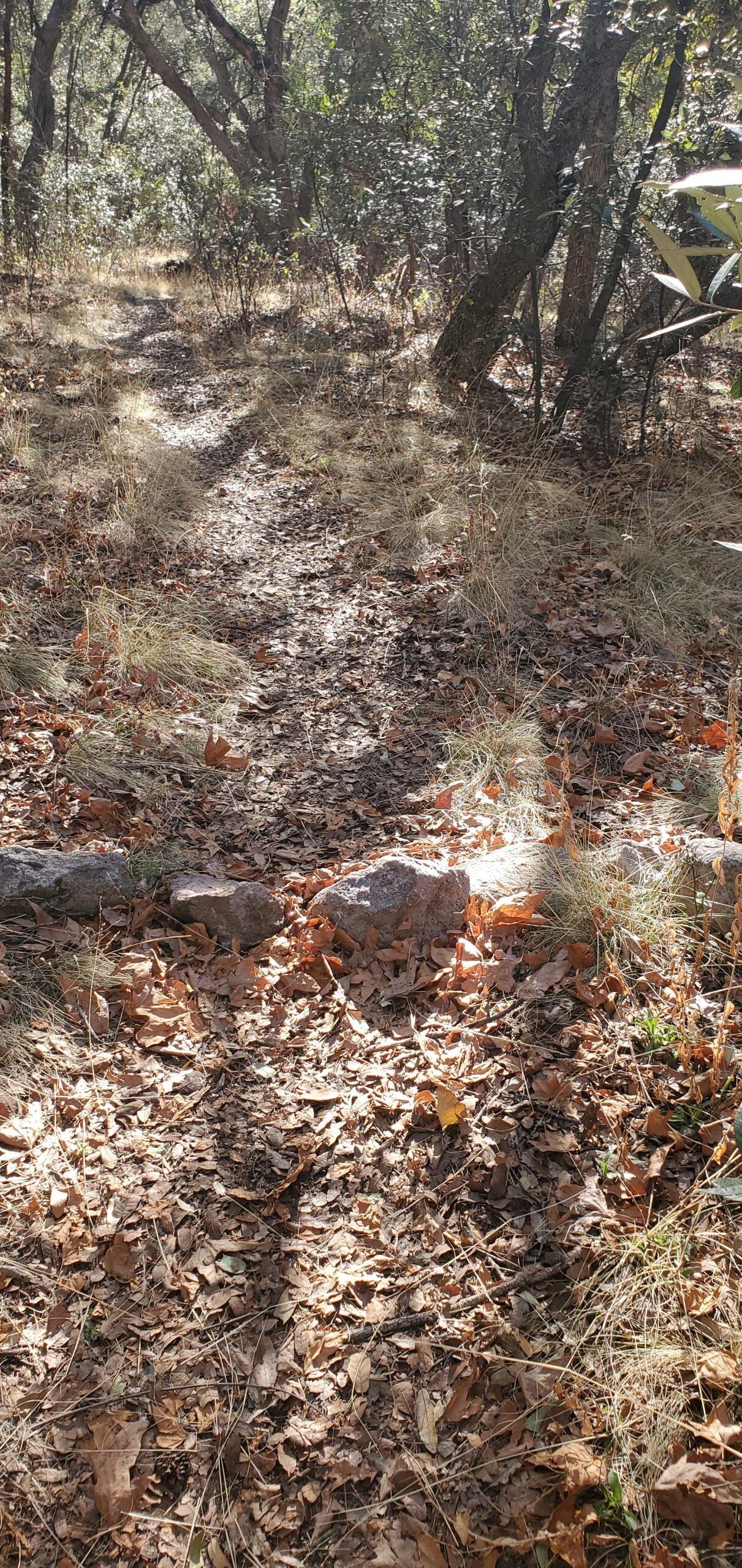
The trail begins with a crossing of Cave Creek. There was some water (from snowmelt high up in the Chiricahuas), but well placed rocks that allowed us to cross with dry feet. Signs confirmed the trailhead as well as directing attention towards other trails leaving from there. Snowshed Trail was well used, easy to hike on, fairly level for the 1st 3/4 mile – an easy grade. The trail then began ascending up onto a ridge, continuing a nice path ‘tho now with more rocks than earlier. The views across the canyon to the walls of the canyons east and south were beautiful.
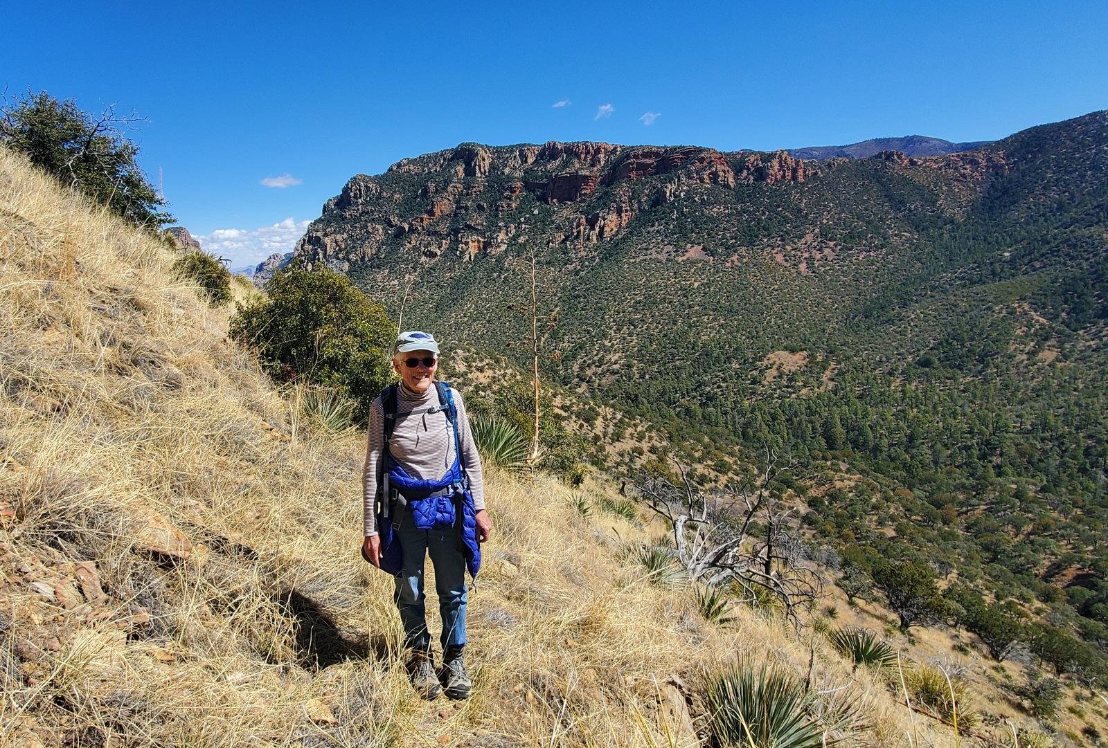
The trail along steep slopes – wide enough but requiring caution.
Reaching the apex of the ridge, the trail continued to ascend but then on the side of a steep slope, up and down. We continued another half mile, then decided it was far enough, and time for lunch. Seeking a vantage point with great views, we scrambled up onto the top of the ridge to find views of the amazing mountain cliffs all around, including a view down-canyon between canyon walls and out into the San Simon Valley.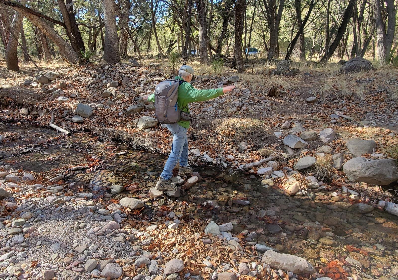
From there it was back to the trailhead, including a crossing of Cave Creek.
Highlights
Cave Creek Canyon is simply a beautiful place to visit, to camp, and to hike. Stewart Campground is small and sites are located among trees with reasonable privacy. Sunny Flat is larger and in the open with few trees. Cellphone/Internet service is nil. We drove back to Portal where we would have a beer and use WiFi at the Portal Store Cafe & Lodge – quite satisfactory.
Epilogue
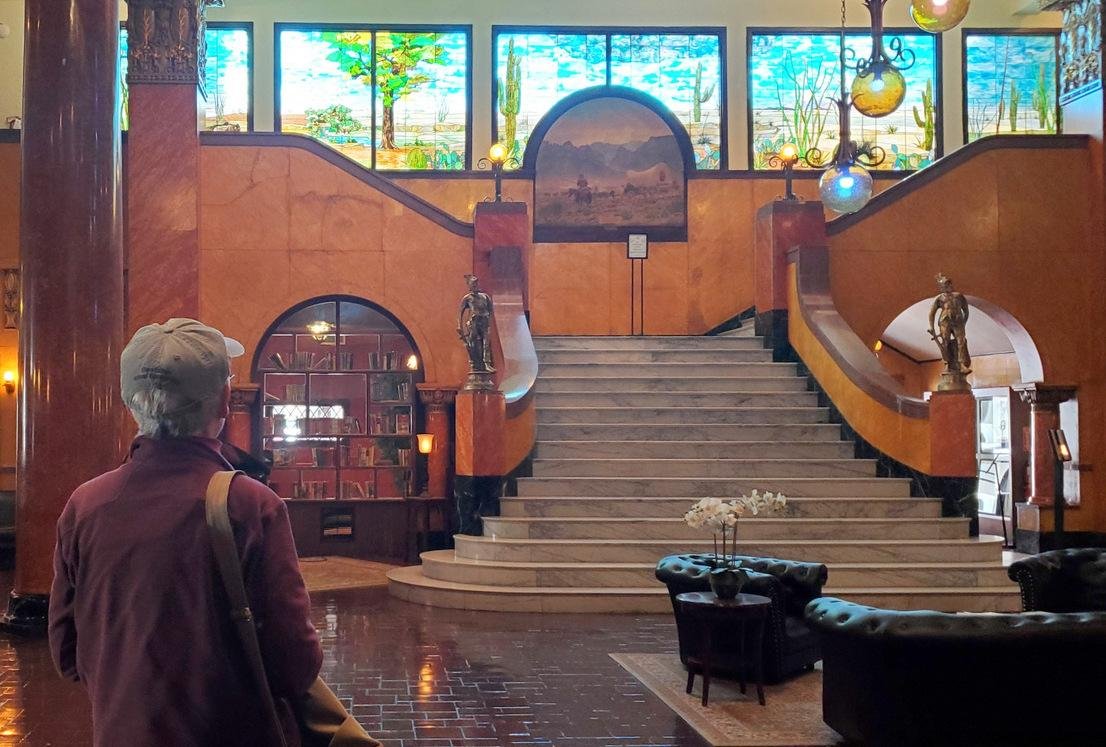 The next day we did some sightseeing – we drove down to Douglas, AZ. ‘Tis an hour drive across -empty- desert terrain. Douglas is a pleasant small town on the border with Mexico, across from Agua Prieta, Sonora. We explored the downtown district and visited the historic Gadsden Hotel. Built in 1907, it has been restored to the grandeur of that era.
We decided to explore further and cross into Mexico. Going through customs was easy in both directions; we needed to have only TSA approved identification to return to the U.S.  (our New Mexico drivers license with the star in the upper left corner was sufficient). We wandered around Agua Prieta, purchased drinks at a small coffee shop (paid in dollars, received change in pesos), and came across an interesting patio and restaurant; might return for a meal some day.
Statistics
Cave Creek Overlook Trail (one way):
Total Distance: .5 miles
Elevation: start 5,029 ft, maximum 5,121 ft, minimum 5,029 ft
Gross gain: 92 ft. Aggregate ascending 57 ft, descending 189 ft
Maximum slope: 18% ascending, 36% descending, 8% average
Duration: 0:16
Snowshed Trail:
Total Distance: 3.96 miles
Elevation: start 5,489 ft, maximum 6,485 ft, minimum 5,489 ft
Gross gain: 996 ft. Aggregate ascending 1,252 ft, descending 1,252 ft
Maximum slope: 43% ascending, 42% descending, 10.4% average
Duration: 4:50
| GPS Track Files for Download | |
142 Downloads | |
|---|---|
159 Downloads | |
252 Downloads | |
182 Downloads | |
If you haven’t explored these hiking tracks with Google Earth, I urge you to try it. With the virtual 3-dimensional presentation, achieved by panning and tilting the view, you can get a much better idea of the hikes and terrain than you can get from the screenshot above. For some ideas, check out Using Google Earth Track Files.
Related Posts
Over the Ridge to Paradise Hike – 03/22/2021
Basin Trail #247 Hike – 03/23/2021
Cave Creek Nature Trail Walk – 03/21/2021
Echo Canyon Loop Hike – 11/20/2018
References and Resources
USDA Forest Service:
Snowshed Trail #246
Map of Snowshed Trail #246 (.pdf download, great resource)
Chiracahua Mountains Hiking Trails:
Snowshed Trail #246
Showshed Basin Trail
AllTrails: Snowshed Trail #246
Douglas & Agua Prieta:
The Historic Gadsden Hotel
Bizio Cafe
Portal, AZ
Portal Peak Lodge, Store, and Cafe
Wander Wisdom: Visiting .. Portal, AZ ..


