This is the 3rd post for a 5-day camping and hiking trip to the Chiricahua Mountains with our friends Jay and Nancy. Having taken a short walk on the Cave Creek Nature Trail the day we arrived at the Stewart Campground (post #1), then the Over the Ridge to Paradise Hike the next day (post #2). There are a number of trails from which to choose, but on this 3rd day in Cave Creek Canyon we chose another point-to-point hike, a portion of Basin Trail #247.

 The Drive In
As for the Over the Ridge hike, we first left a car at the end-of-hike trailhead, then drove to the start-of-hike trailhead.
- For the end-of-hike trailhead: From Stewart Campground, drive west on FR 42 until just past the Southwestern Research Station, where turn left onto FR 42A towards the Herb Martyr Campground. This is a primitive campground (tents only, although there was a small pop-up camper set up down a short rough road); there is ample parking for the trails that emanate from here.
 For the start-of-hike trailhead: From Herb Martyr, on FR 42A return to FR 42, turn left at the Research Station and continue for 2.7 miles, 1.5 miles beyond the trailhead for the Over the Ridge hike. There is a parking are a bit off of FR 42 to the left, and a sign for the “Basin Trail No 247”.

The Hike
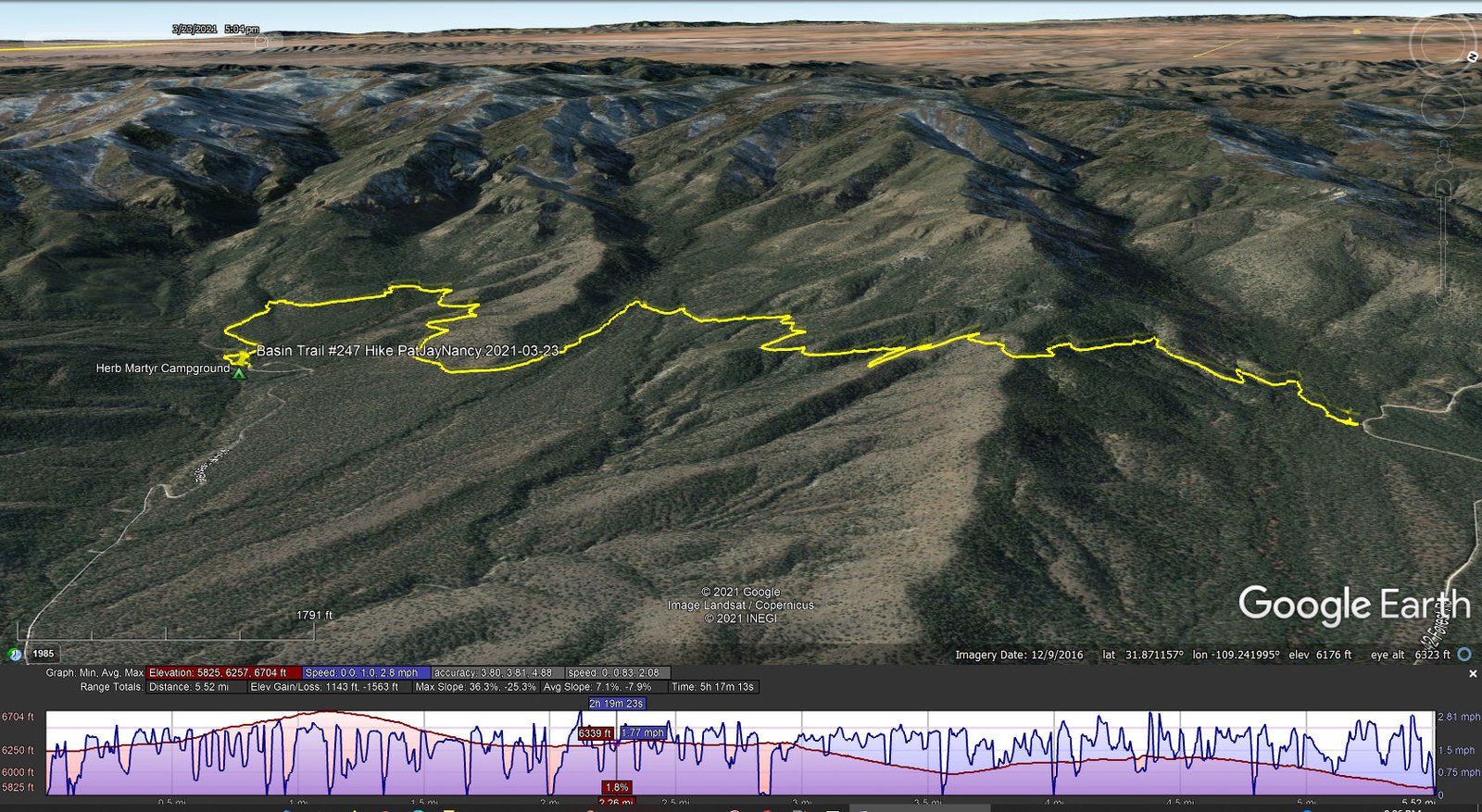
Basin Trail #247 Hike.PatJayNancy.2021-03-23
We chose a north-to-south hike so that we would have the ascending portion of the trail to start and the longer downhill portion to finish. Most of the trail easy easy to follow, well used. It proceeds through open piñon and juniper forest, with a a few switchbacks during the 500′ climb to the highest point on the trail (1.1 miles). Once crossing over the ridge, the trail becomes a bit more rocky (still well used, easy to follow) and one leaves the forest for more open, desert-like landscape.
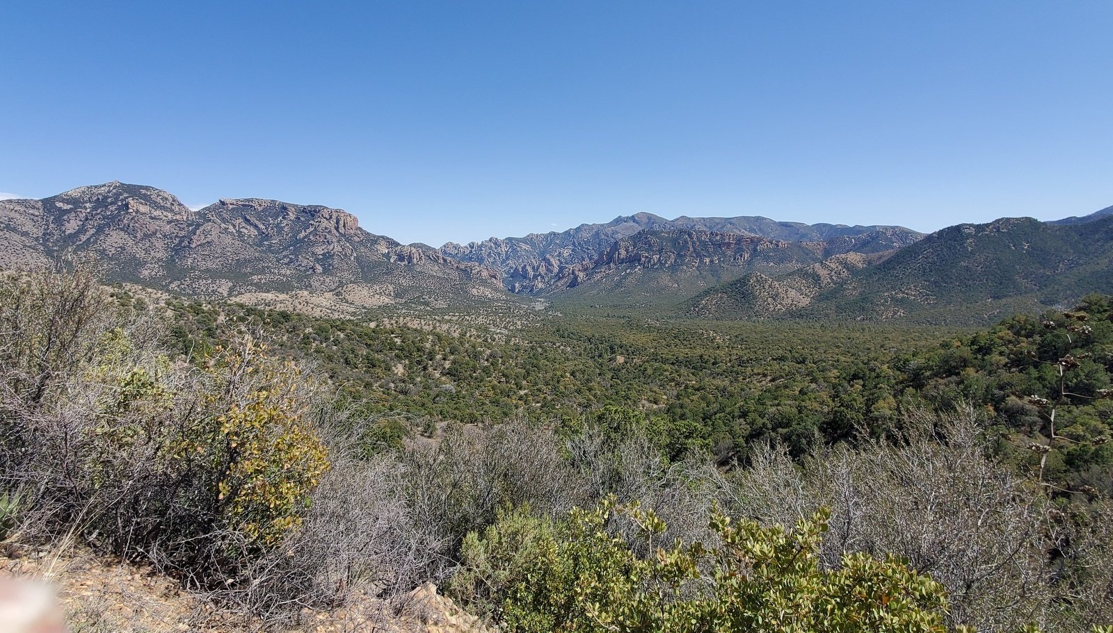 The next .7 miles is an easy descent with some switchbacks, then the trail follows the contour of the terrain for 1.2 miles. From these portions of the trail, the views of this of the southeastern Chiricahuas are really great. Then the trail makes an easy descent for the next .8 miles with a wide variety of desert plants: lots of yucca, cholla, varieties of cacti, agave, manzanita, and other scrub bushes.
The maps and GPS tracks I was following tracked well the trail as we found it. However, nearing what we thought was the end, a combination of inconsistent GPS tracks and trailside signs created some confusion. At one point, where the trail intersected a two-track, there was a sign pointing down the two-track. My interpretation of the map – that would lead us to FR 42A a half mile or so from where our vehicle was parked, then nearly a half mile walk up the road. It appeared to me we could avoid the road by continuing across the two-track onto a continuation of -a- trail (which one?). After some indecisiveness, we chose the trail. The choice made for a somewhat longer hike, but it was easy ambulating and led us to the parking area. This was a great hike.
Note: After-the-fact reviews of GPS tracks that I had collected, it became apparent that we had stumbled onto another trail published widely, the the Ash Spring Loop.
Highlight
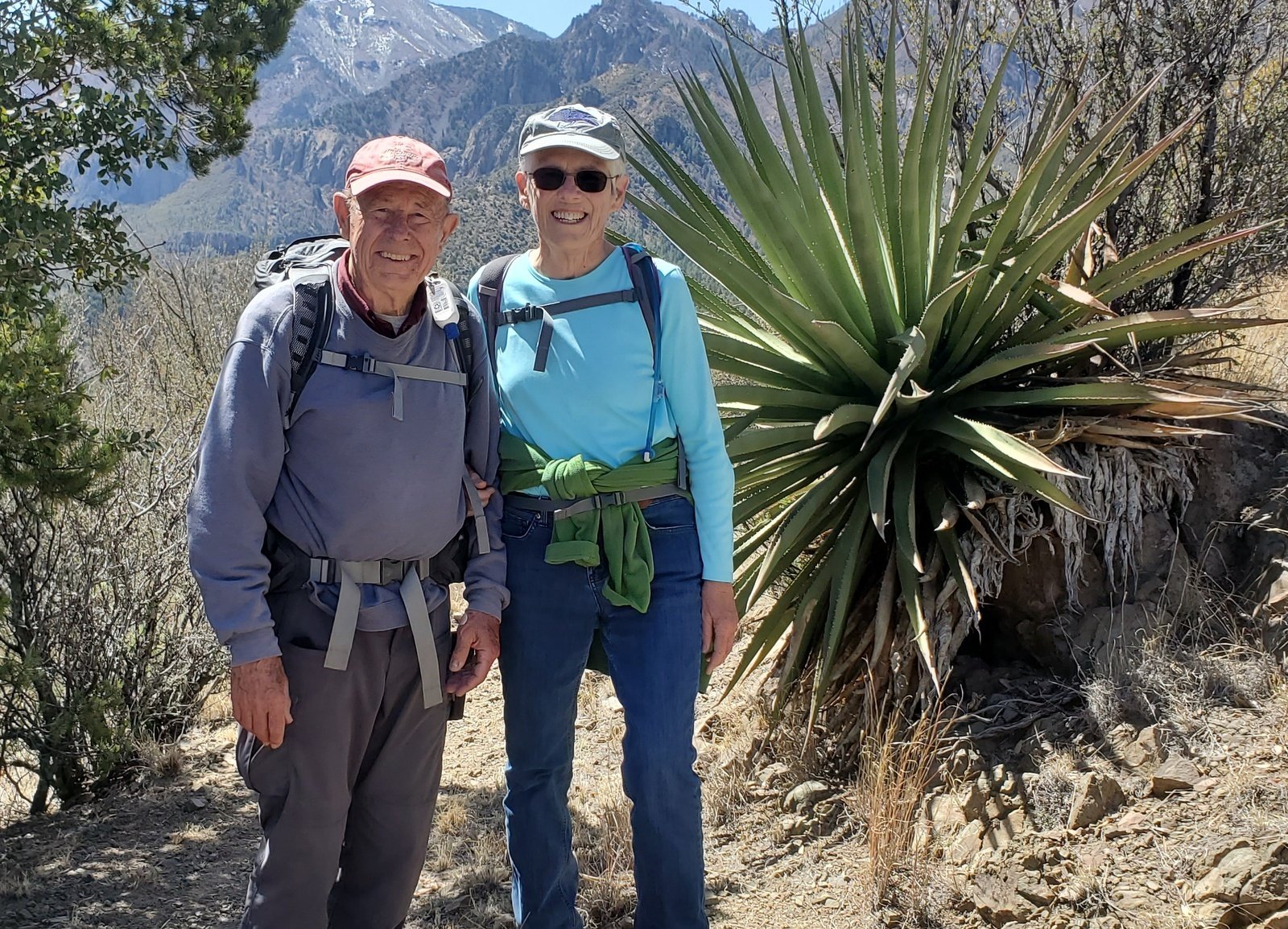
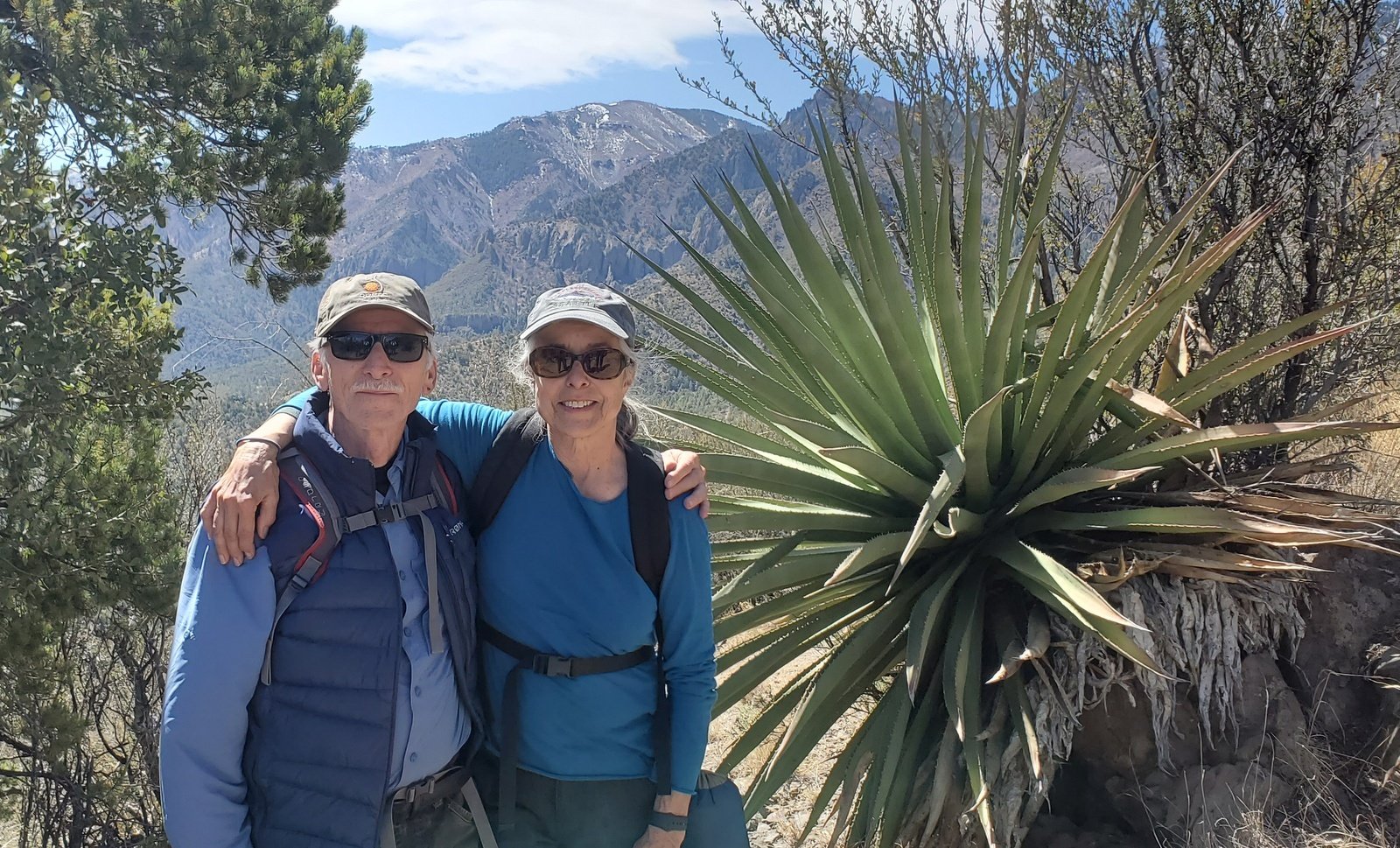
A highlight of this trail was the varied plants and especially the agave that we passed all along the descending portion of the trial. I was taken back to our visits in Oaxaca where agave abound (and are -the- ingredient in Oaxaca’s special spirit – mezcal).
The Drive Out
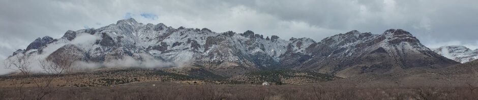
We enjoyed a 3rd night camping, ‘tho like the night before, it was a bit chilly and … during the night wet weather set in with drizzling rain, sometimes mixed with soft popcorn snow. Jay & Nancy needed to get home, so they headed out into iffy weather and road conditions. Not wishing to face possibly poor road conditions, Pat & I chose to remain in Stewart for another day. The weather in the area remained drizzly, and at higher elevations – snowy. That did make for some beautiful scenes, looking at snow-capped mountains, — here in extreme southeastern Arizona —.
For our lay-day, we drove back towards Rodeo and visited the Chiricahua Desert Museum – what an amazing museum to find in this remote location. It’s focus is on rattlesnakes with a few turtles, many alive. The display cases recreated the natural habitat of the snakes with a quality that I would compare to the Smithsonian’s. In addition, they have a collection of artifacts from the tribes local to the Chiricahua and Peloncillo Mountains. And the gift shop is excellent. — And next door is the Geronimo Event Center where very well done posters gave an excellent review of the history of the the Apaches in this area, especially the famous Apache leader Geronimo. These are must-see as part of a trip into this “remote” part of New Mexico.
A note here about “services” in the area.
- Cell phone service is spotty, even out on the plains beyond Portal towards Rodeo, and in Rodeo as well.
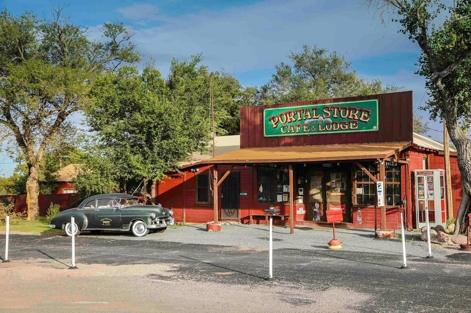
 WiFi service is available at the Portal Peak Lodge Store & Cafe; an ‘open’ WiFi is available, but if you eat there ask for the password for their secure WiFi – that worked quite well (even when we stopped on the way through Portal and parked in front of the Store.
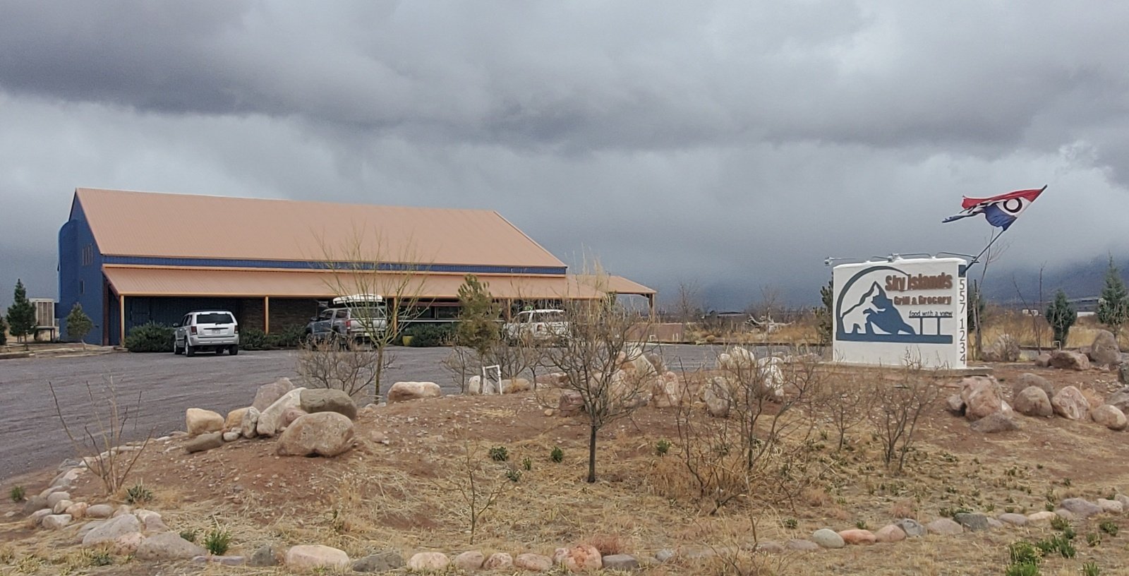
- “Essentials” that one might need (didn’t bring or ran out): The Portal Peak Store has a limited selection. However, a much larger inventory is available back towards Rodeo, at the Sky Island Grill and Grocery.
- Eating Out: sandwiches, pizza, and a limited sele
 ction of beer are available at the Portal Peak Cafe; we had lunch there when Jay & Nancy arrived on the 1st day. A larger menu is offered by the Sky Island Grill.
 After a night in Stewart Campground with rain and snow continuing, the weather cleared in the morning and we set out for home; leaving Cave Creek Canyon we looked back to see the Chiricahuas covered in snow – what a beautiful site. We planned to split the trip over 2 days, to spend a night near Truth or Consequence. After some research, we settled on the South Monticello Campground where we could make reservations. The site overlooks the northern end of Elephant Butte Lake with well designed and well kept campsites. The sites are spaced far apart, good because the surroundings are quite open – no forest here.
The next day, driving up I-25 we were surprised to see snow on all the “mountain islands” – the San Mateos, the Magdalenas, even Ladrone, and the Manzanos.
Statistics
Total Distance: 5.52 miles
Elevation: start 6,246 ft, maximum 6,704 ft, minimum 5,825 ft
Gross gain: 458 ft, Aggregate ascending 1,143 ft, descending 1,563 ft
Maximum slope: 36% ascending, 25% descending, 7.5% average
Duration: 5:17
| GPS Track Files for Download | |
|---|---|
164 Downloads | |
292 Downloads | |
148 Downloads | |
172 Downloads | |
I urge you to explore our hiking tracks with Google Earth. With the virtual 3-dimensional presentation, achieved by panning and tilting the view, you can get a much better idea of the hikes and terrain than you can get from the 2-dimensional screenshot above. For assistance: Using Google Earth Track Files.
Related Posts
Cave Creek Nature Trail Walk – 03/21/2021
Over the Ridge to Paradise Hike – 03/22/2021
References and Resources
USDA Forest Service: Basin Trail #600
Blogging from the Boot Heel: Basin Trail
TrailForks: Basin Trail #600
Chiricahua Desert Museum, and check out their Facebook space
Portal Peak Lodge Store & Cafe
Sky Islands Grill & Grocery


