It has been -hot- in Albuquerque (and in Santa Fe). Even hotter than we anticipated when a few months ago we planned this camping and hiking trip to Cumbres Pass and the Trujillo Meadows campground (10,000 feet elevation and above). This post is for our first hike during this trip: the Red Lake Trail which Pat & I hiked a year ago.
The Drive In
We chose to avoid I-25 and US 84, both busy roadways, and instead chose a route through Cuba (I-25 to Bernalillo, then US 550). Four miles beyond Cuba we turned right on NM 96. Upon reaching the sharp right turn of NM 96, we turned left to continue north on NM 112. The first 27 miles is paved; from there to El Vado dam (19 miles) the road is well maintained gravel; we kicked up quite a plume of dust behind us at 35-45 MPH. Tho’ a sign warned us of the possibility of a delay of up to 2 hours, we took our chances – and won – no delay at the El Vado dam.
The road to cross El Vado dam is interesting. It is one lane down a very steep incline, then very narrow lane across the dam itself. We were OK with the R-Pod but would not attempt to cross here with anything larger. From there, NM 96 is paved to the intersection with US-84; then it was on to Chama. Borrowing the remainder of The Drive In from the post for last year’s trip:
“We drove from Albuquerque to Chama and continued on NM 17 up to the crest of Cumbres Pass (the highway becomes CO 17 as it passes into Colorado). For a good part of the way, Hwy 17 follows the tracks of the Denver and Rio Grande Railroad, aka Cumbres and Toltec Railroad to the crest where there is a small railyard.
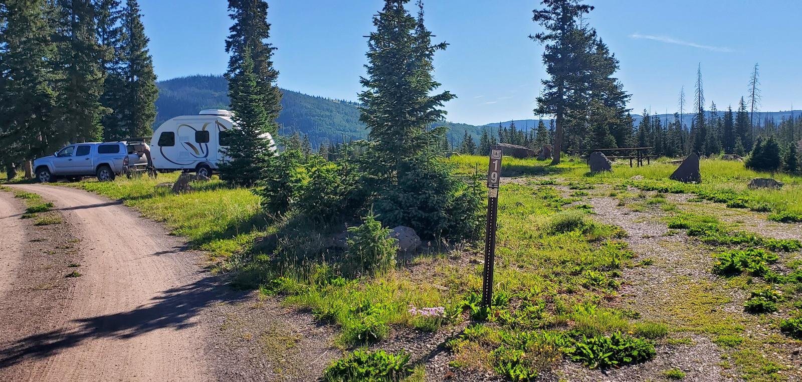
Our campsite in Trujillo Meadows Campground. Atop a hill in the middle of the campground, we had great views in all directions.
Continuing past the crest for 1/4 mile, we turned left onto FR 118 (a good Class 3 road, tho’ there are some sections of serious washboard); in 2.5 miles turn right at the entrance to the campground. (Adjacent to the campground is Trujillo Meadows Reservoir. There are some sites that look down upon the reservoir and there is a road from the campground entrance to a boating ramp; we did not investigate either.) (We met Jay and Nancy in the same campsite that we used last year.)
The Red Lake trail is a bit further north on CO 17 — 6.4 miles from the turnoff to the Trujillo Meadows Campground. Turn left onto FR 113, a Class 3 road towards Red Lake — 3.5 miles. The road makes a sharp 180° turn to the left — parking is on the right up a short rise.”
The Hike
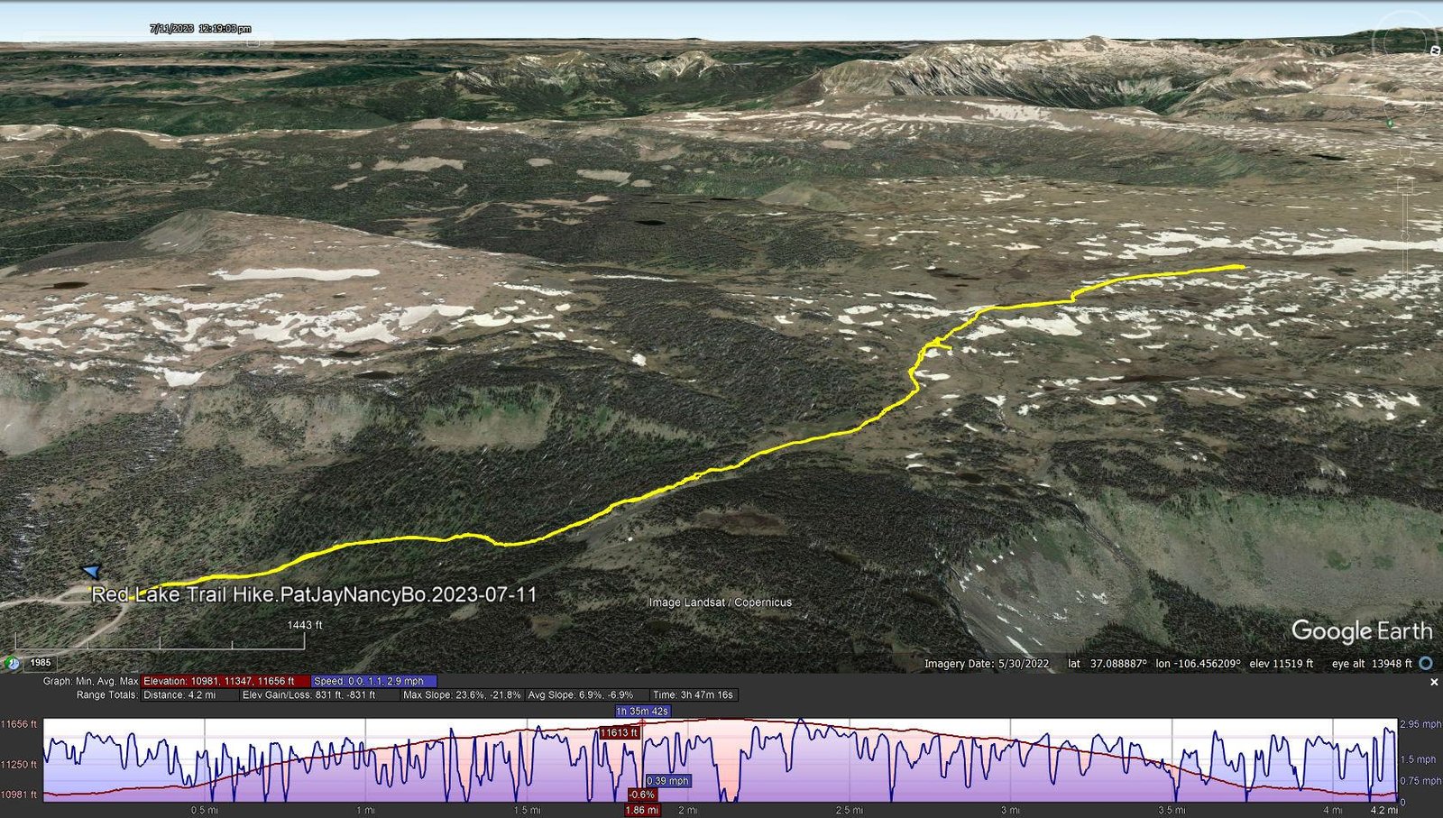
Red Lake Trail Hike.PatJayNancyBo.2023-07-11
Notes about the Google Earth screenshot: the graph at the bottom shows elevation of the track (pink area) and speed (the blue line).
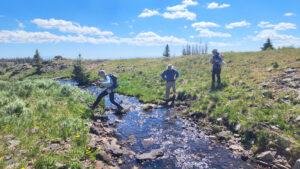
There is little that I can add to the description from last year’s Post. There was however more snow this year as in a large depression we passed and against embankments where it must have been deep. We also had more stream crossings (some small, some large). And there were more wildflowers in bloom this year courtesy the late arrival of spring.
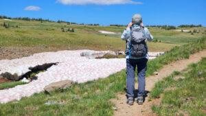
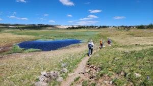
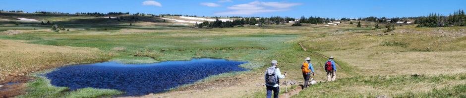
This is a beautiful trail with amazing vistas across a verdant meadow to the mountains all a around. It is an easy trail with a few challenges crossing runoff and streams. Although we cut short the hike again this year and didn’t go as far as Red Lake itself, it remains on our list of hikes to complete in the future.
Jay here: Snow! Snow? It seemed like such a warm day, you had to ask yourself why there was still snow on the ground. But then you remember you’re at 11,000 + feet. It was a great hike that somehow brought us just a little closer to some magnificent clouds.
Statistics
Total Distance: 4.2 miles
Elevation: start 11,004 ft, maximum 11,656 ft, minimum 10,981 ft
Gross gain: 675 ft, Aggregate ascending 831 ft, descending 831 ft
Maximum slope: 24% ascending, 22% descending, 6.9% average
Duration: 3:47, Average Speed: 1.1 mph
| GPS Track Files for Download | |
144 Downloads | |
|---|---|
139 Downloads | |
If you haven’t explored these hiking tracks with Google Earth, I urge you to try it. With the virtual 3-dimensional presentation, achieved by panning and tilting the view, you can get a much better idea of the hikes and terrain than you can get from the screenshot above. For some ideas, check out Using Google Earth Track Files.
Related Posts
References and Resources
USDA Forest Service: Red Lake Trailhead, Trail 733
AllTrails: Red Lake Trail
GAIA GPS: Red Lake
Alamosa.org: 5 Trails You Need To Be On
Oh Ranger.com: Rio Grande National Forest, Red Lake Trail


If you have viewed many of my other posts, you no doubt have noticed that I’ve included many photos and galleries of flowers. And you’ve seen repetition – the same flowers show up on posts for many hikes. That observation having occurred to me, I questioned why I would include flowers .. again. Well .. because they always attract my attention – there are so many colors, shapes, and settings. They exist often in environments that would be drab without them, sometimes in locations that appear to be quite inhospitable. So, again, I include in this post a “bouquet” of flowers:


