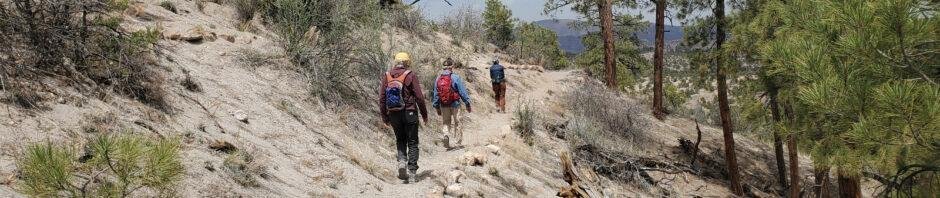
A hike on the Deer Trap Mesa Trail, one of the many trails in and around Los Alamos, with Jay and Nancy on the third day of a camping trip to Bandelier.
The Drive In
The trailhead is on the perimeter of Los Alamos, on one of the narrow mesas/ridges between the many canyons across which the city is spread. Here are directions from Trail Network Map – Los Alamos County (pdf):
From NM 501/East Jemez Road, turn right onto Diamond Drive. Go north then east on Diamond for 2.6 miles to the roundabout at San Ildefonso. Turn left and in 0.3 mile continue straight onto Barranca Road. Follow this road 1.3 miles to its end just past the intersection with Navajo. Parking along the road, with signs for the Trail.
The Hike
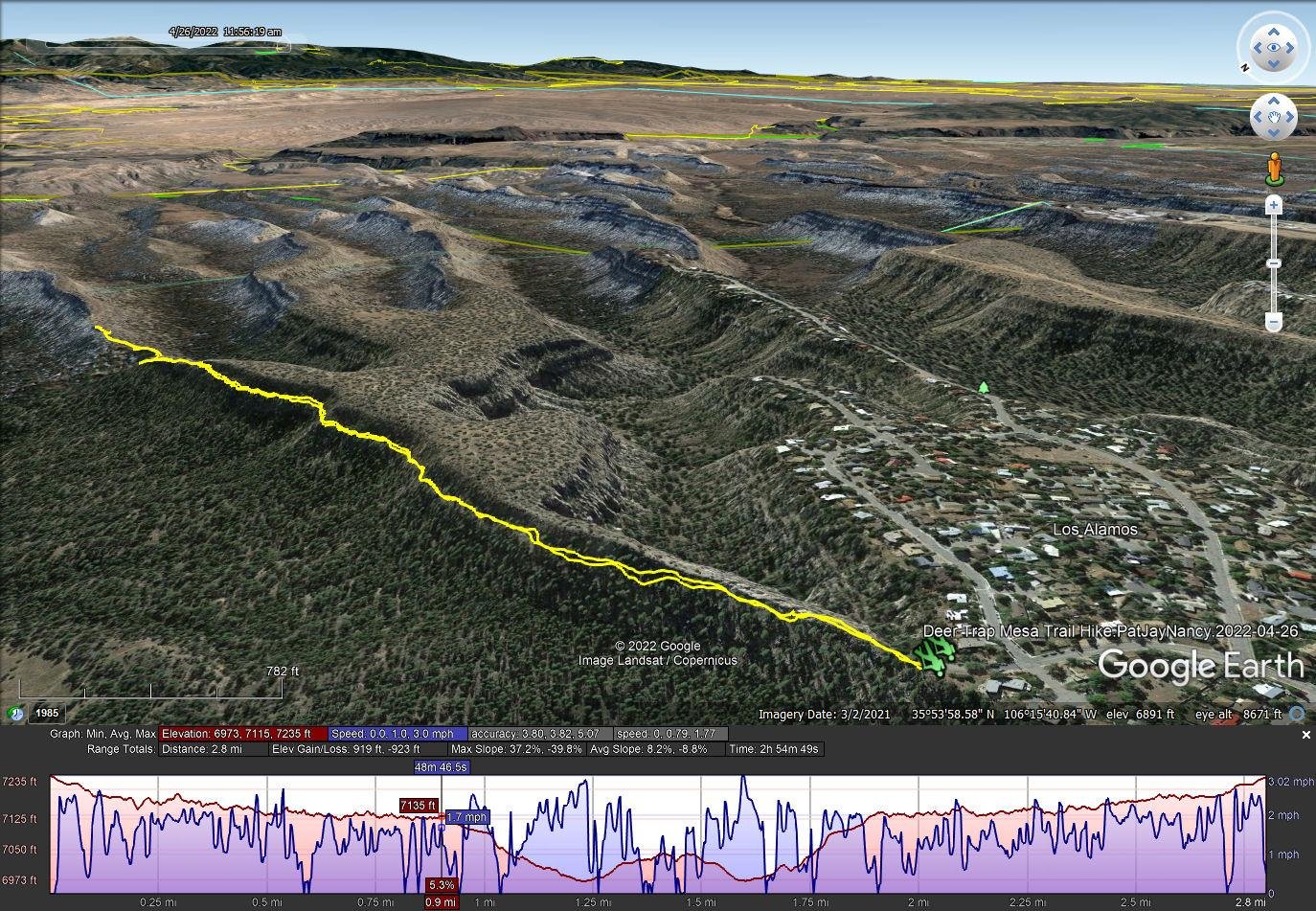
Deer Trap Mesa Trail Hike.PatJayNancy.2022-04-26
Notes about the Google Earth screenshot: the graph at the bottom shows elevation of the track (pink area) and speed (the blue line).
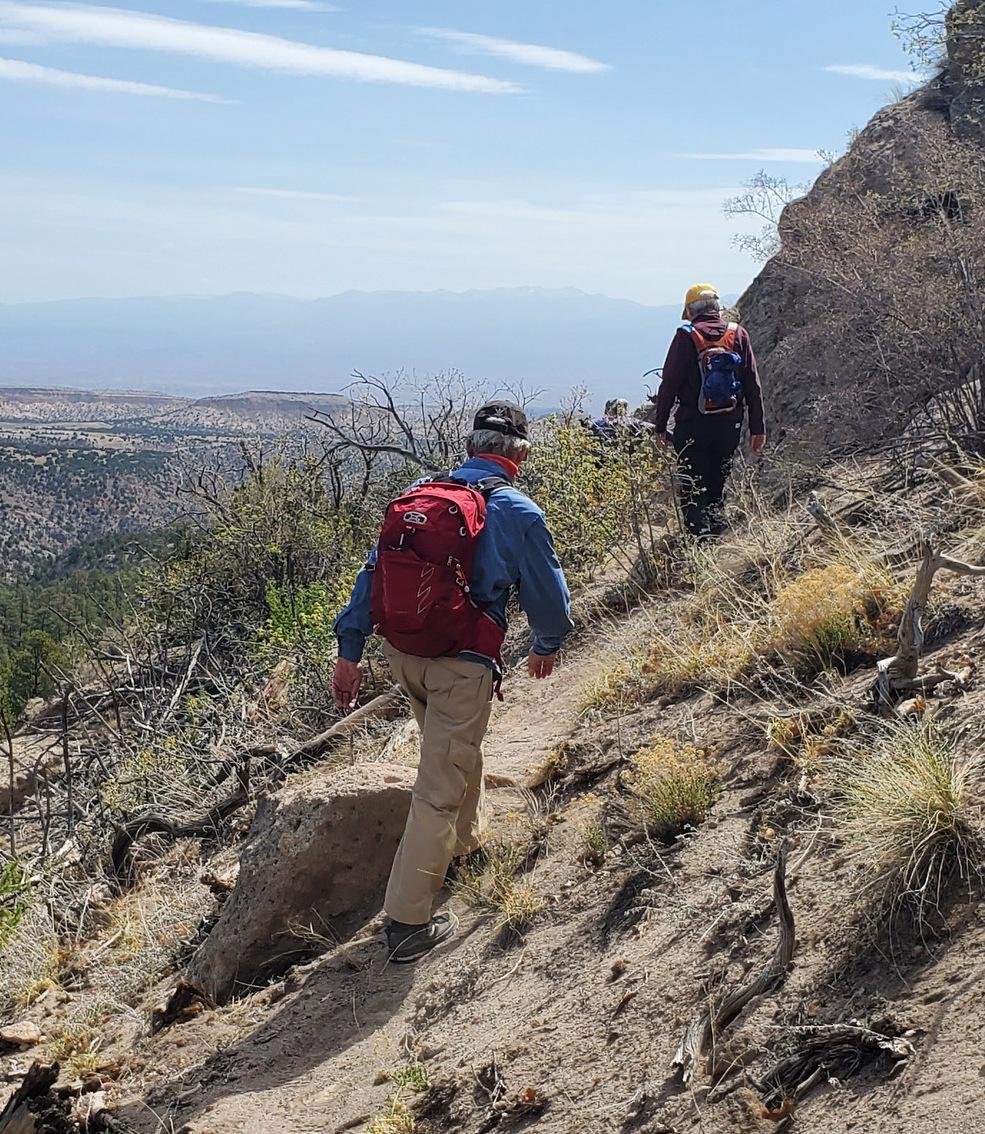 The trail, as we took it, begins on the somewhat narrow spine of Deer Trap Mesa. A couple of hundred yards on, it leaves the spine and traverses the slope near the top of the mesa. It is a well used trail – generally sandy surface but with rock small and large outcroppings to work around. And to the left – a steep slope to the bottom of Rendija Canyon. We continued along this edge of the mesa for about a mile into the hike, where we again climbed atop it. From there, another half mile to a point that required some rock climbing to continue further. We turned back, finding a place for lunch on top, then retraced our steps.
That was -our- hike. Upon returning home and looking again at the published maps of the Deer Trap Mesa Trail, I realized that we missed a turn that would have taken us on top of the mesa. From there, relatively level ground and a loop around the mesa top – that will make a great plan for a return trip.
Statistics
Total Distance: 2.8 miles
Elevation: start 7,235 ft, maximum 7,236 ft, minimum 6,973 ft
Gross gain: 263 ft. Aggregate ascending 919 ft, descending 923 ft
Maximum slope: 37% ascending, 40% descending, 8.5% average
Duration: 2:55
| GPS Track Files for Download | |
183 Downloads | |
|---|---|
175 Downloads | |
If you haven’t explored these hiking tracks with Google Earth, I urge you to try it. With the virtual 3-dimensional presentation, achieved by panning and tilting the view, you can get a much better idea of the hikes and terrain than you can get from the screenshot above. For some ideas, check out Using Google Earth Track Files.
References and Resources
Los Alamos:
Deer Trap Mesa Trails
Trail Network Map – Los Alamos County (pdf)
AllTrails: Deer Trap Mesa Trail
Pajarito Environmental Education Center (PEEC): Deer Trap Mesa Trail


