During a visit to family in North Carolina, Steve & Sharon brought us to some very nice trails in the vicinity of their home in Wake Forest. These were truly family walkabouts, with people from Raleigh, Tucson, Baraboo, Seattle, and St. John VI (or the Azores).
The Hikes (or Walkabouts)
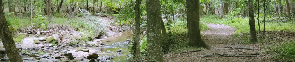
Durant Camp Trails
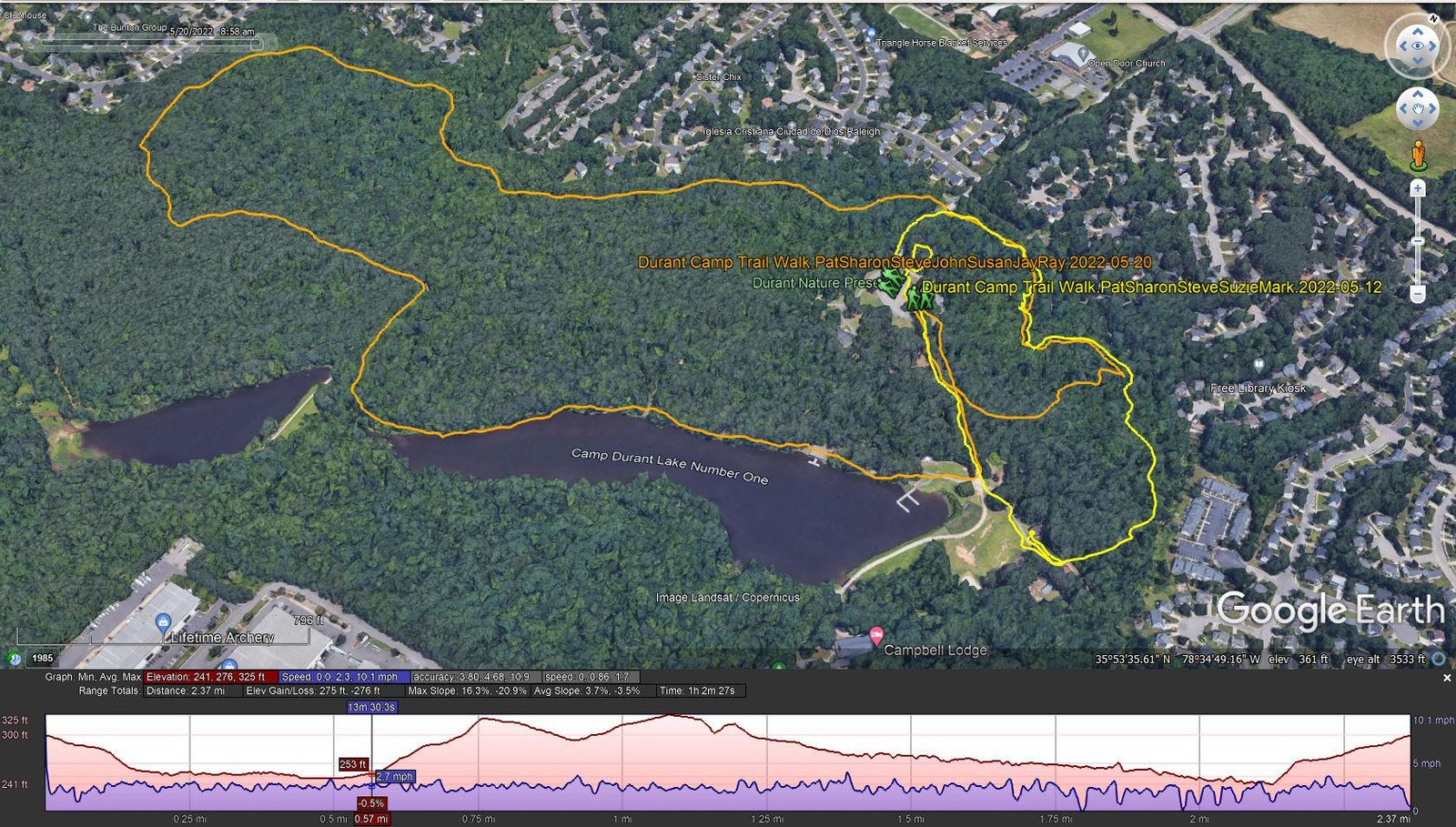
Durant Camp Trail Walks.McDaniels.2022-05-12&20 (profile for 2022-05-20)
Notes about the Google Earth screenshot: the graph at the bottom shows elevation of the track (pink area) and speed (the blue line).
The first walkabout introduced us to North Carolina weather conditions – warm and humid. But it was quite pleasant to walk through the lush woods with a stream and lake nearby. But … so much green; from New Mexico, it is almost overpowering.
The second walkabout took us the length of the Durant Nature Preserve, including a long stretch along the shore of the lake.
Shoreline Trail
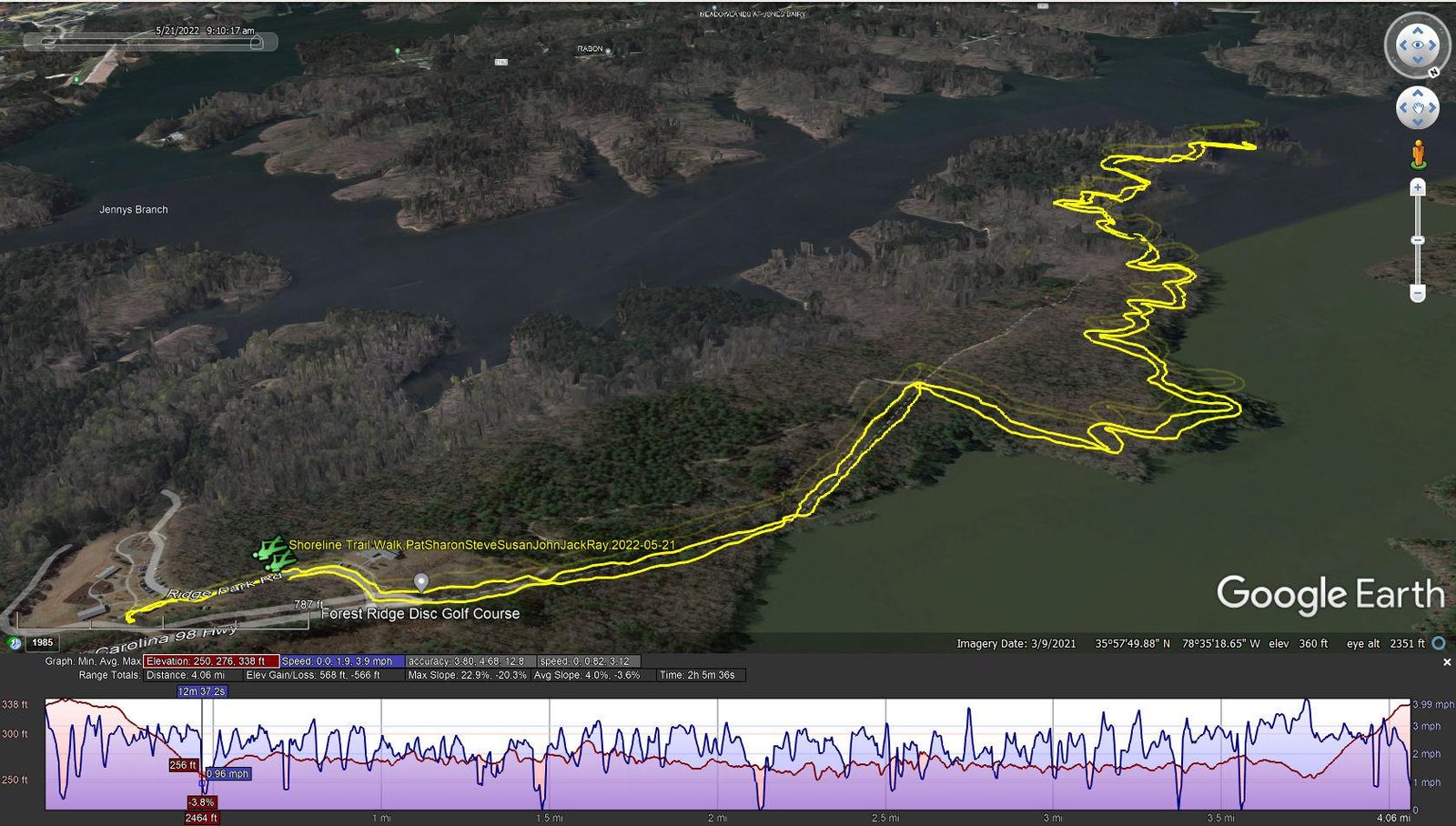
Shoreline Trail Walk.PatSharonSteveSusanJohnJackRay.2022-05-21
For this outing, we went to the Falls Lake and a trail along the water’s edge for the distance, out to a promontory in the middle of the lake. Another nice hike
Wake Forest Reservoir Loop
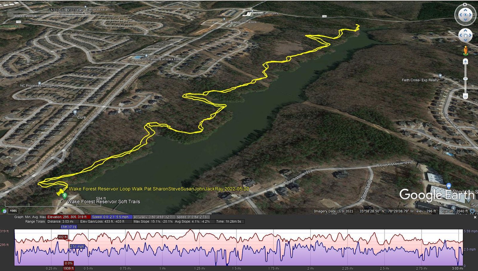
Wake Forest Reservoir Loop Walk.Pat SharonSteveSusanJohnJackRay.2022-05-22
Another lake-side trail along the shore of the Wake Forest Reservoir.
Statistics
Durant Camp Trail Walk – 05/12/2020
Total Distance: 0.99 miles
Elevation: start 300 ft, maximum 304 ft, minimum 233 ft
Gross gain: 71 ft. Aggregate ascending 164 ft, descending 165 ft
Maximum slope: 22% ascending, 32% descending, 5.5% average
Duration: 0:43
| GPS Track Files for Download | |
395 Downloads | |
|---|---|
189 Downloads |
Durant Camp Trail Walk – 05/20/2020
Total Distance: 2.37 miles
Elevation: start 300 ft, maximum 325 ft, minimum 241 ft
Gross gain: 41 ft. Aggregate ascending 275 ft, descending 276 ft
Maximum slope: 16% ascending, 21% descending, 3.6% average
Duration: 1:03
| GPS Track Files for Download | |
158 Downloads | |
|---|---|
189 Downloads |


Shoreline Trail Walk – 05/21/2022
Total Distance: 4.06 miles
Elevation: start 330 ft, maximum 338 ft, minimum 250 ft
Gross gain: 88 ft. Aggregate ascending 568 ft, descending 566 ft
Maximum slope: 23% ascending, 20% descending, 4.0% average
Duration: 2:05
| GPS Track Files for Download | |
164 Downloads | |
|---|---|
193 Downloads |


Wake Forest Reservoir Loop – 05/22/2022
Total Distance: 3.03 miles
Elevation: start 303 ft, maximum 319 ft, minimum 295 ft
Gross gain: 24 ft. Aggregate ascending 433 ft, descending 433 ft
Maximum slope: 15% ascending, 20% descending, 4.0% average
Duration: 1:26
| GPS Track Files for Download | |
164 Downloads | |
|---|---|
398 Downloads |


