Our 2nd hike on a 3-night camping trip to southern New Mexico (where it would be warmer than our usual camping in northern New Mexico). We set up camp in the Leasburg State Park, having made reservations for a larger dry campsite with sufficient room for our Tacoma & R-Pod and Jay and Nancy’s Subaru. The site was quite clean and comfortable with a large table under a shelter and a firepit. And not far from roads to prospective hiking trails.
The Drive In
From Leasburg State Park, we returned to I-25, then 17 miles into Las Cruces where we took the exit to get onto East University Avenue eastbound. About 1.5 miles on, the name changes to Dripping Springs Road; continued for 9 miles to the parking lot for the Dripping Springs Natural Area.
The Hike
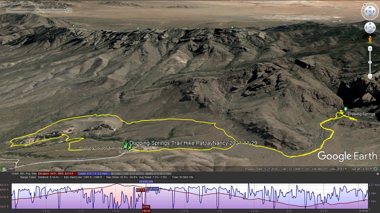
Dripping Springs Trail Hike.PatJayNancy.2021-11-29
Notes about the Google Earth screenshot: the graph at the bottom shows elevation of the track (pink area) and speed (the blue line).
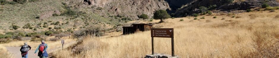
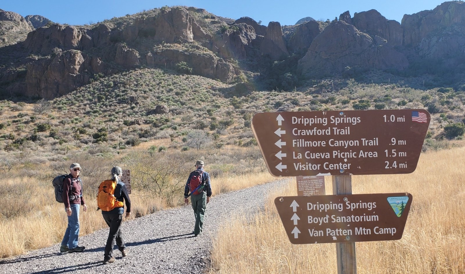 The route from parking to the trailhead is well marked; at the entrance there is a registration stand where one can pay the access fee. (We chose not to pay here, but did pay on our departure after getting a reminder note on our windshield.) The trail was wide with fresh gravel making the hiking easy.
The 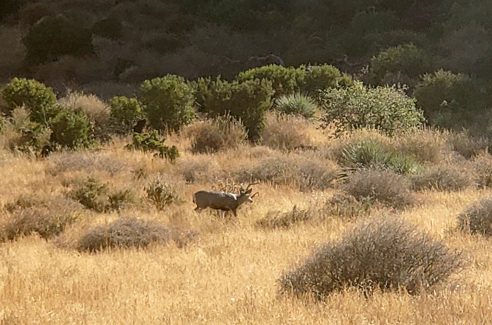 grasses in the valley are quite healthy, presenting a bright yellow landscape all along. A quarter mile into the hike, we spied deer – 2 does and 2 bucks. The latter stayed around long enough for a portrait.
The trail rounds the edge of an extension of the Organ Mountains and enters Ice Canyon, which became narrower as we approached Dripping Springs. The first “improvement” we encountered were buildings that were stage coach stops for people coming from Las Cruces to the Sanatorium (or later, the Mountain Camp). Then we came upon a buttress that forms a dam below a waterfall; there was only a trickle of water this time of year. A bit further on we came upon the buildings that constituted the Boyd Sanatorium and the Van Patten Mountain Camp (great histories by New Mexico Nomad and Hidden New Mexico).
Heading back towards the truck, we decided to make the hike longer by turning right at a trail intersection and take the loop around a large outcropping. The trail continued easy to walk on, descending gently. Rounding the west end of the outcropping, we chose to continue east along the south side; continuing west would have taken us to the La Cueva Picnic Area and a parking lot (not where our truck was parked).
Proceeding east on the trail, we came across what I now know is La Cueva, a cave where the El Hermitaño spent the last days of his life. There are many recounts of his story – see the References below. From there it was an easy hike back to the truck. (And then into Las Cruces for beer at the Little Toad Creek Brewery.)
Jay here: A return trip for Nancy and myself but we got to see more of the ruins when we stopped for snacks at Boyd’s Mountain Camp. Still hard to believe that people came up the mountain via horse drawn wagons.
Statistics
Total Distance: 5.14 miles
Elevation: start 5,661 ft, maximum 6,210 ft, minimum 5,431 ft
Gross gain: 779 ft. Aggregate ascending 1,085 ft, descending 1,088 ft
Maximum slope: 32% ascending, 31% descending, 7.6% average
Duration: 3:56
| GPS Track Files for Download | |
176 Downloads | |
|---|---|
203 Downloads | |
If you haven’t explored these hiking tracks with Google Earth, I urge you to try it. With the virtual 3-dimensional presentation, achieved by panning and tilting the view, you can get a much better idea of the hikes and terrain than you can get from the screenshot above. For some ideas, check out Using Google Earth Track Files.
Related Posts
References and Resources
BLM: Dripping Springs Natural Area
Glimpse to the Dripping Springs History
La Cueva Rock Shelter
AllTrails: Dripping Springs Trail
Visit Las Cruces: Hiking in Las Cruces – Dripping Springs Trail
New Mexico Nomad: Dripping Springs Trail (a superb description)
DesertUSA: The Lure of Dripping Springs (providing a great history)
Tripadvisor: Dripping Springs Natural Area
American Trails: Dripping Spring Trail System, New Mexico
New Mexico Nomad:
Tripping Springs Trail (great history)
The Hermit
Hidden New Mexico: Touching the Past at Dripping Springs (more history)
New Mexico Nomad: Organ Mountains-Desert Peaks National Monument
KFOX14: The haunting past of Dripping Springs (w/ Video)
HistoryNet: Hermit of the Organ Mountains


