We’ve been quite curious about the territory north of San Pedro Parks and Valles Caldera. This trip was to explore the area north of the Parks, with an eye on campsites and hiking trails, and on the condition of the roads.
The Drive In
We drove from Bernalillo on US 550 to just beyond Cuba, then turned north on NM 96 towards Regina. A few miles beyond Regina, NM 56 turns east toward Gallina and ultimately Abiqui Dam. About 4 miles beyond Gallina, we turned right onto FR 103 and followed it for 10.4 miles to check out the Rio Puerco Campground. This is a very small campground, a few sites for tents, no sites really set up for a camper of any kind. It is situated nicely along Rio Puerco with water running in the creek the day we were there.
 Note: On the way from NM 93, we made a point of identifying where the Continental Divide Trail (CDT) crosses FR 103. Mayhap, this will be a trailhead for a future hike, or even a backpacking trip.
We backtracked on FR 103 1.5 miles and turned left on FR 93 towards the Resumidero Campground, 2 miles on. This is a ‘primitive’ campground with facilities limited to one pit toilet. It is identified on the Forest Service web site as a “Camping Area”, an area with trees on the periphery and where one can set up any kind of campsite. (As you can see by the dearth of References below, there isn’t much being reported about this camping area.)
The Hike
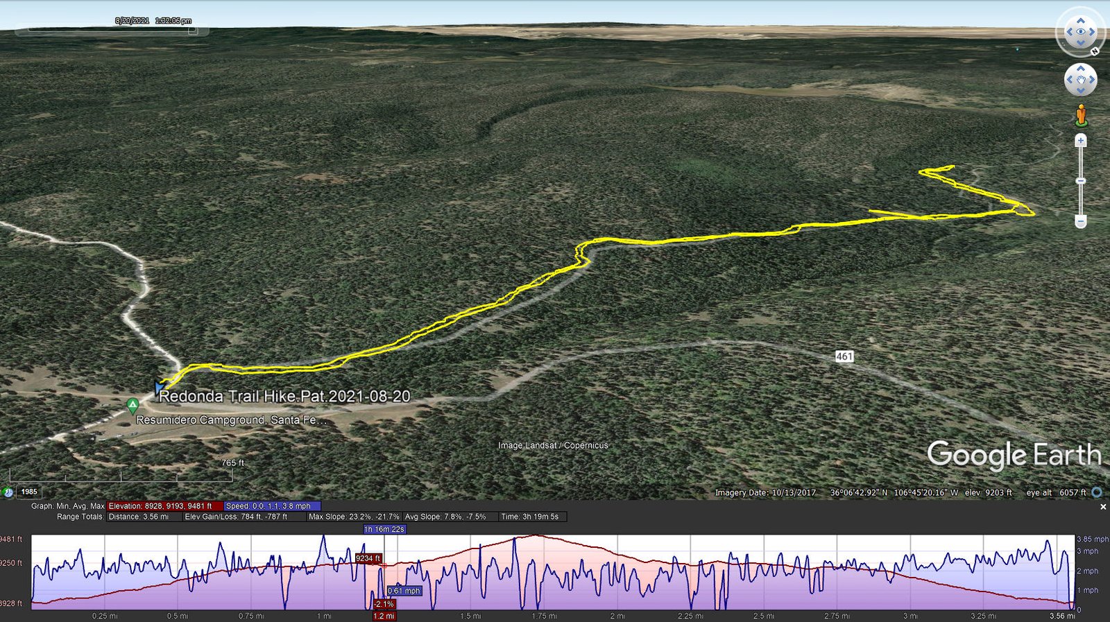
Redonda Trail Hike.Pat.2021-08-20
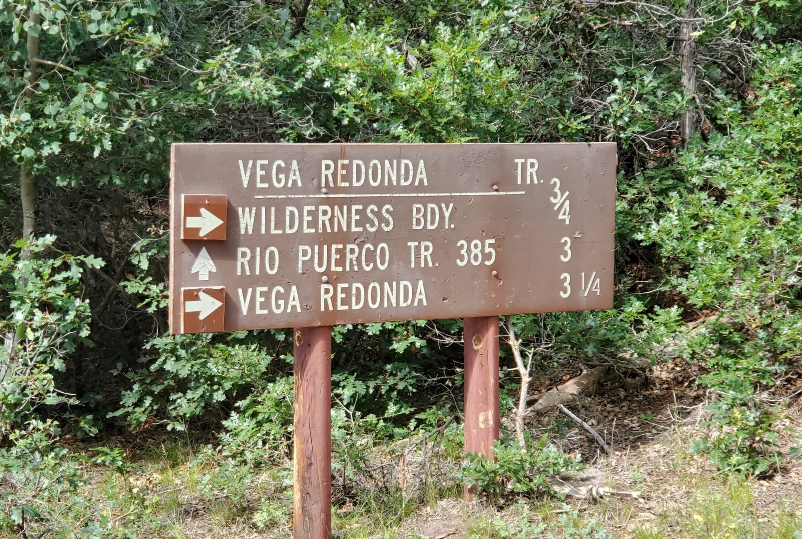
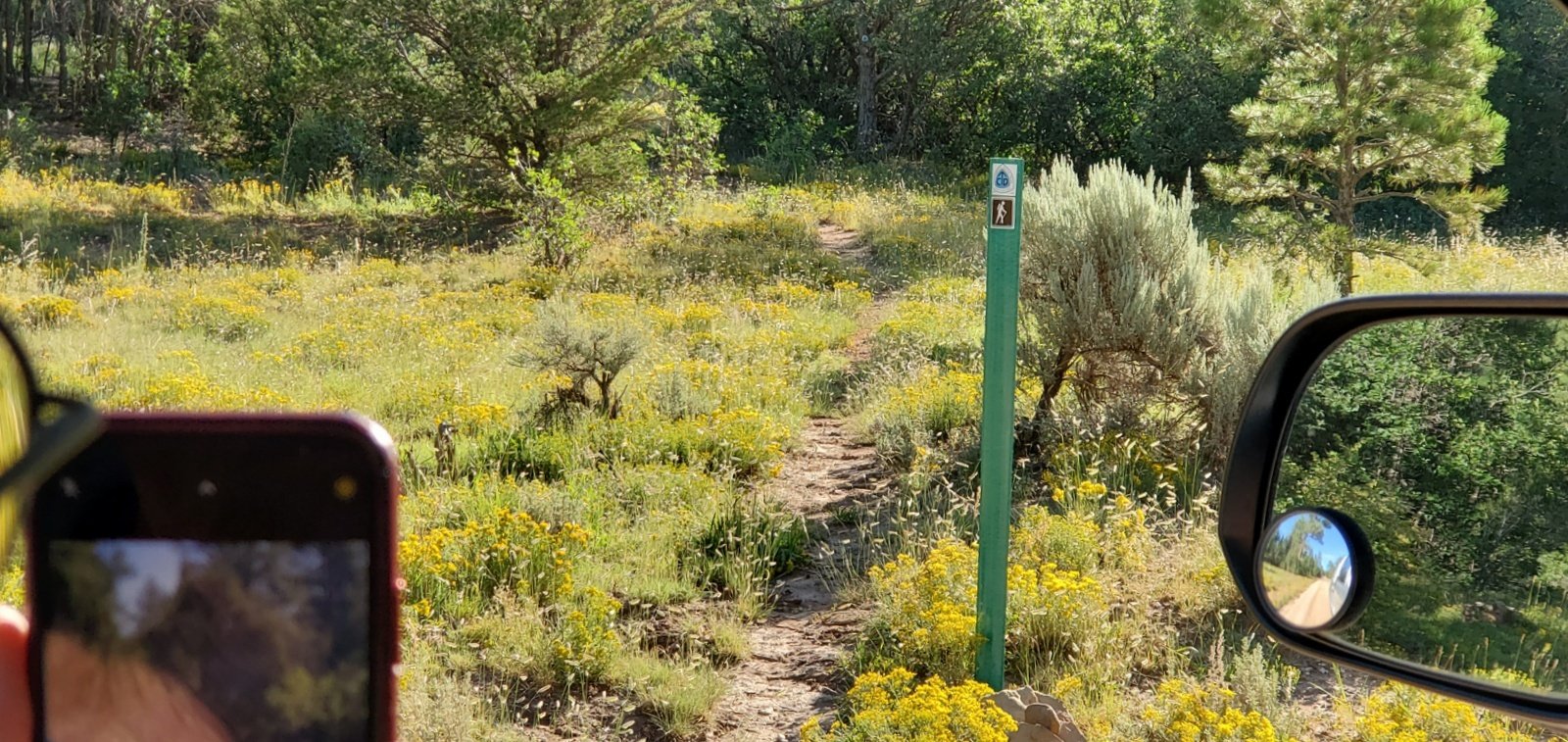
 After driving through the Camping Area, we returned to FR 93 and parked along the road at the eastern edge of the Area. From there walking a bit further along the road, we turned right onto a rough two track where a sign pointed towards the San Pedro Parks Wilderness Boundary and … the Vega Redonda Trailhead. (The tw0-track is identified on the USGS Topo map as FR 53G.) We followed this two-track for .85 miles where it ended and we entered
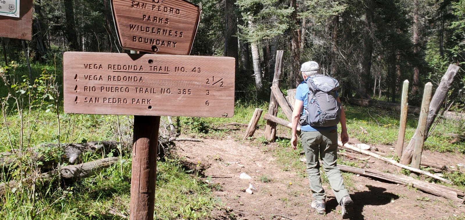
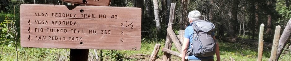
 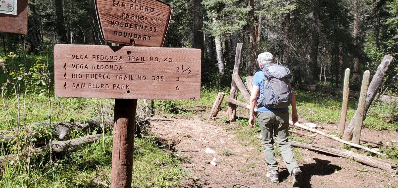 into the Wilderness. Not far to the right was the Rito Resimudero, with a pleasant flow of water (the same Rito the we saw at the Rio Puerco Campground). At the boundary, another sign pointed us onward on the “Vega Redonda Trail No. 43”.
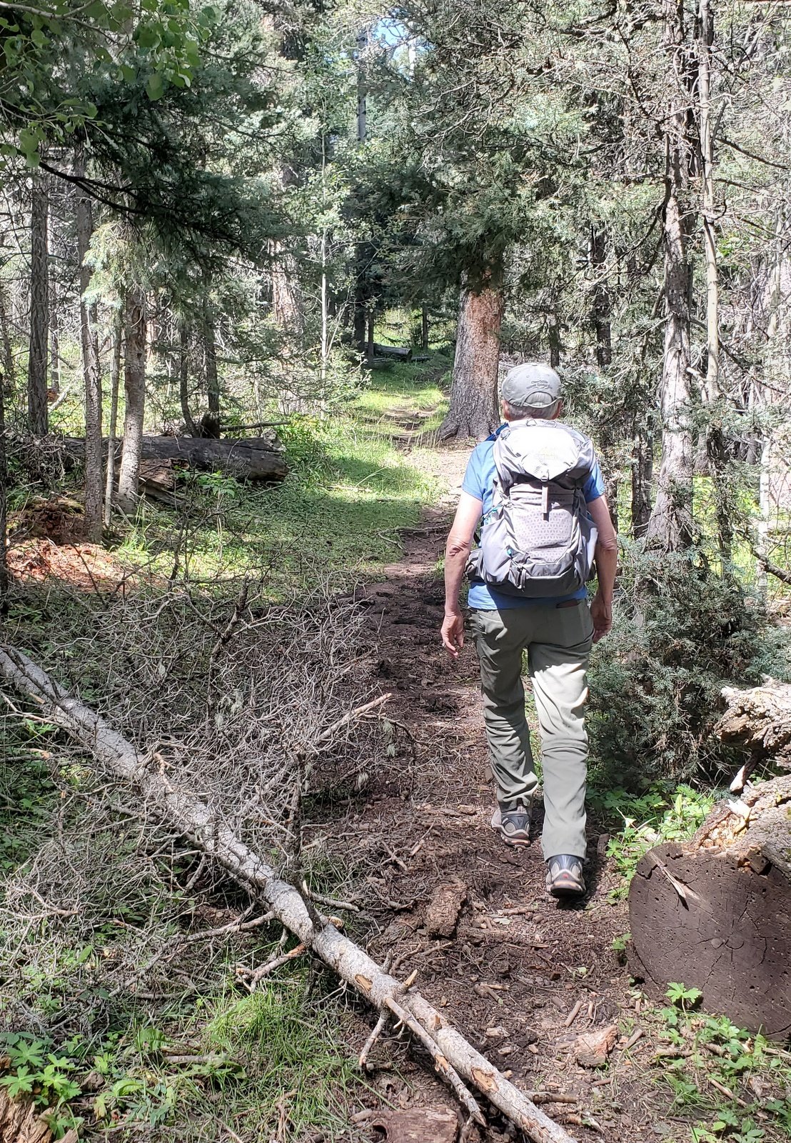
 Within the Wilderness the trail was clean and easy to follow. We continued for .9 miles, encountering some elevation gain in the last half mile. Looking at the topo map, the tril continues to climb up to 10,000 feet, the elevation of much of San Pedro Parks. Since this trip was intended as a reconnoitering visit to the area, and it is quite a long drive from home, we paused here for lunch, then repaired back to the truck.
The area is quite appealing, remote with good hiking opportunities nearby. From this and other visits that we’ve made to San Pedro Parks, it receives ample rain (and/or winter snow?) so the forest is green and healthy. And I’m given to understand that there is a lot of backpacking in the Parks, so the trails are in great condition (which certainly applies to this trail).
Statistics
Total Distance: 3.56 miles
Elevation: start 8,940 ft, maximum 9,481 ft, minimum 8,928 ft
Gross gain: 553 ft. Aggregate ascending 784 ft, descending 787 ft
Maximum slope: 23% ascending, 22% descending, 7.6% average
Duration: 3:19
| GPS Track Files for Download | |
182 Downloads | |
|---|---|
160 Downloads | |
167 Downloads | |
225 Downloads | |
If you haven’t explored these hiking tracks with Google Earth, I urge you to try it. With the virtual 3-dimensional presentation, achieved by panning and tilting the view, you can get a much better idea of the hikes and terrain than you can get from the screenshot above. For some ideas, check out Using Google Earth Track Files.
References and Resources
The trailheads below are within the boundary of San Pedro Parks, not far from the Resumidero Camping Area.
USDA Forest Service: Resumidero Camping Area
Rio Puerco Campground
Vega Redonda Trail
Corralitos Trail #452
GAIA GPS: Best Hiking Trails near Resumidero Camping Area
Vega Redonda Loop
Vega Redonda Loop via Corralitos 452
AllTrails: San Pedro Peaks
Redonda Trail
PeakBagger.com: Ascent of San Pedro Peaks on 2020-07-11