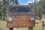
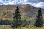
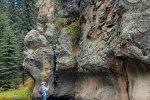
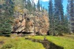
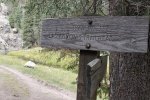
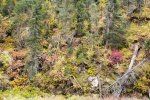
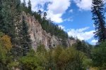
This was our third hike on a 5-day camping trip to the Jemez Mountains with our R-Pod at Jemez Falls Campground. ‘Tis a quite nice campground central in the Jemez Mountains and close to the Valles Caldera. There are many great hiking trails nearby, both “formal” (established by USFS or someone) and informal (hikes that we’ve taken through interesting canyons and atop mesas).
The Drive In
From the campground, drive east on NM 4 for 4.5 miles, the 1st bridge over the Jemez River where you will find a 10-car parking lot on the left (north). The trail begins at this parking lot.
The Hike

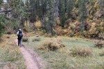
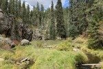
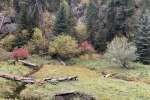
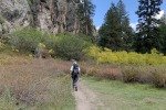
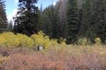
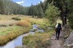
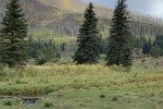
This was a return to the Las Conchas Trail for Pat and me (see Previous Posts below). It is such a lovely trail following the East Fork of the Jemez River. The flowing stream is bounded on each side by steep slopes and cliffs, and the valley bottom is lush with grasses, flowering plants, and ponderosa pine and other healthy trees.
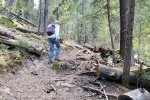
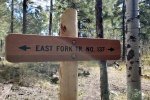
We started down the river, enjoying the ambience of this beautiful place. In the back of our mind, we thought we would be able to reach the “other side” of The Box, where we had hiked in the past. About half a mile in, we noticed a trail that ascended the ridge on the left (south) of the river. Thinking that might allow to get beyond The Box, we climbed up on the ridge and found ourselves on a trail for 1.5 miles; we discovered this was East Fork Trail No. 137. It was at this point, also, that we saw on the topo a trail that descended into the river cañon. Ah ha, down to The Box.
We enjoyed an easy descent into the bottom of the cañon, and saw what we took to be the upstream side of The Box. (A bit of explanation here: hiking from the west to The Box, it had appeared to us that there was no easy way to get from the downstream side of The Box to the upstream side. So it was logical, we were now on that upstream side. More explanation to follow.) Back in the cañon we found ourselves back on the Las Conchas trail No. 137. Proceeding upstream, we were again enjoying the lush, colorful foliage between the cañon walls along East Fork Jemez River. Nearing the trailhead, we stopped for our mid-hike break/lunch – what a beautiful autumn day in the Jemez Mountains.
Epilog
Ok, here’s the “more later”. Trail No. 137, East Fork Jemez River trail, goes from Battleship Rock (way west on NM 4) to the Las Conchas Trailhead. For most of the distance it remains above the Jemez River; it descends into the river canyon to join the end of the Las Conchas Trail. As for how close were we to the box? It would be close to 1.5 miles further on the East Fork Jemez River trail.
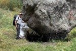
We have wondered – could one go the length, from The Box to the Conchas Trail remaining in the River canyon? One would be required to get around what appears to be a blockage at each end. On our East Fork Jemez Box Hike, it was apparent that we would have to wade in the river to pass through a narrow passage between huge boulders. And at the end of the Las Conchas Trail Hike there was a similar blockage for continuing in the canyon. Maybe someone will comment to address the question or … we might try it one day.
Statistics
Total Distance: 4.1 miles
Elevation: start 8,411 ft, maximum 8,641 ft, 8,328 minimum ft
Gross gain: 313 ft. Aggregate ascending 1,153 ft, descending 1,152 ft
Maximum slope: 27% ascending, 35% descending, 7.9% average
Duration: 4:34
| GPS Track Files for Download | |
156 Downloads |
|
|---|---|
85 Downloads |
|
I urge you to explore our hiking tracks with Google Earth. With the virtual 3-dimensional presentation, achieved by panning and tilting the view, you can get a much better idea of the hikes and terrain than you can get from the 2-dimensional screenshot above. For assistance: Using Google Earth Track Files.
Previous Posts
Las Conchas Trail Hike – 07/26/2019
References and Resources
US Forest Service: Las Conchas Trail
Las Conchas Trailhead
AllTrails: East Fork Trail via Las Conchas Trailhead
Natural Atlas: Las Conchas Trailhead, a very nice interactive map – pan, zoom etc.
SummitPost: Las Conchas, Jemez
Santa Fe New Mexican: Day Hiked: Lingering along Las Conchas Trail
ASCHG: East Fork – Las Conchas Hike
ondafringe: Day Hike: Las Conchas Trail
Las Conchas Trail (YouTube video, 33 minutes)
National Park Service: The Las Conchas Fire
Southwest Fire Consortium: Las Conchas Fire, Jemez Mountains, NM (PDF)
Last Updated on October 18, 2023 by George Young
