This hike isn’t technically in the Valles Caldera National Preserve, but it is so close – we’re associating them. And this Las Conchas Trail on the East Fork of the Jemez River has intrigued us for some time, but we were always on our way to somewhere else when going past it. We’re -very- happy that we stopped – it’s an amazing place.
The Drive In
The Las Conchas Trailhead is just off of NM 4, 10 miles east from La Cueva. There is parking on the left (north) side of the road for 10 or so vehicles. (This parking is a quarter of a mile west of a popular rock climbing wall; folks also climb sections of the wall downstream from the Trailhead).
The Hike
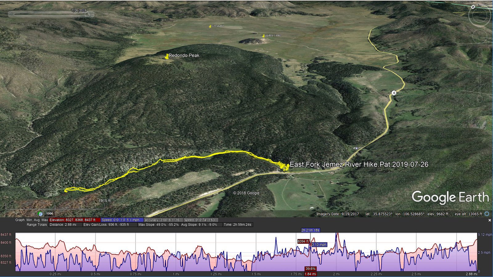
East Fork Jemez River Hike.Pat.2019-07-26
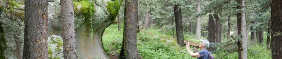
As soon as we left the parking area, we found ourselves in what was almost a tropical forest. The grasses, flowering plants, shrubs, trees, mosses, everything is very lush. Both of us tried valiantly to capture this beautiful, amazing place on “film”, but .. you must be there to fully appreciate what Mother Nature has created here.
The cañon is narrow and deep with steep walls. Through the middle flows the East Fork of the Jemez River, having come out of Valle Grande of the Valles Caldera just a mile or so upstream. This is a popular place, evidenced by the wide and well-worn trail; it crosses the River a few times — on bridges (no wading required). This summer the trail is closed somewhere beyond 1.5 miles (despite what the sign says about 1.25 miles); someday we’ll continue on down the River to the Box (we’ve hiked to the Jemez Box a couple of times from the other direction).
As mentioned above, the cañon is lush with many kinds of flowers. I’ve been collecting photos of flowers on all our hikes these past 5 or 6 years, and here along the Jemez River there are the usual suspects, plus a couple that I had not seen before.
Highlight


Statistics
Total Distance: 2.88 miles
Elevation: start 8,413 ft, maximum 8,437 ft, minimum 8,327 ft
Gross gain: 110 ft. Aggregate ascending 936 ft, descending 935 ft
Maximum slope: 49% ascending, 55% descending, 9.1% average
Duration: 2:59
| GPS Track Files for Download | |
222 Downloads | |
|---|---|
333 Downloads | |
I urge you to explore our hiking tracks with Google Earth. With the virtual 3-dimensional presentation, achieved by panning and tilting the view, you can get a much better idea of the hikes and terrain than you can get from the 2-dimensional screenshot above. For assistance: Using Google Earth Track Files.
References and Resources
US Forest Service:
Las Conchas Trail
Las Conchas Trailhead
AllTrails: East Fork Trail via Las Conchas Trailhead
SummitPost: Las Conchas, Jemez
Santa Fe New Mexican: Day Hike: Lingering along Las Conchas Trail
ASCHG: East Fork – Las Conchas Hike


