The 3rd day of a camping trip in the Jemez Mountains with the R-Pod at the Jemez Falls Campground. After two days of longer hikes, we planned this to be an easy one. We chose to explore the canyon of the East Fork Jemez River for which we had no references about it’s traversability.
The Drive In
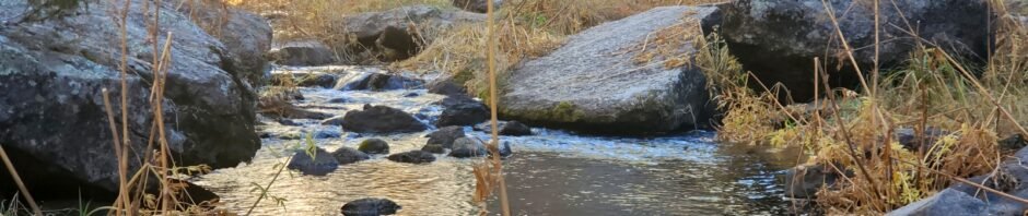
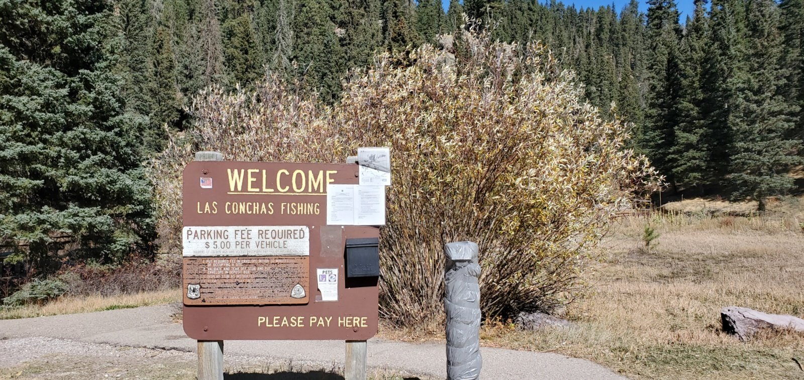 We parked at the Las Conchas picnicking and fishing area, where the River crosses under the highway to the south of NM 4. (This is a quarter mile east of the Las Conchas Trailhead, and is a favorite place for rock climbers to practice climbing on the rock face just east of the parking area.)
The Hike
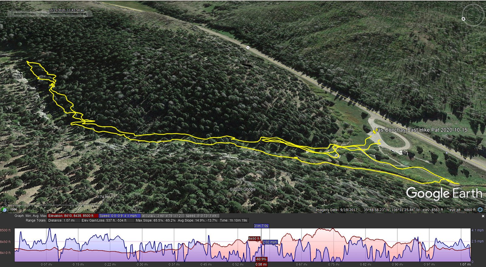
Las Conchas-East Hike.Pat.2020-10-15
We first headed directly the stream from the parking lot. A couple of hundred yards along we faced the end of any path in that direction on this south side of the stream, but we noticed signs of a trail on the other side. Backtracking west beyond the picnic area we discovered a way to get across and onto the trail.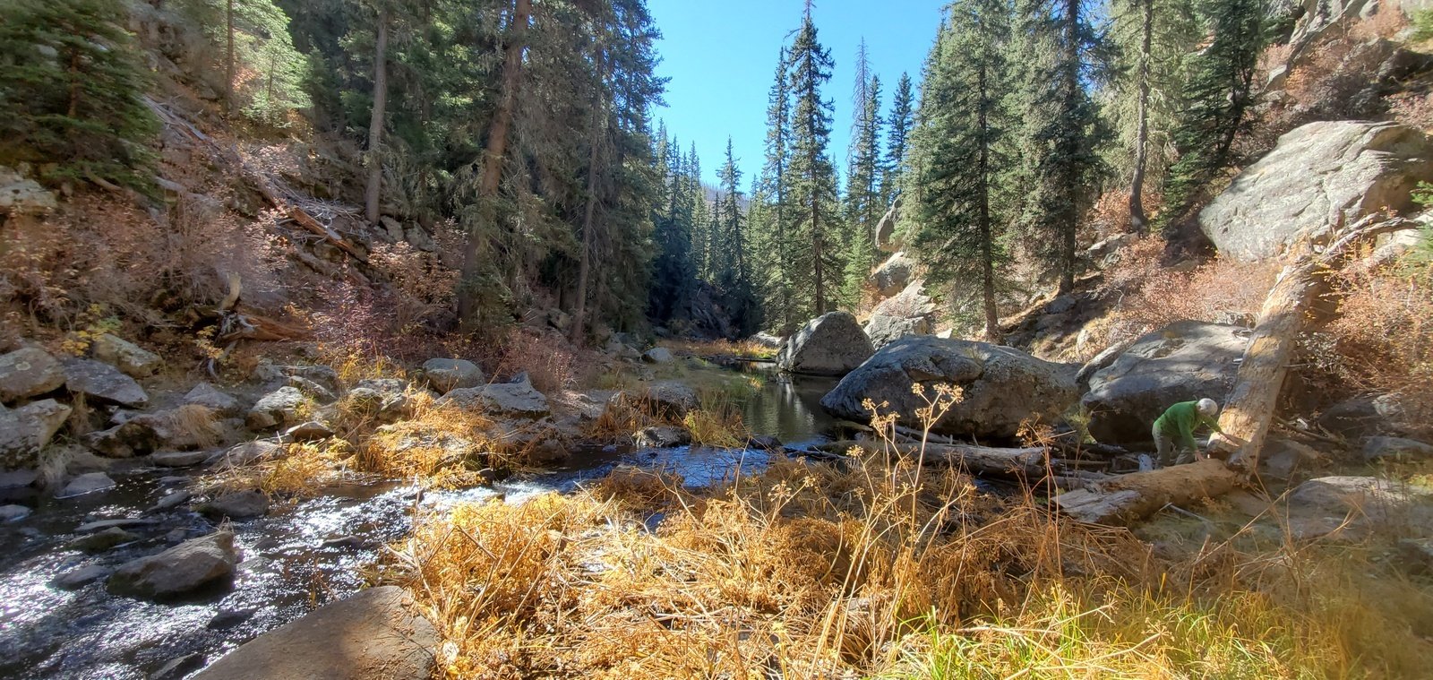 For some distance the canyon was wide enough for both the stream and a trail. But then we encountered rocks over which we had to climb. Soon we encountered a sheer cliff that extended down to the water. This required crossing the stream; fo
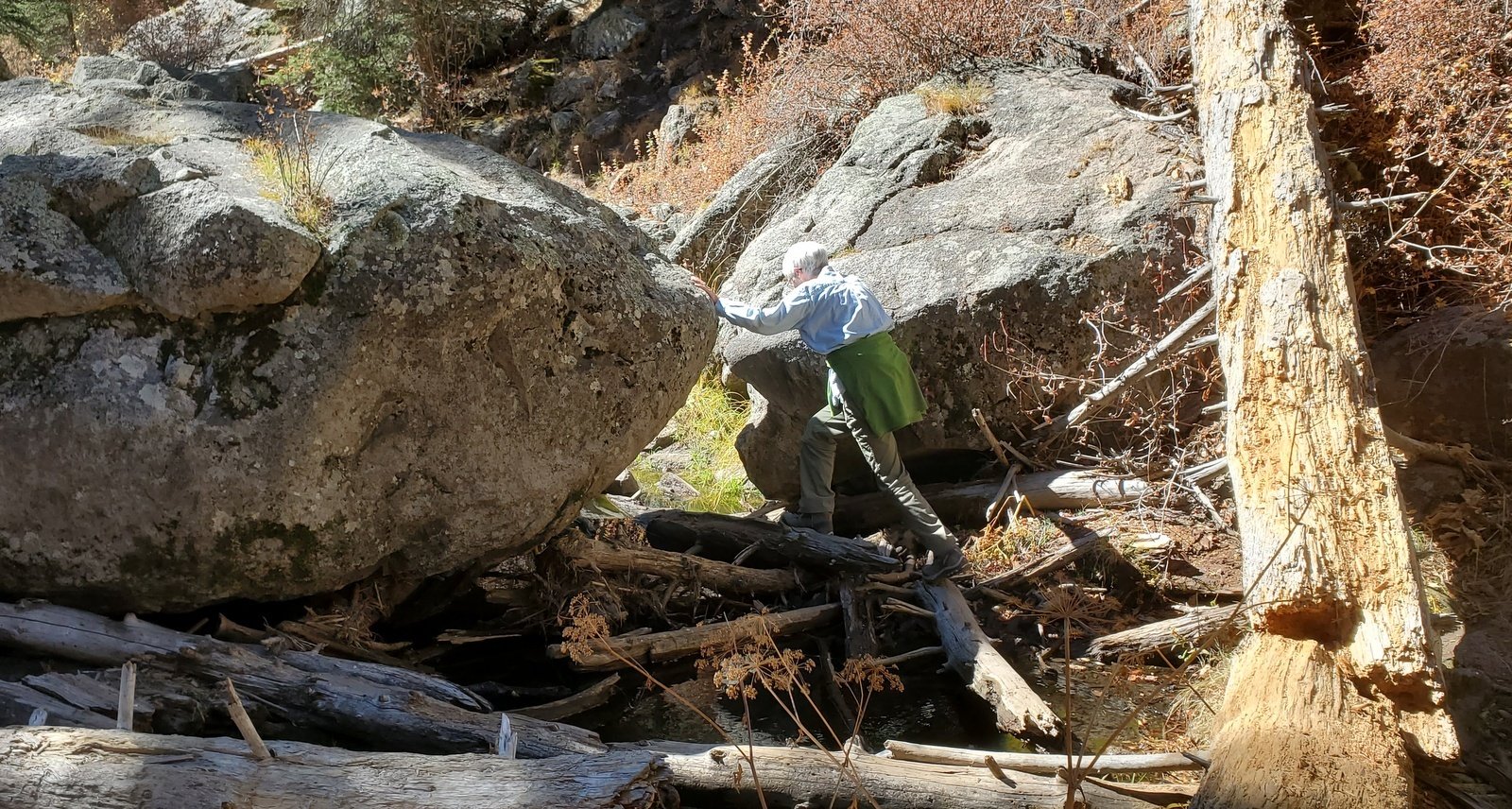 rtunately there were a couple of ways across including a 2×8 board. After crossing, we continued on the south side of the stream until encountering another cliff-to-stream, this time without a means of crossing without wading.
Since we had n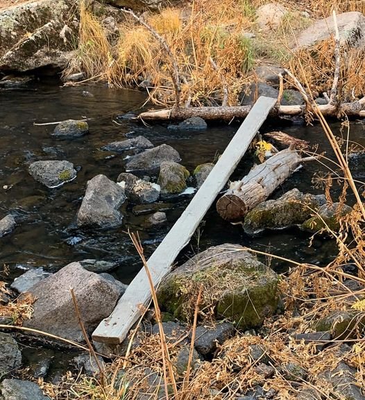 ot planned for a full hike (we didn’t even bring our packs), we turned back promising that we would come back here again. Upon reaching a point opposite the east end of the picnic area, we took the chance of crossing on rocks in the stream – neither of us slipped or lost our balance and succeeded in returning the the picnic/fishing area.
Statistics
Total Distance: 1.07 miles
Elevation: start 8,426 ft, maximum 8,500 ft, minimum 8,410 ft
Gross gain: 90 ft. Aggregate ascending 537 ft, descending 534 ft
Maximum slope: 66% ascending, 65% descending, 14% average
Duration: 1:10
| GPS Track Files for Download | |
204 Downloads | |
|---|---|
194 Downloads | |
I urge you to explore our hiking tracks with Google Earth. With the virtual 3-dimensional presentation, achieved by panning and tilting the view, you can get a much better idea of the hikes and terrain than you can get from the 2-dimensional screenshot above. For assistance: Using Google Earth Track Files.
References and Resources
Summit Post: Las Conchas, Jemez
Mountain Project: Las Conchas Rock Climbing


