Our second hike during a 3-day camping trip in the Jemez Mountains, at the Jemez Falls Campground. After a longer hike the day before, we chose this easier hike from Coco Rae’s book “Hiking Trails in Valles Caldera National Preserve”. We were not disappointed – it was a great trail.
The Drive In
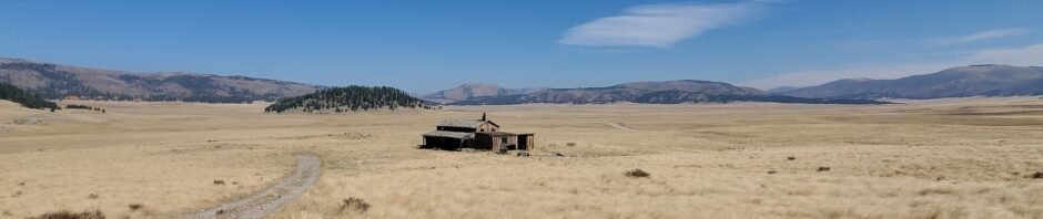
The trail begins at a two-track to the left of the main road into Valles Caldera, about half way to the Visitors Center. Parking is alongside the road, near the two-track with a cable blocking vehicle traffic. ‘Tho it isn’t visible from the parking place, the Missing Cabin is just over the ridge at the end of the two-track.
The Hike
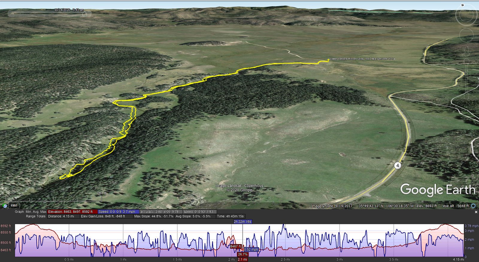
Valles Caldera-Hidden Valley Trail Hike.Pat.2020-10-14
T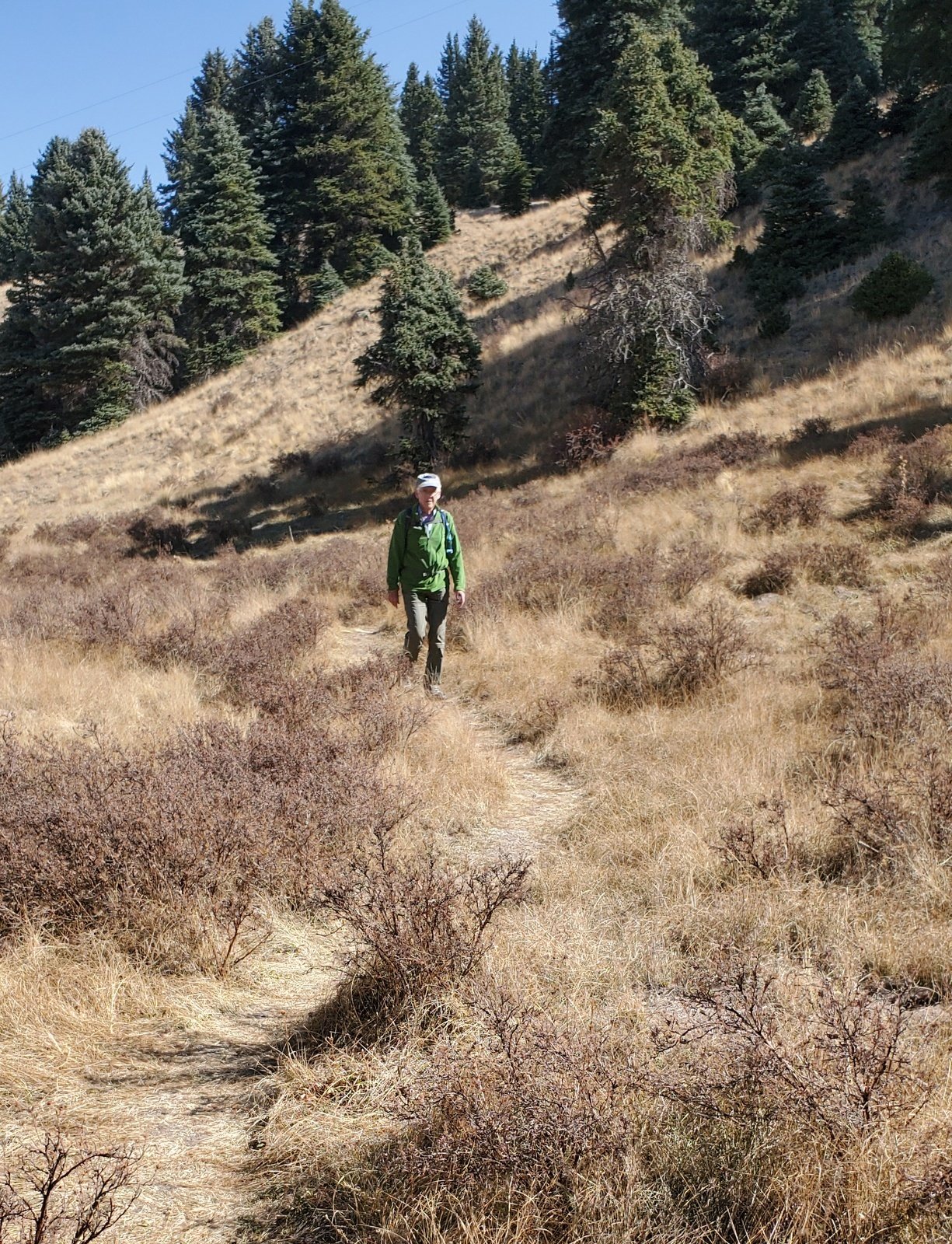 he hike begins with a climb over a cable (or go around it) that blocks vehicle access, and a gentle ascent to the top of a ridge. Nearing the top Missing Cabin comes into view, to further accent the views all around – the grasses of the slope east into Valle Grande and across the Valle, and north and west to the East Fork Jemez River that is flowing out the the Valle into it’s canyon and South Mountain beyond. Then skirting a grove of fir on the left, one intercepts the River and continues along the flowing stream. The trail since the two-track is a well worn path through knee high grass – easy walking.
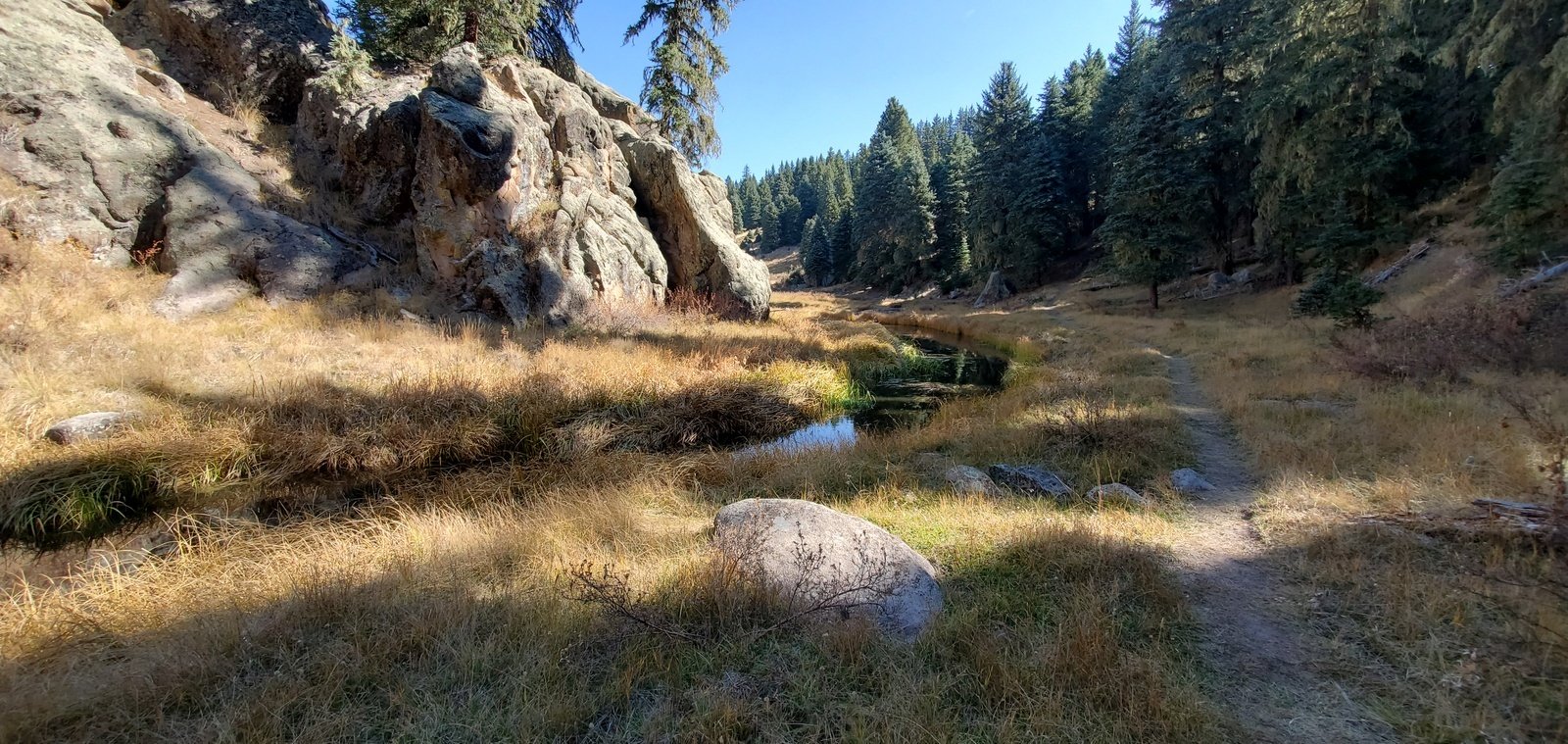 For the next half mile the trail follows the river, crossing to the north side on a log nicely locate there for our use. At about a 1.5 miles into the hike the trail enters the East Fork canyon with rocks forming the edge of the canyon on one side or the other. The
 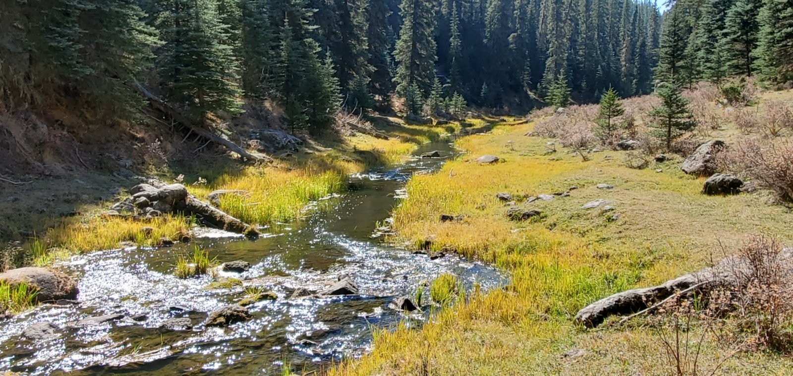 trail continues to be -easy walking- in a beautiful surrounding. And stream burbling along over rocky sections adding to the ambience.
After a stop for our mid-hike break we headed back to the Tacoma with wonderful memories of the Hidden Valley Trail.
Highlight
First, the view across Valles Grande as the trail tops the ridge and passes the Missing Cabin, is truly awesome, the nearly 4 miles across the totally open space of Valles Grande to the far edge of the Valle. And 5 miles beyond that to the eastern rim of the Caldera.
Second, the lush valley of the East Fork Jemez River even in dry time of autumn. The stream continues to flow, the grasses tho’ in their autumn brown are lush, and the fir and ponderosa trees are so healthy. This -is- a gem of a hike!
Statistics
Total Distance: 4.15 miles
Elevation: start 8,544 ft, maximum 8,592 ft, minimum 8,463 ft
Gross gain: 129 ft. Aggregate ascending 848 ft, descending 848 ft
Maximum slope: 45% ascending, 52% descending, 5.2% average
Duration: 4:43
| GPS Track Files for Download | |
272 Downloads | |
|---|---|
214 Downloads | |
If you haven’t explored these hiking tracks with Google Earth, I urge you to try it. With the virtual 3-dimensional presentation, achieved by panning and tilting the view, you can get a much better idea of the hikes and terrain than you can get from the screenshot above. For some ideas, check out Using Google Earth Track Files.
References and Resources
NPS Valles Caldera: Easy Hikes
National Parks Traveler: Exploring The Parks: Setting Foot In Valle Caldera National Preserve
Prime Passages: Hidden Valley Beer Hike
Wikipedia: The Missing (2003 film)
Roger Ebert: The Missing


