This is our first hike on a 3-night camping trip to the area near White Sands with friends Jay and Nancy. We camped at the Oliver Lee Memorial State Park, with campsites affording superb views of the Tularosa Basin to the west (with a glimpse of White Sands 17 miles distant) and the Sacramento Mountains rising from the campground to the east. We chose this weekend to be on hand at White Sands to see the rise of the Blue Moon.
The Drive In
Malpais-Valley of Fires
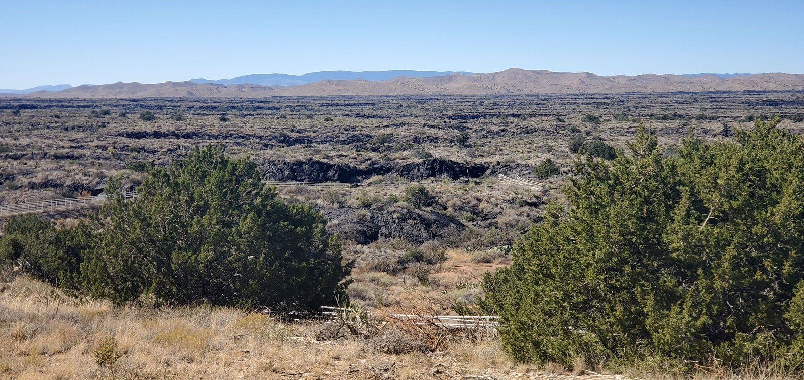
The drive from Albuquerque is some 224 miles, close to 4 hours enroute. We drove south on I-25 to San Antonio, the east on US 380 to Alamagordo. Sixty miles from San Antonio, we stopped at the Valley of Fires Recreation Area for lunch and a view of this large area of malpais (lava flow).
Continuing another 5 miles, we turned south on US Hwy 54, through Alamagordo, and 11 miles further to Dog Canyon Road, turn east for 4 miles to the Oliver Lee State Park and Campground.
The Campground & Camping
Oliver Lee has a mixture of campsites, some with hookups, others with tent pads (many of which also have space enough for small campers like our 17′ R-Pod); reservations are required. The campsites are spaced nicely apart; there are water hydrants near each of them; there are a couple of pit toilets scattered about plus a building with running water (toilets and showers, ‘tho in these times of Covid the showers are closed). There is also a Visitors Center with a small museum (also closed on account of Covid) and adjoining Riparian Nature Trail and Frenchy’s Cabin.
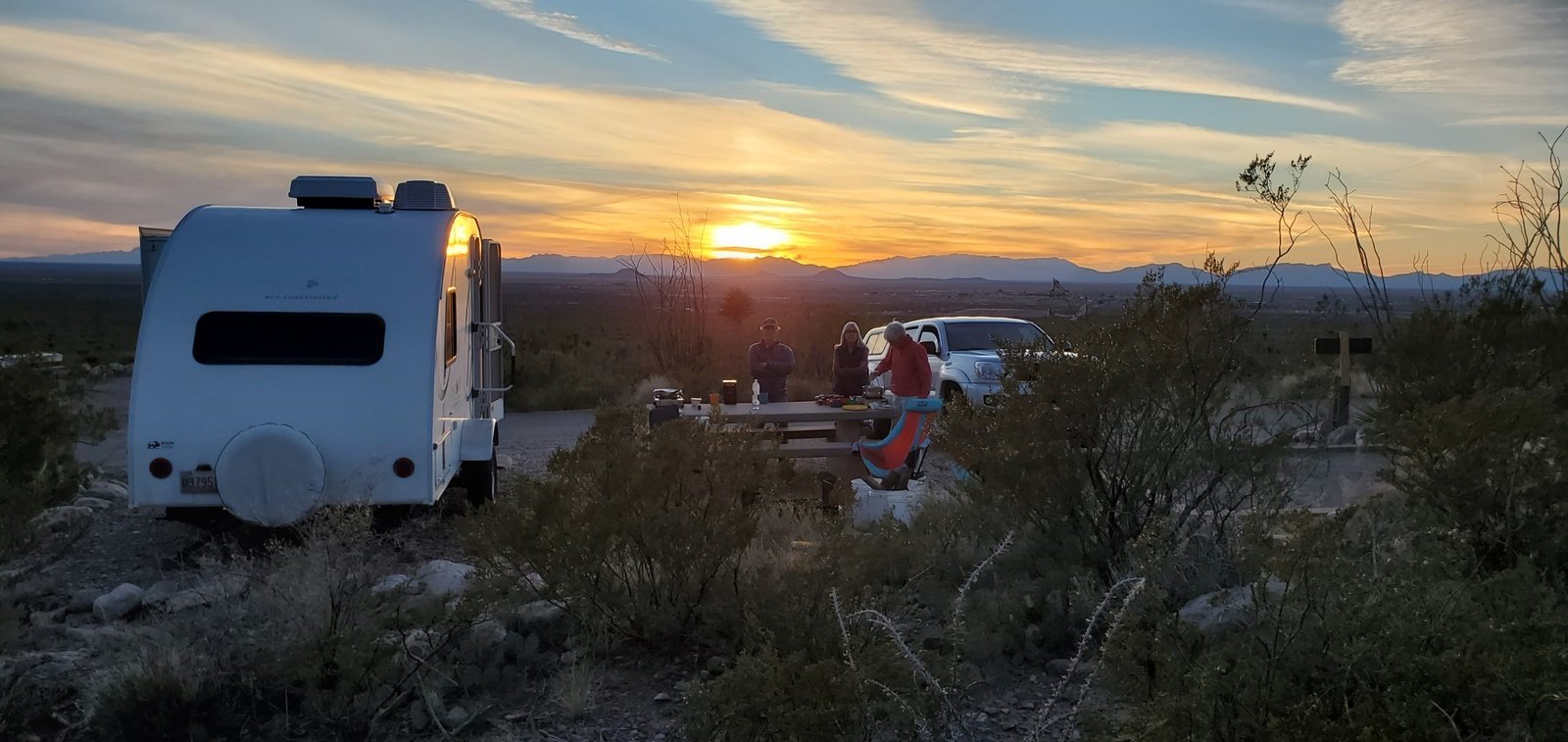 The campground is on the gentle slope between the flat and level Tularosa Basin and the quickly-rising Sacramento Mountains. Thus the views from nearly all the campsites are really great. The area is open desert – no trees, only small shrubs (many with very nasty thorns) and cactus – no place to go bushwhacking. We enjoyed all 3 nights of camping there, starting with a nice fire on the first night (we brought our own firewood).
The Hike
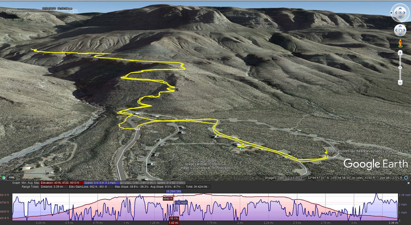
Dog Canyon Trail Hike.PatJayNancy.2020-10-31
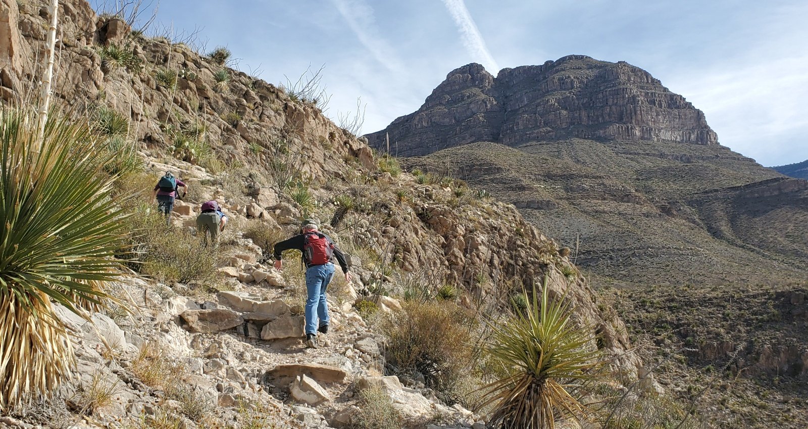 We began the hike at our campsites, proceeded to the trailhead located behind the Visitors Center. The trail starts with a quick elevation gain, steep and very rocky. When not loose rock, the trail traverses a solid rock surface with a steep slope; happily this type of rock affords a good grip for the boots – no sliding. In many places rocks form a staircase (yes, it is that steep) and in a few spots a handhold was required.
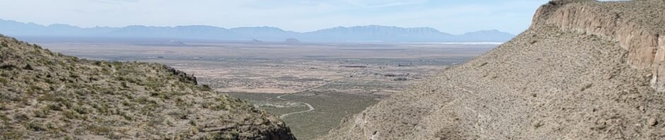
That describes the trail for the first 3/5ths of a mile and 500 feet elevation gain. This brought us to what the map at the trailhead labeled the “First Bench”. From here trail is quite level and, tho’ rocky, is much easier to ambulate, easy enough to look around and enjoy the scenery.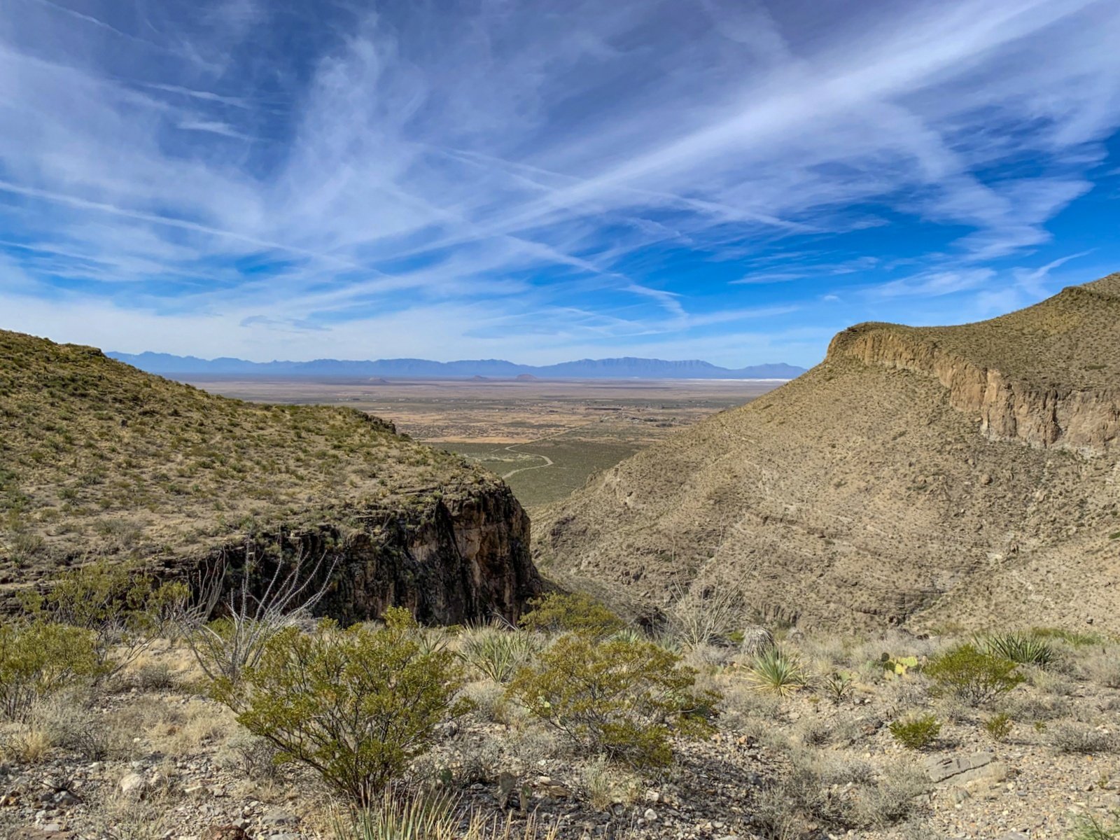 Behind us (to the west) we had a view down Dog Canyon and across the Tularosa Basin to White Sands and the San Andres and Organ Mountains beyond. At times the trail approached the edge of the Bench providing a good look down into the canyon proper, 400′ to the bottom. And across the canyon and up towards the crest of these Sacramento Mountains, steep slopes and sheer cliff faces from the canyon floor at 5,000 feet elevation to 7,000 feet.
Having done what seemed like a lot of difficult elevation gain getting up to the Bench, at 1.7 miles into the hike we stopped for lunch, then headed back to the campground. On the ascent, because of the steep slope and rocky surface, I was concerned about the difficulties of descending on such a trail. It was no problem, easier than I thought it might be.
Jay here: I had high hopes that we could make it all the way to Frenchy’s line camp, but this was a more strenuous hike than I anticipated. Still, it was most enjoyable and far different than our hiking in the Jemez, Sandias, Sangre de Cristos, or even Ojito. The area is considered part of the Chihuahuan Desert, so the vegetation is quite different from the Northern half of New Mexico and the landscape more stark. Loads of ocotillo and more types of cactus than what we normally see. The 400′ drop of the Bench tested my vertigo and the steep portions with rocky descent has me on my butt for a while, but all in all it was a great hike.
Highlight
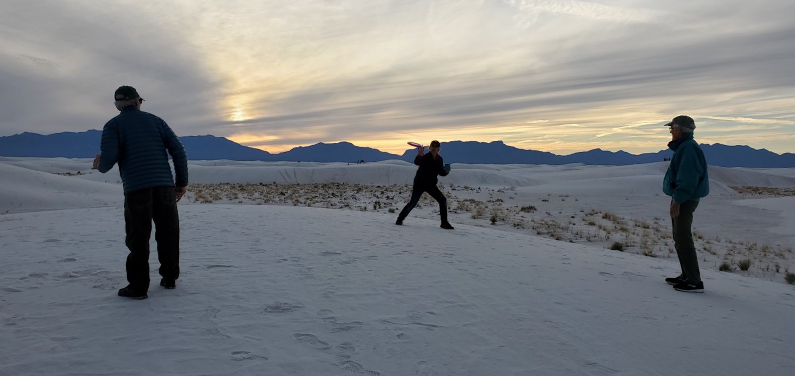 After the hike, we packed up fixings for supper and headed to White Sands National Park, to be there when the Blue Moon rose over the Sacramento Mountains. The ‘sand’scape is quite amazing, driving through the pure white sand dunes, 10’ to 15 feet high all around. We settled on a parking area at the west end of the loop road, then explored the nearby dunes. Not to be outdone by other groups having a good time, we picked up a couple of frisbees and tried to regain some skill in tossing them back and forth.
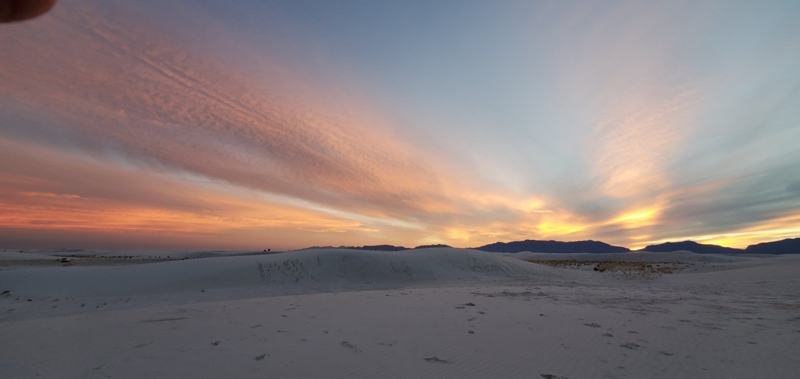 As sunset approached, the light began to change as the sun descended through thin clouds over the San Andres Mountains to the west. The white sand dunes created an eerie scene in the subdued light , then the red color of the sunset took over the sky all
 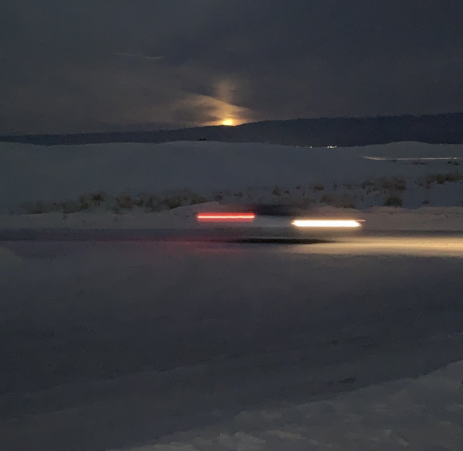 around (yes, in these open spaces sunsets are spectacular for 360 degrees around). We then waited for the Blue Moon to rise over the Sacramento Mountains (we could not stay long since the park closed at 8:00).
Statistics
Total Distance: 3.39 miles
Elevation: start 4,316 ft, maximum 5,013 ft, minimum 4,316 ft
Gross gain: 697 ft. Aggregate ascending 952 ft, descending 951 ft
Maximum slope: 40% ascending, 38% descending, 09.1 % average
Duration: 3:42
GPS Tracks
| GPS Track Files for Download | |
176 Downloads | |
|---|---|
173 Downloads | |
I urge you to explore our hiking tracks with Google Earth. With the virtual 3-dimensional presentation, achieved by panning and tilting the view, you can get a much better idea of the hikes and terrain than you can get from the 2-dimensional screenshot above. For assistance: Using Google Earth Track Files.
References and Resources
New Mexico State Parks: Oliver Lee Memorial State Park
USDA Forest Service: Dog Canyon Trail (T106)
White Sands National Park
AllTrails: Dog Canyon Trail 106
Hiking Project: Dog Canyon Trail (T106)
TinyShinyHome: Hiking The Dog Canyon Trail etc. – Great Photos and Description
Wikipedia: Oliver Lee (New Mexico)
White Sands National Park
A Dangerous Business: … Visiting White Sands National Park – an excellent article
Roswell Daily Record: Quiet and reclusive, Frenchy was one of the bravest men in the Southwest
NM Bureau of Geology & Mineral Resources: Oliver Lee Memorial (PDF)


