This is our 2nd hike on a 3-night camping trip to the area near White Sands with friends Jay and Nancy. We camped at the Oliver Lee Memorial State Park, with campsites affording superb views of the Tularosa Basin to the west (with a glimpse of White Sands 17 miles distant) and the Sacramento Mountains rising from the campground to the east. We chose this weekend to be on hand at White Sands to see the rise of the Blue Moon.
The Drive In
For a description of the drive from Albuquerque, see the post from the 1st hike: Dog Canyon Trail Hike – 10-/31/2020. As for the drive to this day’s hike: From Oliver Lee return to Alamagordo, then continue north on US 54 – we took the bypass to avoid downtown Alamagordo. At the end of the bypass, continue straight ahead onto US 82 towards Cloudcroft. In Cloudcroft, turn right off of US 82 onto NM 130, then in 1.3 miles turn right onto NM 6563 (Sunspot Highway).
Our original plan was to hike the Upper Karr Canyon Trail, but arriving at the entrance to the Recreation Area we found it closed. So we retraced our drive towards Cloudcraft, parking at one of the 4 trailheads identified with the Rim Trail; this is about 3.1 miles from the NM130-NM6563 intersection. On the west side of the road, across the roadside ditch and behind a few trees there is parking for 4 or 5 vehicles.
The Hike
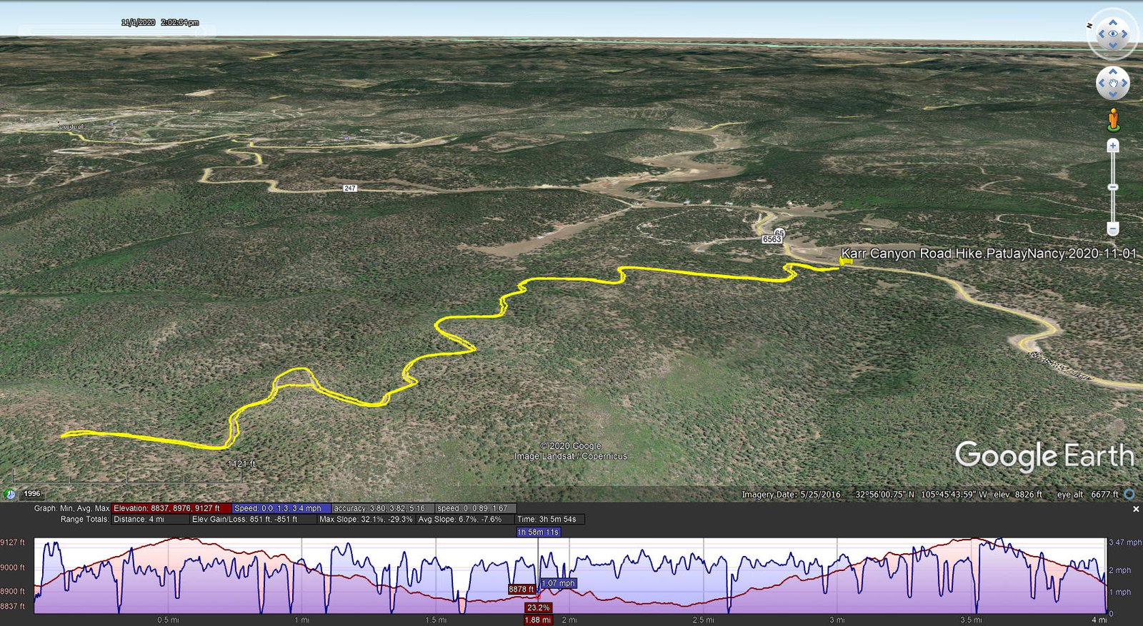
Karr Canyon Road Hike.PatJayNancy.2020-11-01
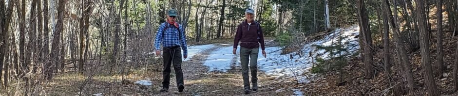
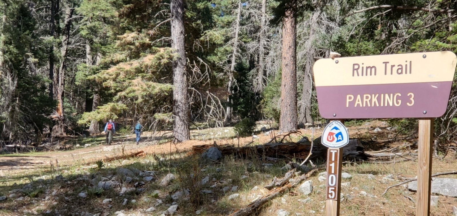 So, we started at the Rim Trail trailhead Parking 3, or so we thought. From the parking area a very nice two-track headed off into the woods.
 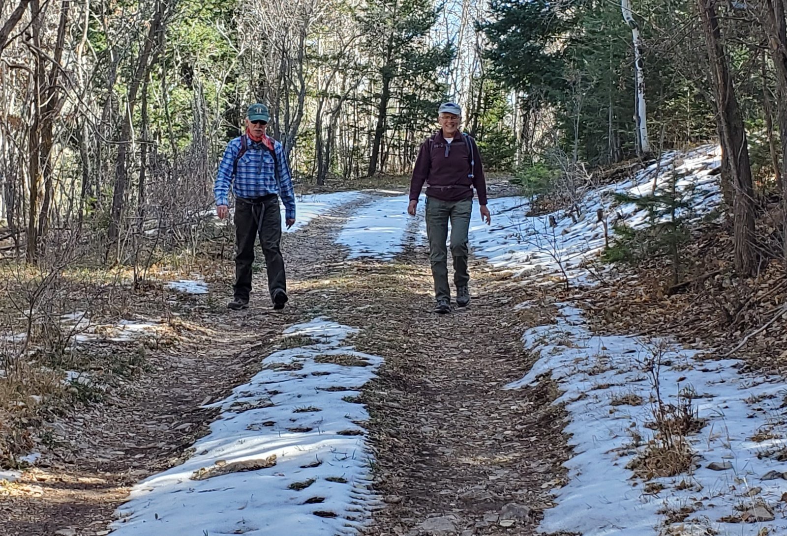 Soon we were surprised to come across snow in the shaded areas. About a
 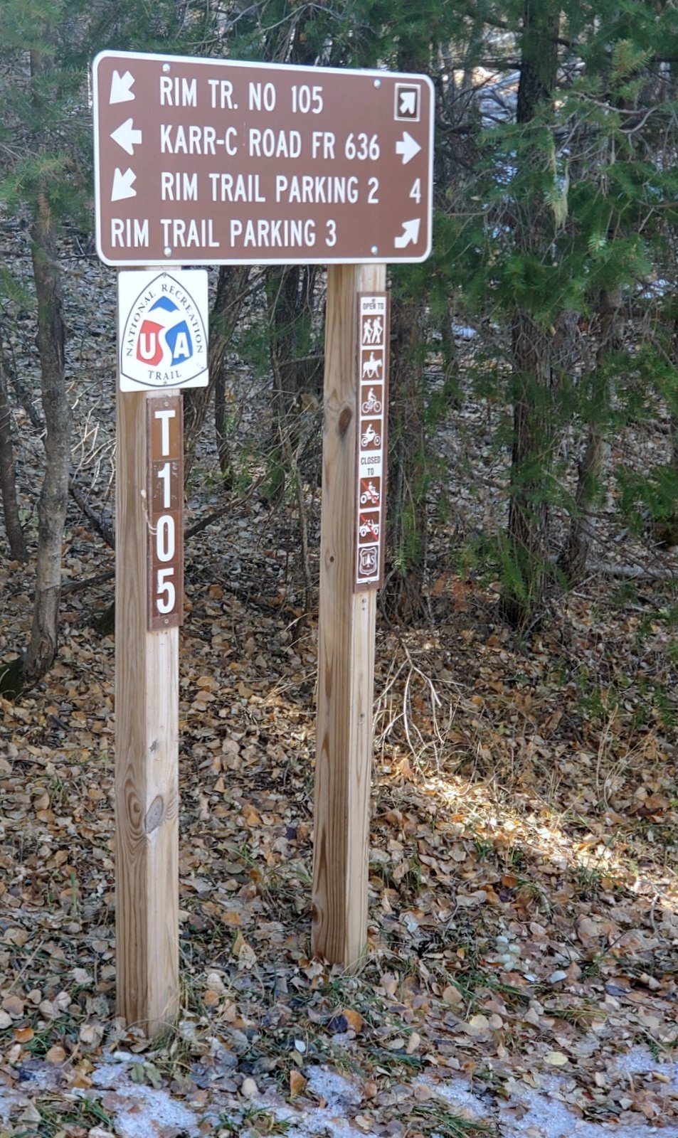 mile on we came across a sign that confused us – it showed the Rim Trail going back/left and forward/right, and Karr-C Road FR 636 going left and right. Not sure, we decided to continue on the very nice two-track.
Note: Later, when I reviewed maps, etc., I concluded that we had missed the Rim Trail at the parking lot; the clue was the ‘dotted line’ on USGS Topo maps. -The- Rim Trail follows somewhat parallel to FR 636 and crosses it at this intersection, continuing north to Rim Trail trailhead #2.
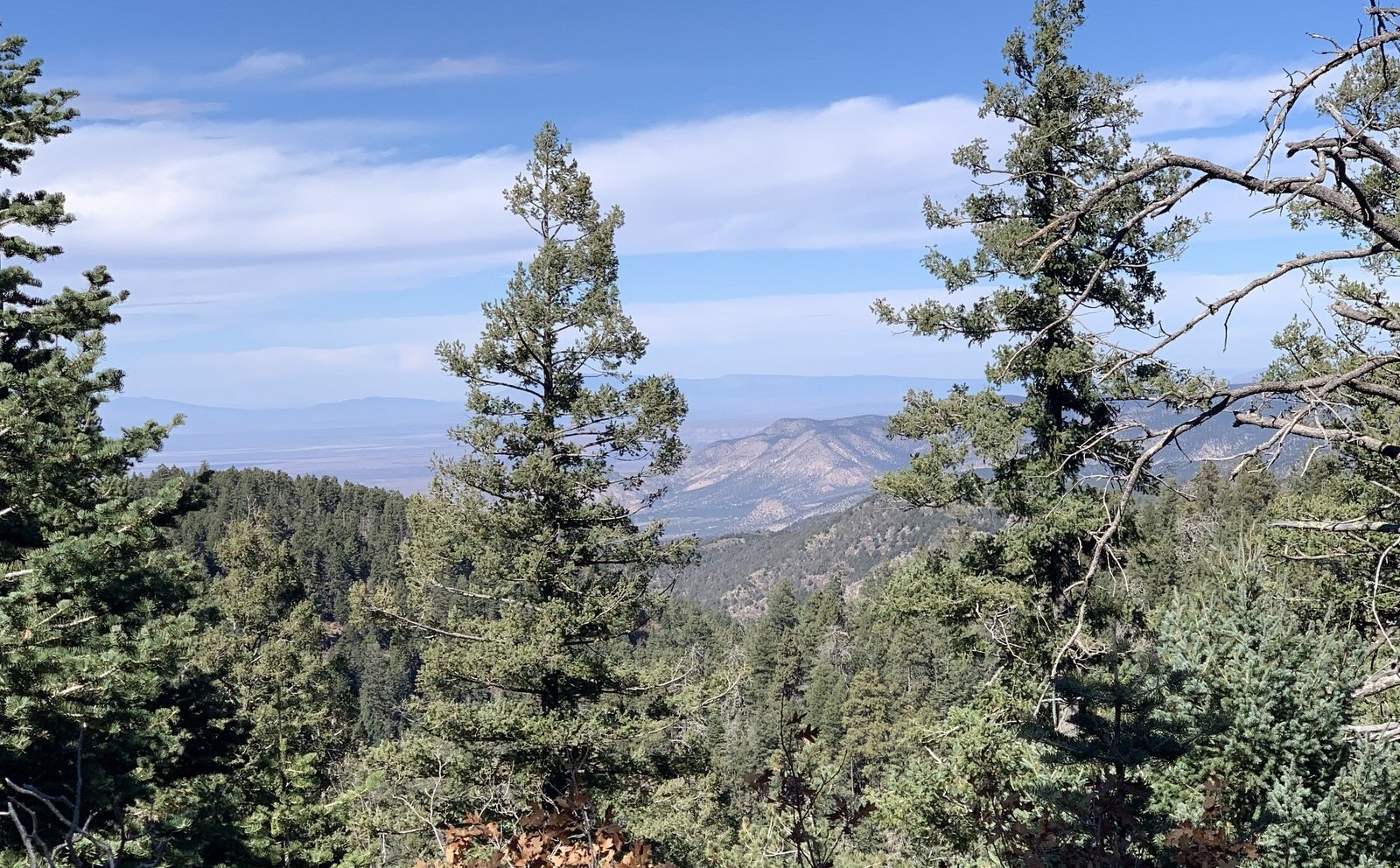 The two-track, FR 636, continues for another mile through mixed conifer forest. At a couple of places we had a view across the valleys and foothills of the eastern slopes Sacramento Mountains. From the tracks it is used occasionally so is in good condition with gentle slopes, 200 feet elevation gain in the first half mile, then descending 280 feet in the next 1.5 miles. At the end of the road, where the ridge ends before descending quickly into Tucker Canyon, we discovered a large camping tent – thought it might be hunters. … On the way back to the truck we did come across a gaggle of half dozen or so deer.
Statistics
Total Distance: 4.0 miles
Elevation: start 8,925 ft, maximum 9,127 ft, minimum 8,837 ft
Gross gain: 290 ft. Aggregate ascending 851 ft, descending 851 ft
Maximum slope: 32% ascending, 29% descending, 7.2% average
Duration: 2:54
| GPS Track Files for Download | |
189 Downloads | |
|---|---|
223 Downloads | |
I urge you to explore our hiking tracks with Google Earth. With the virtual 3-dimensional presentation, achieved by panning and tilting the view, you can get a much better idea of the hikes and terrain than you can get from the 2-dimensional screenshot above. For assistance: Using Google Earth Track Files.
References and Resources
USDA Forest Service: Rim Trail (T105)
Rim Trail (PDF)
National Park Service: America’s National Trails System
AllTrails: National Recreation Rim Trail (Trail 105)
Rim Trail: Sections 1 and 2
TripAdvisor: Rim Trail (lots of comments)
American Trails: National Recreation Trails


