Category Archives: Badlands

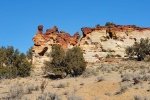
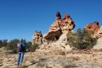
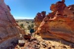
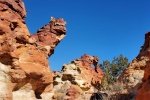
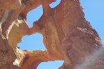
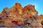
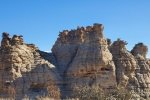
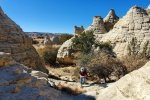
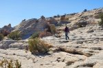
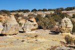
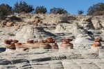
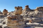
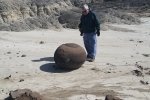
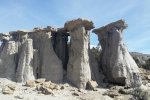
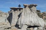
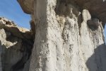
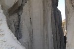
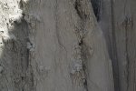
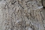
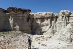
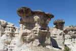
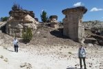
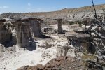
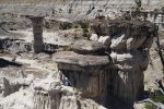
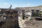
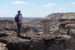
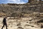
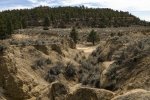
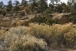
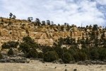
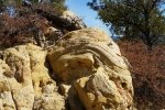
In the vicinity of Badlands, mostly in the San Juan Basin, NM.

‘Goblin Mesa’ & Goblin Colony – 04/07/2021

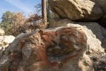
We had no advance plan, but we needed to get out into nature this week. Weather was a bit iffy, forecast to be chilly and windy. We decided to visit an old friend, Goblin Colony, up Paliza Canyon in the Jemez Mountains.

The Drive In

Driving towards the Jemez Mountains is always pleasant. The scenery heading west on US 550 gets better as White Mesa comes into view on the left, and the red cliffs of Mesa Cuchilla west of San Ysidro and the Jemez River come into view. Then the drive north on NM 4 adds more scenery as one passes through the Jemez Pueblo (Obey the Speed Limits – the Pueblo police “give no quarter”.)

No more than half a mile from leaving the Pueblo, turn right onto NM 290, continue pasts the Ponderosa Valley Vineyards and Winery, through the sparse village of Ponderosa, past the lake providing irrigation water to the Pueblo, and onto FR 10 (where the road changes to gravel). In another 2.5 miles or so is the Paliza Camptround (not open yet, but a really nice campground). Turn left across the bridge over Paliza Creek and park at the junction of FR 10, FR 266, and FR 271.

The Hike

‘Goblin Mesa’ & Goblin Colony Hike.Pat.2021-04-07

Goblin Colony is a great, short hike to some fascinating rock formations. The hike to goes up FR 271 (a two-track), then bears to the left. ‘Tis about 1.7 miles from parking with only a couple hundred feet elevation gain. For part of the way on the two-track, water was running in Paliza Creek and was filled with watercress. About .8 miles on, bear to the left and continue up a wash (bearing to the right, through a gate across the two-track, and up Paliza Creek makes for a great alternative, or an extension for some more hiking distance).

Normally, we’ve taken the wash to the Colony. But today – we diverted to explore potential camping sites, looking for level ground on the hillside above the wash. So we climbed 50′ to to the first area, then 150′ to another; and then without a real plan we continued climbing up the side of this small mesa (I can’t find a name for it, so I’m dubbing it “Goblin Mesa”, in honor of the Colony). And we continued climbing.

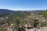
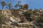
As we neared the top, of course it became more and more steep, until the last 100′ we were scrambling up a rock and gravel slope, about 45°. But we gained the top of Goblin Mesa. We found ourselves on flat & level rock surface that forms the end of the mesa, with an edge that was -vertical-, dropping precipitously a few 10s of feet. From this vantage point, where we paused for a snack, we took in the marvelous views of the canyons and mesas of this part of the Jemez Mountains. 

We gave only momentary thought to descending the way we came up. After checking the topo map (on USTopo, the GPS app on my phone), we decided to take our chances that there would be a easier descent (& safer!) at the other end of the mesa. The hiking along the mesa was easy with some rocky areas and a fair amount of deadfall in some areas (it appeared to be wind-blown where the mesa narrowed, exposing the trees to the strongest winds).

From visits to various sites of Pueblo ruins, I suspected there might be a Pueblo ruin of some sort on this mesa; I was on the lookout for any sign of a ruin. And I did spot a mound with lots of rocks strewn across it, which did not look like something Mother Nature would have formed. I’m convinced it is a small (15’x15′) ruin site. Hiking north for about half a mile, we found ourselves looking down upon Goblin Colony. And as hoped, we enjoyed a reasonable descent from the mesa top into the Colony.

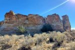
Entering from this direction introduced us to somewhat different formations – quite interesting. We descended to the lower portion of the Colony, stopped in a nook out of the wind for our usual lunch (Trader Joe’s Ramen, PB&J sandwich, apple slices, and carrot sticks) and admired the Goblins around us. Then we hiked down the wash and Paliza Creek, back to the Tacoma.

Statistics

Total Distance:  4.07 miles
Elevation: start  6,854 ft, maximum  7,519 ft,  minimum 6,847 ft
Gross gain: 671 ft.  Aggregate ascending 1,019 ft, descending 1,027 ft
Maximum slope: 48% ascending, 44% descending, 7.8% average
Duration: 5:30

GPS Track Files for Download
325 Downloads
91 Downloads
If you haven’t explored these hiking tracks with Google Earth, I urge you to try it. With the virtual 3-dimensional presentation, achieved by panning and tilting the view, you can get a much better idea of the hikes and terrain than you can get from the screenshot above. For some ideas, check out  Using Google Earth Track Files.

Previous Posts in the area

Paliza Canyon Hike – 8/24/2014
Paliza Canyon & Goblin Colony Hike – 7/19/2015
Paliza Canyon & Goblin Colony Hike – 09/09/2015
Paliza Canyon, Ruins, Goblin Colony Hike – 9/11/2016
Paliza Canyon Hike – 11/09/2017
Ponderosa Mesa Hike – 02/18/2018

References and Resources

***Geology of the Jemez Area, Chapter 13: The Holocene
Prime Passages: Goblin Colony Hike
Lauren Danner: Chasing goblins in the Jemez Mountains
Atlas Obscura: The Goblin Colony
The Shallow Sky: Paliza Goblin Colony (includes Kiatsukwa Ruins)
Only In Your State:
      The Unforgettable New Mexico Hike That Leads To A Goblin Colony
AllTrails: Paliza Goblin Colony
The Gentle Art of Wandering: The Goblin Colony
Judith Bauman: Paliza Canyon Goblin Colony
The Kruse Chronicles: Paliza Canyon Goblin Colony

Mesa de Cuba & Penistaja Driveabout – 11/09/2014

I’m writing this in 2019, reaching back to this great outing to explore territory that was new to us at the time.

The Drive About

Mesa de Cuba & Penistaja Driveabout.Jay.2014-11-09

Having come across articles about Mesa de Cuba and looking for new places to explore, we headed for Cuba (that is Cuba, NM).  Approaching on US 550, we turned left on NM 197, then in 6 miles. right on a dirt road.  After crossing a really rough patch (’twas dry on that day but don’t go there when it’s wet), and a “nearly” washed out culvert (a deep channel with just enough fill for a car to pass over it), w drove for about 2 miles looking for a track that appeared to take us to a place appealing for a hike (we didn’t really know then what we should be looking for). 

A two-track to the right went north towards the mesa, so we took it. We drove on this two-track for about a mile. Still looking for a hike, we stopped and explored the base of the mesa.  The terrain became quite steep, more than we wanted to tackle.  We returned to the Tacoma and continued on the two track.  After crossing a fairly deep wash with sandy bottom (our first “challenging” situation for the Tacoma/4 wheel drive) we eventually came back to the main road. With lots of time remaining that afternoon, we continued on the “main road”, to explore the area further – check the GPS track above (or download the .kml file below for GoogleEarth). 

GPS Track Files for Download
77 Downloads
113 Downloads
I urge you to explore our hiking tracks with Google Earth. With the virtual 3-dimensional presentation, achieved by panning and tilting the view, you can get a much better idea of the hikes and terrain than you can get from the 2-dimensional screenshot above. For assistance: Using Google Earth Track Files.

References

American Southwest: Penistaja Mesa
New Mexico Magazine: Badlands Walkabout
PhotoTrek New Mexico: Penistaja Mesa Badlands
New Mexico Birder: San Juan Basin Badlands – Mesa de Cuba
Facebook: Mesa de Cuba Badlands

La Mesita Roja & Its Hoodoos – 01/16/2021

Weather was beautiful this day in New Mexico, perfect for returning to the Rio Puerco, and to visit geologic formations that are a favorite of our friend and photographer Pat Barrett. We enjoyed a really good hike and the geologic formations are something to behold.

A note about the name I’m using – I haven’t found a name associated with these formations on any map. Three miles southeast are formations and a mesa dubbed La Mesita Blanca, and further south is Mesita Negra. So it seems appropriate, given the red rock outcroppings, that this should be called La Mesita Roja.
UPDATE, 11/29/2022: I’ve discovered the “proper” name for this small but amazing outcrop of hoodoos: Cañada del Ojo. See References below.

The Drive In

The drive from I-40 is paved for 6 miles, then graded and well used dirt to the parking area. There are many roads scattered in the Rio Puerco and few significant landmarks, plus the route passes through the To-Hajiilee Navaho Reservation, so it is easy to unintentionally arrive at the middle of nowhere.  So here are detailed directions:
  • Drive west from Albuquerque to the Cañoncito turnoff, then drive north towards To-Hajiilee on Trail 56, also identified as Cañoncito School Road.
  • Just before the Cañoncito School, turn right off of the pavement, then immediately left to continue on Trail 56. (There are signs for Trail 56 and Trail 57 – Trail 57 angles off to the right, terminating back at I-40, at the interchange near the Route 66 Casino.)
  • Continue north on Trail 56.  Don’t take the Y to the left two-tenths of a mile along, nor the Y to the left 3 miles along; as a guide, stay on the road that is in the better condition.
  • Pass through the 1st fence line (with cattle guard), the boundary between the Reservation and the Herrera Ranch (private land). Another mile along park just beyond the 2nd fence line; you are now on BLM land.

The Hike

Mesita Roja & Its Hoodoos Hike.Pat.2021-01-16

Our introduction, “Red Butte”.

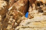
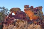
Not being familiar with the territory, we struck out east from the parking area on a 2-track that crossed over the southern end of a ridge. Soon the 2-track headed north, and recalling  Pat Berrett’s advice, we left the 2-track and set out towards the fence line. As we crossed Cañada del Oso, we headed southeast, towards a prominent and interesting geologic feature. Along the way the red rocks that Pat B. had spoken about came into view. We continued on toward the “Red Butte” to  take a closer look. The formation, maybe 30′ tall with columns and windows and amazing range of red colors and hues. Our photos don’t give it its due.

A sampling of “Mesita Roja”.

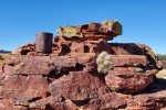
After ogling Red Butte, we headed north to Mesita Roja, the ridge of colorful red rock outcroppings. We wandered through passageways, looking at the most interesting features of color and shapes, windows and forms, passagways and dead ends. Mesita Roja is definitely the most interesting geologic features that we have visited. These photos and in the Gallery below may give you some idea of the beautiful Mesita Roja.

Finding ourselves atop the ridge of Mesita Roja, we could see clearly the Hoodoos a quarter of a mile distant. We descended off of the Mesita and across the arroyo to find ourselves in an amazing array of 20-30 foot tall Hoodoos. We wandered among them, working our way around the collection that sits below the boundary of what I will call “Hoodoo Mesa”. We worked our way

Looking down on a section of the Hoodoos

up the east side, then up onto the Mesa to look at the Hoodos from above – great views. Along the way we came across more and more interesting features and formations.

Not finding a way down the west side of Hoodoo Mesa, we circled back to the east side and circled around the Mesa to the west side to where the cañon narrowed.

Taking a direct route across Cañada del Oso to the truck.

Having thoroughly enjoyed Mesita Roja and Its Hoodoos, we took a bearing from US Topo and struck out for the truck. Taking the direct route, we found ourselves crossing Cañada del Oso through sometimes tall lumps of grass, at other times wending our way through waist to chest high bushes. That along with the soft surface made the hiking a bit more strenuous – that is, a good workout.

Highlight

‘Tis a beautiful place, with such a variety of interesting features – shapes, colors, and more. We’ve enjoyed Goblin Colony, Tent Rocks, Dinosaur Ridge, and mesas around Mesa de Cuba. But this is our favorite. And it is secluded – ‘tho a car was parked near ours when we returned, evidence (and location) suggest that it is rarely visited.

Statistics

Total Distance:  4.27 miles
Elevation: start  5,943 ft, maximum  6,012 ft,  minimum 5,812 ft
Gross gain: 69 ft.  Aggregate ascending 645 ft, descending 648 ft
Maximum slope: 19% ascending, 26% descending, 5.0 % average
Duration: 4:33

GPS Track Files for Download
0 Downloads
120 Downloads
84 Downloads
206 Downloads
I urge you to explore our hiking tracks with Google Earth. With the virtual 3-dimensional presentation, achieved by panning and tilting the view, you can get a much better idea of the hikes and terrain than you can get from the 2-dimensional screenshot above. For assistance: Using Google Earth Track Files.

References and Resources

Thanks to Pat Barrett for telling us about this amazing place, and for the directions to get there.

Update – links to References for Cañada del Ojo:
AllTrails: Canada del Ojo
Woman Seeks Elevation: Cañada del Ojo: An eyeful of hoodoos
The Gentle Art of Wandering: 49 Canada del Ojo
Can also find information in the book “60 Hikes Within 60 Miles, Albuquerque

San Jose Badlands Hike – 11/09/2018

We’ve so enjoyed visits to other Badlands in the San Juan Basin; we chose this time to visit the San Jose Badlands. 

The Drive In

From Albuquerque, go west on US 550, 5.5 miles beyond Cuba. Turn right on NM 96, proceed through La Jara and Regina. When NM 96 turns 90 degrees to the right (east), continue ahead (north) for 1.67 miles, turn left on County 391 (not marked). This is a dirt road in decent shape (it serves gas wells in the area); in about 2.3 miles you will be at the south end of San Jose Badlands.  There are multiple two-tracks in the area; for our parking place, check the GPS track or the screen shot above (we drove in on the road entering from the left edge of the screenshot and parked near a gas wellhead).

The Hike

San Jose Badlands Hike.Pat.2018-11-09

We used the ASCHG hike as a guide for our hike (see reference link below), ‘tho we didn’t follow it precisely nor did we go as far as that hike.  Rounding the end of the ridge north of where we parked, the badlands came into view – a tall and steep hillside on our left punctuated with many hoodoos situated on the slope and atop the ridges.  There are -so- many such formations, small and large – just the stimulation of the features of these badlands was enough to wear us out by the end of the hike; review the photos below to see for yourself (until you visit there).

The terrain is relatively flat and level and the surface in most areas is hard and smooth, although there are areas covered by a scattering of 1/2″ to 1″ dark brown to black loose rocks which sometimes makes walking a bit “slippery”.  We followed the lower edge of the ridges for about 2 miles, where we found ourselves on a 2-track about 1 3/4 miles along.  Continuing on the two track we descended into the northeastern part of San Jose, the only significant elevation change on our hike.  ASCHG explored this lower area, but we chose to look down upon it from a high point – from that vantage point the terrain appeared to be much more challenging.  After our mid-hike break with the light lunch that Pat prepares, we headed back to the truck following 2-tracks.

Highlight

In addition to the geologic features (hoodoos, etc.) there were so many interesting colors and patterns in the surface of the ground and features.  The layers laid down in ancient times are evident in the grays, reds, and browns in the strata visible on the slopes of the ridges.  And water is the sculptor of the shapes, from the large hoodoos to small features: in some cases water created vertical patterns of carved out material; in other cases on more level terrain it created a sharply lumpy array of small pillars; and out on level terrain leaving 1″ to 2″ rocks “high and dry”, sitting atop pedestals, the surrounding soil washed away (sort of like miniature hoodoos).  I’ve tried to capture these features in the “Ground Shots” photo gallery below. 

Reviewing GoogleEarth, there is much more to explore in these San Jose Badlands.

Statistics

Total Distance:  3.89 miles
Elevation: start  7,384 ft, maximum  7,427 ft,  minimum  7,282 ft
Gross gain:  145 ft.  Aggregate ascending  474 ft, descending  474 ft
Maximum slope: 20% ascending, 23% descending, 3.8% average
Duration: 4:17

GPS Track Files for Download
221 Downloads
77 Downloads
I urge you to explore our hiking tracks with Google Earth. With the virtual 3-dimensional presentation, achieved by panning and tilting the view, you can get a much better idea of the hikes and terrain than you can get from the 2-dimensional screenshot above. For assistance: Using Google Earth Track Files.

References

New Mexico Magazine: Badlands Walkabout
The American Southwest:
     San Juan Basin Badlands (an overview description) 
     Map of San Juan Basin Badlands
ASCHG: San Jose Badlands Hike
Mike Spieth: Badlands of New Mexico
PhotoTrek New Mexico: San Jose Badlands 1st
Sehrer’s Place – US Hikes: San Jose Badlands [San Juan Basin]
     (Geman Visitors, in German)
Westernlady’s World: San Jose Badlands, NM (also German)

Mesa Chijuilla Expedition – 02/20/2015

Vince and I went ‘wandering’ beyond Mesa de Cuba in the San Juan Badlands.  This “expedition” (multiple hikes) began with exploration of the east side of Mesa Chijuilla.  We then checked out another area with interesting features some 3 miles southwest of the first hike.  As you will see in the photos below, we encountered some interesting geologic features: strange rocks, hoodoos, vertical erosion patterns, and more. [This is a retro-post (June 2018), an expedition with Vince back in 2015.]

The Hikes

Mesa Chijuilla Expedition.Vince.2015-02-20.#1
Mesa Chijuilla Expedition.Vince.2015-02-20.#2

Statistics

Hike #1
Total Distance:  1.90 miles
Elevation: start 7,091 ft,, maximum 7,205 ft, minimum 7,205
ft Gross gain:  114 ft, Aggregate ascending  341 ft, descending  343 ft
Maximum slope: 26% ascending, 29% descending, 6% average
Duration: 1:45

Hike #2
Total Distance:  1.12
Elevation: start 6,915 ft,, maximum 6,979 ft, minimum 6,915 ft
Gross gain:  64 ft, Aggregate  ascending  308 ft, descending  308 ft
Maximum slope: 37% ascending, 30% descending, 8% average
Duration: 1:23

GPS Track Files for Download
71 Downloads
67 Downloads
278 Downloads
70 Downloads
I urge you to explore our hiking tracks with Google Earth. With the virtual 3-dimensional presentation, achieved by panning and tilting the view, you can get a much better idea of the hikes and terrain than you can get from the 2-dimensional screenshot above. For assistance: Using Google Earth Track Files.

References

New Mexico Magazine: Badlands Walkabout
AllTrails: Mesa Chijuilla

Lybrook Badlands Walkabout – 05/13/2018

After visiting various places in the Ojito Wilderness, then working our way west into the area around Cuba – Mesa de Cuba WestMesa Penistaja, and Ceja Pelon Mesa, I came upon maps of  ‘all’ the badlands, extending all the way to the Chaco River (The American Southwest’s Map of the San Juan Basin Badlands and NM Magazine’s Badlands Walkabout). It only seemed reasonable to next check out Lybrook.  Talking with friends at the Albuquerque Downtown Growers Market, we decided to head out that way on a nice Sunday – before summer sets in here in New Mexico.

The Drive In

Tho’ others had taken a route that brought them in to Lybrook from the west, the maps showed a shorter route – entering from the east.  Well … it is a good road for most of the way, but as one enters the Badlands proper it becomes more challenging.  At mile 42.4 on the Lybrook Badlands DriveInOut track for Google Earth, the road goes down a -very steep- slope (we left the Badlands going out the west road). Otherwise, thanks to the oil and gas industry, the roads are quite good.

The Walkabouts

Lybrook Badlands Walkabout.PatKelleyPatB.2018-05-13

Using ACSHG’s GoogleEarth track, Lybrook Badlands, we followed the two-track to its end, beyond their parking spot.  And there we found the most amazing formations.  I labeled this outing a Walkabout because we just wandered among the hoodoos, into small cañoncitos, up on top of the ridges – everywhere we looked there were fascinating views, shapes, and textures.  There isn’t really much more that I can describe – the photos speak well.

We checked out a second area – it was interesting but I think we may have been saturated by that time.  So we enjoyed our mid-“hike” break, wandered about a bit more, then headed for home.  Tis a bit of a drive (two and a half hours one way) but absolutely well worth it.  Check out the references below for the reports from others who have visited Lybrook Badlands.

The Walkabouts

Walkabout 1
Total Distance:  1.68 miles
Elevation: start  6,977 ft, maximum  7,029 ft,  minimum  6,943 ft
Gross gain:  86 ft.  Aggregate ascending  267 ft, descending  267 ft
Maximum slope: 30% ascending, 28% descending, 6% average
Duration: 2:04

Walkabout 2
Total Distance:  0.79 miles
Elevation: start  6,928 ft, maximum  6,968ft,  minimum  6,928 ft
Gross gain:  40 ft.  Aggregate ascending  95 ft, descending  91 ft
Maximum slope: 27% ascending, 16% descending, 5% average
Duration: 0:48

GPS Track Files for Download
285 Downloads
179 Downloads
462 Downloads
212 Downloads
I urge you to explore our hiking tracks with Google Earth. With the virtual 3-dimensional presentation, achieved by panning and tilting the view, you can get a much better idea of the hikes and terrain than you can get from the 2-dimensional screenshot above. For assistance: Using Google Earth Track Files.

References (roads, features, hikes, great photo collections):

ASCHG: Lybrook Badlands West from South Hike
                .kml file: Lybrook Badlands – ASCHG
Here2Where: Lybrook Badlands
AllTrails:  Lybrook Badlands
AztecNM: Lybrook (Badlands) Fossil Area (brochure, maps, features & formations)
                   Lybrook Badlands (Badlands Features Placemarks, .kml file)
The American Southwest: San Juan Basin Badlands
                                                Map of the San Juan Basin Badlands
New Mexico Magazine: Badlands Walkabout, directory of the 5 badlands near Cuba, NM
Mike Spieth.com: A Lybrook Badlands Project
                                 Badlands of New Mexico
Fox Dreams: The Story of New Mexico: The Lybrook Badlands
Jim Caffrey Images Photo Blog: The Other Badlands
PhotoTrek New Mexico – San Juan Basin Badlands: Lybrook Badlands
Westernlady’s World: Lybrook Badlands (in German, good maps)

Ceja Pelón Mesa Hike – 05/08/2018

This is the next in the string of mesas going west from Mesa de Cuba, after Mesa Chijuilla and Mesa Penistaja.  Various sources have described the area as rife with petrified wood – and we were not disappointed.  Access is via the same road that we use for Mesa Penistaja, except that we turn to the left onto a two-track that leads to an abandoned oil/gas wellhead. 

The Hike

Ceja Pelon Mesa Hike.Pat.2018-05-08

From parking, the first leg is north proceeding up an arroyo towards the edge of Ceja Pelón Mesa.  We proceeded west along the base of the mesa, finding many interesting examples of petrified wood, from small “shavings” up to complete logs.  The latter were typically partially buried, with the exposed log showing signs of gradual disintegration.  About a mile into the hike, we chose to ascend up on top of the Mesa, one of the few places we could get to the top. 

Once on top we had marvelous views in all four directions; particularly interesting were the volcanic necks visible on the horizon to the south, in the Rio Puerco valley.  Prominent was Cabezon, but also Cerro Cuate and others as well as Mesa Prieta; and on the far horizon the Sandia Mountains.  And to the east the Nacimiento and Jemez Mountains.  We found more petrified wood and logs atop the mesa as well as a variety of most interesting rock formations.  We found a nice pinon tree for shade for our mid-hike break, with a fabulous view across the Badlands, the aforementioned Rio Puerco features, and Mesa Chivato & Mount Taylor.

Finishing up, we retraced our route along the top of the Mesa, continuing eastward (following the route from ASCHG) to descend back to the floor of the Badlands and back to the truck.  Simply another wonderful day in the Land of Enchantment.

Statistics

Total Distance:  3.69 miles
Elevation: start  6,919 ft, maximum  7,240 ft,  minimum  6,919 ft
Gross gain:  321 ft.  Aggregate ascending  615 ft, descending  614 ft
Maximum slope: 36% ascending, 25% descending, 5% average
Duration: 5:37

GPS Track Files for Download
180 Downloads
303 Downloads
119 Downloads
263 Downloads
I urge you to explore our hiking tracks with Google Earth. With the virtual 3-dimensional presentation, achieved by panning and tilting the view, you can get a much better idea of the hikes and terrain than you can get from the 2-dimensional screenshot above. For assistance: Using Google Earth Track Files.

References

New Mexico Magazine: Badlands Walkabout
     Directory of the 5 badlands near Cuba, NM
PhotoTrek New Mexico:  San Juan Basin Badlands
The American Southwest:
     San Juan Basin Badlands     
    Map of the San Juan Basin Badlands       
    Ceja Pelón Mesa
AllTrails: Caja Pelón
Living Wonderously: Enchanted Excursion
Two Swiss Hikers: Ceja Pelón Mesa
Jim Caffrey Images Photo Blog: The Other Badlands
Arthouse Photography: New Mexico Badlands: Ceja Pelón in color

Mesa Penistaja Hike – 04/22/2018

Headed back to Mesa Penistaja with Pat to take in more of the amazing scenery, geology, and of course the superabundance of petrified wood. 

The Drive In

Chose to take a two-track off of the northbound road (Penistaja Road?) that would allow us to drive closer to the heart of the Mesa (see the DriveOut link below).  ‘Tis an OK two-track for a high-clearance vehicle, when it is dry. 

The Hike

Mesa Penistaja Hike.Pat.2018-04-22
Notes about the Google Earth screenshot: the graph at the bottom shows elevation of the track (pink area) and speed (the blue line).

Finding an spot for easy crossing of the fence took us down the fenceline on a continuation of the two-track for a third of a mile – found a first wire that permitted a crawl through. Then an easy walk towards the destination – a circular gallery that looked quite interesting on GoogleEarth.  As we entered the ravine (or canyon) going into the gallery we found ourselves proceeding quite slowly, attracted to look closely at the plethora of petrified wood, to take photos, to marvel at the variety of colors, shapes, and patterns, and to occasionally look up at the horizon which is itself fascinating.

The two and one half hours spent in this gallery went by quickly.  We found “woodchip piles”, sections of tree trunks, even a piece that we could only conclude was petrified with it’s bark still in place.  Most had the striations typical of the grain in any wood.  We found end pieces that showed clearly the growth rings.  In some areas the pieces were very black; made us wonder if those pieces were on their way to becoming coal.  It came time for our mid-hike coffee break – we found a perfect location under a ponderosa tree surrounded by pinon, juniper, and even oak trees/bushes.  From there we made a direct line back to the truck (thanks to navigation by GPS) and found another spot in the fence to crawl under.  We didn’t go a great distance, but more time than usual – a great outing.

Statistics

Total Distance:  2.20 miles
Elevation: start  7,012 ft, maximum  7,049 ft,  minimum  6,980 ft
Gross gain:  69 ft.  Aggregate ascending  281 ft, descending  271 ft
Maximum slope: 20% ascending, 23% descending, 4.1% average
Duration: 4:02

GPS Track Files for Download
265 Downloads
73 Downloads
119 Downloads
137 Downloads
202 Downloads
74 Downloads
I urge you to explore our hiking tracks with Google Earth. With the virtual 3-dimensional presentation, achieved by panning and tilting the view, you can get a much better idea of the hikes and terrain than you can get from the 2-dimensional screenshot above. For assistance: Using Google Earth Track Files.

References

The American Southwest:
     San Juan Basin Badlands     
     Map of the San Juan Basin Badlands Phototrek
New Mexico: Badlands Treasure Troves: Fossils and Petrified Wood
listofjohn: Map of the area centered on our Gallery
Jim Caffrey Images Photo Blog: The Other Badlands
Other references on the Journal Entry Mesa Penistaja – 04/07/2018

Plaza Blanca Expedition – 03/28/2018

This was a road trip combined with a hike in Northern New Mexico.  The road trip component was to drive around the perimeter of the Jemez Mountains – San Ysidro, Cuba, Regina, Abiquiú , Española , Santa Fe, and return to Albuquerque.  For the hike component, we intended to visit the Nogales Cliff House, ruins of the Gallina people dating from 1100 AD to about 1275 AD. 

The Expedition

On our way towards Cuba, we enjoyed beautiful scenery – snow from the night before highlighting the Nasciemento Mountains all along US 550 to Cuba.  We thought this might not bode well for the intended visit to Nogales Cliff House.  Sure enough, after a pleasant drive out of Cuba on NM 96 and NM 112, we found that the dirt road, County Road 5, was still wet from the snow.  We gave it a try, but found ourselves nearly stuck in the super-slick wet clay.  It was time to back out and find a Plan B for hiking.

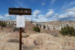
Back to NM 96, then east towards Abiquiú , looking for a place we might hike – nothing.  Then north on US 84 to Ghost Ranch, but we weren’t attracted that day. While enjoying our mid-expedition break overlooking Abiquiú Lake, it occurred to us – return to Plaza Blanca.  Plaza Blanca is a bit hard to find – no signs point the way.  About 3 miles east of the village of Abiquiú, turn north from US 84 onto NM 554.  After crossing the river, turn left on County Road 155, follow the road to the entrance to Dar al Islam. 

The Hike

Plaza Blanca Hike.Pat.2018-03-28

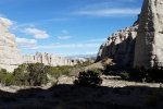
Parking is about .6 miles from County Road 155; you will enjoy some amazing geologic features.  So that became our hike. 

From there, we headed to Española and El Parasol for really good tacos.  Then on towards home, having enjoyed a very nice day in the Land of Enchantment.  

Statistics

Total Distance:  1.66 miles
Elevation: start  6,096 ft, maximum  6,214 ft,  minimum  6,049 ft
Gross gain:  265 ft.  Aggregate  ascending  391 ft, descending  391 ft
Maximum slope: 56% ascending, 54% descending, 7.7% average
Duration: 1:13

GPS Track Files for Download
149 Downloads
93 Downloads
I urge you to explore our hiking tracks with Google Earth. With the virtual 3-dimensional presentation, achieved by panning and tilting the view, you can get a much better idea of the hikes and terrain than you can get from the 2-dimensional screenshot above. For assistance: Using Google Earth Track Files.

Related Posts

Nogales Cliff House Trail Hike – 11/19/2020
Rattlesnake Ridge Trail Hike – 11/19/2020
Plaza Blanca Hike – 3/15/2017

References

AllTrails: Plaza Blanca: Rio Negro Badlands
Trip Advisor: Plaza Blanca
Boarding Pass: Hiking at Plaza Blanca in New Mexico
Narcity: You Can Climb Through Massive White Rock ….

Mesa de Cuba West Hike – 03/25/2018

Back to the Cuba area, to explore a small mesa between Mesa de Cuba and Mesa Chijuilla. As I’ve done for other hikes recently, in the absence of a track someone has published, I began by exploring the area on Google Earth (GE), looking for interesting features (and terrain that is navigable).  Then I sketched a proposed track for our hike; for this one I included an alternate, shorter track.  I then loaded this sketch track into US Topo in my Android/GPS phone to use as a reference during the hike itself.

The Drive In

To get to our starting point for this hike, take US 550 west from Bernalillo to the southern outskirts of Cuba, left onto NM 197 for 5.5 miles, then right through an open gate onto a dirt road.  At about 2 miles. At Y bear left for 1.1 miles, crossing cross Arroyo Chijuilla.  Then turn a hard right up a two track for another mile or so.  Choose your place to park and head east toward what I’m calling Mesa de Cuba West. We angled further northeast on another two-track, until we came to a locked gate, parked there, and embarked on our hike.  (There are other two-tracks in the area, you can check them out on a Topo Map at https://www.listsofjohn.com/mapf?lat=35.9924&lon=-107.0114&z=14&t=u&l=lm&d=y).

The Hike

Mesa de Cuba West Hike.Jay.2018-03-25

We had anticipated that our biggest challenge would be getting up onto (or down from) the mesa top.  From GE and the Topo Maps, it seemed the west side would be most challenging, so we decided on a clockwise hike (based on the Sketch), starting on the west edge of the mesa.  We headed north looking for a place where we might ascend.  A  quarter of mile on we spotted a cow/game path that appeared to head up through a break in the cliff (it happened to be the same place where my reconnoitering with GE and  TOPO that suggested we could ascend).  Those animals figure it out – we were able to get on top with relative ease.

The mesa top is sparsely forested and easy going.  Impressive views, like so many in these parts, are  all around – the other mesas, open spaces, the Nasciementos, and at times Cabezon.  We opted to take the shortened track rather than climbing up to the central ridge of the Mesa; for a future hike.  We continued along the line of the alternate path in the Sketch towards the northeast corner of the mesa, finding and following a nice (old) two-track which made an easy descent into Arroyo Chiluillita where we enjoyed our mid-hike break.  Then it was a 2.25 mile trek around the south end of Mesa de Cuba West back to the truck.  Along the way we crossed a few sometimes deep arroyos coming down from the mesa, later picking up a two-track that made the going easier.

Jay here: Long way back is what I remember most. That and some deep sandy segments that were like walking on a beach. Which is not to say I didn’t enjoy the hike…just that there were times that I had to remind myself why we were out there.

Statistics

Total Distance:  6.54 miles
Elevation: start  6,944 ft, maximum  7,344 ft,  minimum  6,944 ft
Gross gain:  400 ft.  Aggregate ascending  928 ft, descending  927 ft
Maximum slope: 33% ascending, 24% descending, 4.8% average
Duration: 3:59

GPS Track Files for Download
207 Downloads
188 Downloads
347 Downloads
164 Downloads
I urge you to explore our hiking tracks with Google Earth. With the virtual 3-dimensional presentation, achieved by panning and tilting the view, you can get a much better idea of the hikes and terrain than you can get from the 2-dimensional screenshot above. For assistance: Using Google Earth Track Files.

References

New Mexico Magazine:  Badlands Walkabout
The American Southwest: San Juan Basin Badlands
                                                Map of the San Juan Basin Badlands
Jim Caffrey Images Photo Blog: The Other Badlands
AllTrails:  Mesa Chijuilla