This is the next in the string of mesas going west from Mesa de Cuba, after Mesa Chijuilla and Mesa Penistaja. Various sources have described the area as rife with petrified wood – and we were not disappointed. Access is via the same road that we use for Mesa Penistaja, except that we turn to the left onto a two-track that leads to an abandoned oil/gas wellhead.
The Hike
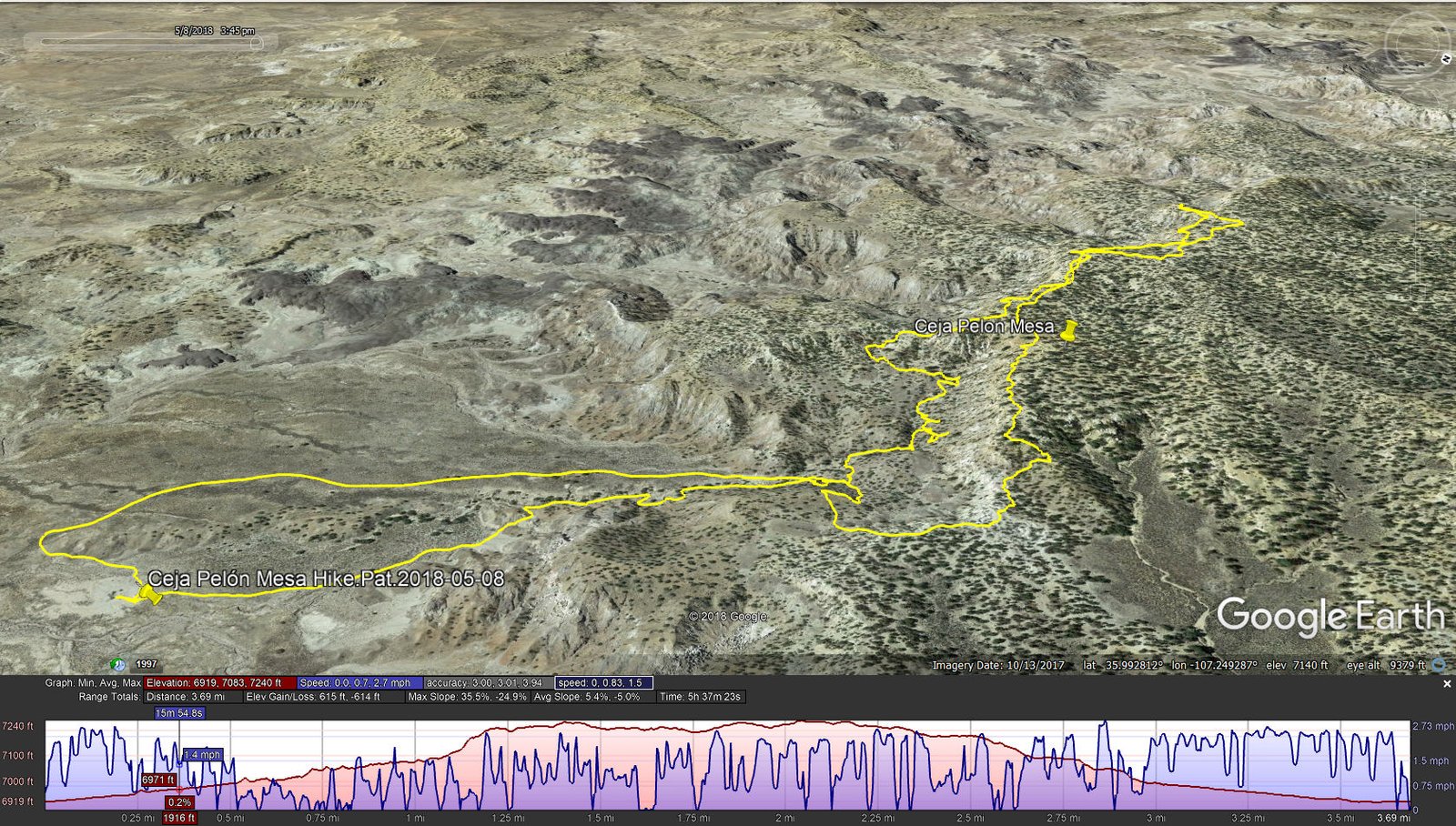
Ceja Pelon Mesa Hike.Pat.2018-05-08
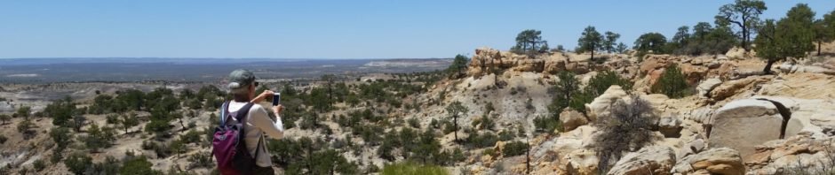
From parking, the first leg is north proceeding up an arroyo towards the edge of Ceja Pelón Mesa. We proceeded west along the base of the mesa, finding many interesting examples of petrified wood, from small “shavings” up to complete logs. The latter were typically partially buried, with the exposed log showing signs of gradual disintegration. About a mile into the hike, we chose to ascend up on top of the Mesa, one of the few places we could get to the top.
Once on top we had marvelous views in all four directions; particularly interesting were the volcanic necks visible on the horizon to the south, in the Rio Puerco valley. Prominent was Cabezon, but also Cerro Cuate and others as well as Mesa Prieta; and on the far horizon the Sandia Mountains. And to the east the Nacimiento and Jemez Mountains. We found more petrified wood and logs atop the mesa as well as a variety of most interesting rock formations. We found a nice pinon tree for shade for our mid-hike break, with a fabulous view across the Badlands, the aforementioned Rio Puerco features, and Mesa Chivato & Mount Taylor.
Finishing up, we retraced our route along the top of the Mesa, continuing eastward (following the route from ASCHG) to descend back to the floor of the Badlands and back to the truck. Simply another wonderful day in the Land of Enchantment.
Statistics
Total Distance: 3.69 miles
Elevation: start 6,919 ft, maximum 7,240 ft, minimum 6,919 ft
Gross gain: 321 ft. Aggregate ascending 615 ft, descending 614 ft
Maximum slope: 36% ascending, 25% descending, 5% average
Duration: 5:37
| GPS Track Files for Download | |
294 Downloads | |
|---|---|
410 Downloads | |
245 Downloads | |
367 Downloads | |
I urge you to explore our hiking tracks with Google Earth. With the virtual 3-dimensional presentation, achieved by panning and tilting the view, you can get a much better idea of the hikes and terrain than you can get from the 2-dimensional screenshot above. For assistance: Using Google Earth Track Files.
References
New Mexico Magazine: Badlands Walkabout
Directory of the 5 badlands near Cuba, NM
PhotoTrek New Mexico: San Juan Basin Badlands
The American Southwest:
San Juan Basin Badlands
Map of the San Juan Basin Badlands
Ceja Pelón Mesa
AllTrails: Caja Pelón
Living Wonderously: Enchanted Excursion
Two Swiss Hikers: Ceja Pelón Mesa
Jim Caffrey Images Photo Blog: The Other Badlands
Arthouse Photography: New Mexico Badlands: Ceja Pelón in color


