Category Archives: Expeditions

Trips that involve both hiking and driveabout.

Bosque del Apache Expedition – 11/24/2020

‘Tis our first visit to Bosque del Apache, heading south as colder temperatures conspire against hiking north of Albuquerque or in the mountains.

The Drive In

Drive south on I-25, through Socorro, exit for San Antonio (Exit 139). Continue east through “downtown” San Antonio, turn right, south on old US Hwy 85. The Visitors Center for Bosque del Apachie is 8 miles down the road (closed when visited due to Covid-19). The entrance is a quarter of a mile further south from the visitors center.

The Hike

Rio Viejo Trail Hike.Pat.2020-11-24

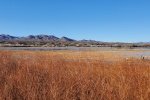
We started with a drive through the north half of the Preserve. The roadway is very wide, clearly to make the driving tour comfortable while one takes in the views. There are a few stopping places with viewing stands offering a good vantage point to look for wildlife. we stopped at a couple of the viewing stands to look out across the marshes. Each time we heard the sounds of sandhill cranes as they come and go in large v-shaped formations to feeding grounds (as far north as Albuquerque). Often we were unable to locate them in the large blue sky above because of the etheral sound of their call.

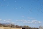
When we got to the northwest corner of the preserve we came across a very large flock of snow geese sitting out in the grain field. We stopped to watch their activity – each 15-20 minutes while we were there the whole flock took flight, circled around the area, and returned to land in a new location – quite a scene.

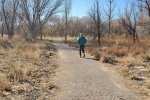
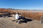
To get in a bit of hiking. we set out on the Rio Viejo Trail. This trail, well groomed with gravel end-to-end, passed through open bosque.  Finishing the hike, we returned to one of the overlooks of the marsh to have lunch.


Statistics (of the hike)

Total Distance:  1.76 miles
Elevation: start  4,512 ft, maximum  4,512 ft,  minimum 4,503 ft
Gross gain: 9 ft.  Aggregate ascending 10 ft, descending 10 ft
Maximum slope: 2% ascending, 1% descending, 0.2 % average
Duration: 0:51

GPS Track Files for Download
75 Downloads
294 Downloads
144 Downloads
246 Downloads
I urge you to explore our hiking tracks with Google Earth. With the virtual 3-dimensional presentation, achieved by panning and tilting the view, you can get a much better idea of the hikes and terrain than you can get from the 2-dimensional screenshot above. For assistance: Using Google Earth Track Files.

References and Resources

US Fish & Wildlife Service: Bosque del Apache
New Mexico True: Bosque del Apache national Wildlife Refuge
AllTrails: Rio Viejo Trail
Friends of Bosque del Apache National Wildlife Refuge
DesertUSA: Bosque del Apache
Wikipedia: Bosque del Apache national Wildlife Refuge
Facebook: Bosque del Apache National Wildlife Refuge


Mesa Prieta Expedition – 03/17/2020

‘Tis an ‘expedition’, planning to drive on roads not yet explored (DriveAbout), with intentions of hiking somewhere along the way.

The Drive In

  • From Albuquerque
    • I-25 to Bernalillo,
    • west on US 550 (20 miles)
    • turn left Cabezon Road, continue through the Ojito Wilderness to Pipeline Road (Cabezon Ts into Pipeline at a pumping station (~13 mile)
    • turn right (northwest) on Pipeline Road (~7.2 miles)
    • turn left on a road that skirts the northern extent of Mesa Prieta to a 3-way intersection (~7 miles)
    • turn right to the intersection with NM 279 (~7 miles)
    • turn right on NM 279 and back to US 550 (~14 miles)

We’re familiar with the drive through Ojito, having enjoyed numerous hikes in the Wilderness. And I had been north on Pipeline some distance but was unsure what lay beyond: it proved to be a Class 4 road (graded dirt, no gravel, high clearance not required, not suitable when any of it is wet). After turning left, to the southwest, the road was much the same. And .. it brought us closer to Mesa Prieta, a place we would like to explore. Luckily, we can upon the two-track that I had spotted in GoogleEarth that appeared to end at the base of the slope up to the Mesa.

So we checked it out, only to find a gate that blocked our path not far off of the road. We turned back and continued southwest on the road. A pickup was following faster than we were driving, so I stopped to let them pass. -They- stopped and during a congenial conversation during which we told them of our interest, they invited us to go through the gate (and a 2nd one) to the tank where the two-track ended. Since this met our wishes, we returned to the two-track, through the gates, and to the tank, from which we made our hike. Note: Checking later on GoogleEarth with the “Surface Ownership” overlay, I discovered that we were on BLM land throughout.

…. Upon returning from the hike, we returned to the road and continued per our plan, through Cañon del Camino (mention in Nasario Garcia’s film “Nasario Remembers the Rio Puerco“) past Cerro Cochino to the intersection (turning left there would lead to the childhood homestead of Nasario Garcio which we visited in 2018). Then north passing other volcanic necks and west of Cabezon, onto NM 279 and on to US 550. There are so many interesting places to be explored – varying topography (per GoogleEarth), canyons, ridges and mesas, so much more. Note: After that first turn off of Pipeline Road, the land is BLM or NM State owned, as was the whole of the hike. Only when one gets near the top of this north slope of Mesa Prieta does it become private land.

The Hike

North Mesa Prieta Hike.Pat.2020-03-17

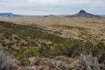
Having received clearance to pass through the gates, we turned back to the turnoff onto the two-track, an easy Class 5, and drove to the “tank”. Donning our packs, we set out  .. uphill on a rocky surface (no trail here to follow). As we ascended the slope, the views from west to east across the Rio Puerco valley were stunning, even on this day with clouds and a hazy atmosphere. We could see volcanic necks all around, small and large (Cabezon), and the northern extent of Chivato Mesa to the west.
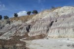
We reached a point where a route further up the slope appeared quite daunting, and we found a rock outcrop above a cliffside that would make a great place for our mid-hike break/lunch – a level ground with a great view. Then we reviewed our options for going down – retrace our steps (steep, rocky surface) or a less steep path down one of the ridges that we could see from that vantage point. We chose the latter, which proved to be an easier route. Reaching the base of the slope, we skirted a -very deep- arroyo (it amazes us to see such deep crevices created by erosion), climbed over a small ridge into another valley. From there it was an easy half mile back to the truck.

Statistics

Total Distance:  1.72 miles
Elevation: start  6,515 ft, maximum  6,882 ft,  minimum  6,567 ft
Gross gain:  825 ft.  Aggregate ascending  579 ft, descending  597 ft
Maximum slope: 32% ascending, 37% descending, 12.3% average
Duration: 3:29

GPS Track Files for Download
188 Downloads
257 Downloads
86 Downloads
154 Downloads

I urge you to explore our hiking tracks with Google Earth. With the virtual 3-dimensional presentation, achieved by panning and tilting the view, you can get a much better idea of the hikes and terrain than you can get from the 2-dimensional screenshot above. For assistance: Using Google Earth Track Files.

Cerro Cuate Expedition – 03/03/2020

This time of year is the best for exploring the Rio Puerco valley. Winter brings snow which make the roads really nasty, and summer is hot (and the monsoon season in late summer often makes roads impassable). So this is the first of more visits we plan to make into this amazing space this spring.

The Drive In

This day’s plan was to take the easiest entrance into the Rio Puerco from Albuquerque: 4o miles west from Bernalillo on US 550, then south (left) on NM 279 (also known as San Louis Road). We had only general ideas for our destination – possibly visit the Guadalupe Ruins or wander west towards the remains the Azabache Stagecoach Station on the old stage line from Milan to Cuba. But as we approached the first volcanic neck, Cerro Cuate, we were intrigued by the idea of visiting it “up close”.

We turned to US Topo to see if we could identify a road or two-track that would permit us to get close enough to hike up on its slopes. We found one that might allow us to get closer. Nope, a quarter of mile off of NM 279 it ended at a corral. Back on NM 279 we were intercepted by a rancher with whom we had a nice conversation, and who wished us well in our pursuit.

We identified another two-track further along NM 279. Again about a quarter of a mile in we encountered a sign: “No Trespassing”; we turned around. Halfway back to NM 279 we were met by another rancher. During a most pleasant conversation we explained our goal and that we had honored the sign. He told us we were welcome to go further but that we would come to the end of the two-track in a mile or less. Having told him we were planning to hike from there, he advised us that we might find it difficult to cross the arroyo. (In the Rio Puerco, these arroyos are channels cut in the soft clay soil, 10 or more feet deep with sheer vertical sides, and often going for many hundreds of yards without a route to cross.) He did add that another two-track, just beyond the –third cattle guard– back on NM 279, might permit us to get closer to Cerro Cuate. We decided to check it out on another day.

The Hike

Cerro Cuate Hike.Pat.2020-03-03
Example of an arroyo found  everywhere in the Rio Puerco.

At home on GoogleEarth, I had identified an unusual feature, a dark circular area that was near our location. I thought it might be a ‘vent’ (there are such vents along US 550 just west of San Ysidro); at least it was a feature of interest. Parking the truck a bit further along NM 276, we set out across the open space with US Topo guiding us accurately to the placemark that I had recorded at home. On the way we came across a smaller of the many arroyos that can interfere with such wanders; this one we could bypass.

A nice spring out in the middle of this wide valley.

Nearing the placemark we discovered that the feature is a spring. It is some 50 feet across with surrounded by reeds (and a few of the tamarisk, an invasive shrub/tree that is present wherever the is some water). The water was quite clear, and there was a small stream flowing from it.  

Sidenote: you will notice in the accompanying photos that mesas surrounded us. And you will see a few of the many volcanic necks that populate this area of the Rio Puerco. In every direction, the views of mesas, necks, and New Mexico’s -blue skies- make for great scenery.

A small adobe cabin not far from the spring.

On the way to the spring, we had noticed what appeared to be a small man-made structure closer to mesa ahead of us. To satisfy our curiosity, we continued  on to find that it is a small rock structure, some walls collapsed; some doors, windows, and some of the roof beams still in place; and .. kitchen cabinets. Hhmm, a kitchen .. it looked like a good place for our mid-afternoon break.

Open kitchen welcoming us for our mid-afternoon break.

We heated water and enjoyed coffee and chocolate de agua, carrot sticks and apples, and peanut butter and jelly on bread from our favorite local baker, Bosque Bakery. We were joined by a group of young cattle, curious if we might have something for them.

Another great outing in the Land of Enchantment.

Statistics

Total Distance:  1.47 miles
Elevation: start  5,950 ft, maximum  5,971 ft,  minimum  5,933 ft
Gross gain:  38 ft.  Aggregate  ascending  102 ft, descending  105 ft
Maximum slope: 11% ascending, 14% descending, 2.3% average
Duration: 1:36

GPS Track Files for Download
141 Downloads
83 Downloads
87 Downloads
79 Downloads
I urge you to explore our hiking tracks with Google Earth. With the virtual 3-dimensional presentation, achieved by panning and tilting the view, you can get a much better idea of the hikes and terrain than you can get from the 2-dimensional screenshot above. For assistance: Using Google Earth Track Files.

Cliff Ruins Expedition – 08/20/2018

Lanny and I had seen a video by Jeff Gilkey flying over Pueblo ruins atop a small mesa, specifically Mesa Pueblo. We located them using GoogleEarth, and headed that way. 

The Drive In

Driving route from Grants to Cliff Ruins.

As you can see from the red track above, we missed a turn or two, found ourselves wandering among the diggings of the nearby coal mine operations, and when the tracks we were following with the GPS and USTopo became -terribly- rough, we aborted the attempt to get to Mesa Pueblo Ruins.

However,  Lanny had a backup – Cliff Ruins.  We located ourselves, and a label on USTopo for “Cliff House”, and judged that we were reasonably close. USTopo also indicated what appeared to be serviceable two-tracks from our position among the mine diggings towards Cliff Ruins.  Along the way Nearing the site, it appeared P1000349that we needed to turn off of the “good two-track”, onto one we could barely follow.  That brought us to a point adjacent to the site as indicated on USTopo; a short walk to the west and we were at the edge of White Mesa, looking into Cliff Dwelling Canyon. 

The Walkabout

Walkabout on the mesa overlooking Cliff Ruins.

P1000352Walking around the edge of this canyon brought into view the Cliff Ruins, perched on a large ledge under a ceiling midway up the cliff face. We noted that the House appeared to be in excellent condition, walls almost all intact and the corners square; some fine workmanship.  We could not see any reasonable path to ascend from the canyon floor to the House. 

Returning the Lanny’s Jeep, we were impressed wiP1000368th the view across the Rio Miguel to Chivato Mesa and Cabezon.  Heading back towards Grants, Lanny chose an alternate two-track which P1000372to our surprise brought us to what appeared to be an old ranch-stead.  We found a corral with stables (rock walls still standing) and what may have been an abode, with the fireplace still standing.   

GPS Track Files for Download
437 Downloads
84 Downloads
100 Downloads
83 Downloads
I urge you to explore our hiking tracks with Google Earth. With the virtual 3-dimensional presentation, achieved by panning and tilting the view, you can get a much better idea of the hikes and terrain than you can get from the 2-dimensional screenshot above. For assistance: Using Google Earth Track Files.

References:

Google Maps: Cliff Dwelling Canyon

FOLLOWUP NOTES:

From a set of comments regarding my posting of photos, “Ranch House and Stables, Rio Puerco Valley“, on Facebook’s group “Abandoned in New Mexico“, March 17, 2019:

“John Cortesy – That looks like one of the old stage coach stops on the route from Milan to Cuba. If you followed the road through the ranches, you passed a dry arroyo with a rock outcropping on the right that was a place where they watered the horses when it was flowing. The passengers would get out of the coach and carve their names and dates into the rocks above. We had taggers back in 1905 and 1897 if I remember the dates correctly. Can’t trust no one to not deface a property these days!”
“George Young – Thanks, John, for adding that information. Your suggestion would certainly make sense to me; the stable (building and fencing) appears to be more than one would use for a ranch. And I see on GoogleEarth that it is on a line from Milan to Cuba. I see also on a topo map that “El Dado Springs” is very close by. It might be worth another trip for us. From which direction did you describe the location of the “tagging”? Do you know of any more features, etc. of that stage line?”
 

Mesa Chijuilla Expedition – 02/20/2015

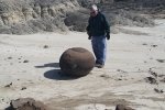
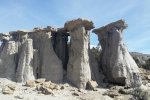
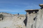
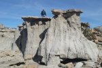
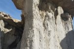
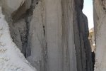
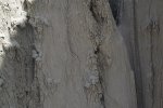
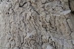
Vince and I went ‘wandering’ beyond Mesa de Cuba in the San Juan Badlands.  This “expedition” (multiple hikes) began with exploration of the east side of Mesa Chijuilla.  We then checked out another area with interesting features some 3 miles southwest of the first hike.  As you will see in the photos below, we encountered some interesting geologic features: strange rocks, hoodoos, vertical erosion patterns, and more. [This is a retro-post (June 2018), an expedition with Vince back in 2015.]

The Hikes

Mesa Chijuilla Expedition.Vince.2015-02-20.#1
Mesa Chijuilla Expedition.Vince.2015-02-20.#2

Statistics

Hike #1
Total Distance:  1.90 miles
Elevation: start 7,091 ft,, maximum 7,205 ft, minimum 7,205
ft Gross gain:  114 ft, Aggregate ascending  341 ft, descending  343 ft
Maximum slope: 26% ascending, 29% descending, 6% average
Duration: 1:45

Hike #2
Total Distance:  1.12
Elevation: start 6,915 ft,, maximum 6,979 ft, minimum 6,915 ft
Gross gain:  64 ft, Aggregate  ascending  308 ft, descending  308 ft
Maximum slope: 37% ascending, 30% descending, 8% average
Duration: 1:23

GPS Track Files for Download
72 Downloads
68 Downloads
279 Downloads
71 Downloads
I urge you to explore our hiking tracks with Google Earth. With the virtual 3-dimensional presentation, achieved by panning and tilting the view, you can get a much better idea of the hikes and terrain than you can get from the 2-dimensional screenshot above. For assistance: Using Google Earth Track Files.

References

New Mexico Magazine: Badlands Walkabout
AllTrails: Mesa Chijuilla

Plaza Blanca Expedition – 03/28/2018

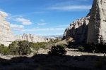
This was a road trip combined with a hike in Northern New Mexico.  The road trip component was to drive around the perimeter of the Jemez Mountains – San Ysidro, Cuba, Regina, Abiquiú , Española , Santa Fe, and return to Albuquerque.  For the hike component, we intended to visit the Nogales Cliff House, ruins of the Gallina people dating from 1100 AD to about 1275 AD. 

The Expedition

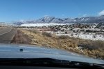
On our way towards Cuba, we enjoyed beautiful scenery – snow from the night before highlighting the Nasciemento Mountains all along US 550 to Cuba.  We thought this might not bode well for the intended visit to Nogales Cliff House.  Sure enough, after a pleasant drive out of Cuba on NM 96 and NM 112, we found that the dirt road, County Road 5, was still wet from the snow.  We gave it a try, but found ourselves nearly stuck in the super-slick wet clay.  It was time to back out and find a Plan B for hiking.

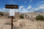
Back to NM 96, then east towards Abiquiú , looking for a place we might hike – nothing.  Then north on US 84 to Ghost Ranch, but we weren’t attracted that day. While enjoying our mid-expedition break overlooking Abiquiú Lake, it occurred to us – return to Plaza Blanca.  Plaza Blanca is a bit hard to find – no signs point the way.  About 3 miles east of the village of Abiquiú, turn north from US 84 onto NM 554.  After crossing the river, turn left on County Road 155, follow the road to the entrance to Dar al Islam. 

The Hike

Plaza Blanca Hike.Pat.2018-03-28

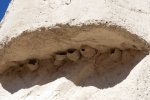
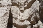
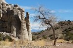
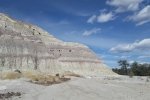
Parking is about .6 miles from County Road 155; you will enjoy some amazing geologic features.  So that became our hike. 

From there, we headed to Española and El Parasol for really good tacos.  Then on towards home, having enjoyed a very nice day in the Land of Enchantment.  

Statistics

Total Distance:  1.66 miles
Elevation: start  6,096 ft, maximum  6,214 ft,  minimum  6,049 ft
Gross gain:  265 ft.  Aggregate  ascending  391 ft, descending  391 ft
Maximum slope: 56% ascending, 54% descending, 7.7% average
Duration: 1:13

GPS Track Files for Download
149 Downloads
93 Downloads
I urge you to explore our hiking tracks with Google Earth. With the virtual 3-dimensional presentation, achieved by panning and tilting the view, you can get a much better idea of the hikes and terrain than you can get from the 2-dimensional screenshot above. For assistance: Using Google Earth Track Files.

Related Posts

Nogales Cliff House Trail Hike – 11/19/2020
Rattlesnake Ridge Trail Hike – 11/19/2020
Plaza Blanca Hike – 3/15/2017

References

AllTrails: Plaza Blanca: Rio Negro Badlands
Trip Advisor: Plaza Blanca
Boarding Pass: Hiking at Plaza Blanca in New Mexico
Narcity: You Can Climb Through Massive White Rock ….

Bonita Canyon & Flourite Mine Expedition – 6/13/2016

The objective of this expedition was to drive through this northeastern part of the Zuni mountains, destination a mine from many years ago that produced flourite.  These mountains are quite different from the Sandia, Manzano, and Jemez ranges – they consist of many ridges and valleys, and an open forest of pinon and juniper with some ponderosa.  (I was pleasantly surprised as we approached NM 53 to recognize the south end of Bonita Canyon, were I came to gather firewood 30+ years ago – this is a beautiful canyon.)

The Drive In

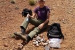
Rock Hunting, Flourite Mine drive in from Grants, via Bonita Canyon;  Pat, Linda, & Lanny, 06/13/2016.  Also showing other possible mine sites.

Turn of NM 53 onto a dirt road (high clearance advised); 1.2 miles ahead will be an area to park.  Then head east about .4 miles where the small mine sits just over a rise.  It was easy to find scraps of rock with flourite embedded.

The Hunt

Rock Hunting, Flourite Mine; Pat, Linda, & Lanny, 06/13/2016.

I found through further online research that there are close to 20 mines or prospects in this section of the Zuni Mountains – see the Interactive Map in the References below.

Statistics

Total Distance: 0.93 miles
Elevation: 7,681 start, 7,681 maximum, 7,511 minimum
Gross gain: 170 ft.  Aggregate ascending 349 ft, descending: 349 ft
Maximum slope: 38% ascending, 43% descending, 13% average
Duration: 1:36

GPS Track Files for Download
124 Downloads
165 Downloads
131 Downloads
209 Downloads