This time of year is the best for exploring the Rio Puerco valley. Winter brings snow which make the roads really nasty, and summer is hot (and the monsoon season in late summer often makes roads impassable). So this is the first of more visits we plan to make into this amazing space this spring.
The Drive In
This day’s plan was to take the easiest entrance into the Rio Puerco from Albuquerque: 4o miles west from Bernalillo on US 550, then south (left) on NM 279 (also known as San Louis Road). We had only general ideas for our destination – possibly visit the Guadalupe Ruins or wander west towards the remains the Azabache Stagecoach Station on the old stage line from Milan to Cuba. But as we approached the first volcanic neck, Cerro Cuate, we were intrigued by the idea of visiting it “up close”.
We turned to US Topo to see if we could identify a road or two-track that would permit us to get close enough to hike up on its slopes. We found one that might allow us to get closer. Nope, a quarter of mile off of NM 279 it ended at a corral. Back on NM 279 we were intercepted by a rancher with whom we had a nice conversation, and who wished us well in our pursuit.
We identified another two-track further along NM 279. Again about a quarter of a mile in we encountered a sign: “No Trespassing”; we turned around. Halfway back to NM 279 we were met by another rancher. During a most pleasant conversation we explained our goal and that we had honored the sign. He told us we were welcome to go further but that we would come to the end of the two-track in a mile or less. Having told him we were planning to hike from there, he advised us that we might find it difficult to cross the arroyo. (In the Rio Puerco, these arroyos are channels cut in the soft clay soil, 10 or more feet deep with sheer vertical sides, and often going for many hundreds of yards without a route to cross.) He did add that another two-track, just beyond the –third cattle guard– back on NM 279, might permit us to get closer to Cerro Cuate. We decided to check it out on another day.
The Hike
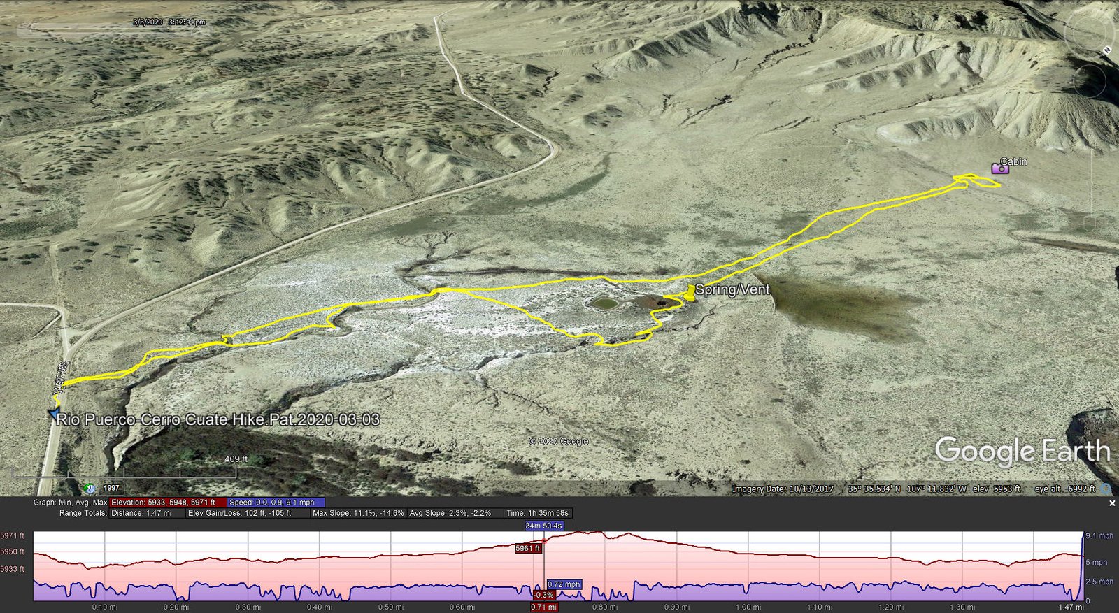
Cerro Cuate Hike.Pat.2020-03-03
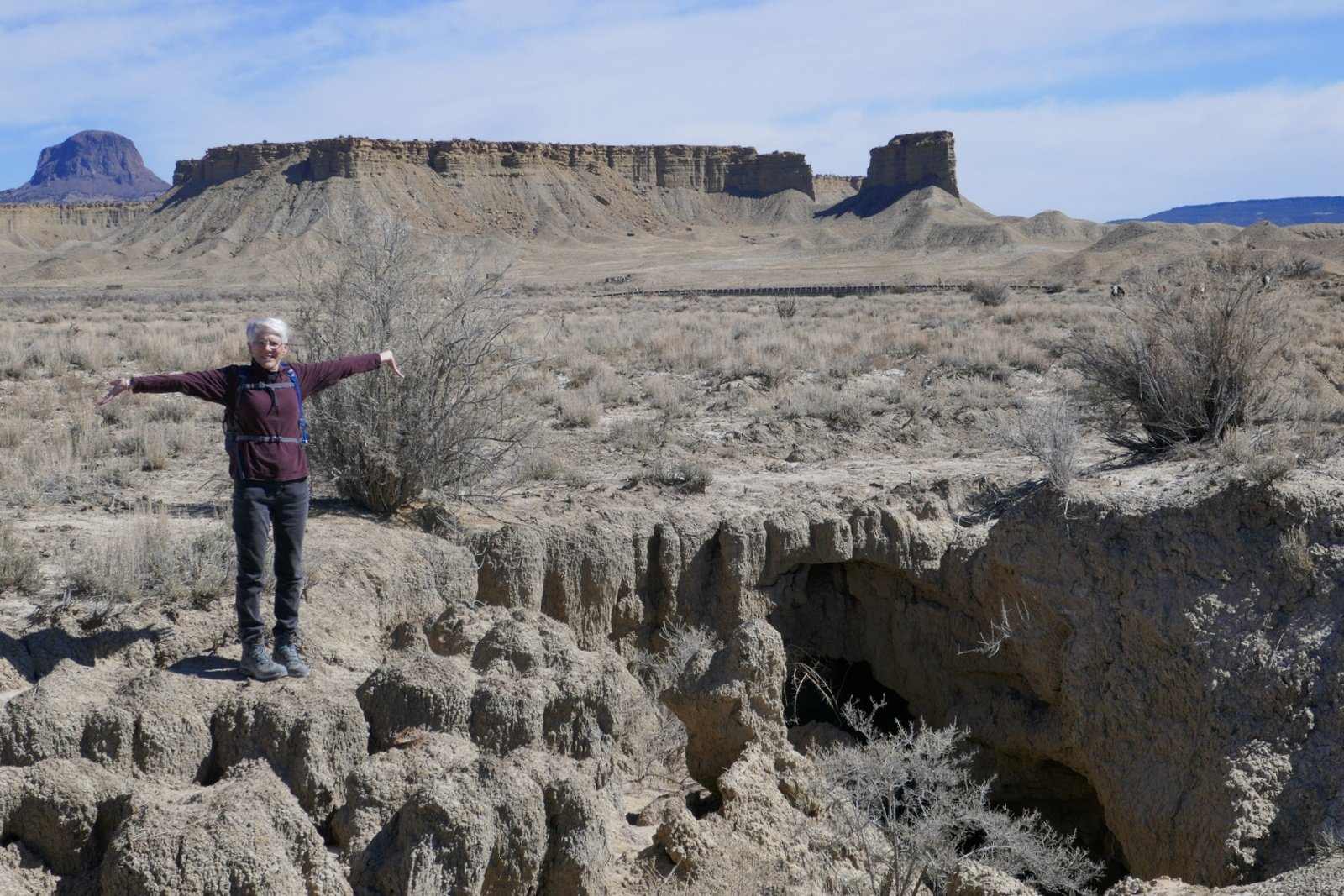
Example of an arroyo found everywhere in the Rio Puerco.
At home on GoogleEarth, I had identified an unusual feature, a dark circular area that was near our location. I thought it might be a ‘vent’ (there are such vents along US 550 just west of San Ysidro); at least it was a feature of interest. Parking the truck a bit further along NM 276, we set out across the open space with US Topo guiding us accurately to the placemark that I had recorded at home. On the way we came across a smaller of the many arroyos that can interfere with such wanders; this one we could bypass.
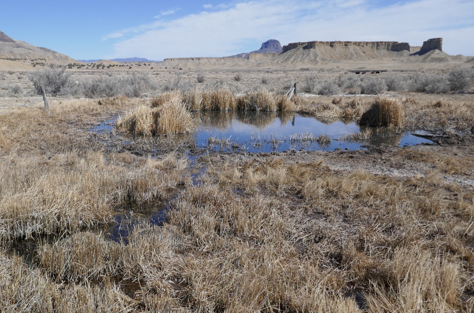
A nice spring out in the middle of this wide valley.
Nearing the placemark we discovered that the feature is a spring. It is some 50 feet across with surrounded by reeds (and a few of the tamarisk, an invasive shrub/tree that is present wherever the is some water). The water was quite clear, and there was a small stream flowing from it.
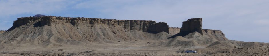
Sidenote: you will notice in the accompanying photos that mesas surrounded us. And you will see a few of the many volcanic necks that populate this area of the Rio Puerco. In every direction, the views of mesas, necks, and New Mexico’s -blue skies- make for great scenery.
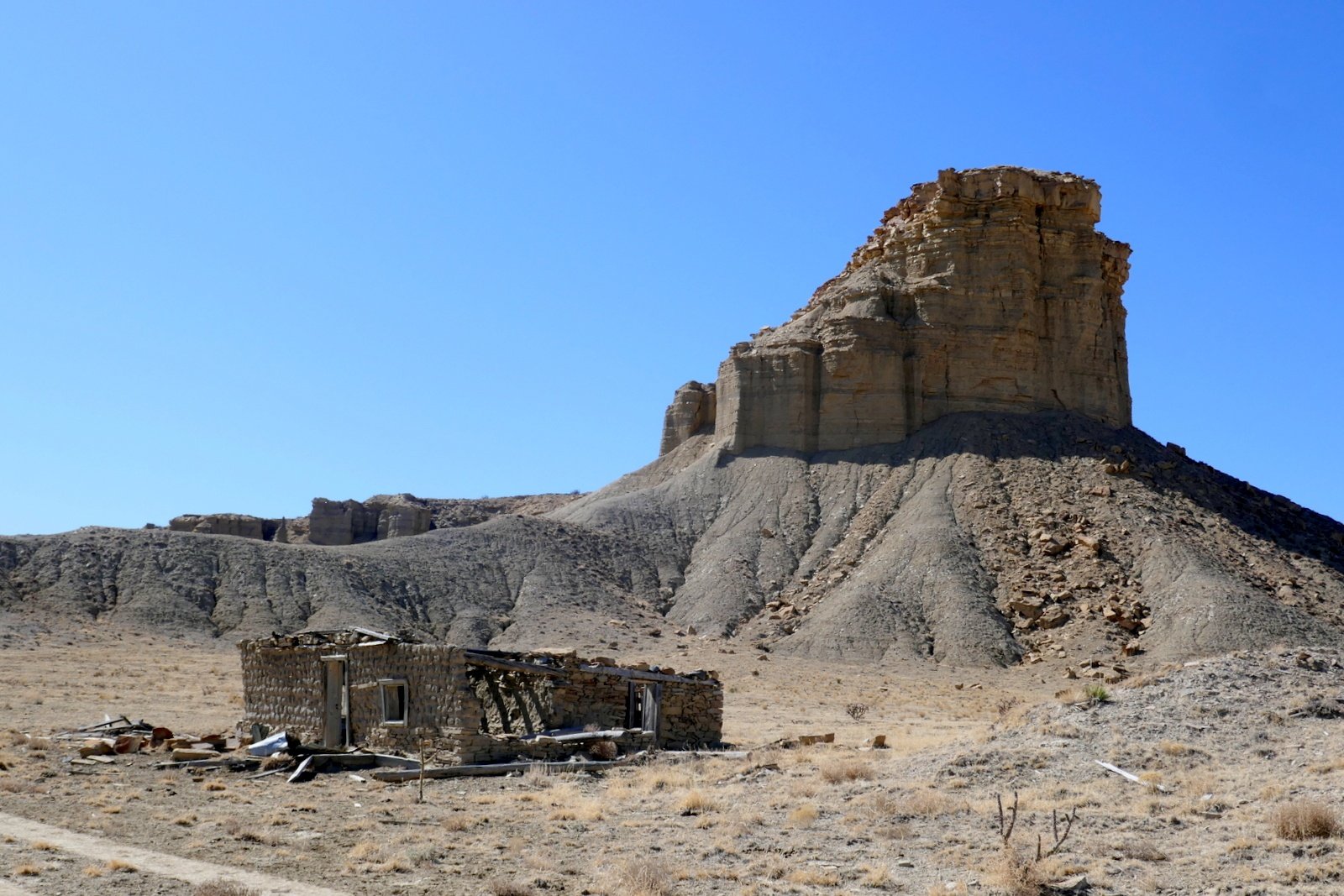
A small adobe cabin not far from the spring.
On the way to the spring, we had noticed what appeared to be a small man-made structure closer to mesa ahead of us. To satisfy our curiosity, we continued on to find that it is a small rock structure, some walls collapsed; some doors, windows, and some of the roof beams still in place; and .. kitchen cabinets. Hhmm, a kitchen .. it looked like a good place for our mid-afternoon break.
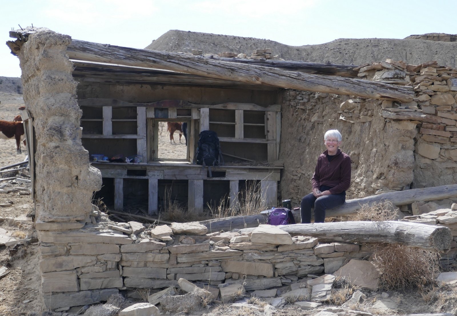
Open kitchen welcoming us for our mid-afternoon break.
We heated water and enjoyed coffee and chocolate de agua, carrot sticks and apples, and peanut butter and jelly on bread from our favorite local baker, Bosque Bakery. We were joined by a group of young cattle, curious if we might have something for them.
Another great outing in the Land of Enchantment.
Statistics
Total Distance: 1.47 miles
Elevation: start 5,950 ft, maximum 5,971 ft, minimum 5,933 ft
Gross gain: 38 ft. Aggregate ascending 102 ft, descending 105 ft
Maximum slope: 11% ascending, 14% descending, 2.3% average
Duration: 1:36
| GPS Track Files for Download | |
248 Downloads | |
|---|---|
189 Downloads | |
191 Downloads | |
193 Downloads | |
I urge you to explore our hiking tracks with Google Earth. With the virtual 3-dimensional presentation, achieved by panning and tilting the view, you can get a much better idea of the hikes and terrain than you can get from the 2-dimensional screenshot above. For assistance: Using Google Earth Track Files.


