‘Tis an ‘expedition’, planning to drive on roads not yet explored (DriveAbout), with intentions of hiking somewhere along the way.
The Drive In
- From Albuquerque
- I-25 to Bernalillo,
- west on US 550 (20 miles)
- turn left Cabezon Road, continue through the Ojito Wilderness to Pipeline Road (Cabezon Ts into Pipeline at a pumping station (~13 mile)
- turn right (northwest) on Pipeline Road (~7.2 miles)
- turn left on a road that skirts the northern extent of Mesa Prieta to a 3-way intersection (~7 miles)
- turn right to the intersection with NM 279 (~7 miles)
- turn right on NM 279 and back to US 550 (~14 miles)
We’re familiar with the drive through Ojito, having enjoyed numerous hikes in the Wilderness. And I had been north on Pipeline some distance but was unsure what lay beyond: it proved to be a Class 4 road (graded dirt, no gravel, high clearance not required, not suitable when any of it is wet). After turning left, to the southwest, the road was much the same. And .. it brought us closer to Mesa Prieta, a place we would like to explore. Luckily, we can upon the two-track that I had spotted in GoogleEarth that appeared to end at the base of the slope up to the Mesa.
So we checked it out, only to find a gate that blocked our path not far off of the road. We turned back and continued southwest on the road. A pickup was following faster than we were driving, so I stopped to let them pass. -They- stopped and during a congenial conversation during which we told them of our interest, they invited us to go through the gate (and a 2nd one) to the tank where the 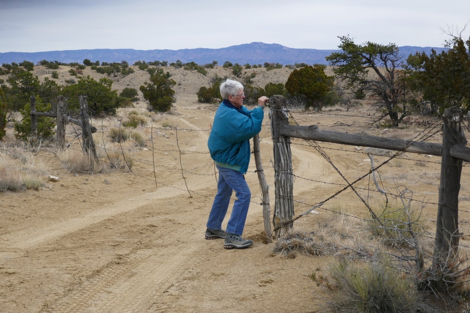 two-track ended. Since this met our wishes, we returned to the two-track, through the gates, and to the tank, from which we made our hike. Note: Checking later on GoogleEarth with the “Surface Ownership” overlay, I discovered that we were on BLM land throughout.
…. Upon returning from the hike, we returned to the road and continued per our plan, through Cañon del Camino (mention in Nasario Garcia’s film “Nasario Remembers the Rio Puerco“) past Cerro Cochino to the intersection (turning left there would lead to the childhood homestead of Nasario Garcio which we visited in 2018). Then north passing other volcanic necks and west of Cabezon, onto NM 279 and on to US 550. There are so many interesting places to be explored – varying topography (per GoogleEarth), canyons, ridges and mesas, so much more. Note: After that first turn off of Pipeline Road, the land is BLM or NM State owned, as was the whole of the hike. Only when one gets near the top of this north slope of Mesa Prieta does it become private land.
The Hike
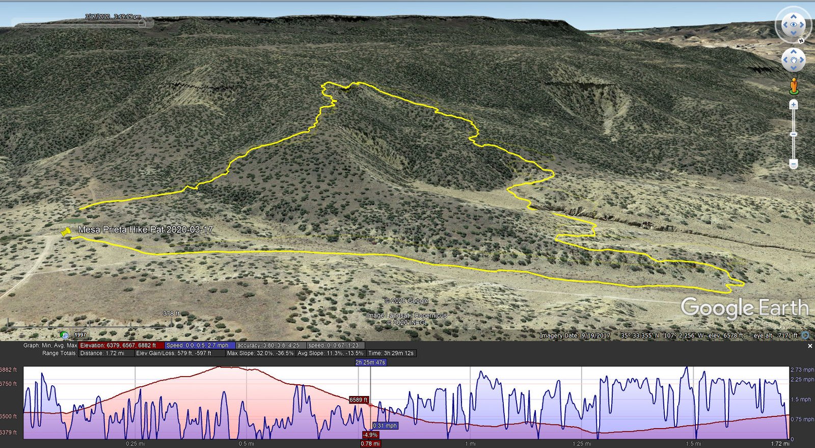
North Mesa Prieta Hike.Pat.2020-03-17
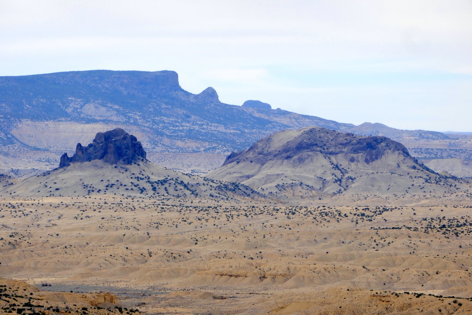 Having received clearance to pass through the gates, we turned back to the turnoff onto the two-track, an easy Class 5, and drove to the “tank”. Donning our packs, we set out .. uphill on a rocky surface (no trail here to follow). As we ascended the slope, the views from west to east across the Rio Puerco valley were stunning, even on this day with clouds and a hazy atmosphere. We could see volcanic necks all around, small and large (Cabezon), and the northern extent of Chivato Mesa to the west.
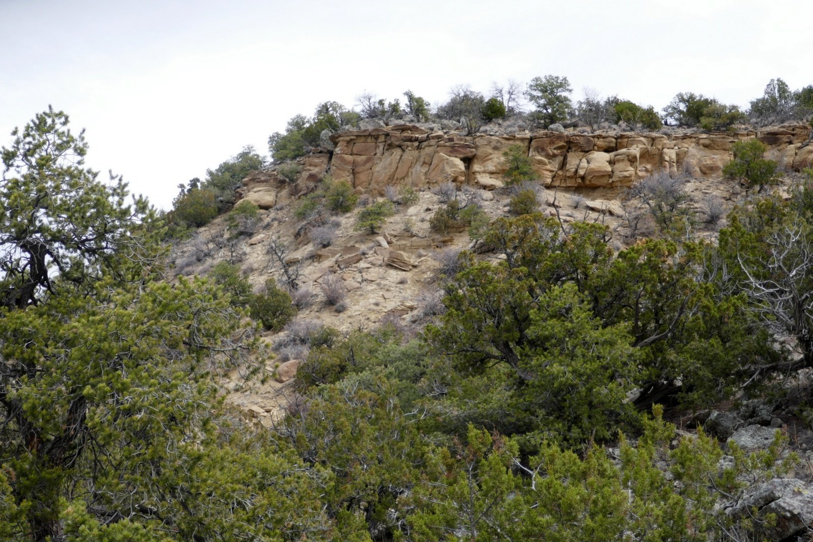 We reached a point where a route further up the slope appeared quite daunting, and we found a rock outcrop above a cliffside that would make a great place for our mid-hike break/lunch – a level ground with a great view. Then we reviewed our options for going down – retrace our steps (steep, rocky surface) or a less steep path down one of the ridges that we could see from that vantage
 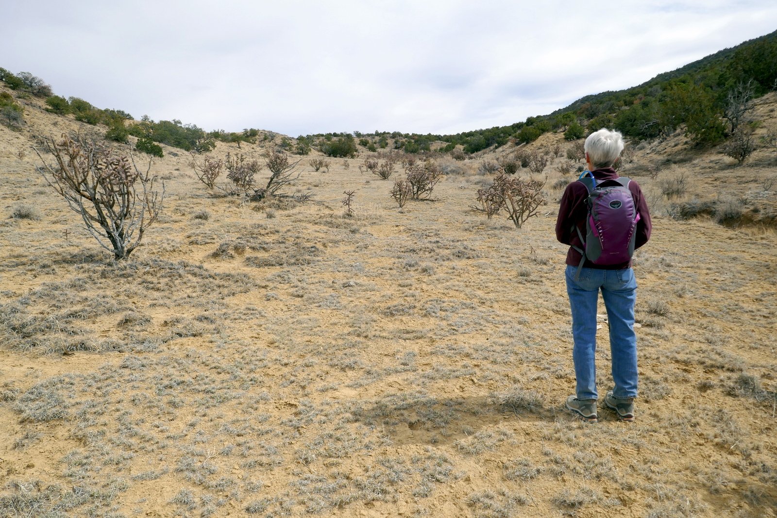 point. We chose the latter, which proved to be an easier route. Reaching the base of the slope, we skirted a -very deep- arroyo (it amazes us to see such deep crevices created by erosion), climbed over a small ridge into another valley. From there it was an easy half mile back to the truck.
Statistics
Total Distance: 1.72 miles
Elevation: start 6,515 ft, maximum 6,882 ft, minimum 6,567 ft
Gross gain: 825 ft. Aggregate ascending 579 ft, descending 597 ft
Maximum slope: 32% ascending, 37% descending, 12.3% average
Duration: 3:29
| GPS Track Files for Download | |
296 Downloads | |
|---|---|
365 Downloads | |
187 Downloads | |
266 Downloads | |
I urge you to explore our hiking tracks with Google Earth. With the virtual 3-dimensional presentation, achieved by panning and tilting the view, you can get a much better idea of the hikes and terrain than you can get from the 2-dimensional screenshot above. For assistance: Using Google Earth Track Files.


.")