Category Archives: 2016

Puye Tour – 01/25/2016

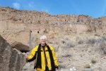
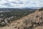
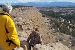
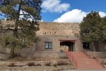
This was a day trip out of Albuquerque, with lunch in Santa Fe on the way to Puye.  After checking in with the Welcome Center on NM 30, we were directed up to the Visitor’s Center below ruins site.  Since there had been snow recently, we rode up to the top of the mesa with our guide in a 4-wheel drive vehicle.  

The Hike

Puye Tour.Pat.2016-01-25

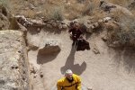
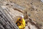
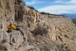
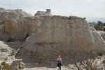
The ruins on top of the mesa are extensive, as one can see on Google Earth.  The guide made the visit more interesting by relating some of the history of these ruins and the Pueblo people related to the site.  We descended down the face of the cliff on ladders and a path, and visited some of the many caves carved into the pumice ejected from the Jemez volcano that forms the mesa.  We found the visit to be worth the trip.

Statistics

Total Distance:  0.50 miles
Elevation: start 7,070 ft, maximum 7,070 ft,  minimum 6,873ft
Gross gain: NAft.  Aggregate ascending NA ft, descending 197 ft
Maximum slope: NA% ascending, 75% descending, 8% average
Duration: 0:45

The track shows only part of our tour.  We got on top of the mesa with a tour bus.  The track then records our tour of the mesa top and then back down to the visitor’s center.  

GPS Track Files for Download
104 Downloads
68 Downloads
I urge you to explore our hiking tracks with Google Earth. With the virtual 3-dimensional presentation, achieved by panning and tilting the view, you can get a much better idea of the hikes and terrain than you can get from the 2-dimensional screenshot above. For assistance: Using Google Earth Track Files.

References

Puye Cliff Site: Puye Cliff Dwellings
Hanksville.org: Puye Cliff Dwellings
New Mexico Nomad: Puye Cliff Dwellings
Legends of America:
     Puye Cliff Dwllings – Ancestral Home of the Santa Clara Indians
Piedra Lisa North Hike – 02/14/2016

The snow had gone, but there was still ice down in the shady sections of the canyon.  ‘Twas a good hike, nice cool temperature.
The Hike

Piedra Lisa Hike.Jay.2016-02-14

Statistics

Total Distance:  1.50 miles
Elevation: start 6,017 ft, maximum 6,509 ft,  minimum 6,017 ft
Gross gain: 492 ft.  Aggregate ascending 604 ft, descending 706 ft
Maximum slope: 57% ascending, 51% descending, 14% average
Duration: 1:11

GPS Track Files for Download
228 Downloads
53 Downloads
If you haven’t explored these hiking tracks with Google Earth, I urge you to try it. With the virtual 3-dimensional presentation, achieved by panning and tilting the view, you can get a much better idea of the hikes and terrain than you can get from the screenshot above. For some ideas, check out  Using Google Earth Track Files.

Foothills-Copper Trailhead Hike- 03/31/2016

A retro-post.

The Hike

Copper Trailhead.Pat.2016-03-31

Statistics

Total Distance:  2.06 miles
Elevation: start 5,926 ft, maximum 6,202 ft,  minimum 5,926 ft
Gross gain: 76 ft.  Aggregate ascending 439 ft, descending: 440 ft
Maximum slope: 30% ascending, 37% descending, 7% average
Duration: 0:47

GPS Track Files for Download
108 Downloads
183 Downloads
I urge you to explore our hiking tracks with Google Earth. With the virtual 3-dimensional presentation, achieved by panning and tilting the view, you can get a much better idea of the hikes and terrain than you can get from the 2-dimensional screenshot above. For assistance: Using Google Earth Track Files.

Mesita Blanca Expedition – 03/08/2016

An after-the-fact post of this hike that Pat and I made before I started the BLOG.

The Hike

Mesita Blanca Expedition.Pat.2016-03-08

Statistics

Total Distance:  1.39 miles
Elevation: start 5,845 ft, maximum 5,906 ft,  minimum 5,906 ft
Gross gain: 61 ft.  Aggregate ascending 251 ft, descending: 251 ft
Maximum slope: 32% ascending, 37% descending, 7% average
Duration: 1:24

GPS Track Files for Download
295 Downloads
133 Downloads
I urge you to explore our hiking tracks with Google Earth. With the virtual 3-dimensional presentation, achieved by panning and tilting the view, you can get a much better idea of the hikes and terrain than you can get from the 2-dimensional screenshot above. For assistance: Using Google Earth Track Files.

Foothills-Copper Trailhead Hike- 04/02/2016

An afternoon hike, just to get outdoors.  ‘Tis wonderful to have such scenic surroundings with easy trails at the very outskirts of the city.

The Hike

Copper Trailhead.Pat.2016-04-02

Statistics

Total Distance:  2.09 miles
Elevation: start 5,924 ft, maximum 6,219 ft,  minimum 5,924 ft
Gross gain: 295 ft.  Aggregate ascending 517 ft, descending: 533 ft
Maximum slope: 29% ascending, 43% descending, 8% average
Duration: 0:59

GPS Track Files for Download
159 Downloads
122 Downloads
I urge you to explore our hiking tracks with Google Earth. With the virtual 3-dimensional presentation, achieved by panning and tilting the view, you can get a much better idea of the hikes and terrain than you can get from the 2-dimensional screenshot above. For assistance: Using Google Earth Track Files.

References

City of Albuquerque: Sandia Foothills Open Space
City of Albuquerque: Copper Trailhead Map (pdf)

La Mesita Blanca Hike – 03/12/2016

Flora for this hike: Winter colors: scrub oak, pinon, and juniper.

Headed off in a different direction today, into the Rio Puerco valley from the south, off of I-40.  Destination – La Mesita Blanca, where Pat and had visited a year ago.  On that trip, we found the road was blocked by a washout, so that day we followed a two-track to what I now know was just the southern corner of this formation.  Today, we found that there is a lot more.

The Drive In

The road from I-40 is paved for the first 5 miles or so, until one is abreast of the village of To’Hajiilee; it then changes to a really good gravel/dirt surface.  The washout area Pat & I encountered is another 7.4 miles from the end of pavement; today Jay and I proceeded beyond the washout another 1.1 miles on the road, then took a two-track to the right, approaching the base the eastern edge of La Mesita Blanca.  

The Hike

Mesita Blanca Hike.Jay.2016-03-12

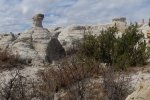
We then proceeded along the base of the mesa, continuing along the western face for about a mile.  We were enjoying so many different and interesting geologic features – different types of rock, different shapes, varying colors and patterns – so many curiosities; oh, to have a geologist accompanying us.

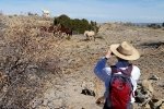
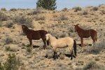
This is unusual, but .. Fauna for this hike: A small herd of horses. The white one on the ridge was clearly the “master of the herd”. He kept his eye on us, staying on the high ground, as the others went ahead, until they were out of site.

Thinking we may have gone far enough for today, finding ourselves near the end of the cliff, we saw a route the allowed us to ascend onto the top of the mesa.  From that vantage point, looking east, we saw that there is much more to explore here at La Mesita Blanca. Although vehicle tracks on the mesa top suggested that we could continue south and be able to descend to the car, we didn’t have time to explore that possibility so we returned along the route by which we had come.

Jay here: This was a unique hike for many reasons, but most of all because I had never been hiking beyond West Mesa on the far western side of Albuquerque. Also, we were hiking on the Canoncito Navajo reservation heading towards a white rock mesa that looked very far away when viewed from Interstate 40. There’s more to explore here when time permits but not a hike you would want to do in summer heat.

Statistics

Total Distance:  2.67 miles
Elevation: start 5,930 ft , maximum 6,075 ft,  minimum 5,905 ft
Gross gain: 170 ft.  Aggregate ascending 509 ft, descending: 509 ft
Maximum slope: 41% ascending, 32% descending, 7% average
Duration: 1:45

GPS Track Files for Download
140 Downloads
133 Downloads
If you haven’t explored these hiking tracks with Google Earth, I urge you to try it. With the virtual 3-dimensional presentation, achieved by panning and tilting the view, you can get a much better idea of the hikes and terrain than you can get from the screenshot above. For some ideas, check out  Using Google Earth Track Files.

File for Interactive Topo from Gmap4: Mesita Blanca Hike.Jay.2016-03-12

Bonita Canyon & Flourite Mine Expedition – 6/13/2016

The objective of this expedition was to drive through this northeastern part of the Zuni mountains, destination a mine from many years ago that produced flourite.  These mountains are quite different from the Sandia, Manzano, and Jemez ranges – they consist of many ridges and valleys, and an open forest of pinon and juniper with some ponderosa.  (I was pleasantly surprised as we approached NM 53 to recognize the south end of Bonita Canyon, were I came to gather firewood 30+ years ago – this is a beautiful canyon.)

The Drive In

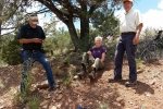
Rock Hunting, Flourite Mine drive in from Grants, via Bonita Canyon;  Pat, Linda, & Lanny, 06/13/2016.  Also showing other possible mine sites.

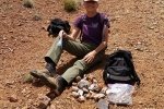
Turn of NM 53 onto a dirt road (high clearance advised); 1.2 miles ahead will be an area to park.  Then head east about .4 miles where the small mine sits just over a rise.  It was easy to find scraps of rock with flourite embedded.

The Hunt

Rock Hunting, Flourite Mine; Pat, Linda, & Lanny, 06/13/2016.

I found through further online research that there are close to 20 mines or prospects in this section of the Zuni Mountains – see the Interactive Map in the References below.

Statistics

Total Distance: 0.93 miles
Elevation: 7,681 start, 7,681 maximum, 7,511 minimum
Gross gain: 170 ft.  Aggregate ascending 349 ft, descending: 349 ft
Maximum slope: 38% ascending, 43% descending, 13% average
Duration: 1:36

GPS Track Files for Download
124 Downloads
166 Downloads
132 Downloads
210 Downloads

Flying with Lanny – Los Lunas to Chaco Canyon – 12/19/2016

‘Tho this BLOG in about hiking, it is also about seeing New Mexico.  And flying is a superb way to see more if it, if not so close at hand.  And it is a great way to identify places to explore on the ground.

The Flight

Flight-Los Lunas to Chaco Canyon.Lanny.2016-12-19

It was a beautiful, clear, sunny day, with light winds, a great day to go flying. Asked where I’d like to go, I said “northwest”.  Lanny replied “Cbaco Canyon?”; “sure” I responded.

Out of Mid Valley Airport, we climbed to 10,500 feet, high enough to clear Chivato Mesa. Continuing west, from the left seat I had a wonderful view of the nearly 40 mile long Chaco Mesa the many canyons that penetrate north from the mesa edge into the mesa.  This appears to be very attractive area for exploring.  The Mesa ends at Chaco Canyon, where we “toured” the ruins of this National Monument from 2,000 feet above the mesas surrounding the canyon; see the photos below.  Then it was back across Chivato Mesa to another fine landing at Mid Valley.

Statistics

Total Distance: 240 miles
Elevation: 4,692 start, 10,841 maximum, 4,692 minimum
Gross gain: 6,149 ft.  Aggregate ascending 25,191 ft, descending: 25,106 ft
Maximum slope: 32% ascending, 37% descending, 3% average
Duration: 1:59

If you haven’t explored these hiking tracks with Google Earth, I urge you to try it. With the virtual 3-dimensional presentation, achieved by panning and tilting the view, you can get a much better idea of the hikes and terrain than you can get from the screenshot above. For some ideas, check out  Using Google Earth Track Files.

SPECIAL NOTE: With the features of Google Earth, you can see the actual flight path, including altitude above the ground.

GPS Track Files for Download
189 Downloads
56 Downloads

Addendum, 5/16/2017: Tried something interesting, matching up a photo taken during the flight with a view using Google Earth.  I’ve added a screen shot from Google Earth to the Photo Gallery below.  And here is the .kml file that matches up with photo of Chaco Mesa (the 9th of the photos in the Gallery): Chaco Mesa Looking East.

El Cerrito Walkabout – 12/18/2016

Went today to El Cerrito del Llano, where Pat & I are building our straw bale cabin.  

The Hike

El Cerrito Walkabout.Jay.2016-12-18

To make it a “hike”, Jay & I walked the perimeter of our “El Cerrito”.  Snow had fallen the day before, about an inch and windblown, and the temperature remained near freezing so it was an easy and picturesque afternoon.

Statistics

Total Distance: 2.84 miles
Elevation: 6,722 start, 6,796 maximum, 6,653 minimum
Gross gain: 69 ft.  Aggregate  ascending 259 ft, descending: 260 ft
Maximum slope: 15% ascending, 25% descending, 4% average
Duration: 1:48

GPS Track Files for Download
112 Downloads
79 Downloads
If you haven’t explored these hiking tracks with Google Earth, I urge you to try it. With the virtual 3-dimensional presentation, achieved by panning and tilting the view, you can get a much better idea of the hikes and terrain than you can get from the screenshot above. For some ideas, check out  Using Google Earth Track Files.

Bernalillito Mesa Top Hike – 12/11/2016

Flora for this hike: Close up of small “star cactus” in winter color.

Jay and I returned to the Ojito Wilderness; it is such an interesting place, not so far from home, and this is the best time of year to hike thereabouts.  We chose the ASCHG hike, Bernalillito Mesa Loop Hike.  We found the complete hike is -on the top- of Mesa Bernalillito.  This made for spectacular views (check out the photo galleries below), tho’ not much interesting geology like we found on the Meseta de Ricardo hike.

The Hike

Bernalillito Mesa Top Loop Hike.Jay.2016-12-11

As you will see in the statistics, there was not much elevation gain.  We could not find any discernible hiking trails, tho’ at times we could follow cattle trails.  In some areas, the surface was (almost) flat rock, but most was soft soil with fairly large clumps of grasses and shrubs making the surface uneven.  

A friend had reported visiting Pueblo ruins on a mesa near a pipe line pumping station (there is one near where we started), so we were on the lookout for signs of ruins.  We found some mounds that were suspicious, but none of the other signs that we associate with ruins: somewhat orderly piles of rock rubble from collapsed blockhouses, pottery sherds, and depressions reflecting the locations of kivas.

Flora for this hike: This juniper saw many winters, and now presents us with another beautiful sculpture by Mother Nature.

Jay here: While this hike certainly had no shortage of spectacular scenic views, I kept wishing that there was an actual trail to follow. Not that I mind a certain amount of bushwhacking, but the soft soil and the constant need to dodge nasty little cacti can get tiresome. Finding a cow path on the return loop was almost a relief. I’d much rather dodge cow pies than cacti. Either way, there’s a lot of looking down when you would rather be looking up at the great vistas.

Statistics

Total Distance: 4.93 miles
Elevation: 5,885 start, 6,217 maximum, 5,885 minimum
Gross gain: 332 ft.  Aggregate ascending 673 ft, descending: 673 ft
Maximum slope: 45% ascending, 52% descending, 4% average
Duration: 3:23

GPS Track Files for Download
97 Downloads
55 Downloads
If you haven’t explored these hiking tracks with Google Earth, I urge you to try it. With the virtual 3-dimensional presentation, achieved by panning and tilting the view, you can get a much better idea of the hikes and terrain than you can get from the screenshot above. For some ideas, check out  Using Google Earth Track Files.

Related Posts (in the vicinity)

All Ojito Hikes

References

ASCHG: Bernalillito Mesa Loop Hike
The American Southwest: Ojito Wilderness Area
Backpacker Magazine: Albuquerque, NM: Bernalillito Mesa 
Dog of the Desert: Mesa Bernalillito inthe Ojito Wilderness
TopoZone: Bernalillito Mesa Top Map in Sandoval County NM