
Went today to El Cerrito del Llano, where Pat & I are building our straw bale cabin.
The Hike
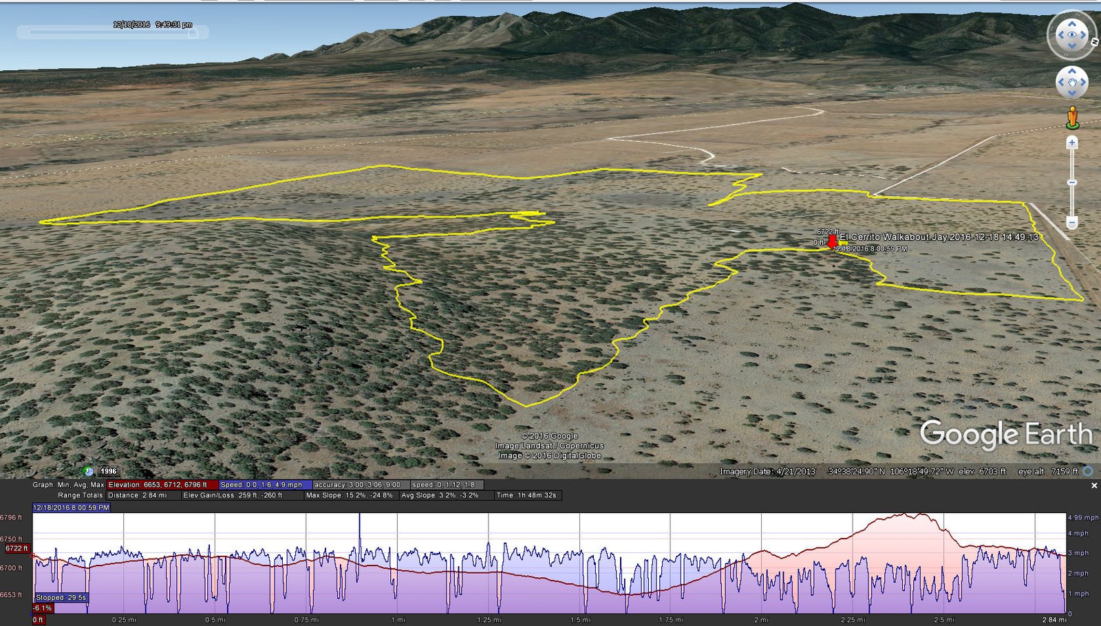
El Cerrito Walkabout.Jay.2016-12-18
To make it a “hike”, Jay & I walked the perimeter of our “El Cerrito”. Snow had fallen the day before, about an inch and windblown, and the temperature remained near freezing so it was an easy and picturesque afternoon.
Statistics
Total Distance: 2.84 miles
Elevation: 6,722 start, 6,796 maximum, 6,653 minimum
Gross gain: 69 ft. Aggregate ascending 259 ft, descending: 260 ft
Maximum slope: 15% ascending, 25% descending, 4% average
Duration: 1:48
| GPS Track Files for Download | |
234 Downloads | |
|---|---|
187 Downloads | |
If you haven’t explored these hiking tracks with Google Earth, I urge you to try it. With the virtual 3-dimensional presentation, achieved by panning and tilting the view, you can get a much better idea of the hikes and terrain than you can get from the screenshot above. For some ideas, check out Using Google Earth Track Files.

