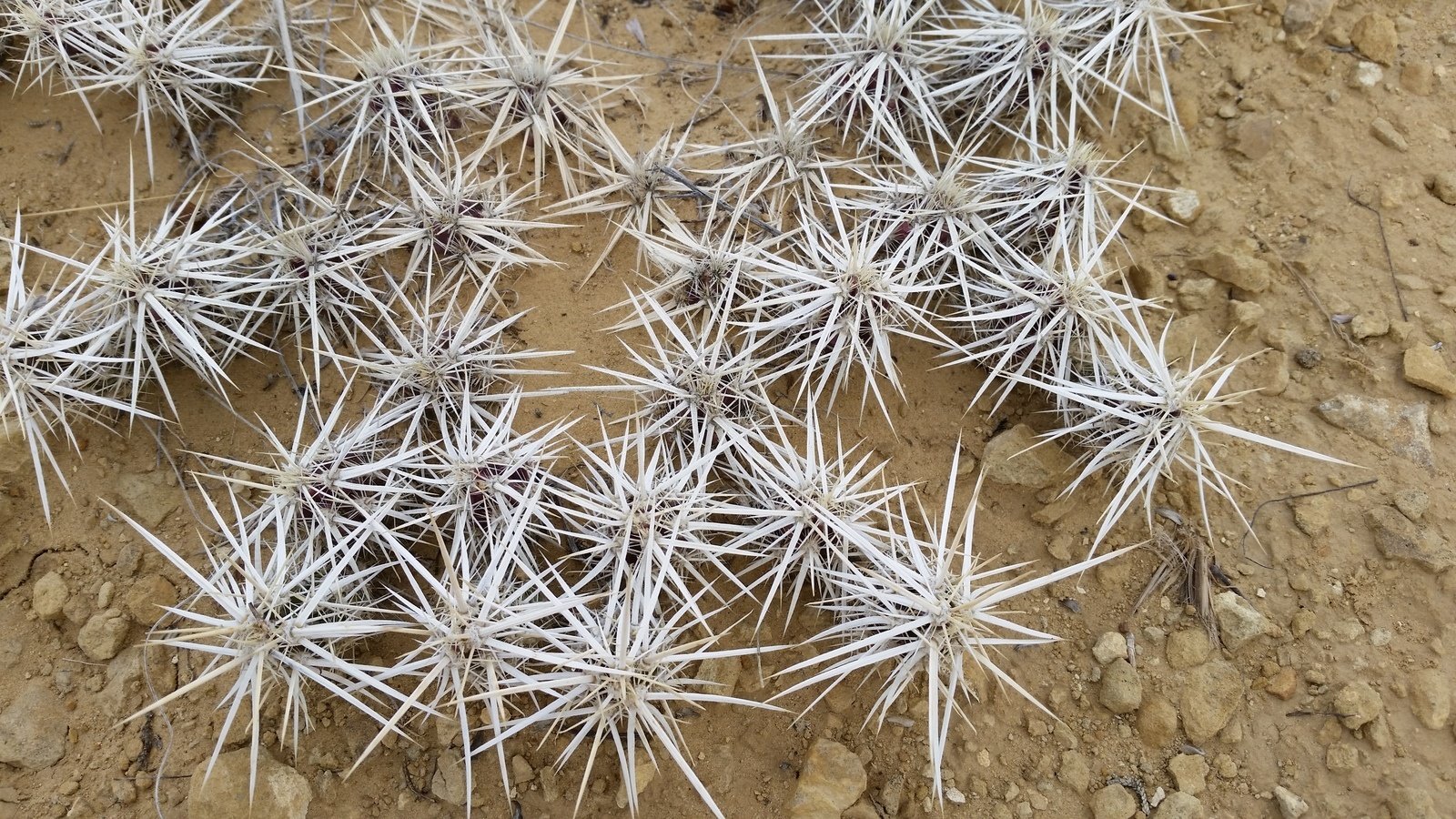
Flora for this hike: Close up of small “star cactus” in winter color.
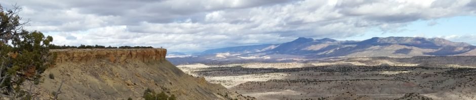
Jay and I returned to the Ojito Wilderness; it is such an interesting place, not so far from home, and this is the best time of year to hike thereabouts. We chose the ASCHG hike, Bernalillito Mesa Loop Hike. We found the complete hike is -on the top- of Mesa Bernalillito. This made for spectacular views (check out the photo galleries below), tho’ not much interesting geology like we found on the Meseta de Ricardo hike.
The Hike
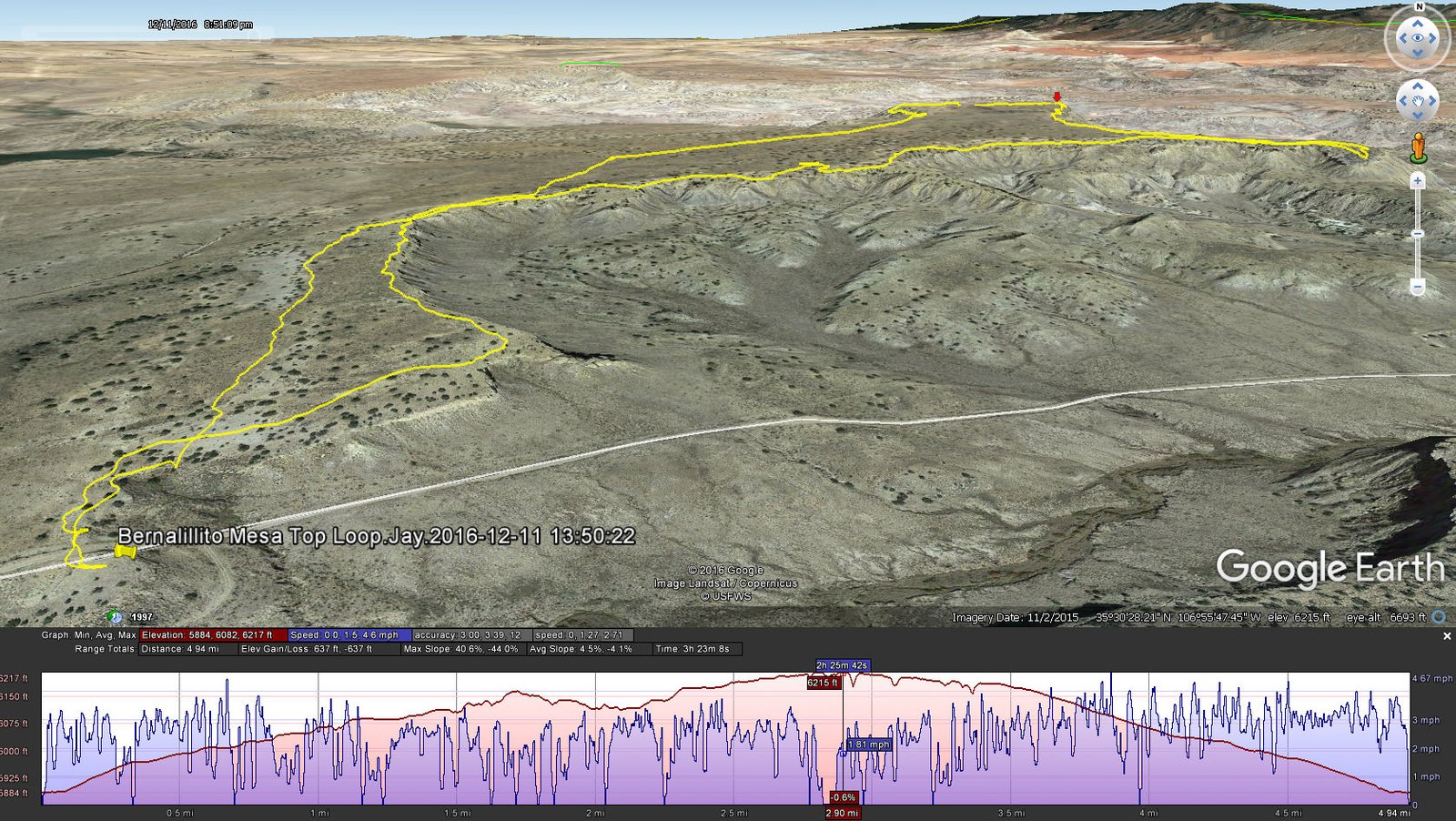
Bernalillito Mesa Top Loop Hike.Jay.2016-12-11
As you will see in the statistics, there was not much elevation gain. We could not find any discernible hiking trails, tho’ at times we could follow cattle trails. In some areas, the surface was (almost) flat rock, but most was soft soil with fairly large clumps of grasses and shrubs making the surface uneven.
A friend had reported visiting Pueblo ruins on a mesa near a pipe line pumping station (there is one near where we started), so we were on the lookout for signs of ruins. We found some mounds that were suspicious, but none of the other signs that we associate with ruins: somewhat orderly piles of rock rubble from collapsed blockhouses, pottery sherds, and depressions reflecting the locations of kivas.
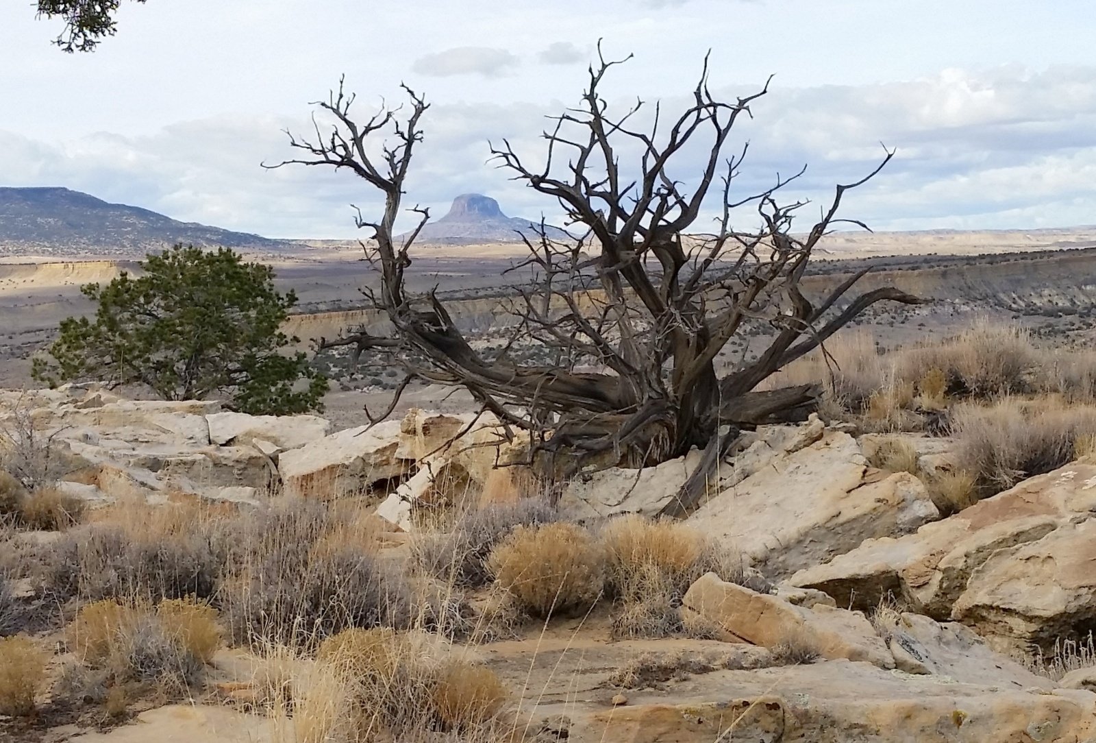
Flora for this hike: This juniper saw many winters, and now presents us with another beautiful sculpture by Mother Nature.
Jay here: While this hike certainly had no shortage of spectacular scenic views, I kept wishing that there was an actual trail to follow. Not that I mind a certain amount of bushwhacking, but the soft soil and the constant need to dodge nasty little cacti can get tiresome. Finding a cow path on the return loop was almost a relief. I’d much rather dodge cow pies than cacti. Either way, there’s a lot of looking down when you would rather be looking up at the great vistas.
Statistics
Total Distance: 4.93 miles
Elevation: 5,885 start, 6,217 maximum, 5,885 minimum
Gross gain: 332 ft. Aggregate ascending 673 ft, descending: 673 ft
Maximum slope: 45% ascending, 52% descending, 4% average
Duration: 3:23
| GPS Track Files for Download | |
213 Downloads | |
|---|---|
155 Downloads | |
If you haven’t explored these hiking tracks with Google Earth, I urge you to try it. With the virtual 3-dimensional presentation, achieved by panning and tilting the view, you can get a much better idea of the hikes and terrain than you can get from the screenshot above. For some ideas, check out Using Google Earth Track Files.
Related Posts (in the vicinity)
References
ASCHG: Bernalillito Mesa Loop Hike
The American Southwest: Ojito Wilderness Area
Backpacker Magazine: Albuquerque, NM: Bernalillito Mesa
Dog of the Desert: Mesa Bernalillito inthe Ojito Wilderness
TopoZone: Bernalillito Mesa Top Map in Sandoval County NM


