
Drove up the Crest Highway to Sandia Crest for a hike with Pat and Peyton.
The Hike
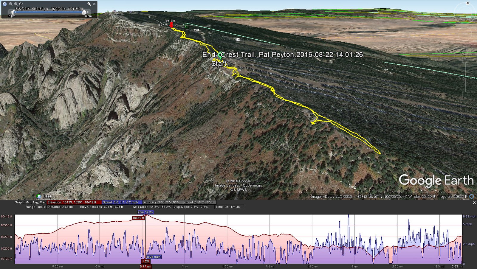
Crest Trail, Pat & Peyton, 8/22/2016
From Albuquerque, the Crest was shrouded in clouds. And the clouds were still hanging around when we arrived at the Crest House. None the less, we had a very nice hike, first north on the Crest Trail for 3/4 of a mile, then south for half a mile.
Statistics
Total Distance: 2.83 miles
Elevation: 10,389 start, 10,419 maximum, 10,145 minimum
Gross gain: 244. Aggregate 593 ft ascending, 596 ft descending
Maximum slope: 45% ascending, 46% descending, 7.5% average
Duration: 2:18
| GPS Track Files for Download | |
230 Downloads | |
|---|---|
291 Downloads | |
If you haven’t explored these hiking tracks with Google Earth, I urge you to try it. With the virtual 3-dimensional presentation, achieved by panning and tilting the view, you can get a much better idea of the hikes and terrain than you can get from the screenshot above. For some ideas, check out Using Google Earth Track Files.


