During our visit to Oaxaca in 2026, we arranged with our guide and friend José for an Expedition from Oaxaca City to the Chinanteca region near the city of Tuxtapec. As has been for our Expeditions in other years, our interests were a bit of hiking, visiting indigenous villages in the area, and in particular to see in the villages the distinctive textiles traditional to the Indigenous cultures and to bring home examples.
The Chinanteca region is about a 5+ hour drive north from Oaxaca City through the Sierra Norte mountains. The elevation is near sea level and receives sufficient annual rainfall so that near the mountains it is a tropical forest. Away from the mountains towards Tuxtapec, the land is flat and has been cleared for the fields of sugar cane.
The Drive In
To reach the Chinanteca region and Tuxtapec from Oaxaca City, one must travel north across the Sierra Norte mountains. This mountain range is quite rugged with very steep slopes and deep and narrow valleys. The paved, 2-lane highway has few straight sections between sharp curves with sometimes steep climbs or descents. And the drivers of the van-buses are intent on making a quick trip, ie they drive fast, so one experiences high-G forces in the corners. The GoogleEarth screenshot below provides a visual – from the red arrow in the upper left corner of the image, MX 175 crosses the Sierra Norte and descends into Tuxtapec (163 miles, 7 hours).
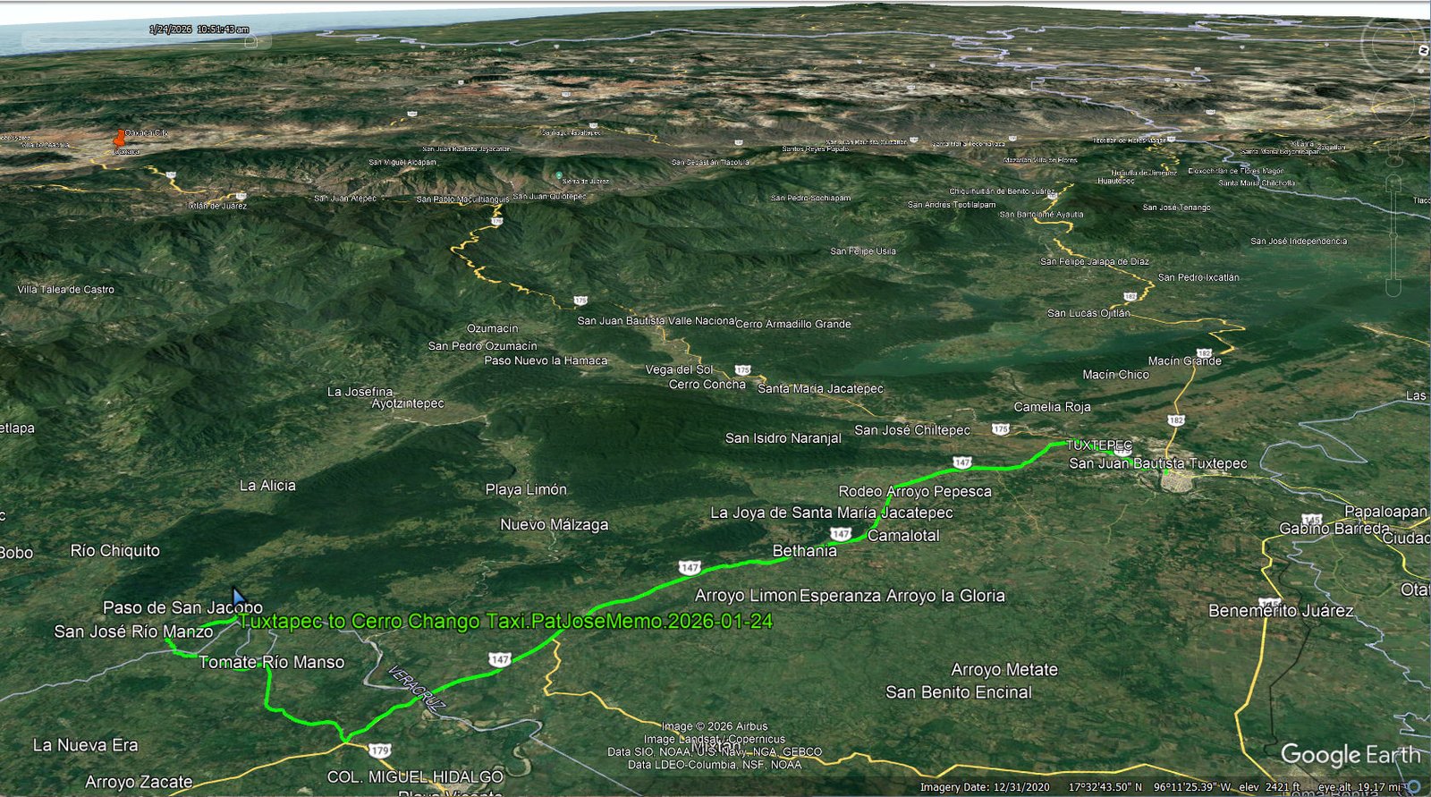
Tuxtapec to Cerro Chango Taxi.PatJoseMemo.2026-01-24 … Notes about the Google Earth screenshot: the graph at the bottom shows elevation of the track (pink area) and speed (the blue line). Click on the image for a full-screen view.
Our itinerary for this Expedition began with 3 nights in a hotel in Tuxtapec. On the day after arriving, we drove by taxi to San José Nuevo Rio Manso for a hike on Cerro Chango. From Tuxtapec we drove south on a state road, then local roads to San José Rio Manso, about 48 miles/2 hours on good roads (see the Google track above).
The Hike
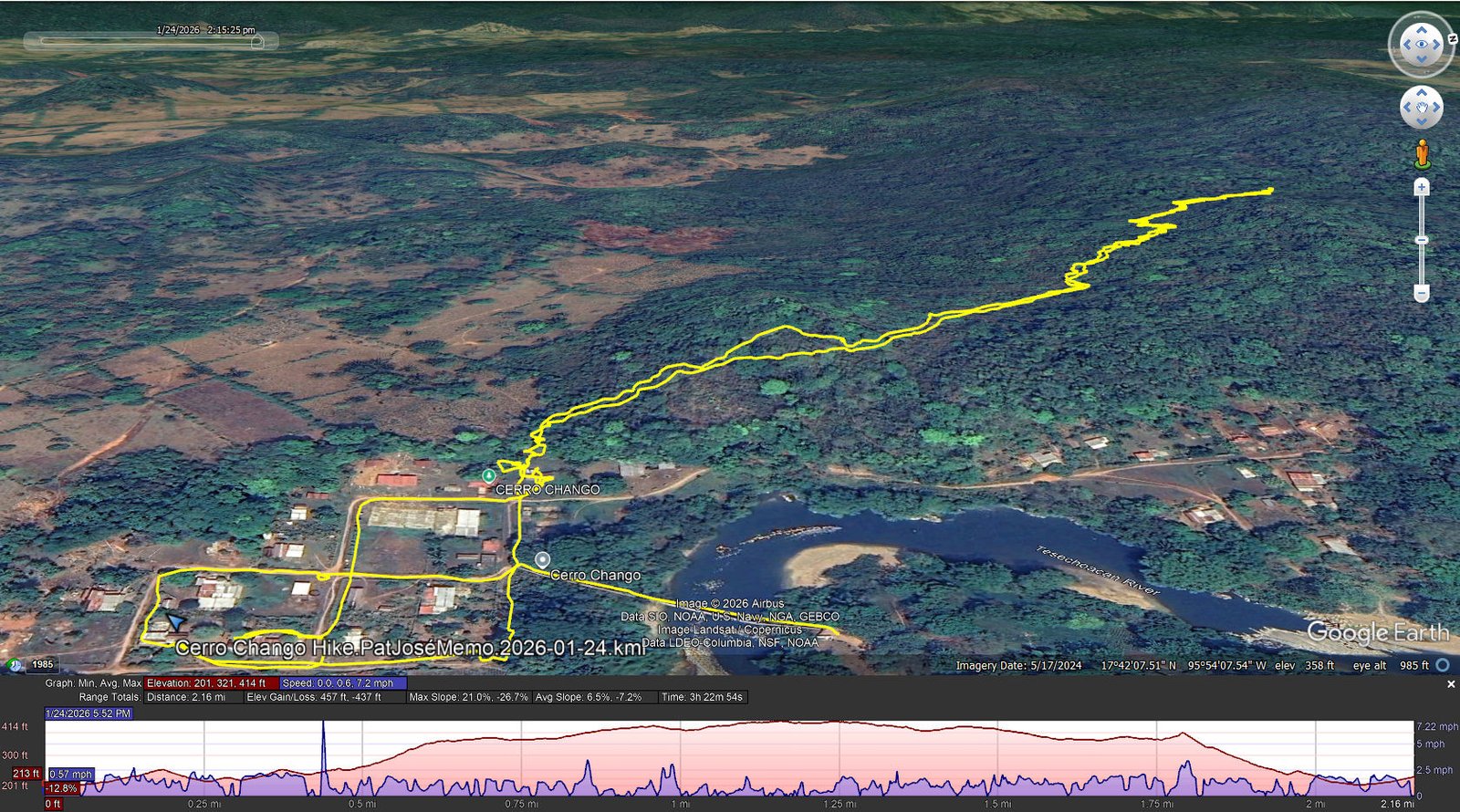
Cerro Chango Hike.PatJoséMemo.2026-01-24 … Notes about the Google Earth screenshot: the graph at the bottom shows elevation of the track (pink area) and speed (the blue line). Click on the image for a full-screen view.
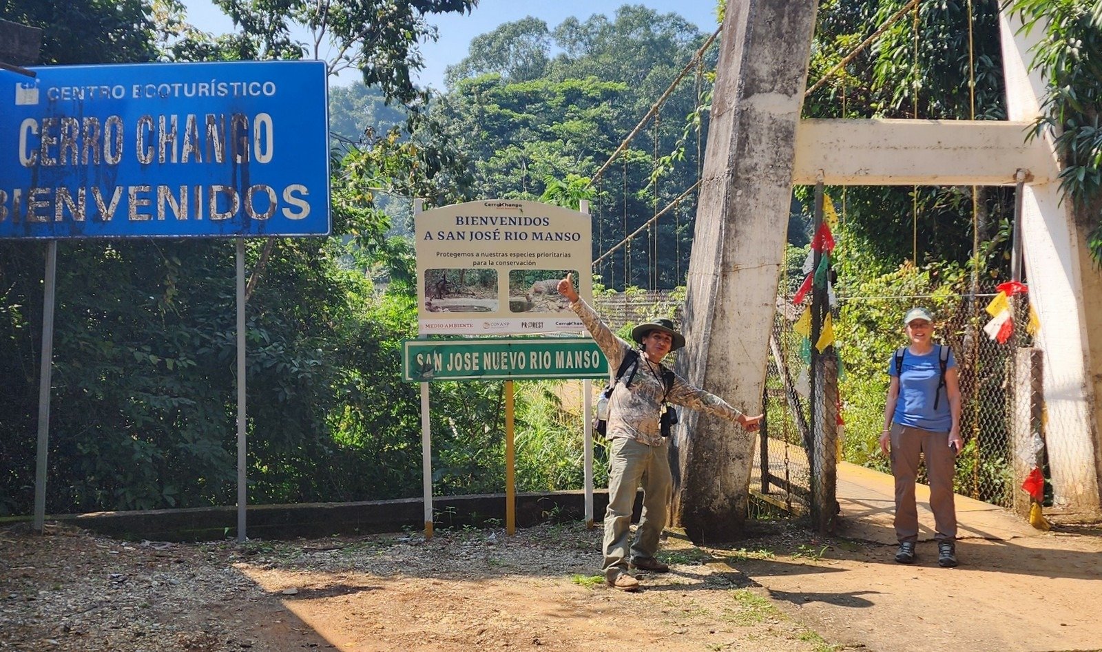 We were met at the gate by Memo and crossed with him on the 90 yard long suspension bridge to the Cenro Ecoturístico over the Rio Manzo. Touring the Centro we were introduced to some of the wildlife that has been rescued including an alligator and lowland paca. We then embarked on a hike into the jungle of Cerro Chango.
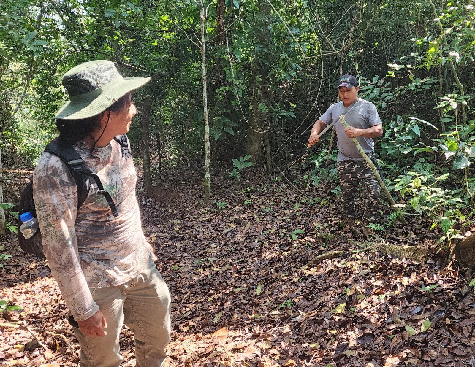
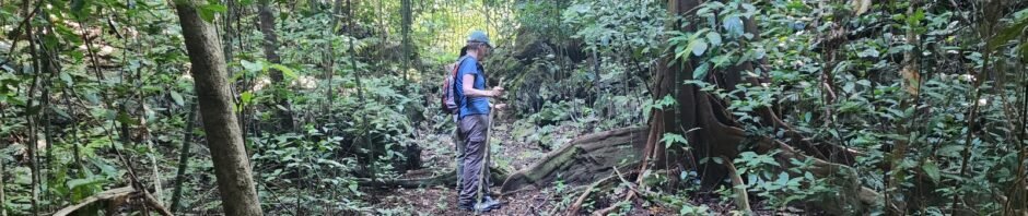
But first, Memo asked if (or suggested?) that we might need hiking poles. Not have one, he quickly pulled out his machete and cut a pole for Pat and me. Then it was off into the dense tropical forest, among banana, coconut, and other “exotic” trees. José and Pat enjoyed very much recognizing the various plants with Memo offering information on how many of the different plants are used in cooking or other purposes.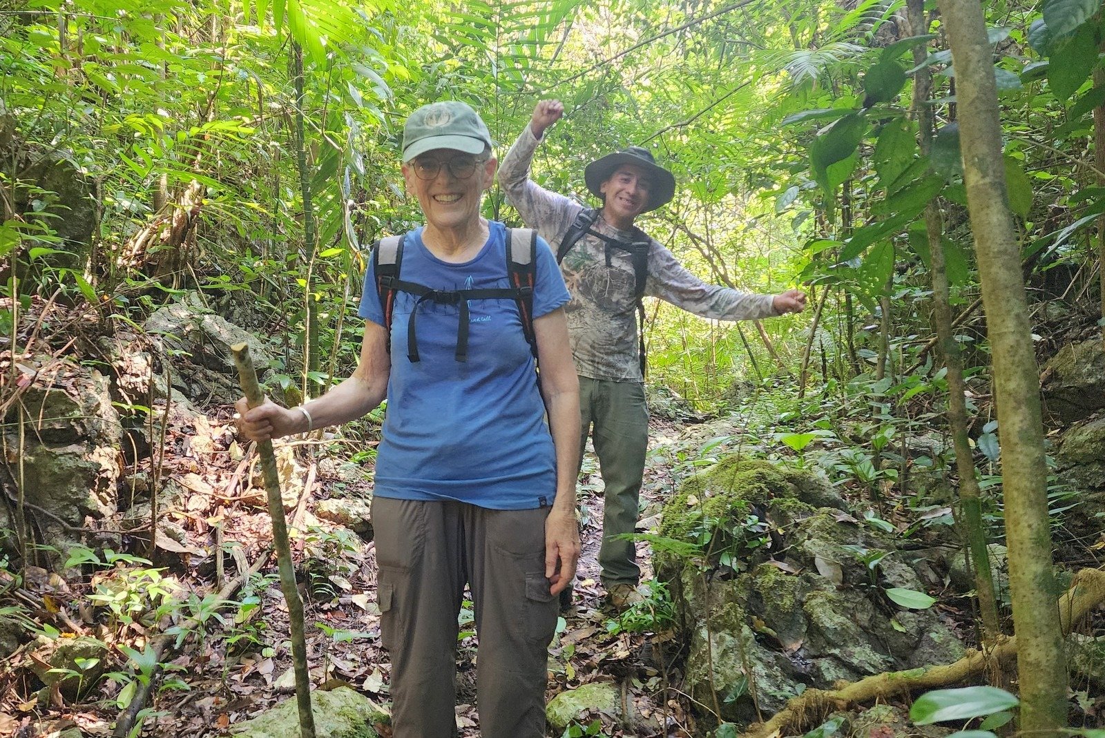
The trail through the forest was nice and wide with rocks forming the trail in some places. We came to a steep, rocky section and I was uneasy about my ability to descend the slope safely, so we turned back. But the exposure to the tropical plants was quite interesting (but..we didn’t see monkeys or anteaters, as some visitors have reported).
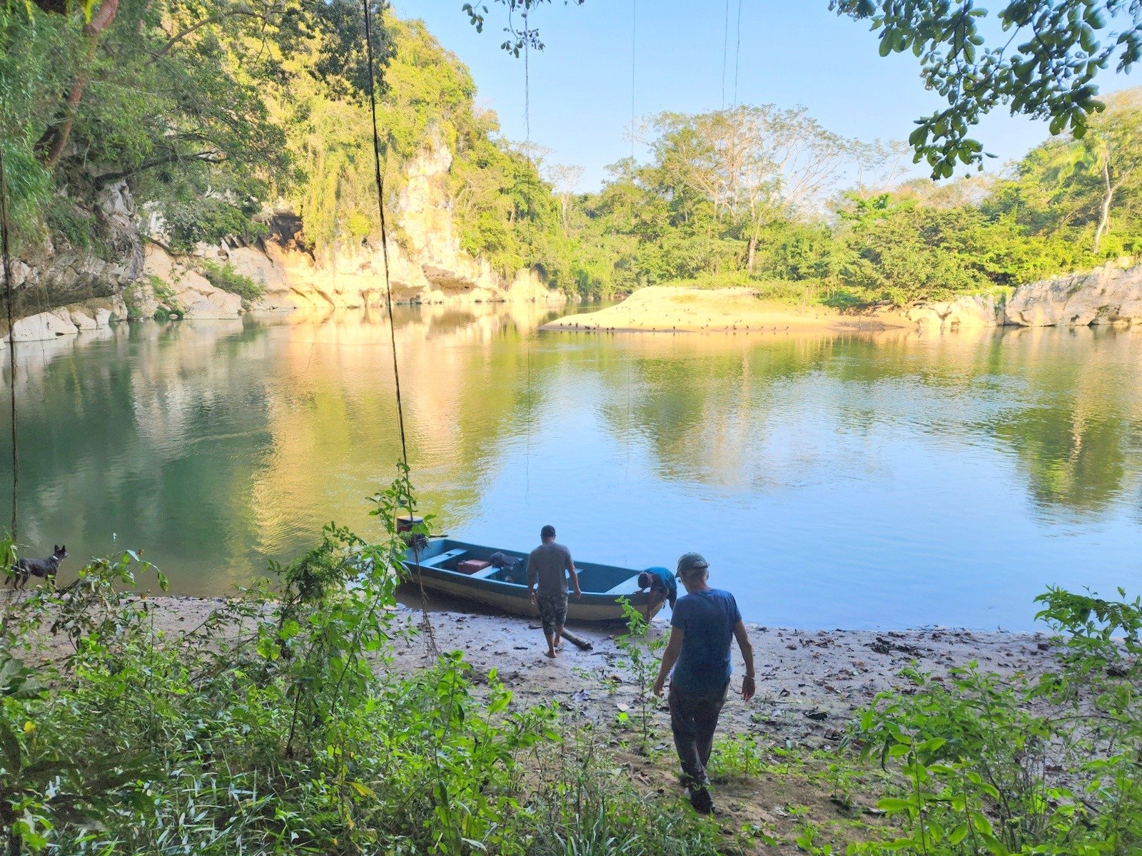
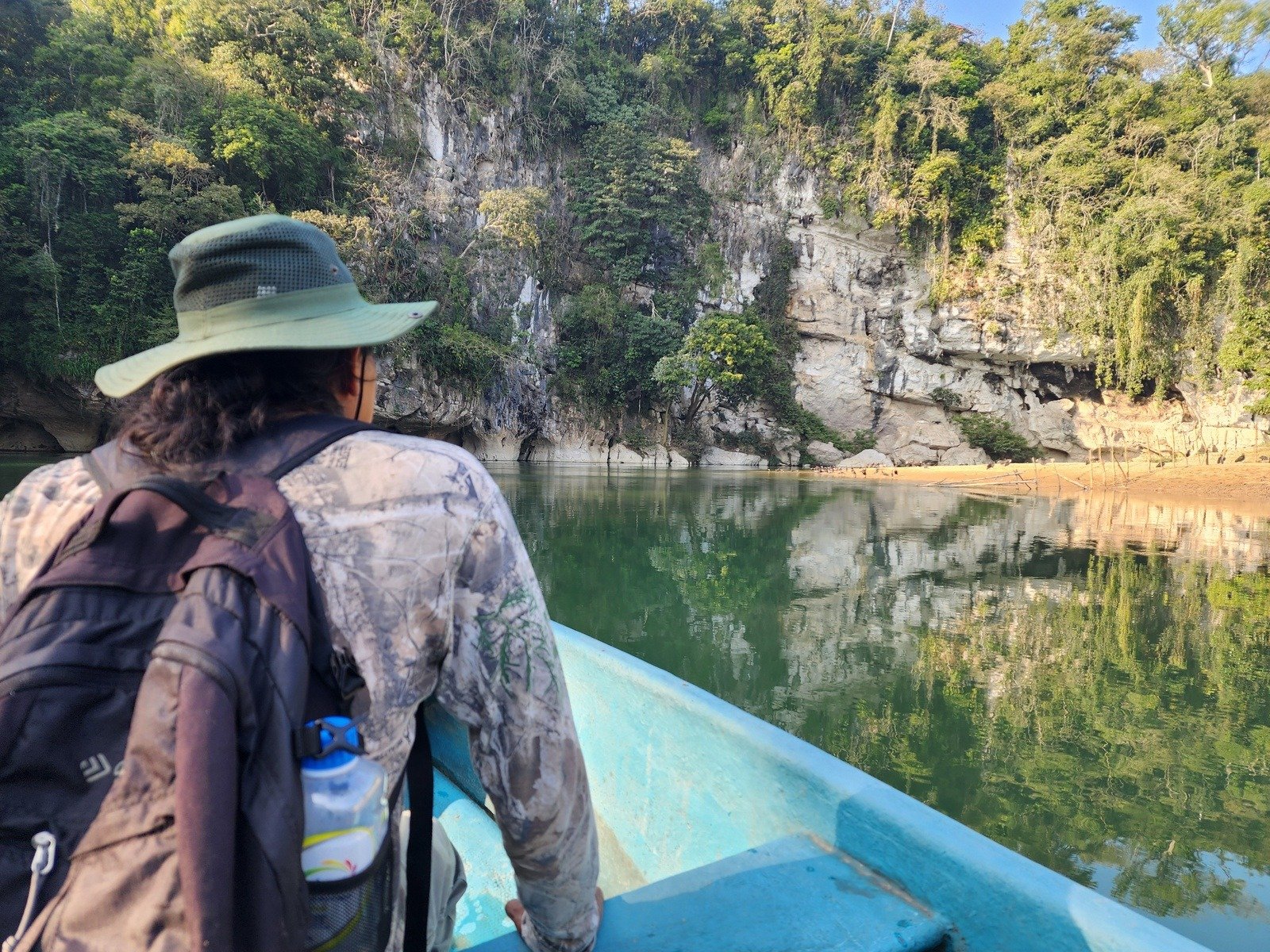
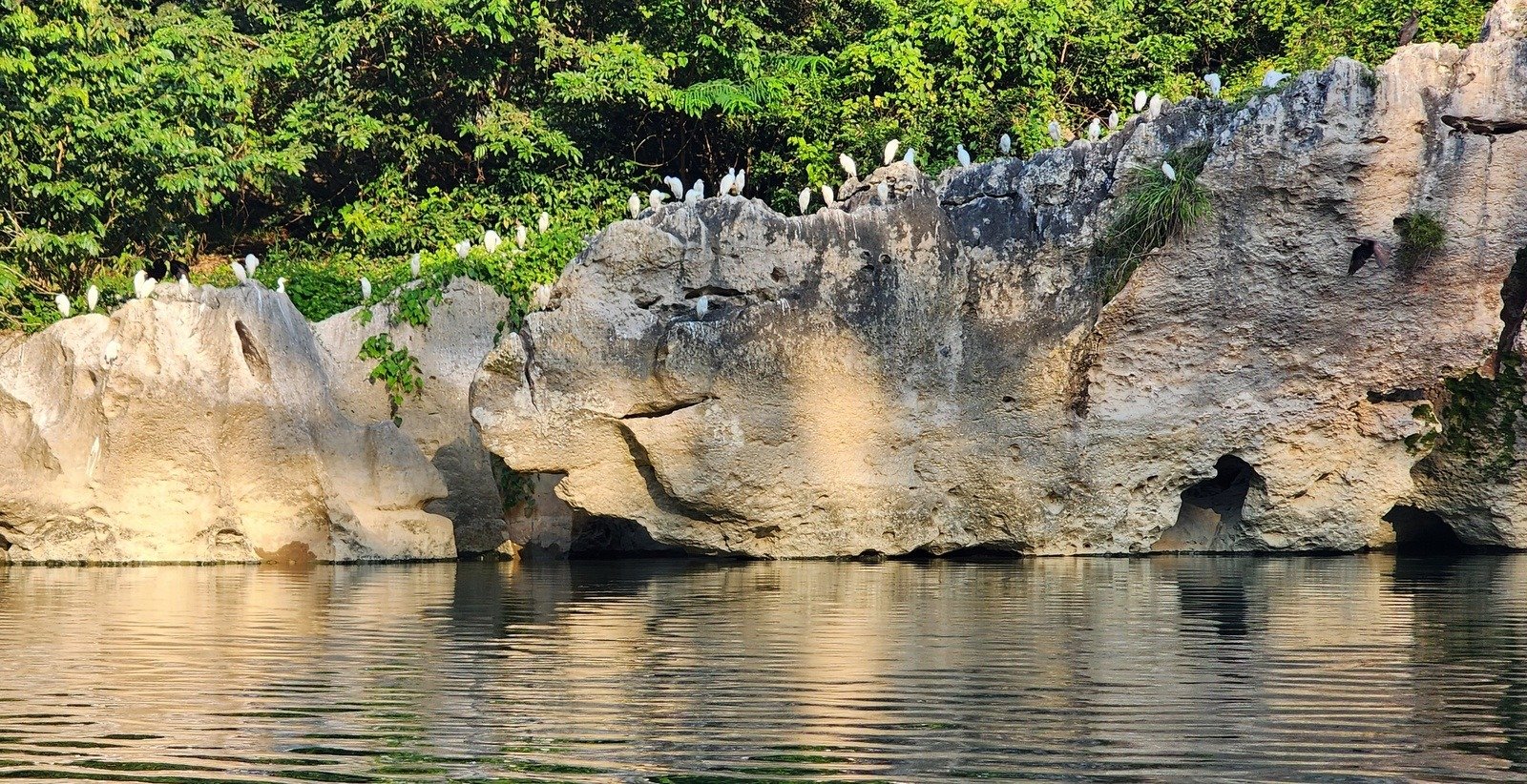
On returning to the Centro, we enjoyed a great lunch prepared by Memo’s wife. Then it was down to the river front for a boat ride on the Rio Manzo.
Statistics
Total Distance: 2.16 miles
Elevation: start 213 ft, maximum 414 ft, minimum 201 ft
Gross gain: 213 ft. Aggregate ascending 457 ft, descending 437 ft
Maximum slope: 21% ascending, 28% descending, 6.8% average
Duration: 3:23, Average Speed: 0.6 mph, Shade: 90%
| GPS Track Files for Download | |
51 Downloads | |
|---|---|
45 Downloads | |
| Link to GAIA GPS: “Cerro Chango Hike.PatJoséMemo.2026-01-24” | |
52 Downloads | |
48 Downloads | |
| Link to GAIA GPS: “Tuxtapec to Cerro Chango Taxi.PatJoseMemo.2026-01-24” | |
| If you haven’t explored these hiking tracks with Google Earth, give it a try. With the virtual 3-dimensional presentation, achieved by panning and tilting the view, you can get good idea of the hike and the terrain. For some ideas, check out Using Google Earth Track Files. | |
Related Posts
References and Resources
wikiloc: Tour Cerro Chango
Facebook: Cerro Chango, Santiago Jocotepec
Oaxaca 2026 Posts
Photos


Views to date: 3 views.