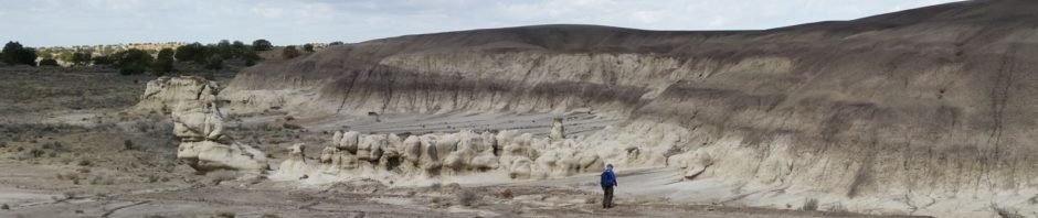
We returned to Mesa Penistaja, having visited back in 2014. This is truly an amazing place – badlands (mesas and arroyos), large variety of landforms, and petrified wood everywhere. And the hoodoos, small and large, create in some places a stunning skyline.
The Hike
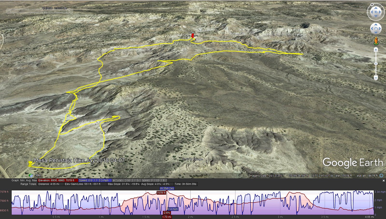
Mesa Penistaja Hike.Jay.2018-04-07
As I’ve done lately, I began by surveying the area via GoogleEarth and Topo maps. I sketched a track that appeared to be interesting and practical; download the sketch from the link below. In this instance, I chose a track that would take us into canyons that looked interesting, and up on mesas as well.
Our actual track began at a different starting point, initially parallel to the edge of a mesa. Then we struck across open places to join the sketch for some distance. Then, on the ground, we chose not to follow the sketch that would take us on a more strenuous track, but headed towards topography that looked interesting. All along we found petrified wood – big pieces, small pieces, even and area that I described as a Wood Chip Pile, where the ground was covered with small sherds of petrified wood. ‘Tis an amazing place.
The weather this day was cool, and –very– windy. Heading back towards the truck, since we had gradually ascended to the top of a mesa, we found that our descent was through a fairly steep, narrow, rocky crease in the edge of the mesa. It was a bit treacherous in any case, but with the strong winds maintaining balance was even more challenging. ‘Tho this is our second foray into Mesa Penistaja, there is much more to explore; we will back (but not during the hot days of summer).
Jay here: If you are a fan of petrified wood, you can’t do any better than Penistaja. From full size trees and stumps down to small slivers and pieces of bark, this is a wonderland. And the landscape is not only other worldly, it also can often appear like a lunar landing site for a space probe. Definitely worth the long drive and the rough dirt road access.
Statistics
Total Distance: 4.05 miles
Elevation: start 6,950 ft, maximum 7,078 ft, minimum 6,930 ft
Gross gain: 148 ft. Aggregate ascending 551 ft, descending 551 ft
Maximum slope: 32% ascending, 20% descending, 4% average
Duration: 3:51
| GPS Track Files for Download | |
245 Downloads | |
|---|---|
380 Downloads | |
I urge you to explore our hiking tracks with Google Earth. With the virtual 3-dimensional presentation, achieved by panning and tilting the view, you can get a much better idea of the hikes and terrain than you can get from the 2-dimensional screenshot above. For assistance: Using Google Earth Track Files.
References
New Mexico Magazine: Badlands Walkabout
The American Southwest:
San Juan Basin Badlands
Map of the San Juan Basin Badlands
Penistaja Mesa
Photographs of Penistaja Mesa
Jim Caffrey Images Photo Blog: The Other Badlands
Pinterest: Penistaja Mesa


