Returning again to trails in the Placitas area, this time the Agua Sarca trail which we last hiked in 2016. The trailhead is next to a parking area on Tunnel Springs road just short of the Picnic Area. (Caution: the upper portions Tunnel Springs Road are a mess; high terrain vehicle strongly advised.)
The Hike
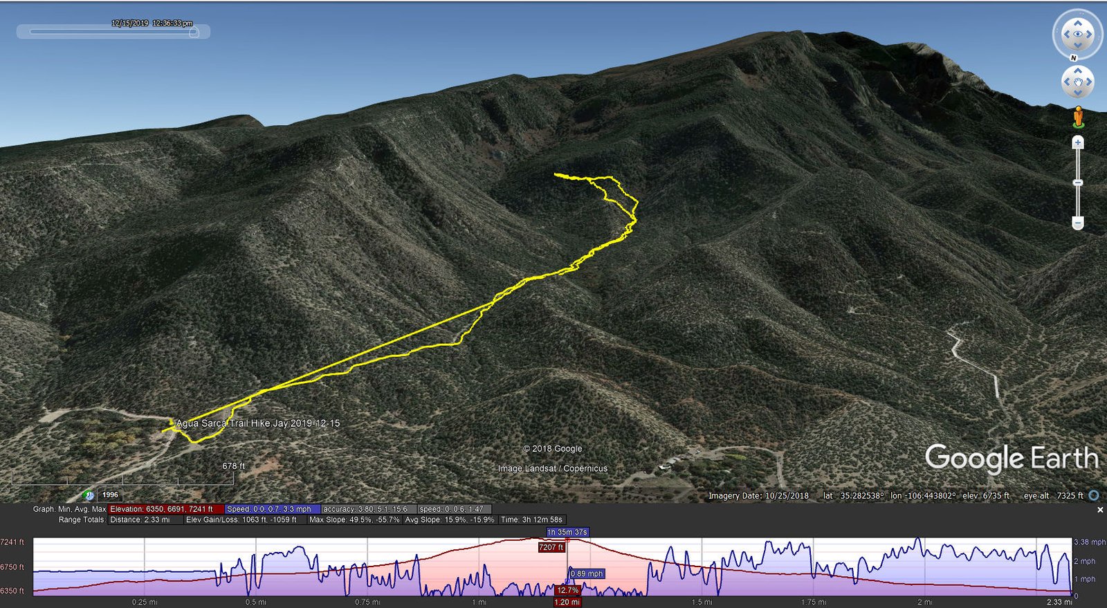
Agua Sarca Trail Hike.Jay.2019-12-15
(Straight line is our start on the trail – operator error, didn’t start track recording with USTopo.)
Initially the trail surface is firm with few rocks – quite pleasant. About 1/3 mile on, it becomes very rocky, then again maybe 2/3 miles on it is again quite pleasant. And that’s mostly the way it goes as one hikes up the canyon. About .8 miles into the hike, the real Agua Sarca trail bears to the left (I say this in hindsight after comparing today’s track with previous hikes and other resources). We missed this turn and instead continued into the canyon to the right. (I didn’t think to check the GPS at this point, it so looked like a ‘good’ trail.) Another .15 miles on the canyon bottom became thick with brush – nearly impassable. By then I had checked the GPS and saw that the real trail was off to the east.
Jay asked “Shall we bushwhack over there?” “Sure” I said, and we headed up what became a very steep slope. Climbing and climbing, at times pulling ourselves up and hanging on to juniper trees and other plants, I began checking the GPS/Topo to monitor our progress. I noted that there was a dotted line on the Topo indicating a trail in our vicinity (these dotted lines usually show a trail from some time in the past). We may have crossed it a couple of times, until I came across a cairn just beyond which we discovered a narrow trail going left and right. Still thinking we could make it to the real Agua Sarca Trail, we went left hoping it would follow a topo elevation line and ultimately bring us to the real trail back in Agua Sarca Canyon.
I do think we were on the ‘dotted line’ trail. It was a very narrow path, at times indiscernible and along a very steep slope. We reached a point where we were unable to see it ahead of us and the terrain appeared to become even steeper. Very tired from the strenuous climb behind us, we opted to retrace our track and head back the way we came. Then we faced the very steep descent, using a completely different set of muscles and at times sitting and sliding down on loose dirt and sand. It was a relief to make it to the bottom of the canyon — where we stopped for our mid-hike break (and some welcome rest). The return trip from there was easy (quite easy, by comparison). We identified the turn we had missed (and discovered a small cairn marking this spot).
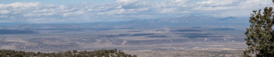
The day had started under heavy clouds over the Sandias (and blue, sunny skies elsewhere), but the lack of sun, the gusty winds, and temperature in the mid 40’s, added to the strenuous nature of this hike. The warmer conditions when were back down in Agua Sarca Canyon were welcome. I look forward to returning to Agua Sarca; I think there is much more to see (locate the ‘dotted line trail’, or make it a loop returning via North Crest and Oho del Orno trails).
Jay here: Yep, this was a strenuous hike alright. To make matters worse for me, I left my good Vasque boots in Santa Fe, so I was forced to hike with some old Merrell boots that were low-cut and designed for sandy level terrain. Therefore, I had little traction and bite going up the steep hillside and not enough support to keep the ankles from getting weary. Still not sure how we missed that left turn but those things are a lot easier to see on the way back when you’re figuring out how we went wrong.
Statistics
Total Distance: 4.66 miles
Elevation: start 6,350 ft, maximum 7,241 ft, minimum 6,350 ft
Gross gain: 891 ft. Aggregate ascending 1,063 ft, descending 1,059 ft
Maximum slope: 50% ascending, 56% descending, 15.9% average
Duration: 3:13
| GPS Track Files for Download | |
197 Downloads | |
|---|---|
293 Downloads | |
I urge you to explore our hiking tracks with Google Earth. With the virtual 3-dimensional presentation, achieved by panning and tilting the view, you can get a much better idea of the hikes and terrain than you can get from the 2-dimensional screenshot above. For assistance: Using Google Earth Track Files.
References and Resources
USDA Forest Service: Agua Sarca Trailhead & Agua Sarca Trail 231
AllTrails: Agua Sarca Trail
Backpacker: Albuquerque, NM: Agua Sarca Canyon Loop
ASCHG: Del Orno – N Crest – Agua Sarca Loop Hike


