Not having hiked recently, I headed out to the Northeast Heights for a hike on the western slopes of the Sandia Mountains. I chose the Embudito area because, unlike the other hiking destinations in the Foothills trails that go into the Sandias, there is not a long walk from parking to the trailhead. I had hiked the Embudito Trail before, way back in 2014, so this was also a reacquaintence with the trail.
The Hike
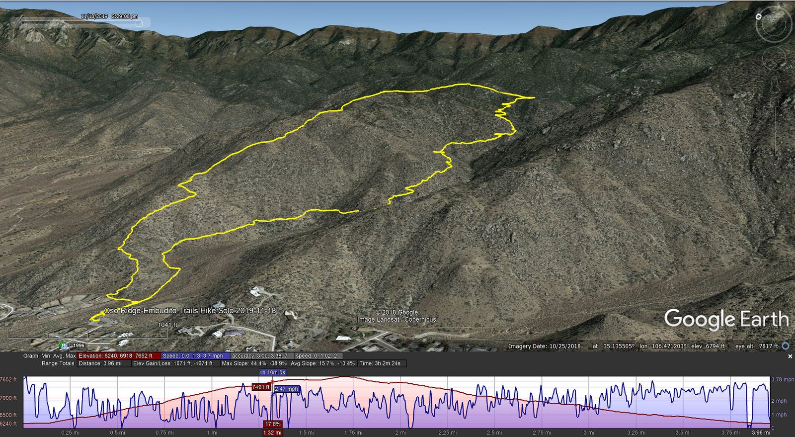
The trailhead is at the eastern edge of the Glenwood Hills neighborhood, east of Tramway – take Montgomery Blvd east to Glenwood Hills Dr, then right on Trailhead Rd. I chose to take the Oso Ridge trail up Oso Ridge, then loop back on the Embudito trail. I walked along residential back yards looking for the trail – it was difficult initially but after climbing up the slope a bit the trail became evident. ‘Tis a bit challenging (easy surface, just uphill) – 1,100 feet in a bit over a mile.
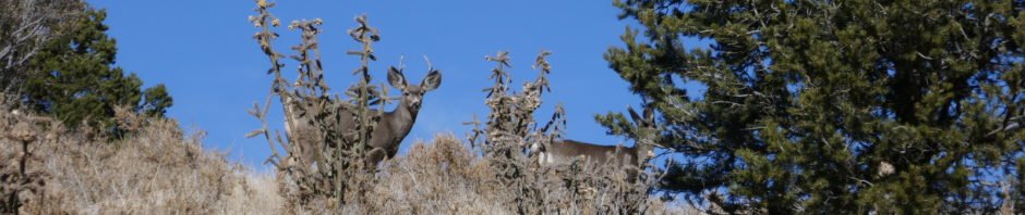
Once on the ridge the going was easier. It was another 300 feet of elevation gain along the ridge to the highest elevation, but easy hiking. Along the way I came upon a small heard of mule deer, a half dozen does and one buck who stood alert above me on the ridge until the does had gone to the other side of the ridge.
At about 3.75 miles into the hike the trail begins descending to intersect the Embudito trail. After relaxing a bit with ramen noodles (great to have some warm soup), I headed down Embudito and back to the Tacoma. As on so many trails in the Sandias (and elsewhere), the views were so scenic, the weather clear and sunny, and the trails challenging enough to get the body warmed up.
Statistics
Total Distance: 3.96 miles
Elevation: start 6,240 ft, maximum 7,652 ft, minimum 6,240 ft
Gross gain: 1,412 ft. Aggregate ascending 1,671 ft, descending 1,671 ft
Maximum slope: 44% ascending, 39% descending, 15.7% average
Duration: 3:02
| GPS Track Files for Download | |
204 Downloads | |
|---|---|
221 Downloads | |
I urge you to explore our hiking tracks with Google Earth. With the virtual 3-dimensional presentation, achieved by panning and tilting the view, you can get a much better idea of the hikes and terrain than you can get from the 2-dimensional screenshot above. For assistance: Using Google Earth Track Files.
References and Resources
AllTrails:
Oso Ridge Trail
Oso Ridge and Embudito Trail Loop
ASCHG: Oso Ridge – Embudito Loop Hike
Santa Fe Outdoors: Oso Ridge-Embudito Loop
New Mexico Meanders:
2017-12-02 Oso Ridge (Vertical Forest) Trail
2017-01-14 Embudito Canyon (Sandia Mountains)


