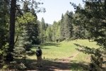
Another venture to higher elevation for cooler temperatures, this time driving up Hyde Park Road from Santa Fe to the Borrego trailhead. We started early enough to enjoy the cool air, tho’ it warmed up by the time we finished, the heat amplified by the uphill climb back to parking.
The Hike
This is a very popular trail with lots of hikers and bike riders; it didn’t feel crowded however. We chose to do the loop counterclockwise, so proceeded down the Borrego trail to its intersection with the Winsor trail. Looking for more that the 4 miles of the loop, we turned right onto Winsor and climbed a mile up to our maximum altitude where we enjoyed our mid-hike break. Then it was back down Winsor, past the Borrega intersection to the intersection with the Wallow trail. Turning left there, we headed up the mile plus back to parking. This was a steady uphill climb; to have the elevation gain of this trail at the end of the hike – I’ll call it “building” .. endurance that is.
As mentioned above, the trail is well used, which makes it’s surface wide and smooth (a few rocky areas). It is also well marked with signs at the intersections identifying the trails. The folks in the featured image above were marking out a new path through a nice meadow; the original tracks had become deep and narrow, washed out after years of use and rain. The new track is a great improvement. Thanks to the trail steward from the Santa Fe Fat Tire Society.
Jay here: Not sure exactly why this hike took so much out of us, although uphill for the last few miles was surely a factor. Letting faster hikers lope on by us we were reminded that we had 40 years on them and a whole lot more lifetime miles.
Statistics
Total Distance: 6.30 miles
Elevation: start 8,878 ft, maximum 9,127 ft, minimum 8,207 ft
Gross gain: 920 ft. Aggregate ascending 1,932 ft, descending 1,945 ft
Maximum slope: 32% ascending, 31% descending, 10% average
Duration: 4:10
| GPS Track Files for Download | |
366 Downloads |
|
|---|---|
124 Downloads |
|
If you haven’t explored these hiking tracks with Google Earth, I urge you to try it. With the virtual 3-dimensional presentation, achieved by panning and tilting the view, you can get a much better idea of the hikes and terrain than you can get from the screenshot above. For some ideas, check out Using Google Earth Track Files.
References and Resources
Santa Fe New Mexican: Happy Trails: Borrego Trail offers …
ASCHG: Bear wallow – Borrego Loop Hike
Hiking Project: Borrego Trail
AllTrails: Borrego-Bear Wallow-Winsor Triangle Trail


