Category Archives: Pecos

In the vicinity of the Pecos River and Pecos Wilderness.

Rio Mora Trail Hike – 09/29/2020

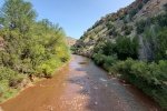
After spending time in the Jemez Mountains last week, and seeing the colors of autumn begin to appear, we were attracted to return to the Rio Mora. Another inducement: our hike in May was foreshortened because of the high water around a river-side outcropping prevented us from going further (without wading in the swift-flowing water).

The Drive In

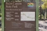
I-25 east from Santa Fe to Glorieta, then NM 50 to the village of Pecos (6 miles). Turn left onto NM 63 to the old mining camp of Tererro (13.5 miles). From here the road becomes more of a forest road (‘tho paved and still NM 63); it is narrow and winds a lot. About a mile on you will pass the now-inoperative Tererro Mine. From Tererro the trailhead is at the Mora Campground/Mora Recreation Area (part of the Pecos CanyonState Park, also known as the Pecos Complex Wildlife Areas).
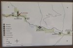
Note: The Campground/Recreation Area was closed when we visited; as I write this it is open only Thursday thru Sunday. We parked off the road outside the Campground; while we were hiking a kind person left a note, sort of a warning that the area is not open and we maybe shouldn’t park there. The ENMRD web site advises that Day Use are open daily; the Park Map (PDF) shows North Mora fishing area about 400 yards north of the Mora Campground, so that may be an alternative for parking.

The Hike

Rio Mora Trail Hike.Pat.2020-09-29

We were greeted with a most colorful and serene scene, the campground with the yellow colors of fallen leaves against the gray tree trunks and the green of ponderosa pine. And above us, the true blue of New Mexico’s skies.


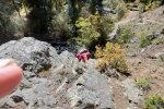
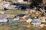
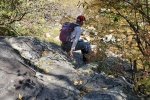
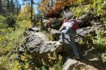
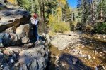
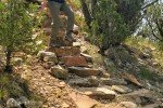
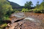
We passed through the campground and  continued on an old two-track which soon turned into a well-used trail. To our right the Rio Mora burbled along, plenty of water even this late in the season. Not quite a half mile into the hike we encountered our first of 3 “rock crawls”, an outcropping at the very edge of the river – the only way forward was to crawl over the rock.

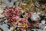
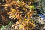
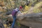
So it went, a pleasant trail along the river, another rock crawl, meandering through wide areas in the river bottom among willows, scrub oak, river maple, and many kinds of ground cover. Some plants were already showing their autumn colors; certainly there will be more to come. We encountered two more “rock crawls”, plus a “log crawl”, getting over a large tree trunk, resting at a very steep angle into the river, that we had to get over.


At 1.6 miles we took our mid-hike break in a very pleasant alcove along the river. Of course, on the return we faced the same “rock and log crawls”, but this time with a bit more confidence arising from experience.

Highlight

New Mexico offers the most amazing array of colors. Perhaps the colors stand out because they are not overwhelmed by so much green, as exists in places where there is more rain and fertile soils. Even this late in the season, flowers abound to brighten the views. As autumn is approaching, leaves are turning colors, on the trees, vines, and other plants. And no doubt the clear air, without the haze of humidity or pollutants, contributes to the colorful scenery. And often the background, such as rocks, further enhances the beauty.

Statistics

Total Distance:  3.3 miles
Elevation: start 7,908 ft, maximum  8,103 ft,  minimum 7,907 ft
Gross gain: 196 ft.  Aggregate ascending 946 ft, descending 943 ft
Maximum slope: 35% ascending, 34% descending, 07.5% average
Duration: 4:26

GPS Track Files for Download
180 Downloads
235 Downloads
I urge you to explore our hiking tracks with Google Earth. With the virtual 3-dimensional presentation, achieved by panning and tilting the view, you can get a much better idea of the hikes and terrain than you can get from the 2-dimensional screenshot above. For assistance: Using Google Earth Track Files.

Previous Posts

Rio Mora Hike – 05/08/2020

References and Resources

New Mexico State Parks: Pecos Canyon State Park
ReserveAmerica: Pecos Canyon State Park, NM
ExplorNM: Mora (campground)
Stop Tererro Mine.org: Help Protect the Pecos

Photos

Viewpoint Loop Trail Hike – 09/15/2020

Villanueva has been on our list for some time; we made it this day.

The Drive In

East from Albuquerque on I-40 (62 miles), continue 12.3 miles past Clines Corners, turn north on NM 3, 20.4 miles to the village of Villanueva. At the main intersection in the village, turn right onto county road B29E which takes you to the Villanueva State Park, at the end of the road. There you will find 33 campsites (some with electric) and plenty of parking.

We enjoyed very much the drive north from Clines Corners. To me it represents typical northeast NM plains, flat and open. (As a friend once said, in places like this if your dog runs away you can still see him 3 days later.) There are occasional low-lying mesas along the way, the road crosses Arroyos Calaveras and Guajalote, and on higher ground juniper/piñon forests are prevail. And throughout – lush grassland (for NM). I wrote, ‘flat and open’, that is – until one comes upon the cañon of the Rio Pecos – then the land drops off quickly, some 500 feet to the cañon floor. (This is an experience I’ve encountered in other places in NE NM, such as the cañon of the Canadian River; we must go there one day – Mills Canyon Campground maybe?).

The Hike

Viewpoint Loop Trail Hike.Pat.2020-09-15

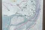
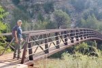
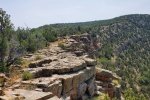
There are three trails, a short one along the Pecos River and a half mile trial onto the mesa above the campground to the north. The 3rd trail, the Viewpoint Loop Trail, crosses over the Pecos River on a bridge, proceeds along the south side of the river, then up onto the mesa. It continues along the edge of the mesa for .9 miles descending gradually until a steep descent to the valley floor. The return to the bridge is on a narrow trail between the mesa cliff and the river (see map -PDF).

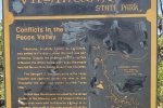
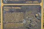
We hiked the loop counterclockwise, choosing  first what we thought would be the steeper climb. What seemed like midway up we passed the remains of farm and ranching operations – ’tis interesting that they chose this site, up on the slopes of the mesa, for a threshing floor, corral, and other facilities. (It “seemed like” midway up, but we learned that most of the elevation gain to the mesa top was to follow.)

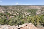
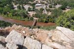
At the top of the ascent, for our mid-hike break, we took the spur to Upper Overlook, a set of shelters overlooking the valley. The view, particularly up the valley, was great. Back on the trail, it followed the -edge- of the mesa above the river (not too close to the edge, unless one wished to check it out – thus the photo looking down upon the campground). The trail (well marked and well traveled) continued along atop the mesa until descending back to the river’s edge (and this proved to be steep also, but with steps kindly put in place on the steepest parts). From there the trail followed the edge of the river (between the river and the bottom of the mesa face) until terminating back at the bridge.

Statistics

Total Distance:  2.15 miles
Elevation: start  5,747 ft, maximum  6,175 ft,  minimum 5,745 ft
Gross gain: 430 ft.  Aggregate ascending 654 ft, descending 655 ft
Maximum slope: 40% ascending, 37% descending, 10.5% average
Duration: 2:41

GPS Track Files for Download
75 Downloads
70 Downloads
I urge you to explore our hiking tracks with Google Earth. With the virtual 3-dimensional presentation, achieved by panning and tilting the view, you can get a much better idea of the hikes and terrain than you can get from the 2-dimensional screenshot above. For assistance: Using Google Earth Track Files.

References and Resources

NM State Parks: Villanueva State Park
                               Villanueva State Park Trails (PDF)
AllTrails: Viewpoint Loop Trail


Beatty’s Trail Hike – 07/02/2020

In our previous visits to the Pecos Wilderness we found some areas were closed. We learned the week before that some have been reopened. Prepared with a list of trails as options, we returned to this beautiful area with its many great trails. Our 1st choice, Jack’s Creek, was indeed open which allowed us the trail of our first choice, Beatty’s Trail.

Driving Directions

For those who are headed to this area for the first time, some description may be helpful. Take I-25 east from Santa Fe to the exit for Glorieta and Pecos-NM 50 (this is about 90 miles from Albuquerque). After crossing  over I-25, turn right; in about 6 miles, turn left at the stop sign onto NM 63 through the very old village of Pecos.  From here it about 20 miles to Cowles, a placename at the end of NM 63 and the entrance to Forest Service campgrounds and hiking trails. This road, paved the whole way, is relatively open at the beginning but gradually narrows and winds more as you ascend the cañon. This will take you 45 minutes or more during which you will climb from 6,900 feet at Pecos to 8,100 feet at Cowles. Along the way you will pass many pullouts and parking areas as well as 3 NM State Parks that provide access to the river for fishing. It’s a beautiful drive; take your time to enjoy it.

At Cowles, continue straight ahead to the Jack’s Creek Campground/Horse Camp and Beatty’s trailhead among others. One may also turn left onto FR 121 for the Panchuela Campground and other trailheads. This is a very popular area for hiking and backpacking, with numerous trails going into the wilderness, into the various river cañons as well as to the peaks in the Sangre de Cristo mountains.

The Hike

Beatty’s Trail Hike.Pat.2020-07-03

Beatty’s Trail: this is one of the most pleasant trails – it presents a very steady, easy climb from the trailhead for the 1st 1.8 miles, then a half mile slight descent before continuing up to our turnaround point. ‘Tho on a the side of a steep slope its width is ample for people to pass. Except in a few places the surface is free of rocks which makes it easy walking. We hiked through a healthy open forest of fir and aspen (the tallest I’ve seen) with spruce at the higher elevation. At 2.5 miles the trail splits, one leg (to the left) going towards Jack’s Creek and even Pecos Baldy, the other going to Beatty’s Flats. And as for many of the trails, .. beyond – a backpacker’s paradise.

We had planned to go out 2.8 miles, to the edge of the forest and into a large open area the on the approach to the summit of Round Mountain. The objective was to have an open view to the west, to see the highest peaks in this part of the Sangre de Cristo. We discovered that such views were unlikely without another mile or so, further up the slope of Round Mountain, to get above the healthy (and tall) forest between us and the peaks. So we “settled” for a really great view to the east and south for our mid-hike break; we could even see down  Jack’s Creek to the Jack’s Valley campgrounds. (For lunch, we sought out some shade from the intense sun at this elevation. While relaxing afterwards, a small shower got us moving again. We quickly wrapped up our lunch paraphernalia, donned raincoats and pack covers, and headed back to the trail. Hardly reaching the trail the shower abated leaving a much cooler temperature for our hike back to the truck.)

Statistics

Total Distance:  5.59 miles
Elevation: start  8,832 ft, maximum  9,966 ft,  minimum  8,832 ft
Gross gain:  1,134 ft.  Aggregate ascending  1,541 ft, descending  1,541 ft
Maximum slope: 27% ascending, 29% descending, 9.1% average
Duration: 4:40

GPS Track Files for Download
137 Downloads
138 Downloads
I urge you to explore our hiking tracks with Google Earth. With the virtual 3-dimensional presentation, achieved by panning and tilting the view, you can get a much better idea of the hikes and terrain than you can get from the 2-dimensional screenshot above. For assistance: Using Google Earth Track Files.

References and Resources

USDA Forest Service: Beattys Trail #25
ASCHG: Beatty’s Trail #25 to Mesa View Hike
AllTrails: Beatty’s Trail
                  Beatty’s Trail #25 to Jack’s Creek Trail
New Mexico Meanders: 2017-06-12 East Pecos Baldy

Iron Gate Campground-Monte Vista Trail Hike – 05/21/2020

This hike is a continuation of the hike the week before – Iron Gate Road Hike. Having acquainted ourselves with the road out of the Canyon up onto Hamilton Mesa, this week Pat drove up the steep road (on a very steep hillside), onto the Mesa and to the meadow where we turned back last week.

The Hike

Iron Gate Campground Hike.Pat.2020-05-21
Starting out on Iron Gate Road, headed for the Campground.

We began our hike by staying on Iron Gate Road. We were tempted by what appeared to be a hiking trail off to the right not far from the meadow, but not knowing where it might go, we stayed on the Road. That made for an easy walk of 1.5 miles to the Campground. Along the way we passed through more semi-residential areas; most appeared to be retreats rather than full time residence. Where we passed through areas open to views, Santa Fe Baldy and other peaks made for great views like that above.

Trail Junction a short distance from the Campground.

Reaching the Campground, we checked out the 14 campsites – a number appeared suitable for our small R-Pod camper. We continued through the far end of the Campground to the trailhead. There we found helpful information for hiking further north on the Trail, a log for hikers, and other general information. Looking for another route back to the truck, we checked USTopo. It showed a ‘dotted line’ depicting a trail that paralleled the Road headed back to our meadow.  A couple of hundred yards on the trail into most pleasant woods, we encountered a sign that identified destinations of trails further along the Mesa.

Trail junction up Monte Vista Trail, to Valle Largo Trail.

We headed uphill on the Monte Vista Trail to the Valle Largo Trail which would take back to the truck. Again we found a signpost identifying trails from there. Valle Largo tracks nicely along the edge of Hamilton Mesa. The view to the left is down a steep hillside (aka cliff in places) to the Rio Mora river. Across the Rio Mora valley we enjoyed great views of the mountains to the east including Valle Largo and Valle Medio (which appear on the topo map to be not a valley but a ridge above 10,400 feet).

One of the aspen groves on Valle Largo Trail.

Just to explore, we hiked a quarter of a mile up Valle Largo, having in mind finding a nice place not too far from the campground for a future mini-backpacking trip. Finding a nice open overlook we stopped for our mid-hike break. Valle Largo is a really easy trail, trending generally downhill through open forest. In places it wanders through wonderful stands of aspen. We stopped often to enjoy the views of the green forested mountain slopes to the east, to look down the Rio Mora valley, or to enjoy the forest around us. About half way back we stopped again for our lunch break.

Signpost at entrance to Valle Largo trail (just off of the road near the meadow).

Having enjoyed very much the scenery along the edge of the mesa, we followed the trail as it turned downhill back towards Iron Gate Road. It goes through still more beautiful aspen groves before turning parallel to the road. Then … we discovered that the trail which we had seen leading off of the road as we started is … the terminus of the Valle Largo Trail. Next trip we will drive to the Campground and …  what lies beyond??

Statistics

Total Distance:  4.77 miles
Elevation: start  8,958 ft, maximum  9,563 ft,  minimum  8,958 ft
Gross gain:  605 ft.  Aggregate ascending  925 ft, descending  931 ft
Maximum slope: 20% ascending, 30% descending, 6.5% average
Duration: 5:01

GPS Track Files for Download
293 Downloads
86 Downloads
If you haven’t explored these hiking tracks with Google Earth, I urge you to try it. With the virtual 3-dimensional presentation, achieved by panning and tilting the view, you can get a much better idea of the hikes and terrain than you can get from the screenshot above. For some ideas, check out  Using Google Earth Track Files.

References and Resources

USDA Forest Service: Iron gate Campground
                                        Iron Gate Trailhead
                                        Hamilton Mesa Trail #249
Sangres.com: Santa Fe National Forest Trails
ExploreNM: Iron Gate
AllTrails: Hamilton Mesa via Iron Gate Campground
                  Hamilton Mesa #249 and Larkspur #260
ASCHG: Hamilton Mesa Hike
The Dyrt: Iron Gate
Another Walk in the Park: Sweeping Vistas from the Hamilton Mesa Trail
Best Wildflower Hikes: Hamilton Mesa Trail (book exerpt via Google Books)

Iron Gate Road Hike – 05/13/2020

Back to the Pecos River Valley in the Sangre de Cristo, to explore the road to Iron Gate Campground. From the topo map and our assessment when visiting there last week, we wanted to assess our comfort level with driving up such a steep incline on such a steep hillside with no guard rails. So we made a hike of it.

The Hike

Iron Gate Road Hike.Pat.2020-05-13

The hike proceeds -up- quickly, with  the view down to the bottom of the canyon becoming further and further -down- a very steep slope. The climb is about 1.5 miles from whence elevation gains are minimal. Along the way the road passes through private land designated as Cowles and Geronimo communities, and a “Summer Home Area” both with cabins/houses scattered about. Geronimo appears to be made up of a lovely ranch which appears to have been possibly the original settlement hereabouts – it is quite a nice spread.

Santa Fe Baldy from a meadow along Iron Gate Road.

At about 1.5 miles the road skirts a large meadow, cleared of trees. From there we could take in the full scale of the southern end of the Sangre de Cristo, with Santa Fe Baldy in full view, still with lots of snow on top. Again at the 3 mile point, in another open space we enjoyed the great beauty of these mountains. We took our first break here (pre-lunch), then our full lunch half way back to the Tacoma.

Yes, the road is steep and the terrain falls away steeply on the downhill side. But it is wide enough for meeting cars to pass. Next trip we will drive up to the 3 mile point and hike the remaining distance to the Iron Gate Campground.

Statistics

Total Distance:  6.16 miles
Elevation: start  8,259 ft, maximum  8,986 ft,  minimum  8,225 ft
Gross gain:  761 ft.  Aggregate ascending  1,383 ft, descending  1,390 ft
Maximum slope: 24% ascending, 33% descending, 7.1% average
Duration: 5:27

GPS Track Files for Download
74 Downloads
84 Downloads
I urge you to explore our hiking tracks with Google Earth. With the virtual 3-dimensional presentation, achieved by panning and tilting the view, you can get a much better idea of the hikes and terrain than you can get from the 2-dimensional screenshot above. For assistance: Using Google Earth Track Files.

Rio Mora Hike – 05/08/2020


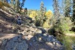
The Pecos River area has beckoned to us for sometime. We made a foray last year, hiking on the Holy Ghost Trail. For this trip we hoped to make it to the Jacks Creek Campground and one of the many trails that start there. But we discovered that the entrance gate at Cowles was closed. So we backtracked and stopped at the Pecos Complex Wildlife Area (’tis also the Mora Campground). The Campground was closed so we parked at the blocked-off entrance. The topo map showed a two-track along the northern boundary of the Complex, then continuing some distance up the Rio Mora; we decided to give it a try for a short hike.
The Hike

Rio Mora Hike.Pat.2020-05-08

The Rio Mora was flowing smartly, which added a lot to the hike since so many places have -no water-. The two-track served us well for about 2/5ths of a mile; from there we followed a well used trail. For the most part the trail was easy, being above the water even with that day’s high flow. There were, however 2 or 3 rock scrambles that we had to navigate.  Although we planned for a short hike (still recovering a bit from last week’s 8 miler), today’s hike ended where we encountered a rock outcrop that we weren’t comfortable scrambling over.

On the return trip, we made the usual stop for our mid-hike/lunch break. We also scouted out potential tent sites, thinking the short distance from parking would make this a good place to test our mettle for back-packing. We identified three that looked quite good (placemarks are on the GPS track).

[Speaking of the GPS track, it got a bit messed up: I failed to make a necessary change to Options on USTopo after reloading everything on the phone. But the track (with sketched extensions) will still give you an idea of the hike.] We enjoyed the beauty of this area and will be returning; it is especially attractive because of it’s high elevation and … cooler temperatures in the summer.

Statistics

Total Distance:  2.04 miles
Elevation: start  7,917 ft, maximum  8,038 ft,  minimum  7,917  ft
Gross gain:  121 ft.  Aggregate ascending  478 ft, descending  470 ft
Maximum slope: 41% ascending, 56% descending, 9.4% average
Duration: ~3:00

GPS Track Files for Download
75 Downloads
72 Downloads
I urge you to explore our hiking tracks with Google Earth. With the virtual 3-dimensional presentation, achieved by panning and tilting the view, you can get a much better idea of the hikes and terrain than you can get from the 2-dimensional screenshot above. For assistance: Using Google Earth Track Files.

References and Resources

The Dyrt: Mora Campground

Holy Ghost Trail Hike – 4/11/2018

Pat & I headed for the Pecos River Canyon, to get our first exposure to one of the favorite hiking, camping, and fishing spots around Santa Fe. 

The Drive In

Getting there: I-25  to Glorieta, then NM 50 to Pecos, turn left onto NM 63, continue to the south edge of Tererro where you turn left onto Holy Ghost Canyon Road.  Proceed to the entrance to the campground.

The Hike

Holy Ghost Canyon Hike.Pat.2018-04-11

Parking for hikers is at the entrance to the campground (which was closed), so the first half mile is through the tent, trailer, and group campgrounds.  Then it is into the canyon – the trail follows Ghost Canyon Creek; we crossed over the creek on logs 3 times in the 1.5 miles up the canyon on our hike.  The trail is well used and easy going, generally through open forest, occasionally open spaces that afford views of the steep forested sides of the canyon.  Aspen are sprinkled throughout the forest, between very tall fir, ponderosa, and a few spruce trees. And all the time we heard the sound of the bubbling  brook.

Statistics

Total Distance:  3.30 miles
Elevation: start  8,089 ft, maximum  8,481 ft,  minimum  8,089 ft
Gross gain:  392 ft.  Aggregate ascending  659 ft, descending  659 ft
Maximum slope: 25% ascending, 24% descending, 6.3% average
Duration: 2:57

GPS Track Files for Download
95 Downloads
70 Downloads
148 Downloads
64 Downloads
I urge you to explore our hiking tracks with Google Earth. With the virtual 3-dimensional presentation, achieved by panning and tilting the view, you can get a much better idea of the hikes and terrain than you can get from the 2-dimensional screenshot above. For assistance: Using Google Earth Track Files.

References

USDA Forest Service: Holy Ghost Trail #283
ASCHG:
     Holy Ghost Creek Hike
     Holy Ghost – Stewart Lake – Winsor Creek Hike
Southern New Mexico Explorer: Holy Ghost Trail (FT 283) – Pecos Wilderness AllTrails: Holy Ghost Creek Trail
OhRanger: Trail 283 Holy Ghost Trail