The Pecos River area has beckoned to us for sometime. We made a foray last year, hiking on the Holy Ghost Trail. For this trip we hoped to make it to the Jacks Creek Campground and one of the many trails that start there. But we discovered that the entrance gate at Cowles was closed. So we backtracked and stopped at the Pecos Complex Wildlife Area (’tis also the Mora Campground). The Campground was closed so we parked at the blocked-off entrance. The topo map showed a two-track along the northern boundary of the Complex, then continuing some distance up the Rio Mora; we decided to give it a try for a short hike.
The Hike
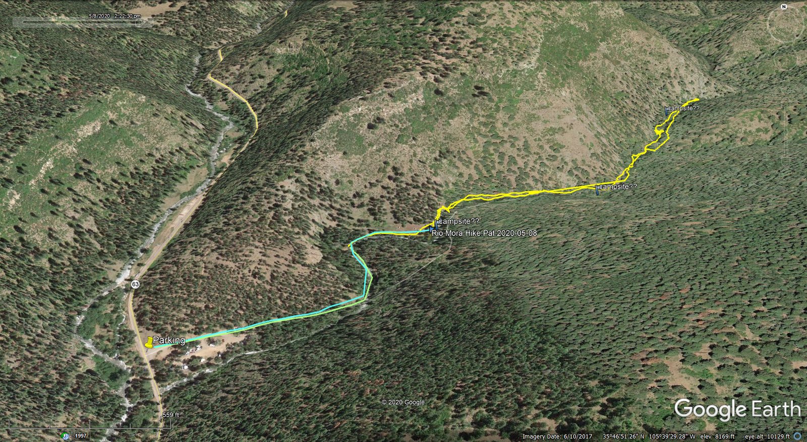
Rio Mora Hike.Pat.2020-05-08
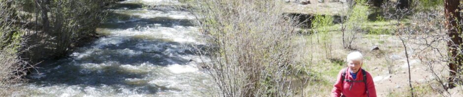
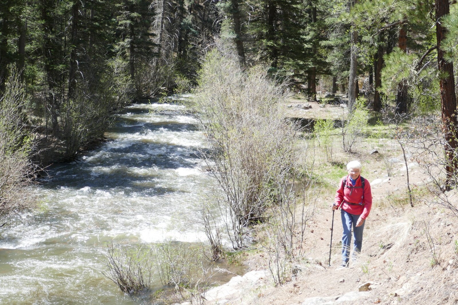 The Rio Mora was flowing smartly, which added a lot to the hike since so many places have -no water-. The two-track served us well for about 2/5ths of a mile; from there we followed a well used trail. For the most part the trail was easy, being above the water even with that day’s high flow. There were, however 2 or 3 rock scrambles that we had to navigate. Although we planned for a short hike (still recovering a bit from last week’s 8 miler), today’s hike ended where we encountered a rock outcrop that we weren’t comfortable scrambling over.
On the return trip, we made the usual stop for our mid-hike/lunch break. We also scouted out potential tent sites, thinking the short distance from parking would make this a good place to test our mettle for back-packing. We identified three that looked quite good (placemarks are on the GPS track).
[Speaking of the GPS track, it got a bit messed up: I failed to make a necessary change to Options on USTopo after reloading everything on the phone. But the track (with sketched extensions) will still give you an idea of the hike.] We enjoyed the beauty of this area and will be returning; it is especially attractive because of it’s high elevation and … cooler temperatures in the summer.
Statistics
Total Distance: 2.04 miles
Elevation: start 7,917 ft, maximum 8,038 ft, minimum 7,917 ft
Gross gain: 121 ft. Aggregate ascending 478 ft, descending 470 ft
Maximum slope: 41% ascending, 56% descending, 9.4% average
Duration: ~3:00
| GPS Track Files for Download | |
196 Downloads | |
|---|---|
189 Downloads | |
I urge you to explore our hiking tracks with Google Earth. With the virtual 3-dimensional presentation, achieved by panning and tilting the view, you can get a much better idea of the hikes and terrain than you can get from the 2-dimensional screenshot above. For assistance: Using Google Earth Track Files.
References and Resources
The Dyrt: Mora Campground