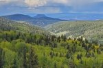
During past visits to Valles Caldera, we’ve thought the view would be great from atop the mountains on the north boundary of the Caldera. A trail leads from the road that crosses the north end of the Preserve, but it entails nearly 2,000 feet of elevation gain to a spot -near- the peak of Cerro de la Garita.
Also, we have been curious about the Jemez Mountains north of the Preserve, between San Valles Caldera and NM 96. Checking maps and GoogleEarth, we identified Forest Roads that 1) would take us to the north slopes of those mountains, and 2) would give us an edge of 1,400 feet for the ascent to the peak. And this would also give us a chance to explore that territory.
The Drive In
The distance from Albuquerque to Youngsville is about the same, whether going up US 550 to just beyond Cuba and then NM 96 north and east to Youngsville. Or I-25 and US 285 to Abuquiu, then NM 96 west to Youngsville. We opted for Cuba on the way out (so we could grab a burrito for breakfast at the Chaco Grill in Cuba), then returned by US 285 and I-25. Either way, it is about 124 miles.
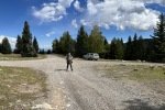
A short distance east of Youngsville, we turned south on FR 100 for 12 miles, then turned left onto FR 99. Both roads are good Class 3s, generally through flat terrain with only a couple of narrow, steep hillside sections. And along the way they climb from 6,800 feet to 10,229 feet elevation. FR 99 tee’s into FR 144 not far from the peak of Cerro de la Garita; we parked off of the road, donned our packs, and set out for the peak.
The Hike
Notes about the Google Earth screenshot: the graph at the bottom shows elevation of the track (pink area) and speed (the blue line).
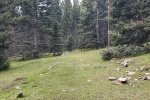
With no marked trail to follow (or GPS track), set set out to go uphill in a general southerly direction. After crossing the edge of a gravel pit and into open forest, we came across what appeared to be an old 2-track, an open corridor in the forest – we followed it for some distance until we realized we were not on a track towards the peak. Getting better oriented with the help of the GPS and USTopo, we turned left onto another “2-track opening” that was at least going up hill.
At some point, we decided to take a bearing (using USTopo) and set our course towards the peak. So we continued at times along a 2-track opening, at other times proceeding through the open forest, aiming for the peak. That worked – we found ourselves on the edge of the mountain, on –the peak– of Cerro de la Garita at 10,612 feet elevation.
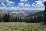
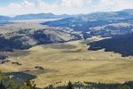
We were looking down upon what proved to be Valle Toledo in the northeast corner of the Caldera. What a view it was.

And the view down the middle of this northern area of the Caldera – the road coming from Valle Grande through Valle Jaramillo and into Valle San Antonio.
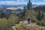
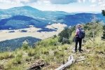
Thinking we might get a view that included the northwest area of the Caldera, we proceeded southwest along the edge of this mountain. We soon found ourselves on somewhat of a promontory, still at 10,570, looking down upon the whole north end of the Caldera. Wow, it was the view we were looking for.
A note about the photos: This was a very hazy day, and we were looking into the sun. So, then, the photos are hazy and the colors are not accurate, for either Pat’s iPhone or my Samsun phone. (Click on the photos to see them full-screen.)
Setting out to return to the Tacoma, we followed one of the 2-track openings downhill for some distance, then realized that we needed to turn north to the parking place. We were able to follow a sequence of the 2-track openings at generally the same elevation back to “our trailhead”.
A note about those “2-track openings”: As you can see from the GoogleEarth screen shot above (and your own view when you review our GPS track on GoogleEarth), thsese openings criss-cross the whole of the north side of La Garita. For a return visit in the future, I will do some pre-trip planning to lay out a GPS track that uses the openings to best advantage.
Highlight
Pat drove in from NM 96 and out as well; she expanded her experience driving on Forest Roads and I could give more time to the scenery and surroundings. And the hike proved to be an easy way to get to amazing views of Valles Caldera
Statistics
Total Distance: 4.07 miles
Elevation: start 10,228 ft, maximum 10,601 ft, minimum 10,198 ft
Gross gain: 403 ft. Aggregate ascending 860 ft, descending 860 ft
Maximum slope: 23% ascending, 21% descending, 6.9% average
Duration: 3:35
| GPS Track Files for Download | |
120 Downloads |
|
|---|---|
115 Downloads |
|
291 Downloads |
|
252 Downloads |
|
If you haven’t explored these hiking tracks with Google Earth, I urge you to try it. With the virtual 3-dimensional presentation, achieved by panning and tilting the view, you can get a much better idea of the hikes and terrain than you can get from the screenshot above. For some ideas, check out Using Google Earth Track Files.
References and Resources
AllTrails: Cerro La Garita
Peak Advisor: Cerro de la Garita
Discover Abiquiu: Abiquiu’s Neighbor – The Village of Youngsville
(Great stories and photos)


