Cumbres Pass and the Continental Divide Trail (CDT) are a favorite destination and hike. You will find other posts of our visits there, one solo, another with Pat, and still another with Jay and Nancy. For this trip, we reserved Campsite 13 at the Heron Lake “Willow Creek” campground. Many of the sites in this campground are quite nice; Site 13 offered a through-drive with room for 2 vehicles, and 2 or 3 spots suitable for tent camping (since Pat didn’t make this trip, I brought a tent to sleep in).
The Drive In
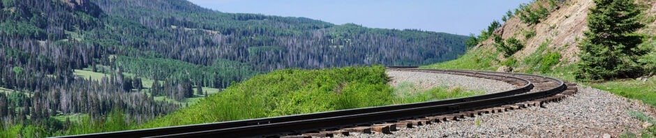
 I will leave it to you to find your way to the Heron Lake campgrounds, and from Heron (if you camp there) to Chama. From Chama, continue north on NM 17 for 12 miles (..uphill.. from 7,900 feet to 10,000 feet at the pass) following the tracks of the Cumbres & Toltec Railroad (a National Historic Landmark). You will leave New Mexico for Colorado about 5 miles below the pass, continue on CO 17. Maybe 200 yards before reaching the summit, use the parking area on your right; there is a sign above the parking lot for CDT Trailhead #813. (The CDT goes both north and south from here – we hiked to the north, across the highway from the sign.)
The Hike
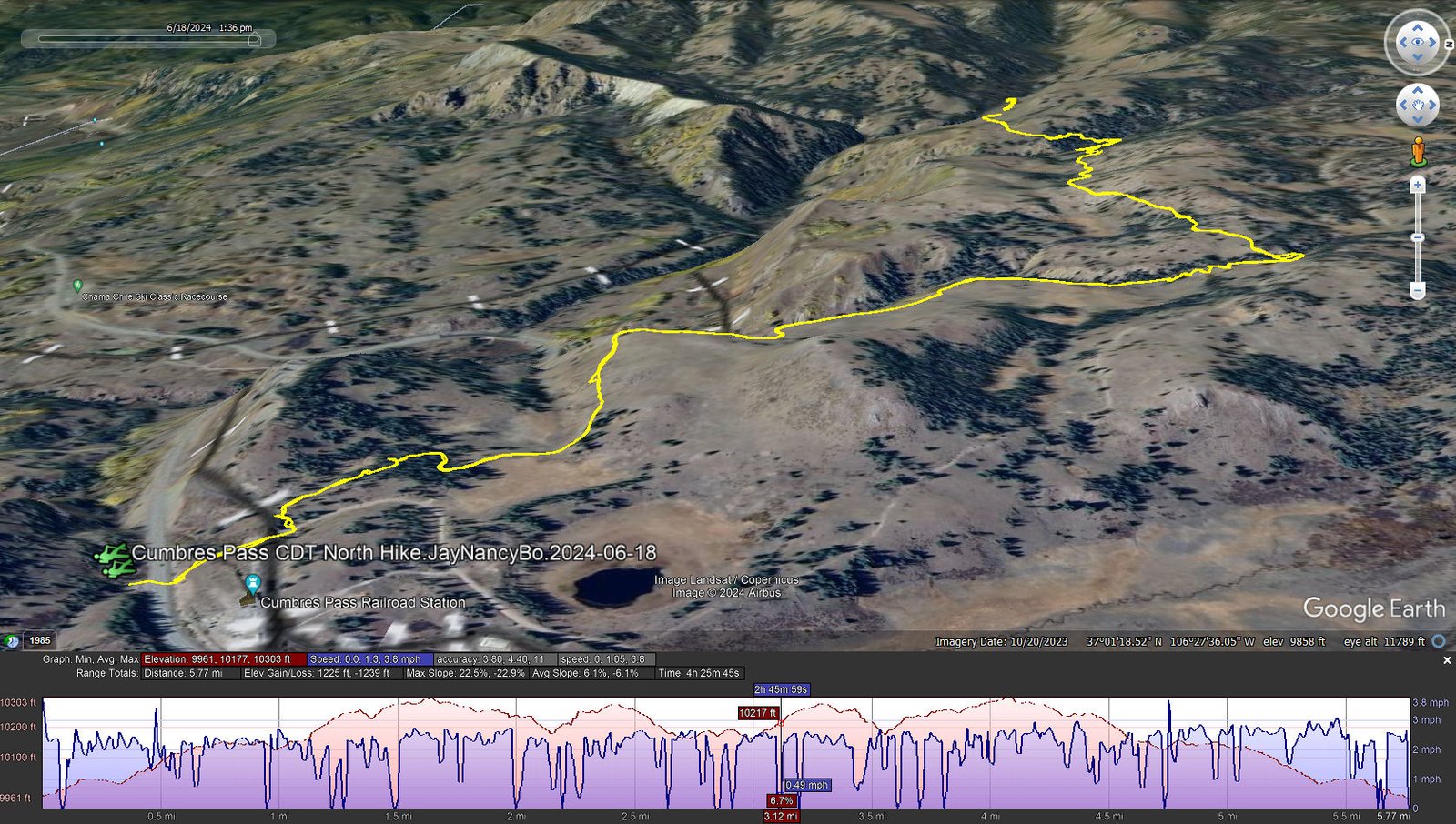
https://nmhiking.com/wp-content/uploads/2024/06/Cumbres-Pass-CDT-North-Hike.JayNancyBo.2024-06-18
Notes about the Google Earth screenshot: the graph at the bottom shows elevation of the track (pink area) and speed (the blue line).
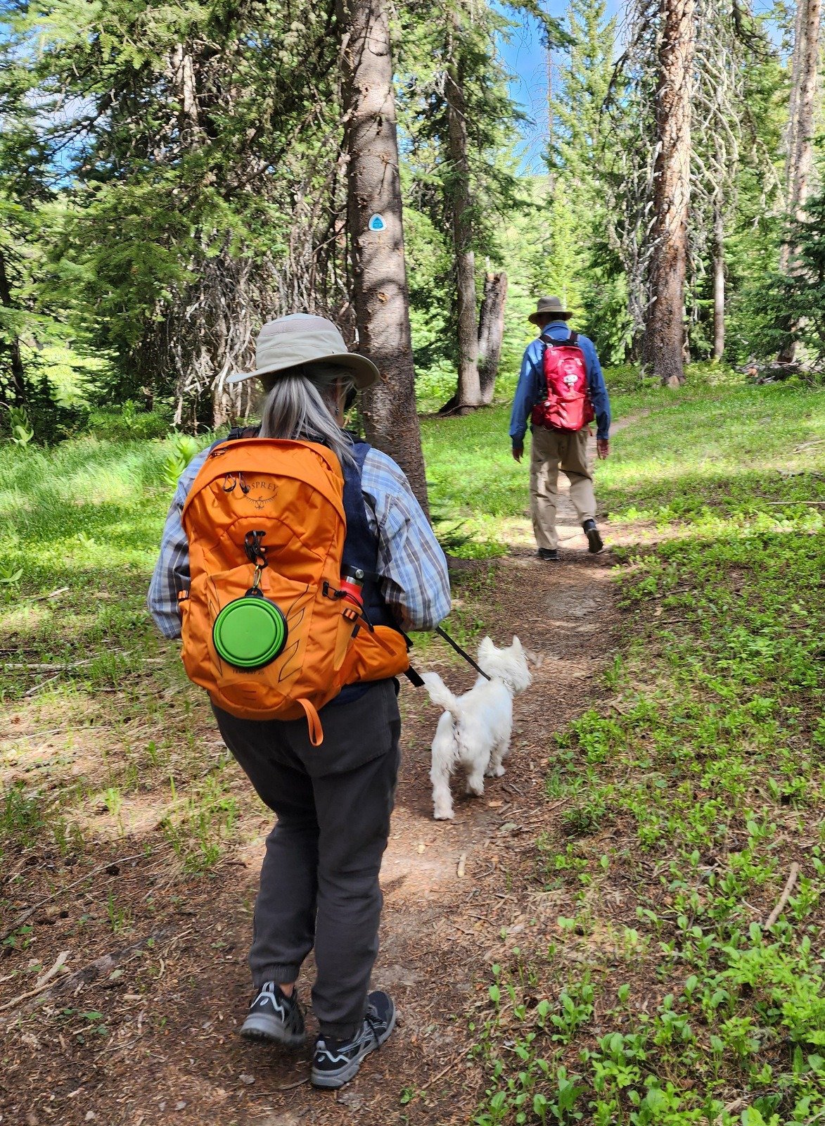
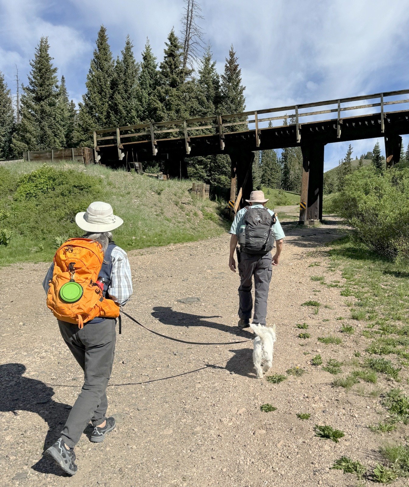 From parking, we crossed the highway and under the C&TRR trestle; the trailhead is just beyond. The first quarter mile is uphill, through an area of open forest. Then across an flat open area before taking on the climb. For the next 1.4 mile or so the trail climbs, traversing a steep slope (as Jay says, FARD – Fall and Roll Downhill).
From there the trail continues on a not-so-steep slope across an open hillside. Twice the trail crosses a tiny “valley”, the 2nd at 2.2 miles which had a bit of water draining from above. We continued until encountering a flowing stream which would require wading to cross; we decided to pause here for lunch, then return to the trailhead. (As I had done on my solo hike, added our names to the logbook.
Jay here: Like finding a missing cufflink, we now have the matching set of CDT hikes: North and South. Very different in character. CDTS was mostly open along the ridge tops and with wide views of the valley below. CDTN was more confined in some ways but still had extended views to the ridges we hiked on CDTS the prior year. The steep portions were not FOAD (Fall Off And Die) but you could roll a long way down before arresting your descent. Bo did a great job for a little Westie, even jumping over logs a few times.
Highlight
The views from the beginning of this section are magnificent. Here’s an excerpt from a hike with Pat back in 2022 that will give you an idea:
Statistics
Total Distance: 5.77 miles
Elevation: start 9,976 ft, maximum 10,303 ft, minimum 9,961 ft
Gross gain: 342 ft. Aggregate ascending 1,225 ft, descending 1,239 ft
Maximum slope: 23% ascending, 23% descending, 6.1% average
Duration: 4:26, Average Speed: 1.3 mph
| GPS Track Files for Download | |
140 Downloads | |
|---|---|
116 Downloads | |
If you haven’t explored these hiking tracks with Google Earth, I urge you to try it. With the virtual 3-dimensional presentation, achieved by panning and tilting the view, you can get a much better idea of the hikes and terrain than you can get from the screenshot above. For some ideas, check out Using Google Earth Track Files.
Related Posts
References and Resources
USDA Forest Service: CDNST – Cumbres Pass North Trailhead # 813
AllTrails: Cumbres Pass CDT North
Continental Divide Trail Coalition: Cumbres Pass on the CDT, …
Taos News: Hiking in Southren Colorado: Cumbres Pass North to Wolf Creek Falls
Photos


