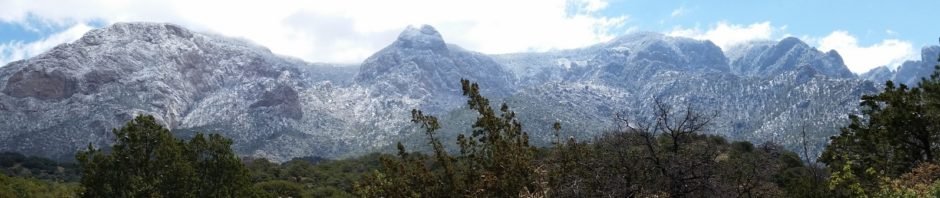
Snows from recent storms across northern New Mexico steered us away from the Jemez Mountains, so looking for a new trail nearby, we opted for the Juan Tabo Canyon trail. This is a well-used trail; we met a half dozen hikers, many with dogs, on the first fifth of a mile, but not many hikers after that.
The Hike
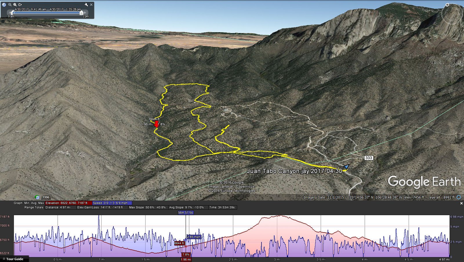
Juan Tabo Canyon North Hike.Jay.2017-04-30
As we embarked on the hike, the temperature was in the 40s and there was lots of snow on the ground and and on the plants (cholla, prickly pear, juniper, oak, all kinds of plants), deposited there by a storm the day before. Snow covered a large part of the mountain, with lots of white on the rocks and trees, and on the Crest one could see rime ice coating trees and the radio towers. And the clouds whirling around the northern end of the Sandias were amazing.
The first part of the trail is wide and well worn; we could walk abreast over a sand/dirt surface. A bit over a half mile into the hike, we turned to the right on a ‘good looking trail’; checking the GPS .4 miles later I realized that we had turned onto a spur that was taking us away from our intended track. So we backtracked and proceeded ahead into the bottom of Juan Tabo Canyon. Hiking was easy, a gradual slope uphill following the GPS track from ASCHG; easy sandy surface, few trees, and the temperature had warmed to make the hiking quite pleasant.
Jay here: Just when you think there are no hikes left that we have not done in the Sandias, you discover one that you missed. The hike starts off easy in the canyon bottom but if you follow the canyon up as we did, you will need to tackle many rockfalls to reach higher elevations. The swirling clouds on a freshly snow covered mountain put on a great show for us all morning. The latter stage of the hike had a lot more bushwhacking than would be my preference but it’s all part of the challenge of making your way back to the trailhead without settling for returning the way you came.
Statistics
Total Distance: 4.97 miles
Elevation: start 6,712 ft, maximum 7,187 ft, minimum 6,522 ft
Gross gain: 664 ft. Aggregate ascending 1,417 ft, descending 1;,419 ft
Maximum slope: 51% ascending, 44% descending, 8% average
Duration: 3:54
| GPS Track Files for Download | |
271 Downloads | |
|---|---|
166 Downloads | |
I urge you to explore our hiking tracks with Google Earth. With the virtual 3-dimensional presentation, achieved by panning and tilting the view, you can get a much better idea of the hikes and terrain than you can get from the 2-dimensional screenshot above. For assistance: Using Google Earth Track Files.
References
ASCHG: Juan Tabo Canyon Hike


