Weather continued to be perfect for visiting the openness of the San Juan Basin and the Badlands near Cuba, NM.
 The San Juan Basin covers the northwest quarter of New Mexico and a portion of Colorado along the NM-CO border. There are -many- Badlands including the Ojito (near San Ysido), San Jose (north of Cuba), and going west Lybrook, Bisti/De-Na-Zin, Ah-Shi-Sle-Pah, and several others (see the map at American Southwest).
Plus these five south and west of Cuba: Mesa de Cuba, Mesa Chijuilla, Mesa Penistaja, Ceja Pelon, and Cejita Blanca Mesa.
A closeup map of the first 4 of the 5 Cuba Badlands.
The Drive In
From Albuquerque: I-25 to Bernallilo and US-550, then US 550 to the south edge of Cuba. At the edge of town turn left onto NM 197. Continue south along the large Mesa de Cuba on your right; NM 197 bends around to the west; at 5.6 miles, just past the top of a rise in the road, turn right onto a dirt road. Go around a depression (muddy after rain or snow), proceed for .6 miles. Approaching a nearly-washed crossing of an arroyo, we turned right onto a 2-track and proceeded .7 miles to our parking place. There are a few spots along this 2-track that suggest a high-clearance vehicle (we drive a Tacoma). But one could stop anywhere along this 2-track and walk from there towards very interesting territory.
The Hike
Notes about the Google Earth screenshot: the graph at the bottom shows elevation of the track (pink area) and speed (the blue line).
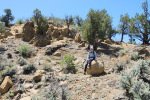
 We began our Walkabout by seeking a path up onto a ridge south of were we parked. Alighting from the Tacoma, we immediately came across interesting features – the light and dark gray mounds and rocks on pedestals. After a bit of reconnoitering, we found our way up the steeper slope to the top of the ridge.
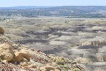
 From there we enjoyed a good view of the light and dark gray mounds between there and the open plains beyond. We explored this ridge top, considered going down among the mounts but … continued on looking for more interesting features.
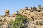
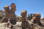
 Before descending, our view was punctuated by small rock monuments on the end of this ridge.
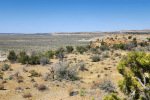
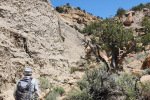
 From there we explored the lower level of this area enjoying the wonderful weather, walking among the scattered juniper trees, and the views of the the mesa around us. We explored a couple of small canyons that penetrated the mesa. And the edges of the dark/light gray mounds have quite an interesting appearance and texture – erosion of the fragile material forming various patterns and shapes.
We came upon more upstanding rocks, sentinels in this fascinating geology.
And we came across a few spherical shaped rocks – what variety Mother Nature produces.
Highlight
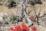
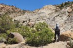
Wherever we hike, even in what seems to be the driest setting, we come across more of Mother Nature’s glory – flowers in bloom, the sculpture of skeletons of juniper trees, and sagebrush and a healthy juniper tree forming a backdrop.
Statistics
Total Distance: 2.06 miles
Elevation: start 6,963 ft, maximum 7,021 ft, minimum 6,948 ft
Gross gain: 73 ft. Aggregate ascending 424 ft, descending 424 ft
Maximum slope: 34% ascending, 43% descending, 6.5% average
Duration: 3:53, Average Speed: 0.5 mph
| GPS Track Files for Download | |
95 Downloads |
|
|---|---|
88 Downloads |
|
95 Downloads |
|
102 Downloads |
|
If you haven’t explored these hiking tracks with Google Earth, I urge you to try it. With the virtual 3-dimensional presentation, achieved by panning and tilting the view, you can get a much better idea of the hikes and terrain than you can get from the screenshot above. For some ideas, check out Using Google Earth Track Files.
Related Posts
Mesa de Cuba:
11/09/2014: Mesa de Cuba & Penistaja Driveabout
03/27/2015: Mesa de Cuba Hike
03/25/2018: Mesa de Cuba West Hike
All San Juan Basin hikes
References and Resources
New Mexico Magazine: Badlands Walkabout
The American Southwest: San Juan Basin Badlands
PhotoTrekNM: San Juan Basin Badlands
AllTrails: Mesa de Cuba
XXX’s Photos w/ Captions: Click on a Photo for Gallery Show.
Photos
To date: 93 views.





I think I could have spent the rest of my life hiking around northwest New Mexico and not seen all I want to. To my eyes, this country is just spectacular. I love reading about your day trips.
Good evening, Vince. As you can see, we continue to explore and enjoy tremendously New Mexico natural wonders. And I remember so clearly getting among my first introductions a visit to the Guadalupe volcanic plug in the Rio Puerco. I’m happy that I can share our ramblings with you and others through this BLOG. I have a post in the wings, to Ceja Pelón where there is an abundance of shards and blocks of pretrified wood.
I hope this finds you in good health and rambling about in your territory. To