Seeking new route in the Ojito Wilderness, I sketched a track on Google Earth around the north side of Mesa de Ricardo. (Note: I’ve been unable to find a map that identifies this mesa by name. But the very small mesa at the southeast corner is known as Mesita de Ricardo. So … I’m dubbing this large one Mesa de Ricardo. (I don’t know who Ricardo was.)
 The Drive In
The drive in on Cabezon Road, then Pipeline Road, is easy – it has been graded since last winter leaving it without ruts or dried-up mudholes. The turnoff onto the two-track is easy to identify and it is reasonably good- for a two-track (if careful, one could traverse it with less than a high-clearance vehicle). Parking is at the locked gate .4 mile off of Pipeline Road.
The Hike
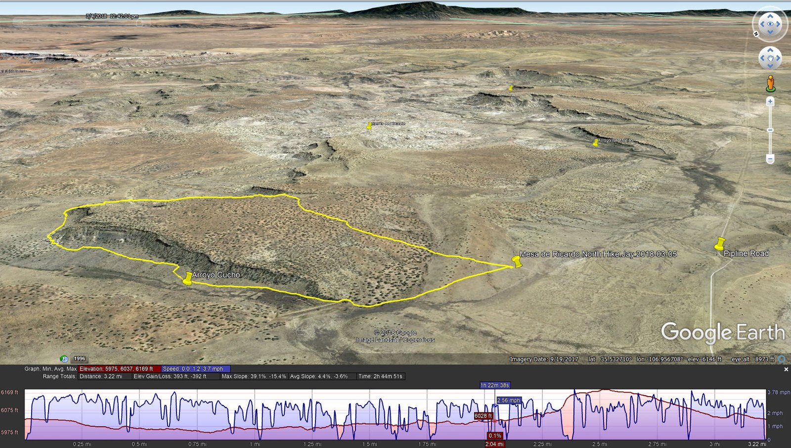
Mesa de Ricardo North Hike.Jay.2018-03-05
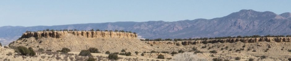
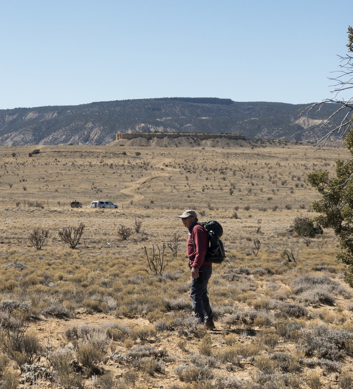
We opted to go clockwise, planning to proceed northeast in Arroyo Cucho, along the north face of Mesa de Ricardo. Then around the northeast end and back on top to return to the truck. The first 1/3 mile is on a two-track and the open space of the base of the Mesa. Cabezon Peak is in view to the northwest, and the Nascimiento Mountains plus other mesas in the vicinity are in view to the northeast (as in the featured image above). Then into the Arroyo, past a fairly large dam (there are other smaller dams further down the Arroyo); the Arroyo is wide and mostly flat. Staying close to the side of the mesa on our right, we found little in the way of interesting rocks or other geology; the going was easy ‘tho we had to cross a few very small arroyos.
Rounding the northeast end of the Mesa, we found more interesting features: rock formations, rocks with strange surfaces, the edge of the mesa that in some places appeared to be ready to calve (like a glacier), and occasionally a small rock different than anything around it – where did that piece come from and how did it get here?
Since we decided to not make a complete circumnavigation, I had identified 3 possible routes to get back atop the Mesa and more directly back to the truck. Two of them went up more or less the face of the Mesa, the third up a small canyon (as it appeared on Google Earth and the Topo maps). The weather was chilly, amplified by wind, so we chose the canyon. The going was easy until near the top where we had 20′ or 30′ feet of rockfall to climb up. After a pause for our mid-hike break, Jay led the way up and onto the Mesa.
The return route to the truck was over generally flat land, among a few small juniper trees, and notably over many large clumps of prickly pear cactus. I’m always on the lookout for signs of past occupation (ruins), and ‘tho this mesa would seem to be as accommodating as others where we’ve found ruins, none came to our attention here. On the way out, we encountered a few cows, one with a nearly-newborn calf; we had to pause for Jay to take a photo of the pair.
Jay here: I was under the weather with a cold for this hike, hence its brevity. We usually can do a lot better than 3.2 miles, but under the circumstances it was the best I could do. And anything under 400 ft of ascent is always okay by me.
Statistics
Total Distance: 3.22 miles
Elevation: start 6,034 ft, maximum 6,169 ft, minimum 5,975 ft
Gross gain: 194 ft. Aggregate ascending 393 ft, descending 392 ft
Maximum slope: 39% ascending, 15% descending, 4.4% average
Duration: 2:45
| GPS Track Files for Download | |
216 Downloads | |
|---|---|
193 Downloads | |
239 Downloads | |
326 Downloads | |
I urge you to explore our hiking tracks with Google Earth. With the virtual 3-dimensional presentation, achieved by panning and tilting the view, you can get a much better idea of the hikes and terrain than you can get from the 2-dimensional screenshot above. For assistance: Using Google Earth Track Files.
Related Posts (in the vicinity)
References:
ASCHG:
Mesita De Ricardo – Northwest Passage Hike
Beyond Meseta De Ricardo Hike
The American Southwest:
San Juan Basin Badlands
Map of the San Juan Basin Badlands


