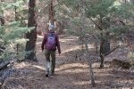
This hike is the first of two short hikes on a day trip to the area once inhabited by the Gallinas culture. The area is north of Cuba some 28 miles on NM 96>NM 112. In years past I’ve read about the Gallina people who occupied this area until about 1275 when they suddenly vanished. There are various explanations that make for interesting reading (see References below). But this site and the other one that we visited this trip provide a glimpse into the history of these parts.
The Drive In
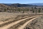
To get to this area from Albuquerque, travel west on US 550 to Cuba. Continue on through Cuba for 3.6 miles, turn right (north) on NM 96. Continue for 13 miles where NM 96 turns right (east); continue north on NM 112 for 13 miles. Our first try to get to Nogales Cliff House (3 years ago and again this trip) was to turn onto a dirt road a half mile further – that didn’t work – recent snow had melted but not dried – even if dry it is a road for high-clearance vehicles. Rather, turn left at that 13 miles point onto Forest Road 313. This is a good Class 4 dirt road (courtesy the oil industry) unless there has been recent precipitation (rain or snow).
 Six tenths of a mile in continue past the compound for oil field tanks and equipment. Although FR 313 continues west, turn right (north) on a lesser dirt road just beyond the compound. Follow this road for a bit more than 1 mile, then turn left; this will take you to a gas wellhead and the trailhead. These roads are Class 5 roads – low clearance “city” vehicles should avoid them.
The Hike
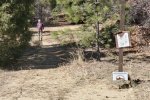
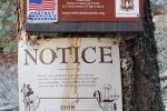
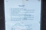
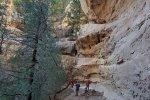
This is a short, pleasant hike on a well used trail with a most interesting destination. From the parking area the trail proceeds up Spring Canyon, a pleasant easy walk with steep canyon walls left and right. Near the trailhead, check out the sign to get an idea of the extent of the ruins; this will help your exploration once reaching the bench where the ruins are located.

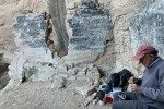
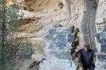
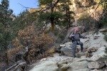
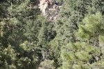
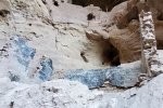
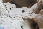
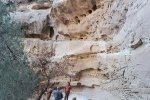
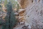
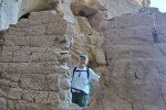
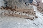
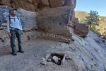
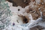
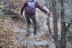
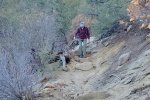
 About 6/10ths of a mile from the trailhead, the trail turns abruptly up the left-hand canyon wall. Although steep, the trail is easy to follow with a few places over large rocks – not strenuous. About 300′ in elevation gain (2/10ths of a mile) we reached a large bench with a large blockhouse with erect walls to the right, come caves, and above a wall structure and larger cavity behind it. There were also remnants of other structures around the bench to the left.
It would appear the blockhouse was a gathering place and possibly food preparation – there is what appeared to be a firepit in the center of the floor and the walls were blackened (with smoke?)
 There was a group of students at the site, so with the cautions of Covid, we did not explore beyond the blockhouse. We did pause there to enjoy our first mid-hike break in these amazing surroundings. The hike back down the to the floor of the canyon was in the shadow of the canyon wall, by now late afternoon. We plan to return in the future to explore further around the bench.
Statistics
Total Distance: 1.80 miles
Elevation: start 7,206 ft, maximum 7,608 ft, minimum 7,200 ft
Gross gain: 408 ft. Aggregate ascending 898 ft, descending 899 ft
Maximum slope: 82% ascending, 80% descending, 14% average
Duration: 2:23
| GPS Track Files for Download | |
345 Downloads |
|
|---|---|
361 Downloads |
|
190 Downloads |
|
168 Downloads |
|
I urge you to explore our hiking tracks with Google Earth. With the virtual 3-dimensional presentation, achieved by panning and tilting the view, you can get a much better idea of the hikes and terrain than you can get from the 2-dimensional screenshot above. For assistance: Using Google Earth Track Files.
Related Posts
Rattlesnake Ridge Trail Hike – 11/19/2020
Plaza Blanca Expedition – 03/28/2018
Plaza Blanca Hike – 3/15/2017
References and Resources
OtherHand: Spring (Nogales) Canyon Cliff Dwellings
Rock Art Blog: Anasazi Wall painting: Nogales Cliff House
USFS Report: Potential Management Areas, page 7: Potential Management Area, Nogales Cliff House Cultural Interpretive Management Area (PDF)
About the Gallina Culture
Wikipedia: Gallina
Gallina Landscapes of History: Gallina: the culture hidden in the hills
USFS Passport in Time: Gallina Site Relocation and Documentation
And there is much more about the fascinating history of the Gallina Culture.


