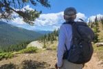
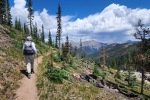
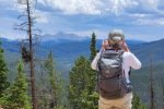
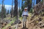
This hike was near the end of a road trip through Kansas to visit my home town and cousins in eastern Kansas. After 8 days of driving and visiting, it was really good to get out on a trail. And a trail as beautiful as this one.
The Drive In
Not much to say here: drive to the summit of Monarch Pass on US Highway 50, 18 miles west of Poncha Springs, CO. Park in the very large parking area at the Visitor Center. The trailhead is 500 yards west (downhill) and across the highway.
The Hike
Notes about the Google Earth screenshot: the graph at the bottom shows elevation of the track (pink area) and speed (the blue line).
Reading reviews on AllTrails, I found a discussion about taking the loop clockwise or counterclockwise. We recommend counterclockwise, as Pat observed the best views will be ahead of you, those during the early part of the hike.
 The trail is quite well used which makes for an easy hike. Whether going clockwise or counterclockwise, the first 300 yards will be steep, steeper going counterclockwise for about 150 ft elevation gain. Gaining the top of the ascent the view to the north is spectacular – the -big- peaks of the Sawatch Range and the Presidential Range, some of them among Colorado’s “Fourteeners” (over 14,000 feet elevation at the summit).
 Two thirds of a mile into the hike the trail rounds the end of the ridge above the highway and proceeds northwest, now on the north face of the ridge and through nice spruce and fir forest (although many of the fir are dead, having been killed by the bark beetle that infested these mountains some years back).

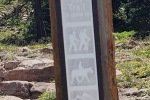
 The “top end” of the loop is the Old Monarch Pass Summit, a dirt road and a sign to mark the spot. The trail then turns southeast then south back towards the highway. It passes through open and shaded sections, rounding the other end of the aforementioned ridge. It then descends down, not so steep, back to the road. And back at the trailhead, a signpost notes that this is part of the Continental Divide Trail (and we saw quite a few backpackers in the visitors center and a few seeking a ride to Poncha Springs).
Highlight
The views to the north, looking across the many high peaks of this central part of Colorado’s Rocky Mountains.
Statistics
Total Distance: 3.33 miles
Elevation: start 11,308 ft, maximum 11,490 ft, minimum 11,233 ft
Gross gain: 257 ft. Aggregate ascending 868 ft, descending 868 ft
Maximum slope: 32% ascending, 30% descending, 7.8% average
Duration: 2:39, Average Speed: 1.3 mph
| GPS Track Files for Download | |
117 Downloads |
|
|---|---|
122 Downloads |
|
If you haven’t explored these hiking tracks with Google Earth, I urge you to try it. With the virtual 3-dimensional presentation, achieved by panning and tilting the view, you can get a much better idea of the hikes and terrain than you can get from the screenshot above. For some ideas, check out Using Google Earth Track Files.
Related Posts
Other Colorado Hikes
Other Colorado Hikes on CDT
References and Resources
AllTrails: Old Monarch Pass Loop
GAIA GPS: Monarch Pass via CDT
Wikipedia:
Monarch Pass
Sawatch Range
Presidential Range
dangerousroads: Driving through the scenic Monarch Pass in Colorado


