Another hike seeking cooler temperatures at a higher elevation – this time to Sandia Crest. And for this hike, we were joined by my brother who moved to Albuquerque a few weeks ago.
The Hike
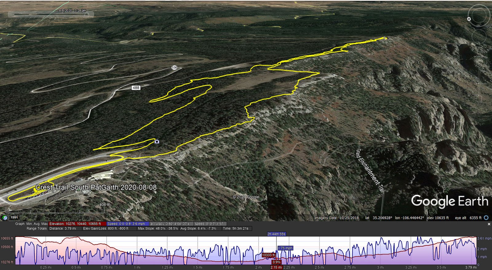
South Crest Trail.PatGarth.2020-08-08

We parked at the Visitors Center, then headed south on the South Crest Trail as far as the Top of the Tram, then returned on the Gravel Pit Trail then Switch Back and Buried Cable trails back to the parking lot. A pleasant hike on well used trails. For more details, please see my earlier post, South Crest Trail Hike – 07/09/2020.
Statistics
Total Distance: 3.79 miles
Elevation: start 10,651 ft, maximum 10,655 ft, minimum 10,276 ft
Gross gain: 379 ft. Aggregate ascending 800 ft, descending 800 ft
Maximum slope: 48% ascending, 39% descending, 6.8% average
Duration: 5:03
| GPS Track Files for Download | |
377 Downloads | |
|---|---|
171 Downloads | |
I urge you to explore our hiking tracks with Google Earth. With the virtual 3-dimensional presentation, achieved by panning and tilting the view, you can get a much better idea of the hikes and terrain than you can get from the 2-dimensional screenshot above. For assistance: Using Google Earth Track Files.
Previous Posts:
South Crest Trail Hike – 07/09/2020 Crest Trail Hike – 8/22/2016