This is our 2nd hike during two days visiting Capulálpam, one of the Pueblos Mancomunados, Zapotec villages in the Sierra Norte (TripAdvisor: Pueblos Mancomunados). The day before we had driven from Oaxaca city to Capulálpam and hiked from Ecoturismo Capulálpam through the forest (see Capulálpam Trail Hike – 01/08/2023).
Staying the night in a cabin at Ecoturismo Capulálpam, the next morning we were promised amazing scenery, driving and hiking to a viewpoint (mirad0r) to watch the sun rise. Up long before the crack of dawn, we met José and Leonel for the drive to the trailhead and hike to the mirador. We were not disappointed.
The Drive In
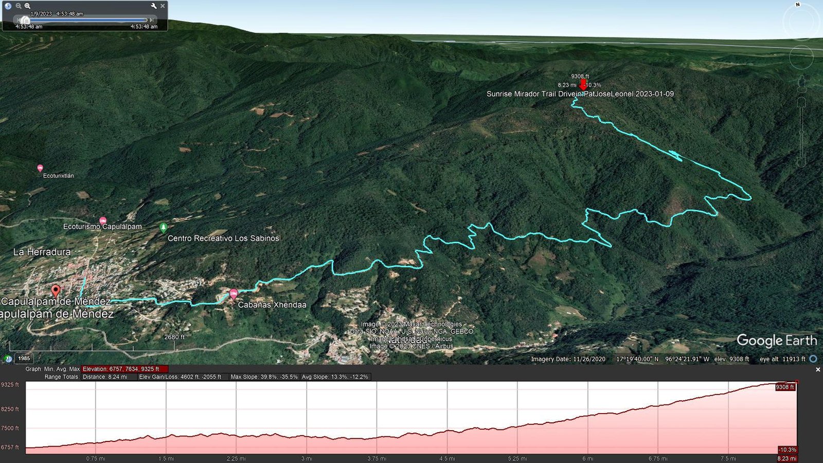
Sunrise Mirador Trail Drivein.PatJoseLeonel.2023-01-09
We met Leonel and José at 0430 and made the 8 mile drive to the trailhead. The road from Ecoturismo Capulálpam was like many in the Sierra Norte – a rough, rocky two-track roadway, in this case climbing 2,500 feet to the trailhead near the mountaintop.
The Hike
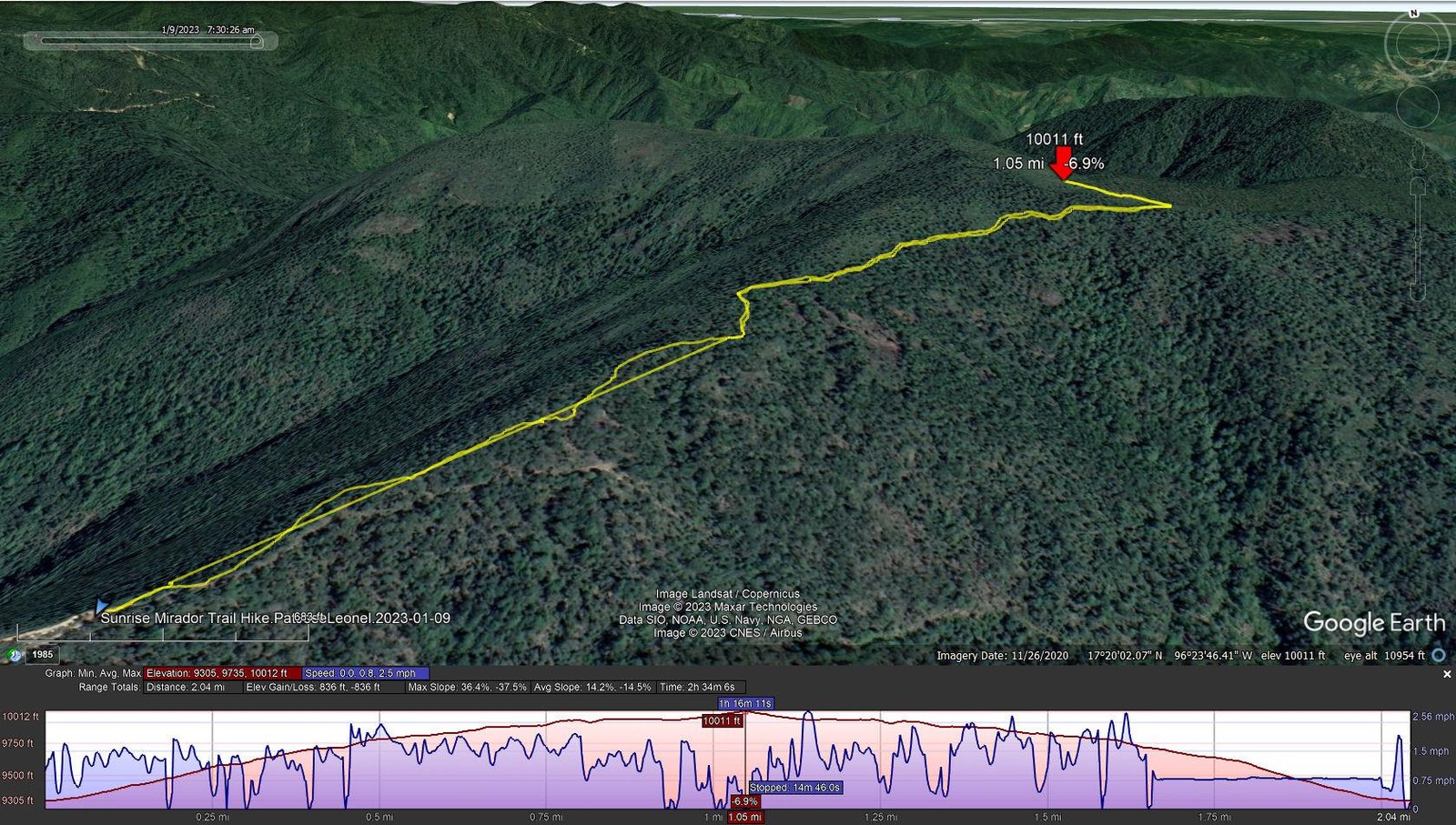
Sunrise Mirador Trail Hike.PatJoseLeonel.2023-01-09
Notes about the Google Earth screenshot: the graph at the bottom shows elevation of the track (pink area) and speed (the blue line).
At 5:00, it was dark 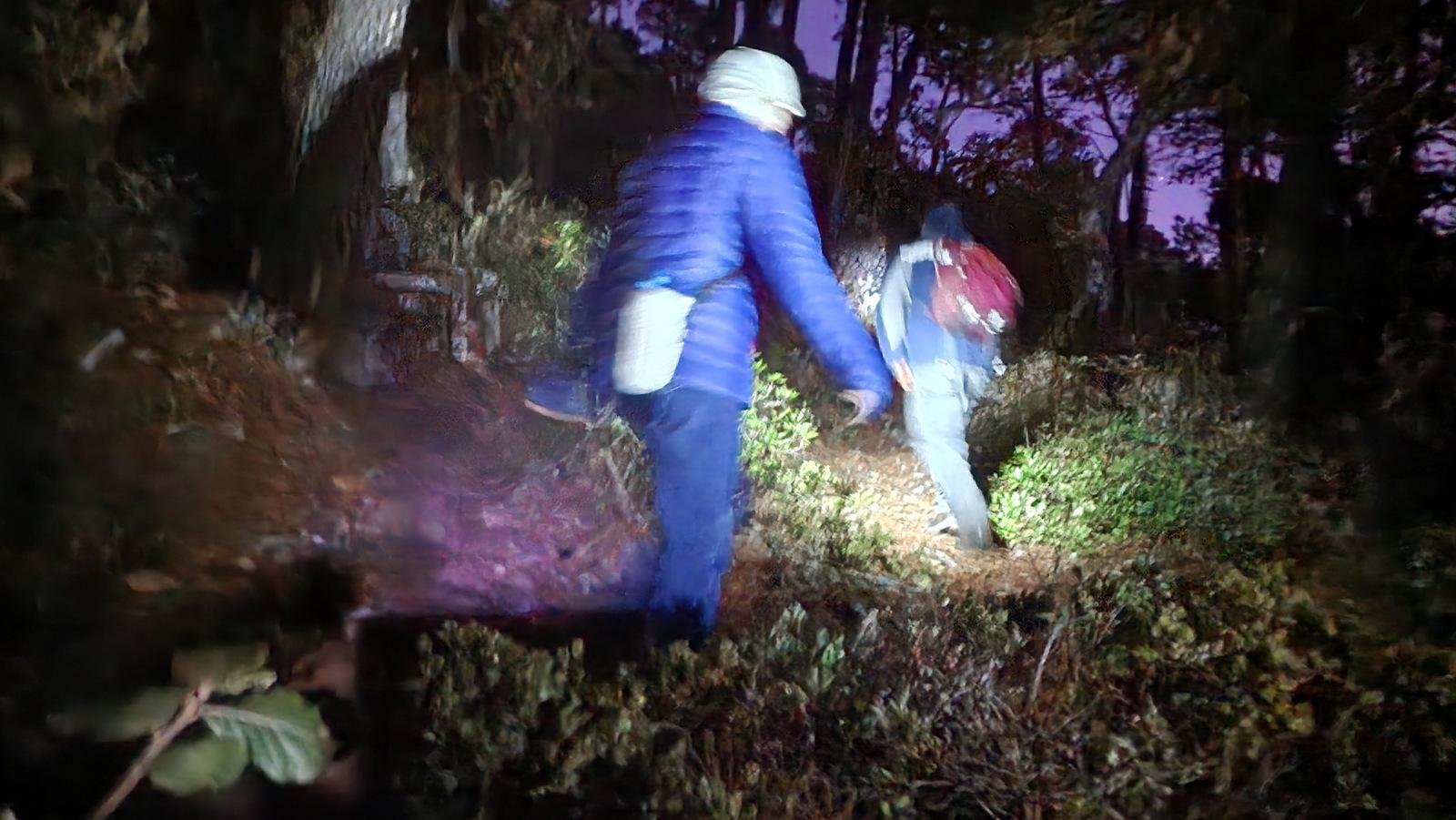 at 0600 when we hit the trail. Leonel gave each of us a headlamp, and off we went with Leonel leading the way. The trail was generally a gentle slope on soft soil and pine needles in a few places climbing up a bit of rock outcrop. A mile on, we reached a vantage point which presented marvelous view across the mountains to the east, clouds in the valleys all around, and the sun beginning to present its spectacular sunrise scenery.
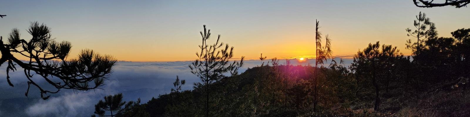
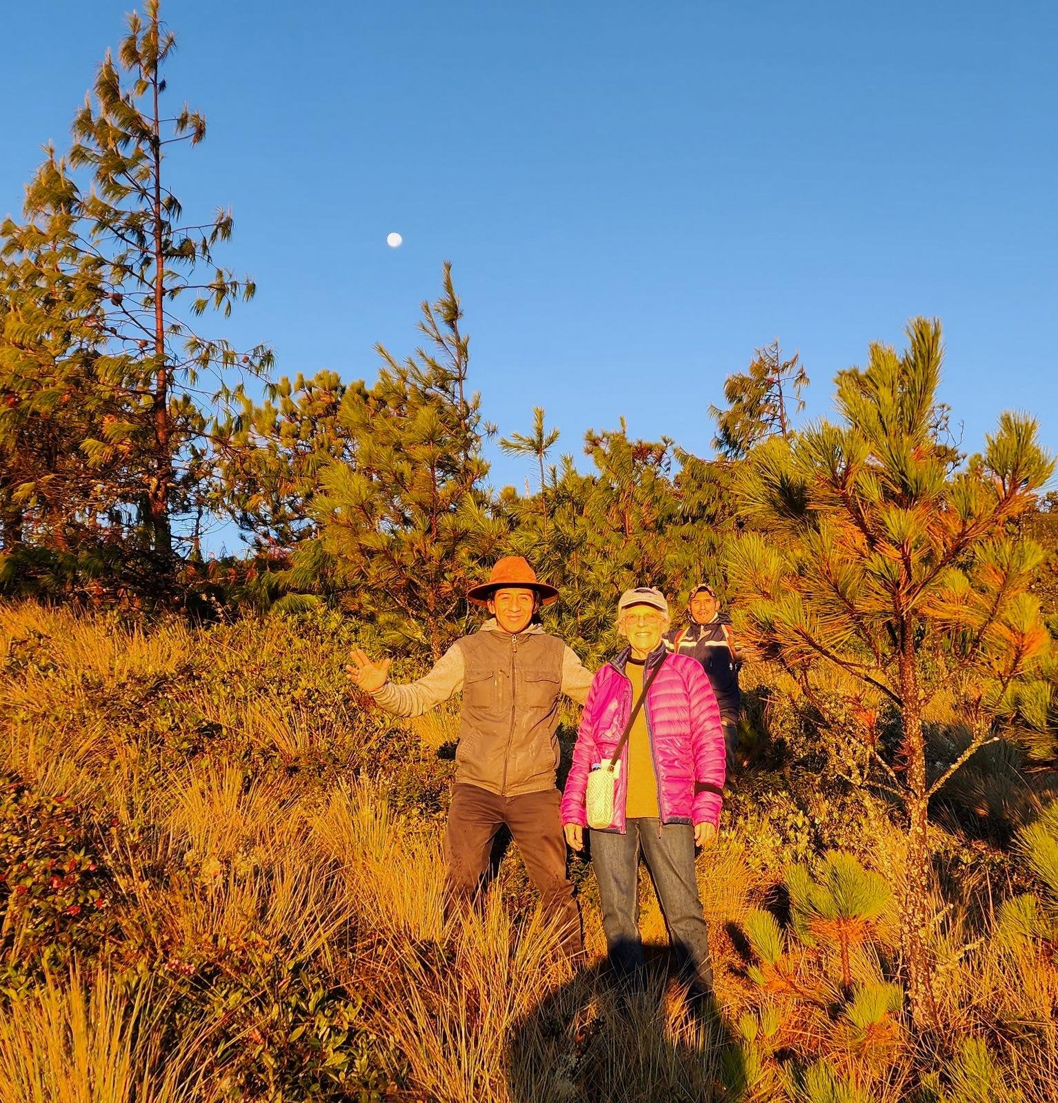 Reaching the ridge, we spent the next 45 minutes enjoying the view – the sun coming above the mountains, the changing light from bright orange to yellow, the clouds below us changing position and shape, even the waning moon above us to the west. As full daylight set in, we then admired the surroundings – the pine trees and various shrubs and grasses on this mountain top at 10,000 feet (3,000 meters).
 On our return to the trailhead, now in daylight we enjoyed the scenery of clouds on nearby mountains and valleys, and the lush forest.
Highlight
Clearly it was the sunrise above the mountains and clouds, followed closely by the experience of hiking at night.
Statistics
Total Distance: 2.04 miles
Elevation: start 9,306 ft, maximum 10,012 ft, minimum 9,305 ft
start 2,836 m, maximum 3,052 m, minimum 2,836 m
Gain: gross 707 ft, aggregate ascending 836 ft, descending 836 ft
gross 216 m, aggregate ascending 255 m, descending 255 m
Maximum slope: 36% ascending, 38% descending, 37% average
Duration: 2:34
| GPS Track Files for Download | |
282 Downloads | |
|---|---|
629 Downloads | |
173 Downloads | |
216 Downloads | |
If you haven’t explored these hiking tracks with Google Earth, I urge you to try it. With the virtual 3-dimensional presentation, achieved by panning and tilting the view, you can get a much better idea of the hikes and terrain than you can get from the screenshot above. For some ideas, check out Using Google Earth Track Files.
Related Posts
Other hikes to Capulálpam.
Other hikes around Oaxaca.
References and Resources
Turismo Ecológico Comunitario Capulálpam Mágico: Welcome to Capulálpam
Things to do in Oaxaca: Capulálpam – Sierra Norte, Oaxaca
Oaxaca Mio: Capulálpam de Méndez
Oaxaca Cultural Navigator : Norma Schafer: One Day in Capulálpam de Mendez: Oaxaca’s Pueblo Mágico.
Photos
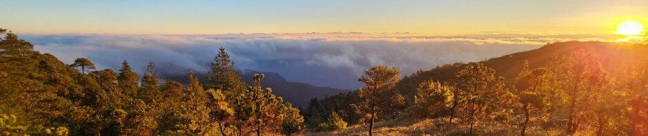
Great photos of amazing colors of the sunrise over the mountains and clouds that filled the valleys.


